Tips nearby


| Hidden gem |
| 16 hairpin turns |
| Bad road |
| #37 toughest climb of La Maurienne |
| #46 most elevation gain of La Maurienne |
| #50 longest climb of La Maurienne |
| #37 average steepest climb of Savoie |
Route de Fresche from Saint-Rémy de Maurienne is a climb in the region La Maurienne. It is 5.2 mi long and bridges 2418 ft of vertical ascent with an average gradient of 8.8%, resulting in a difficulty score of 665. The top of the ascent is located at 3852 ft above sea level. Climbfinder users shared 1 review/story of this climb and uploaded 7 photos.
Road name: Route de Fresche
3.0 by CromagnonThis is an automatic translation, the original language is: French.A rather demanding climb on a road in rough condition. It's amusing to compare the graph of the perfect, even profile of this climb with the much more chaotic reality! The unevenness of the road doesn't affect the climb too much, but it does make the descent unpleasant. The gradients encourage you to go fast, but the state of the road clearly doesn't allow you to (gravel, holes, bumps...). It climbs seriously at around 9, 10%. No rest. On the other hand, we're protected ... read more
Welcome! Please activate your account if you would like to share something. Look for the verification email in your inbox.
If you want to upload your photos, you need to create an account. It only takes 1 minute and it's completely free.
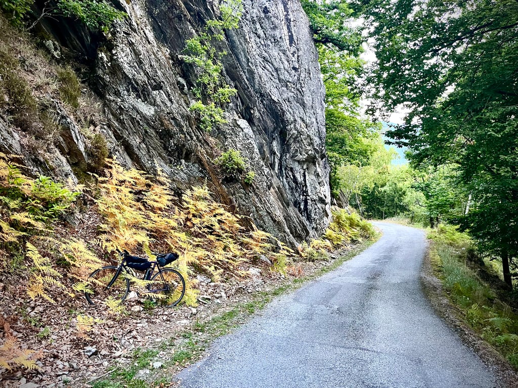
A rather demanding climb on a road in rough condition.
It's amusing to compare the graph of the perfect, even profile of this climb with the much more chaotic reality!
The unevenness of the road doesn't affect the climb too much, but it does make the descent unpleasant. The gradients encourage you to go fast, but the state of the road clearly doesn't allow you to (gravel, holes, bumps...).
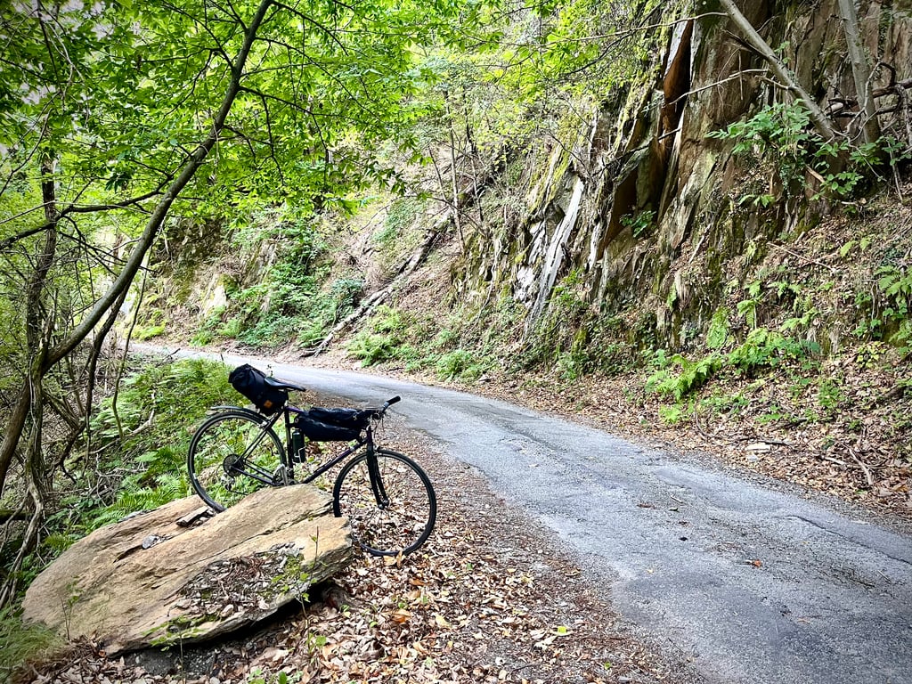
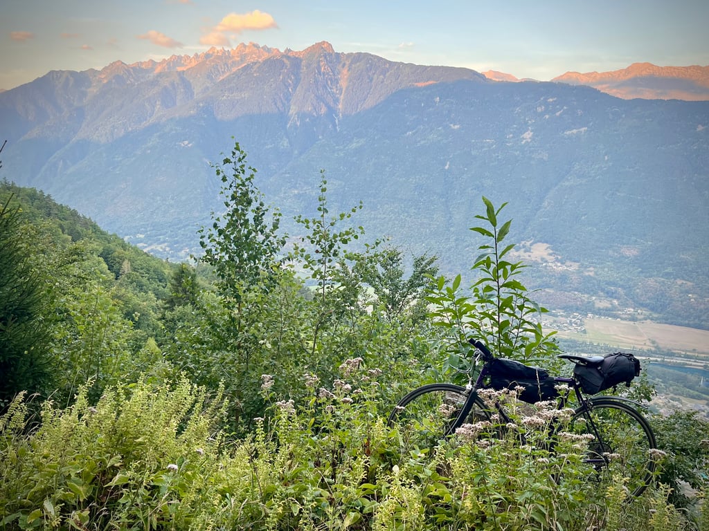
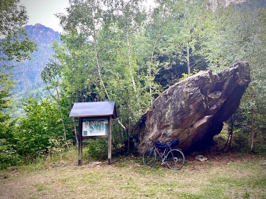
It climbs seriously at around 9, 10%. No rest. On the other hand, we're protected from the sun. The forest is not ugly. You get that feeling that you're going through a pretty wild place and in fact I came across some roe deer wondering what I was doing there.
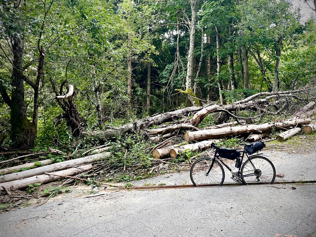
The climb stops in front of a pile of cut wood. Next, a gravel path ventures into the forest. No spectacular views, but absolute peace and varied vegetation.
Not breathtaking, but not unpleasant.
Une ascension plutôt exigeante sur une route dans un état approximatif.
Il est amusant de comparer le graphique du profil parfait et homogène de cette montée avec la réalité nettement plus chaotique !
Les irrégularités de la route ne handicapent pas trop la montée mais rendent la descente désagréable. Les pourcentages invitent à rouler vite mais l’état de la route ne le permet clairement pas (gravillons, trous, bosses…).
Ça grimpe sérieusement aux alentours des 9, 10%. Pas de repos. Par contre, on est protégé du soleil. La forêt n’est pas moche. On a ce sentiment de traverser un lieu assez sauvage et d’ailleurs j’ai croisé des chevreuils qui se demandaient ce que je faisais là.
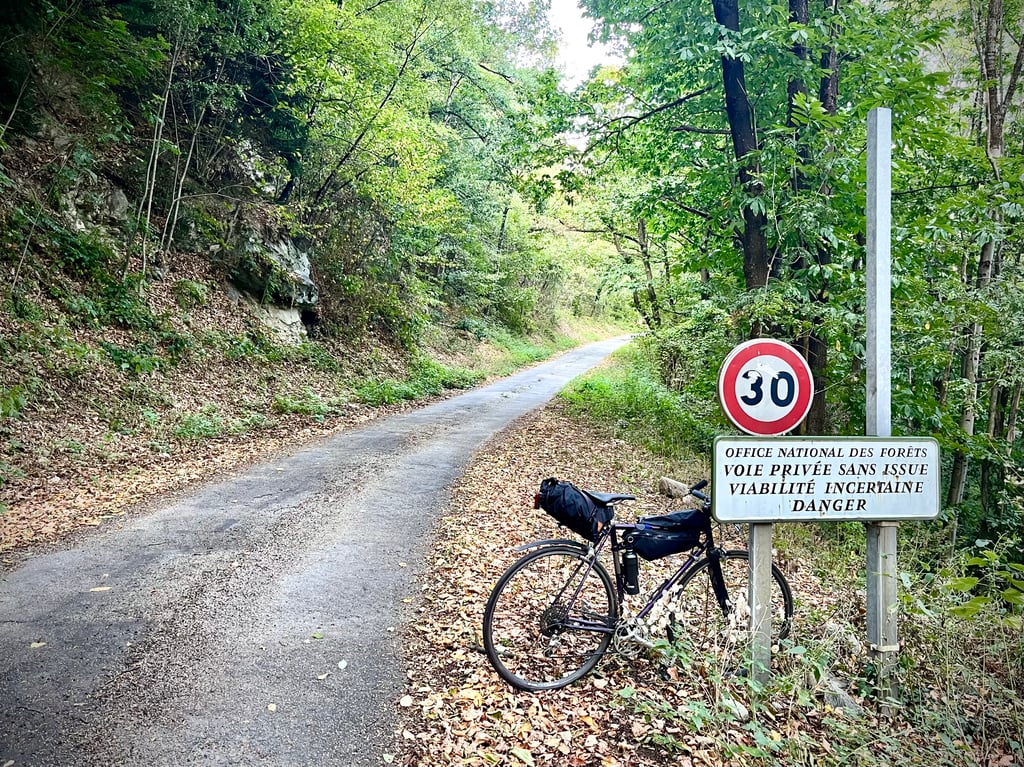
J’ai détesté ce panneau qui limite l’ascension à 30km/h alors que je culminais à 11km/h !
La balade s’arrête devant un tas de bois coupé. Ensuite, un chemin gravel s’aventure dans la forêt.
Pas de vues spectaculaires mais le calme absolu et la végétation variée.
Pas décoiffant, mais pas désagréable.
| 5 mph | 01:02:42 |
| 7 mph | 00:44:23 |
| 9 mph | 00:34:35 |
| 12 mph | 00:25:59 |
This page is better in the app