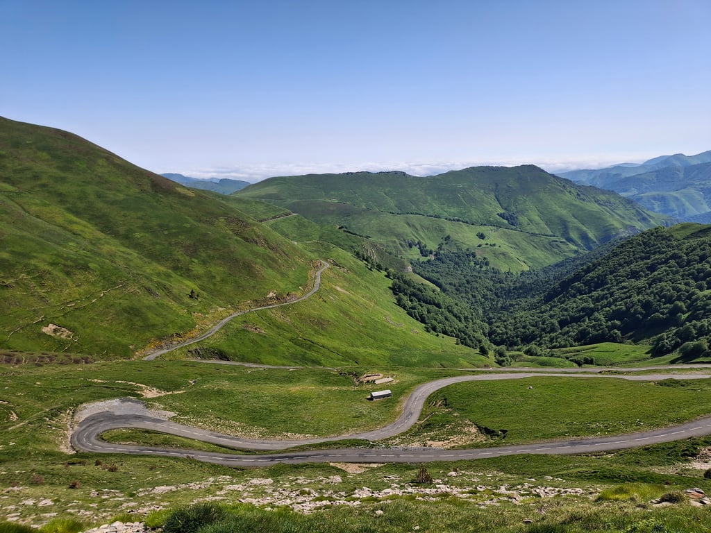
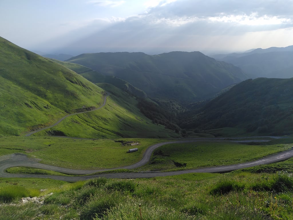
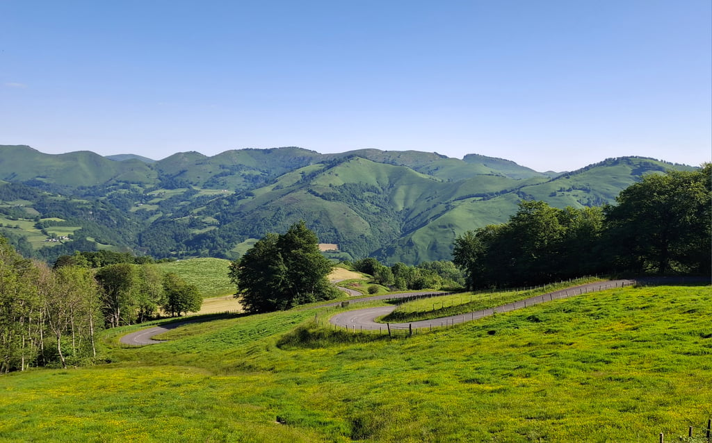
Port de Larrau is a climb in the region Pyrénées-Atlantiques. It is 9.2 mi long and bridges 3986 ft of vertical ascent with an average gradient of 8.2%, resulting in a difficulty score of 1266. The top of the ascent is located at 5167 ft above sea level. Climbfinder users shared 7 reviews of this climb and uploaded 28 photos.
Road name: D26
by Maikel
This is an automatic translation, the original language is: Dutch.
What a tough climb. Difficult to get a rhythm. For me the most difficult climb in the Pyrenees....read more
Photos (28)
Welcome! Please activate your account if you would like to share something. Look for the verification email in your inbox.
This is an automatic translation, the original language is: French.
Show original
Given the comments on this climb and my not phenomenal level, I was quite worried.
In the end, I'm going to give this pass a name: the 10% and +: indeed, when you look at your computer, the gradient is very regularly over 10% excluding flat sections.
Setting off at 7am from the Logibar hostel( it's already 20°), it climbs almost instantly and the kilometre before Larrau is around 11%.
Past Larrau, it climbs quite steeply until a section that goes up to 15% on my odometer.
The 6th kilometre is the hardest in my opinion where the % varies almost all the time between 12 and 14%.
Behind that, the 2-digit %s roll by with a long straight at the 7° kilometre and the 8° kilometre, there are at least 500 metres at 12% constantly.
You think you've reached the Col d'Eyrommondie because there's an almost flat section but you have to give it a go because it climbs back up to 11-12% to reach the top and even a steep climb to 16% in the last 100 metres.
The next 3km allow you to get back into the swing of things with a descent and sections that don't climb much: you have to keep up the effort during the last kilometre, which varies between 10 and 11% and a final steep climb at 14%.
Vu les commentaires sur cette montée et mon niveau pas phénoménal, j’étais assez inquiet.
Au final, je vais donner un nom à ce col: le 10% et + : en effet, lorsqu’on regarde son compteur, la pente est très régulièrement à + de 10% hors passage plat.
Parti à 7 h du matin de l’auberge de Logibar( il fait déjà 20°), ça monte quasiment instantanément et le kilomètre avant Larrau est aux alentours de 11%.
Passé Larrau, ça monte assez fort jusqu’à un passage qui va jusqu’à 15% à mon compteur.
Le 6° kilomètre est le plus dur à mon avis où le % varie pratiquement tout le temps entre 12 et 14%.
Derrière, les % à 2 chiffres défilent avec une longue ligne droite au 7° kilomètre et le 8° kilomètre, il y a au moins 500 mètres à 12% constamment.
On croit qu’on est arrivé au col d’Eyrommondie car il y a une portion quasiment plate mais il faut donner un cou de collier car ça remonte à 11-12% pour arriver au sommet et même un raidillon à 16% dans les 100 derniers mètres.
Les 3 kms suivants permettent de se refaire la cerise avec descente et portions qui montent peu: il faut poursuivre l’effort durant le dernier kilomètre qui varie entre 10 et 11% et un raidillon final à 14%.
This is an automatic translation, the original language is: Dutch.
Show original
What a great col this was! In any case, the toughest I have done in this region (Le Bearn) so far. The devil in the climb was in my opinion in the 4/5 kilometres before the intermediatecol, col d'Erroimendi, continuously steep upwards, without a moment of rest. Good road surface, not busy, and when you get above the tree line there are the beautiful views and mountains of the Basque Country. From the intermediate col, relax for a few kilometres, and then the final climb, which went faster than I thought. Descent via the same road back to Larrau - Tardets - Oloron st Marie.
Anyway, highly recommended this col!
Wat een geweldige col was dit! In ieder geval de zwaarste die ik in deze streek (Le Bearn) tot nu toe heb gedaan. Venijn in de klim zat wat mij betreft in de 4/5 kilometers voor de tussencol, col d'Erroimendi, continue steil omhoog, zonder enig moment van rust. Goed wegdek, niet druk, en wanneer je boven de boomgrens komt zijn daar de prachtige vergezichten en gebergten van Baskenland. Vanaf de tussencol even een paar kilometer relaxt, en dan nog even die laatste klim, die sneller ging dan ik van te voren dacht. Afdaling via zelfde weg weer terug naar Larrau - Tardets - Oloron st Marie.
Hoe dan ook, absolute aanrader deze col !!
This is an automatic translation, the original language is: Dutch.
Show original
Superb and difficult climb, average 8% and that with a descent, flat part in it, then you know that most of the climb is 10+%. In the same holiday, I also did Hautacam and Tourmalet, and found this one really tough. It is steepest just before the intermediate pass, the Erroymendi. From the top, you have a very nice view of the last few kilometres.
Supermooie en lastige klim, gemiddeld 8% en dat met een afdaling, stukje vlak er in, dan weet je wel dat het meerendeel van de klim 10+% is. Dezelfde vakantie ook Hautacam en Tourmalet gedaan, en vond deze toch echt zwaarder. Net voor de tussen col, de Erroymendi, is het het steilste. Vanaf de top heb je een heel mooi uitzicht terugkijkend op de laatste paar kilometers.
This is an automatic translation, the original language is: Dutch.
Show original
A tough climb, not something to do at the end of a long day. The kilometres around Larrau are steep and you get no rest. Very quiet in terms of traffic and good road surface.
Een pittige klim, niet iets om aan het eind van een lange dag te doen. De kilometers rond Larrau zijn steil en je krijgt nergens rust. Wel heel stil qua verkeer en goed wegdek.
Port de Larrau is a challenging ascent. For this type of climbing, we recommend mountain gearing, specifically a compact system. This means a small front chainring of 34 teeth, combined with a rear cassette where, depending on your level, strength, and experience, you choose a sprocket with 30, 32, or even 34 teeth. Remember that a smooth cadence is always more efficient!
Port de Larrau belongs to the Hors Catégorie, the top category. These are legendary and very tough climbs. A solid cycling condition, experience, and a good climbing gear ratio are essential to maintain a smooth cadence and complete the climb comfortably.
Port de Larrau is 9.2 mi long.
The average gradient of Port de Larrau is 8.2%.
Port de Larrau has a steepest segment with an average gradient of 18%.
The summit of Port de Larrau is at 5167 ft.
At a slow pace of 5 mph, it takes about 01:50:49 to climb Port de Larrau. At 7 mph the time is 01:18:27, and at 9 mph 01:01:08. For the fastest cyclists, 00:45:56 is an achievable time.