Tips nearby


| 22 hairpin turns |
| #45 toughest climb of La Maurienne |
| #35 most elevation gain of La Maurienne |
| #31 longest climb of La Maurienne |
| #55 average steepest climb of La Maurienne |
Le Pérousaz from Saint Michel de Maurienne is a climb in the region La Maurienne. It is 7.6 mi long and bridges 2782 ft of vertical ascent with an average gradient of 7%, resulting in a difficulty score of 615. The top of the ascent is located at 5141 ft above sea level. Climbfinder users shared 2 reviews of this climb and uploaded 7 photos.
Road names: D 215b, D 82a & D 219
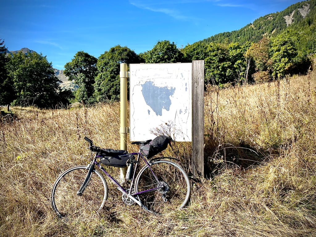
3.0 by CromagnonThis is an automatic translation, the original language is: French.La Perousaz! The plan was for this area to become a ski resort. According to the inhabitants of Le Thyl, the allocated budget was swallowed up by the organisation of the 1992 Olympics. So all that's left is a pretty sign (see photo!). It's not a particularly exciting climb. The road is fairly clean. It's all between 6 and 8%. Trees accompany us, but it's not the real forest. The road is deserted. That's the main attraction of this climb. Up there, a cute little house ... read more
Welcome! Please activate your account if you would like to share something. Look for the verification email in your inbox.
If you want to upload your photos, you need to create an account. It only takes 1 minute and it's completely free.
La Perousaz! The plan was for this area to become a ski resort. According to the inhabitants of Le Thyl, the allocated budget was swallowed up by the organisation of the 1992 Olympics. So all that's left is a pretty sign (see photo!).
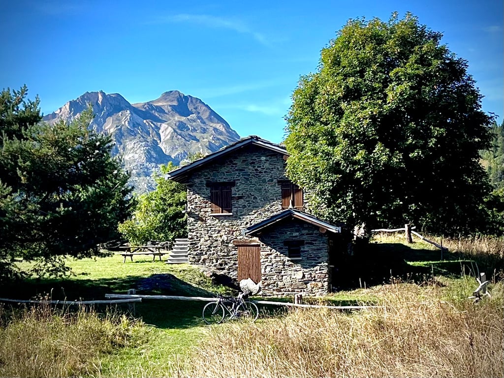
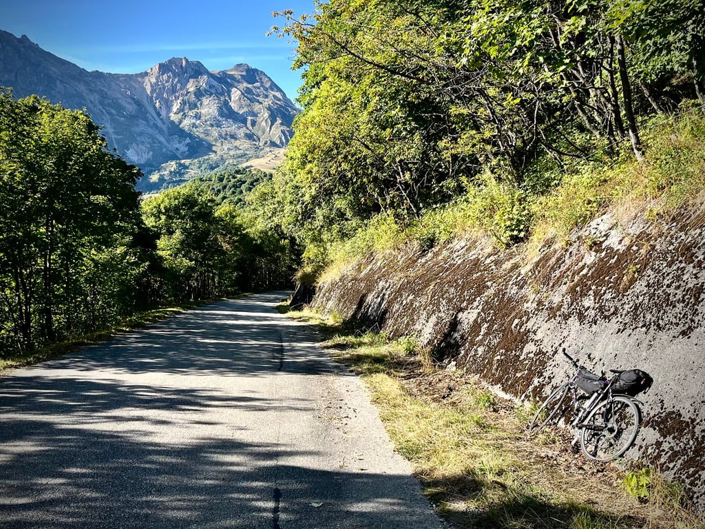
It's not a particularly exciting climb. The road is fairly clean. It's all between 6 and 8%. Trees accompany us, but it's not the real forest. The road is deserted. That's the main attraction of this climb. Up there, a cute little house and a pleasant view of the high massifs. But there's nothing breathtaking about it. I preferred the climb up to Le Thyl, where you get to see a real village. Here, you end up in front of a sign summarising an aborted project.
Note: the path continues in gravel mode.
La Perousaz ! Il était prévu que ce lieu devienne une station de ski. Selon les habitants du Thyl, le budget alloué a été avalé par l’organisation des JO de 1992. Alors, il ne reste qu’une jolie pancarte (cf photo !).
Ce n’est pas une montée particulièrement excitante. La route est plutôt propre. Tout se passe entre 6 et 8%. Des arbres nous accompagnent, mais ce n’est pas la vraie forêt. La route est déserte. Voilà le principal attrait de cette ascension. Là-haut, une mignonne petite maison et une vue plaisante sur les hauts massifs. Mais, rien de stupéfiant. J’ai préféré la montée vers Le Thyl, qui, elle, offre la découverte d’un vrai village. Ici, on finit devant une pancarte qui résume un projet avorté.
A noter : le chemin se poursuit sur un mode gravel.
A pass that allows you to continue climbing after the Col de Beaune, the road is good and very little used as it is a cul de sac at the top. It was supposed to be a ski resort but nothing has been done, but the road is pleasant.
Col qui permet de continuer à grimper après le col de beaune, la route est bonne et très peu fréquentée car c est un cul de sac en haut. Celà devait être une station de ski mais il n'y a rien eu de réalisé, mais cette route est agréable
| 5 mph | 01:31:18 |
| 7 mph | 01:04:38 |
| 9 mph | 00:50:22 |
| 12 mph | 00:37:50 |
This page is better in the app