Tips nearby


| 8 hairpin turns |
| Bad road |
| #39 toughest climb of La Maurienne |
| #53 most elevation gain of La Maurienne |
| #54 longest climb of La Maurienne |
| #69 average steepest climb of Savoie |
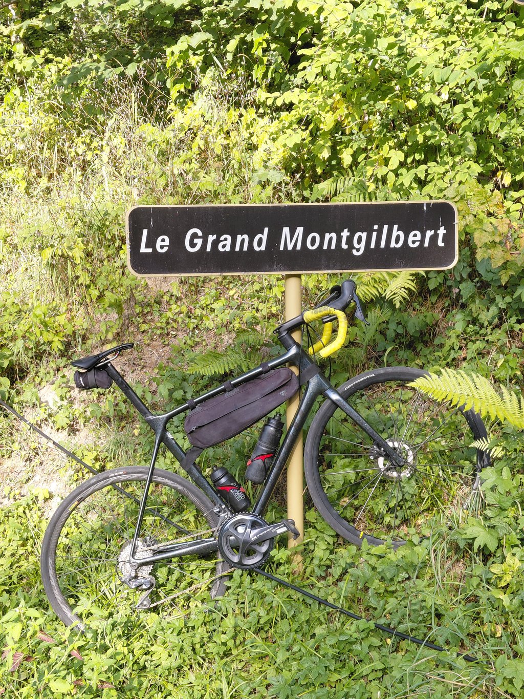
Le Grand Montgilbert from Montgilbert is a climb in the region La Maurienne. It is 4.7 mi long and bridges 2087 ft of vertical ascent with an average gradient of 8.3%, resulting in a difficulty score of 631. The top of the ascent is located at 3179 ft above sea level. Climbfinder users shared 2 reviews of this climb and uploaded 17 photos.
3.0 by YehoSerThis is an automatic translation, the original language is: French.Nice climb with very little traffic. The beginning is difficult with kilometres at 9% but the last 2 km are much easier and that makes it fun. The road is top except for the last kilometre where it's a bit of a gravel road but ok for a road bike. No view at the top, you have to go back down one to get a nice one.... read more

Welcome! Please activate your account if you would like to share something. Look for the verification email in your inbox.
If you want to upload your photos, you need to create an account. It only takes 1 minute and it's completely free.
Nice climb with very little traffic. The beginning is difficult with kilometres at 9% but the last 2 km are much easier and that makes it fun. The road is top except for the last kilometre where it's a bit of a gravel road but ok for a road bike. No view at the top, you have to go back down one to get a nice one.
Belle ascension avec très peu de circulation. Le début est difficile avec des kilomètres à 9% mais les 2 derniers km sont bien plus facile et ca fait plaisir. La route est top sauf le dernier kilomètres où c’est un peu une routier gravier mais ok pour un vélo route. Pas de vue au sommet, il faut redescendre un pour en avoir une belle
Thanks to Rogier for adding this climb to the Climbfinder site.
This is the very first serious climb at the very beginning of the Maurienne valley, it is located on the same side as the Grand Cucheron pass and opposite the Tioulevé pass also detailed on the site: https://climbfinder.com/fr/montees/tiouleve-aiguebelle
The beginning starts at the exit of Aiguebelle, direction Montgilbert, once passed the bridge which overhangs the motorway you arrive at a bus shelter and there you have the choice to take either the version by Montgilbert (on the right), or the version by Chez Cathelin on the left.
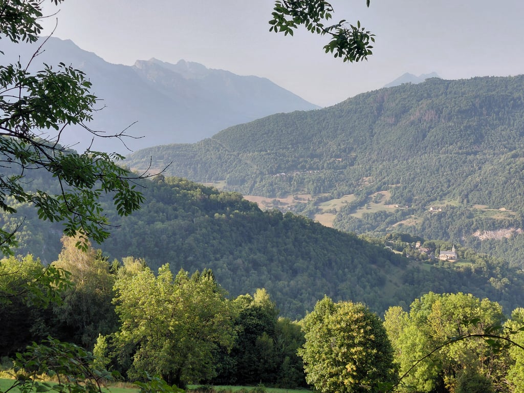
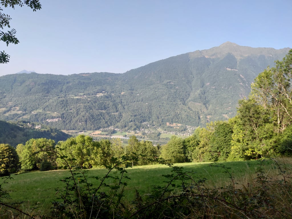
This May 2, 2022 I chose the one by the right, the departure is strong until the chief town of Montgilbert, the road rises quickly with a beautiful sight plunging on the valley.
Then a short but steep passage through a mountain pasture before going into the woods, apart from a few gaps in the trees the views become scarce.
I was surprised that the tarmac is very good for most of the climb, only a few sections are a bit damaged but nothing insurmountable with a road bike.
It is better to do this climb in the morning, because despite some shaded passages the sun is strong, the traffic is very calm, on the 8km I had to see 2 vehicles.
The slope is steady with 8,5-9% and several portions above 10-11%, it is necessary to push until the village of Grandmongilbert, a small hamlet of a few houses with a fresh water basin and a small chapel.
I hope that my commentary and the photos will encourage you to cycle up this route.
Merci à Rogier d'avoir ajouté cette ascension sur le site Climbfinder.
C'est la toute première ascension sérieuse au tout début de la vallée de la Maurienne, elle est située sur le même versant que le col du Grand - Cucheron et en face de celle de Tioulevé détaillée aussi sur le site : https://climbfinder.com/fr/montees/tiouleve-aiguebelle
Le début commence à la sortie d'Aiguebelle, direction Montgilbert ,une fois passé le pont qui surplombe l'autoroute vous arrivez à un abri bus et là vous avez le choix de prendre soit la version par Montgilbert ( à droite ), soit la version par chez Cathelin à gauche.
Ce 2 mai 2022 j'ai choisi celle par la droite, le départ est costaud jusqu'au chef lieu de Montgilbert, la route s'élève rapidement à flan de falaise avec une belle vue plongeante sur la vallée.
Ensuite passage court mais pentu à travers un alpage de montagne avant de s'enfoncer dans les bois , à part quelques trouées dans les arbres les vues deviennent rares.
J'ai été surpris car le bitume est quasiment très bon sur la majorité de la montée, seul quelques portions sont un peu abimées mais rien d'insurmontable avec un vélo de route.
IL vaut mieux faire cette ascension le matin, car malgré quelques passages ombragés le soleil tape fort, la circulation est très calme, sur les 8km j’ai du voir 2 véhicules.
La pente est soutenue avec 8,5-9% et plusieurs portions au dessus de 10-11%, il faut pousser jusqu'au village de Grandmongilbert, petit hameau de quelques maisons avec un bassin d'eau fraiche et une petite chapelle.
J'espère que mon commentaire et les photos vous inciterons à monter cette route en vélo.
| 5 mph | 00:57:10 |
| 7 mph | 00:40:28 |
| 9 mph | 00:31:32 |
| 12 mph | 00:23:42 |
This page is better in the app