Tips nearby


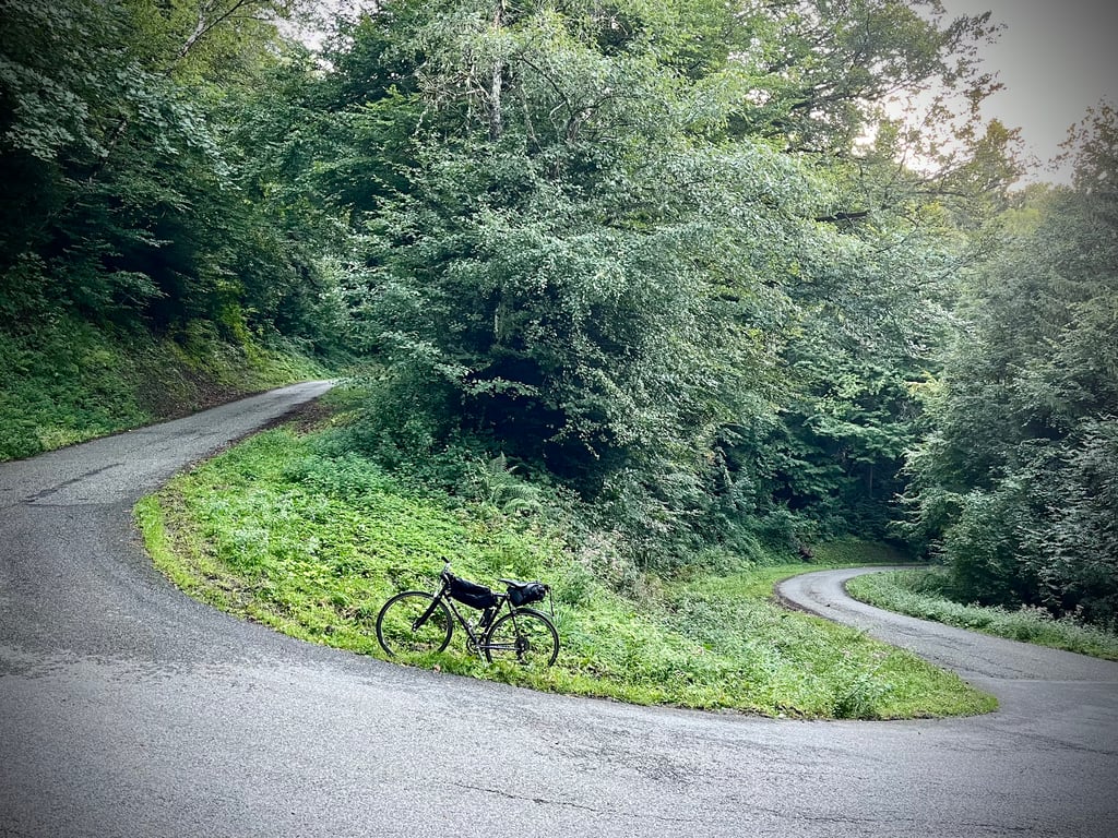
| 18 hairpin turns |
| #40 toughest climb of La Maurienne |
| #54 most elevation gain of La Maurienne |
| #55 longest climb of La Maurienne |
| #36 average steepest climb of Savoie |
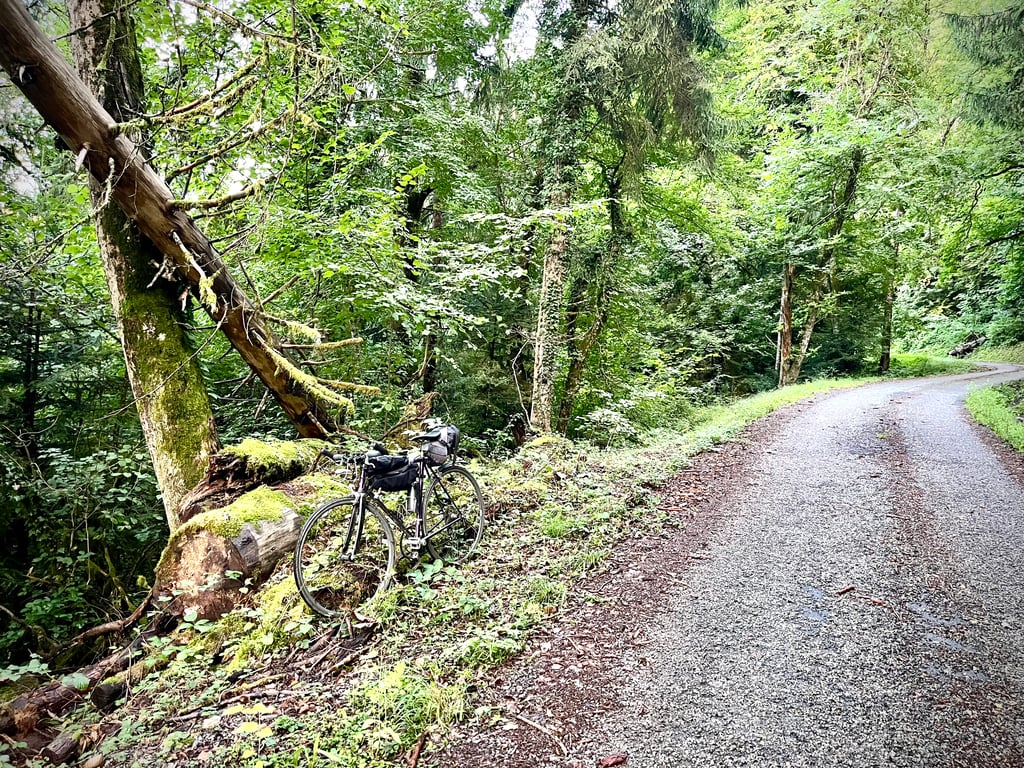
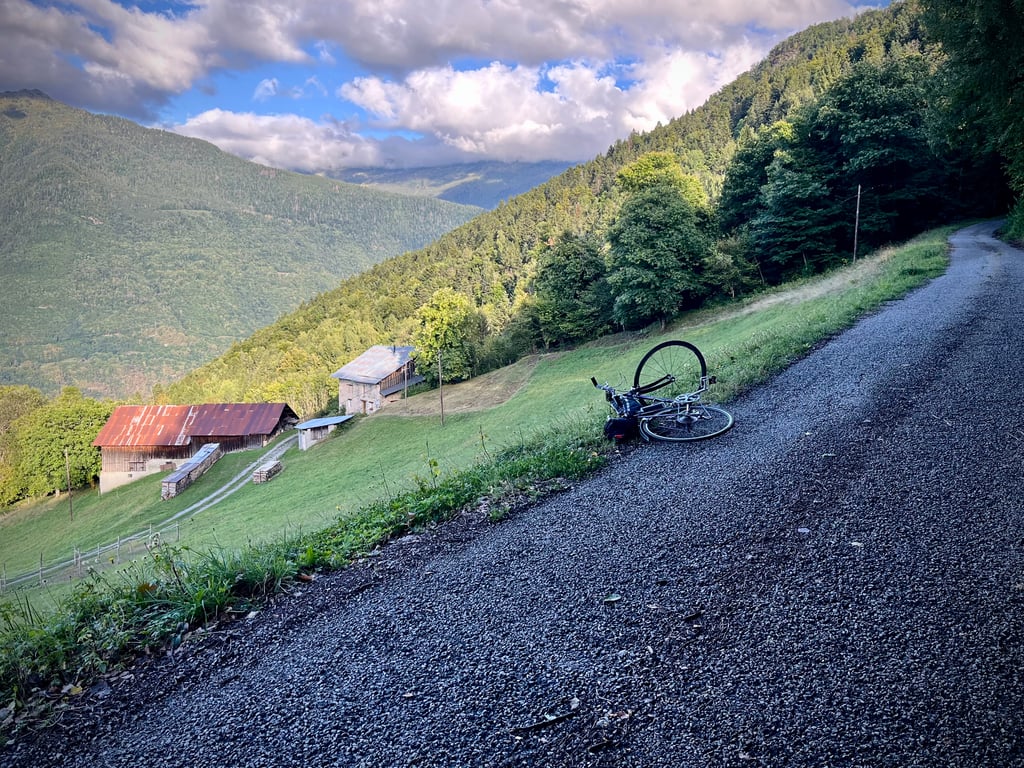
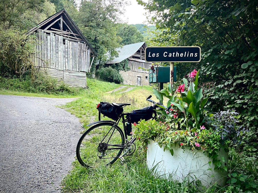
Le Grand Montgilbert via Les Cathelins is a climb in the region La Maurienne. It is 4.5 mi long and bridges 2087 ft of vertical ascent with an average gradient of 8.8%, resulting in a difficulty score of 629. The top of the ascent is located at 3179 ft above sea level. Climbfinder users shared 2 reviews of this climb and uploaded 16 photos.
4.0 by CromagnonThis is an automatic translation, the original language is: French.A very pretty little road that winds gently and climbs steeply through the forest. Yes, you have to love trees. It's a real tough climb. The gradients are steep. Some parts are quite spicy. It's wild and deserted. The surface is "grainy" but adequate. The bends are very good. The scenery is not stunning, but the houses at the top are truly authentic. A dozen beers were chilling in the tub of the little fountain that is so good for cyclists. A stout fellow approaches. Ala... read more

Welcome! Please activate your account if you would like to share something. Look for the verification email in your inbox.
If you want to upload your photos, you need to create an account. It only takes 1 minute and it's completely free.
A very pretty little road that winds gently and climbs steeply through the forest. Yes, you have to love trees.
It's a real tough climb.
The gradients are steep. Some parts are quite spicy.
It's wild and deserted.
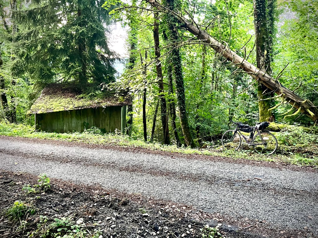
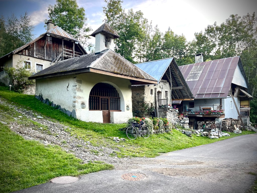
The surface is "grainy" but adequate. The bends are very good. The scenery is not stunning, but the houses at the top are truly authentic.
A dozen beers were chilling in the tub of the little fountain that is so good for cyclists. A stout fellow approaches. Alain, a retired shepherd. "Would you like to join me for a drink? I'd be delighted, I'll be celebrating my 300th Alpine climb with you!
And Alain tells me all about the passes he climbed on foot. I loved that moment!
Une très jolie petite route qui serpente délicatement et grimpe fort à travers la forêt. Ah oui, il faut aimer les arbres…
C’est une vraie côte qui sait faire mal.
Les pourcentages sont soutenus. Certains passages sont assez épicés.
C’est sauvage et désert.
Le revêtement est « granuleux » mais convenable. Les virages sont très réussis. Les paysages ne sont pas renversants mais, au sommet, les maisons sont vraiment authentiques.
Là-haut, dans le bac de la petite fontaine qui fait du bien aux cyclistes, une dizaine de bières prenaient le frais. Un gaillard s’approche. Alain, berger, retraité. « Vous buvez un coup avec moi ? ». Euh, bah oui, carrément avec plaisir, je fêterai avec vous ma 300e montée alpine !
Et Alain me raconte les cols qu’il arpentait à pieds. La nuit tombe. Il me reste 40km pour rentrer à mon camping. J’ai adoré ce moment !
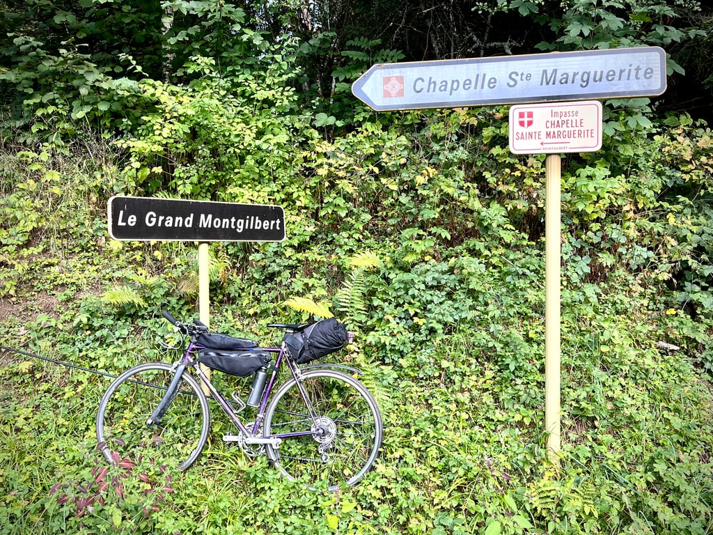
Same starting point as the alternative via Montgilbert except that you have to go left on a very narrow and rough road.
The climb has a high average gradient but is quite irregular with many passages above 10 %
The tarmac is OK for an ordinary bike, the road winds through the woods largely in the shade, an advantage on hot days but you should take advantage of a few gaps in the trees to discover some great views, at one point you will see the church and a few houses of the village of Montgilbert on the other side on the alternative version.
The finish point is the same on both sides, if you want fresh water and to relax, take a diversion (on a gentle slope) to the village hall car park just a little further up.
The traffic is very, very quiet, I only saw one car, which is nice compared to the big Alpine passes.
Have a good ride and be careful on the way down
Même point de départ que l’alternative par Montgilbert sauf qu’il faut partir à gauche sur une toute petite route étroite et rugueuse.
L’ascension présente une pente moyenne élevée mais est assez irrégulière avec de nombreux passages au-dessus de 10 %
Le bitume est correct pour un vélo ordinaire, la route serpente dans les bois en grande partie à l’ombre, avantage les jours de grosses chaleurs mais il faut profiter de quelques trouées dans les arbres pour découvrir des vues magnifiques, à un moment vous apercevrez l’église et quelques maisons du village de Montgilbert situé de l’autre côté sur la version alternative.
Le point d’arrivée est le même pour les 2 versants, si vous voulez de l’eau fraîche et vous relaxer, faites un détour ( dans une faible pente ) jusqu’au parking de la salle des fêtes juste un peu plus haut.
La circulation est très-très calme, j’ai croisé une seule voiture, c’est agréable par rapport aux grands cols Alpins.
Bonne route et prudence en descente
| 5 mph | 00:54:05 |
| 7 mph | 00:38:17 |
| 9 mph | 00:29:50 |
| 12 mph | 00:22:25 |
This page is better in the app