View on map
© MapLibre | OpenStreetMap contributors
1%
2%
4%
6%
8%
10%
12%
15%
20%

Kerkdelstraat

2.5
2 reviews | Elevation profile | 4 photos
Tips nearby
Kerkdelstraat
Kerkdelstraat
Kerkdelstraat
Kerkdelstraat
transparant thumb
transparant thumb
transparant thumb
transparant thumb
Your achievable time
Calculating based on your best performances...
Relaxed
Maximum
W/kg
W/kg
W/kg
Analyze your climbing performance
Detailed insight into your climbing performance & automatically check off climbs
Based on your best performances.
Your best attempt:
Number of attempts:
Elevation profile Kerkdelstraat

Statistics

Difficulty points 13
Length 0.2 mi
Average gradient 6.2%
Steepest segment 7.9%
Total ascent 62 ft
Feedback about this climb?
Show climbs nearby Export to GPS device

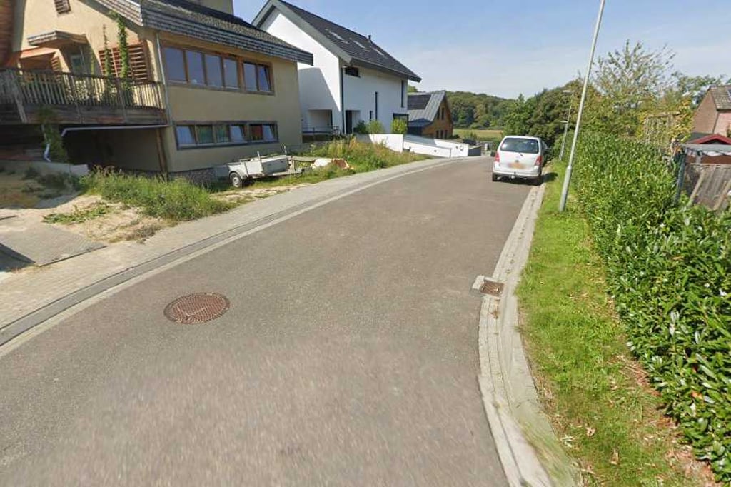
Kerkdelstraat is a climb in the region South Limburg. It is 0.2 mi long and bridges 62 ft of vertical ascent with an average gradient of 6.2%, resulting in a difficulty score of 13. The top of the ascent is located at 528 ft above sea level. Climbfinder users shared 2 reviews of this climb and uploaded 4 photos.

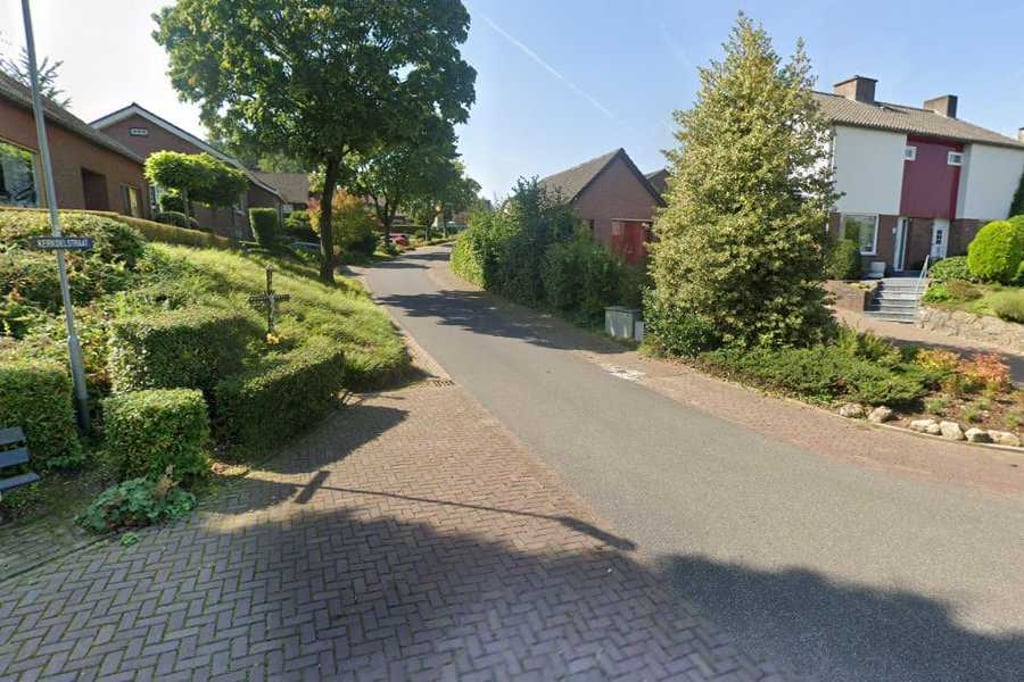
Road names: Anderdelstraat & Kerkdelstraat

2.0 by Fedor
This is an automatic translation, the original language is: Dutch.
Short climb from the main road into a residential area where you end up at the highest point with a few turns. Not quite a dead end as a small loop takes you back to the main road. This very small diversions is worth it though as it rises quite nicely between the houses.... read more

Photos (4)

Kerkdelstraat
Kerkdelstraat
Kerkdelstraat
Kerkdelstraat
transparant thumb
transparant thumb

Your uploads (max 4)

Welcome! Please activate your account if you would like to share something. Look for the verification email in your inbox.

If you want to upload your photos, you need to create an account. It only takes 1 minute and it's completely free.

  • Receive free climbfinder goodies for your reviews & photos.
  • Create a bucket list and check off conquered climbs.
  • Add missing climbs.
Continue with GoogleContinue with Google Continue with FacebookContinue with Facebook Continue with AppleContinue with Apple Sign up with email
By signing up you agree to our terms of service and confirm that you have read our privacy & content policy.

Reviews (2)

5.0
4.0
3.0
2.0
1.0
Fedor
1 y 2.0
This is an automatic translation, the original language is: Dutch. Show original

Short climb from the main road into a residential area where you end up at the highest point with a few turns. Not quite a dead end as a small loop takes you back to the main road. This very small diversions is worth it though as it rises quite nicely between the houses.

Korte klim vanuit de hoofdweg een villawijkje in waarbij je met enkele bochten op het hoogste punt uitkomt. Niet helemaal doodlopend want met een kleine lus kom je weer op de hoofdweg uit. Dit hele kleine ommetje is het wel waard want tussen de huizen stijgt het best leuk.

Dashboard
BikerJohan
1 y 3.0
This is an automatic translation, the original language is: Dutch. Show original

Nice little climb through Slenaken's only residential area. Coming from the direction of the Piemert, the climb starts on the Dorpsstraat as false flat thv the entrance to water mill. At the first junction, turn right onto Anderdelstraat and then turn left onto Kerkdelstraat. This goes round to the top. After this, you descend via Anderdelstraat back to Dorpsstraat. From there, you have a choice of climbing Schilberg, Grensweg, Loorberg or Piemert.

Leuk klimmetje door het enige woonwijk van Slenaken. Komende uit de richting van de Piemert begint de klim op de Dorpsstraat als vals plat thv de inrit naar watermolen. Op de eerste splitsing ga je rechtsaf de Anderdelstraat op en sla je vervolgens linksaf de Kerkdelstraat in. Deze loopt rond tot de top. Hierna daal je via de Anderdelstraat weer af naar de Dorpsstraat. Vanaf dat punt heb je keuze om beklimming van Schilberg, Grensweg, Loorberg of Piemert te gaan doen.

Dashboard

Climbing times

5 mph 00:02:14
7 mph 00:01:34
9 mph 00:01:13
12 mph 00:00:55

Road surface condition

0% 0% 0%
Based on 0 votes
Share your knowledge. What was the road condition during your ascent?

Traffic

0% 0% 0%
Based on 0 votes
Your experience counts. How much traffic did you encounter during the climb?

Frequently Asked Questions

Kerkdelstraat can be cycled from 4 sides. Grensweg from Slenaken is the most popular side, but the summit can also be reached via Grensweg, Anderdelstraat & Kerkdelstraat.

You don't need special gearing for Kerkdelstraat. The slope isn't long or steep enough to require much shifting down. You can conquer this climb on power alone. However, a compact gearing system with a smallest front chainring of 34 and largest rear sprocket of 28 or 30 is always nice if you enjoy cycling uphill. This helps maintain a smooth cadence.

Kerkdelstraat is not tough enough to be assigned a mountain category. This means that even untrained cyclists can reach the top without any problems on this climb.

Kerkdelstraat is 0.2 mi long.

The average gradient of Kerkdelstraat is 6.2%.

Kerkdelstraat has a steepest segment with an average gradient of 7.9%.

The summit of Kerkdelstraat is at 528 ft.

At a slow pace of 5 mph, it takes about 00:02:14 to climb Kerkdelstraat. At 7 mph the time is 00:01:34, and at 9 mph 00:01:13. For the fastest cyclists, 00:00:55 is an achievable time.

Kerkdelstraat is located in the region Limburg in Netherlands.

This page is better in the app

Climbfinder app
Climbfinder
(Free)
Open