View on map
© MapLibre | OpenStreetMap contributors
1%
2%
4%
6%
8%
10%
12%
15%
20%

Heugdenweg from Etenaken

3.8
4 reviews | Elevation profile | 7 photos
Tips nearby
Heugdenweg from Etenaken
transparant thumb
Your achievable time
Calculating based on your best performances...
Relaxed
Maximum
W/kg
W/kg
W/kg
Analyze your climbing performance
Detailed insight into your climbing performance & automatically check off climbs
Based on your best performances.
Your best attempt:
Number of attempts:
Elevation profile Heugdenweg from Etenaken

Statistics

Difficulty points 43
Length 1.4 mi
Average gradient 3.6%
Steepest segment 8.5%
Total ascent 269 ft
Feedback about this climb?
Show climbs nearby Export to GPS device

Heugdenweg from Etenaken is a climb in the region South Limburg. It is 1.4 mi long and bridges 269 ft of vertical ascent with an average gradient of 3.6%, resulting in a difficulty score of 43. The top of the ascent is located at 571 ft above sea level. Climbfinder users shared 4 reviews of this climb and uploaded 7 photos.

Road names: Frombergerweg & Heugdenweg

4.0 by EeSmee
This is an automatic translation, the original language is: Dutch.
Beautiful and somewhat longer climb. Steep right at the start, then it flattens out a bit. When you think it's good to keep going, there's a little dessert at the top. Very nice views to the south, which you can quietly enjoy after the climb.... read more

Photos (7)

Heugdenweg from Etenaken
transparant thumb
transparant thumb
transparant thumb
transparant thumb
transparant thumb

Your uploads (max 4)

Welcome! Please activate your account if you would like to share something. Look for the verification email in your inbox.

If you want to upload your photos, you need to create an account. It only takes 1 minute and it's completely free.

  • Receive free climbfinder goodies for your reviews & photos.
  • Create a bucket list and check off conquered climbs.
  • Add missing climbs.
Continue with GoogleContinue with Google Continue with FacebookContinue with Facebook Continue with AppleContinue with Apple Sign up with email
By signing up you agree to our terms of service and confirm that you have read our privacy & content policy.

Reviews (4)

5.0
4.0
3.0
2.0
1.0
EeSmee
1 y 4.0 via the Climbfinder app
This is an automatic translation, the original language is: Dutch. Show original

Beautiful and somewhat longer climb. Steep right at the start, then it flattens out a bit. When you think it's good to keep going, there's a little dessert at the top. Very nice views to the south, which you can quietly enjoy after the climb.

Mooie en wat langere klim. Direct in t begin stijl, daarna vlakt t wat af. Als je denkt, lekker zo doortrekken, komt bovenaan nog een klein toetje. Erg mooie uitzichten naar t zuiden, waar je als je na de klim doorrijdt rustig van kunt genieten.

Dashboard
BasKruis
1 y 3.0
This is an automatic translation, the original language is: Dutch. Show original

Like all roads around Fromberg, very nice for cycling. Good to do moreover.

Zoals alle wegen rond de Fromberg heel mooi om te fietsen. Goed te doen bovendien.

Dashboard
BikerJohan
1 y 4.0
This is an automatic translation, the original language is: Dutch. Show original

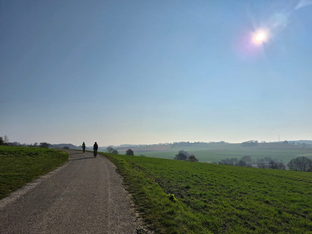
One of the variants to climb Fromberg. The climb starts even before the little tunnel of the Miljoenenlijn and rises steeply right away. At the first junction you turn right where the steep section continues for a while. In the right/left curve it then levels off a bit but rises again up to the junction with Scheumerweg. After this it flattens out and at the junction with Akerweg you are at the top. Beautiful views to the right.

Eén van de varianten om de Fromberg te beklimmen. De klim begint al voor het tunneltje van de Miljoenenlijn en loopt gelijk flink omhoog. Op de eerste splitsing ga je rechtsaf waar het steile stuk nog even doorloopt. In de rechts/links bocht vlakt het dan even wat af maar tot aan de splitsing met de Scheumerweg stijgt het dan weer. Hierna vlakt het af en op de splitsing met de Akerweg ben je op de top. Naar rechts mooi uitzicht.

Dashboard
Fedor
2 y 4.0
This is an automatic translation, the original language is: Dutch. Show original

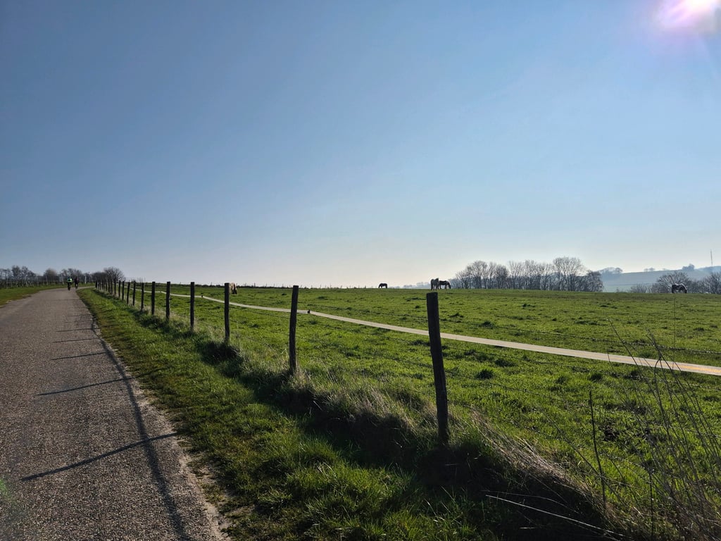
When the Vrakelbergerweg was undergoing repairs in recent years, the diversion route for cyclists ran along the route of this climb - and it is quite a tough one. Right after the railway tunnel at the start, it rises sharply and continues to do so once you've turned right. After turning left, the percentage slowly goes down and follows a nice little road with regular beautiful views over the valley to the right. So nice spice in the beginning, and enjoyment in the second part. Lovely quiet roads in terms of motorised traffic.

Toen de afgelopen jaren de Vrakelbergerweg onder handen werd genomen liep de omleidingsroutes voor fietsers over het traject van deze klim - en dat is best een pittige. Meteen na het spoortunneltje aan het begin loopt het flink op en dat blijft het ook doen als je naar rechts bent gegaan. Na het linksaf slaan gaat het percentage langzaam naar beneden en volgt een mooi weggetje met regelmatig prachtige uitzichten over het dal aan de rechterkant. Lekkere pit in het begin dus, en genieten in het tweede deel. Heerlijk rustige weggetjes qua gemotoriseerd verkeer.

Heugdenweg from Etenaken
Dashboard

Climbing times

5 mph 00:16:53
7 mph 00:11:57
9 mph 00:09:19
12 mph 00:07:00

Road surface condition

0% 0% 0%
Based on 0 votes
Share your knowledge. What was the road condition during your ascent?

Traffic

0% 0% 0%
Based on 0 votes
Your experience counts. How much traffic did you encounter during the climb?

Frequently Asked Questions

Heugdenweg can be cycled from 6 sides. Kruishoeve from Termoors is the most popular side, but the summit can also be reached via Akerweg from Termoors, Koekoeksweg from Winthagen, Vrakelberg, Achtbundersweg from Ransdaal & Heugdenweg from Etenaken.

You don't need special gearing for Heugdenweg from Etenaken. The slope isn't long or steep enough to require much shifting down. You can conquer this climb on power alone. However, a compact gearing system with a smallest front chainring of 34 and largest rear sprocket of 28 or 30 is always nice if you enjoy cycling uphill. This helps maintain a smooth cadence.

Heugdenweg from Etenaken falls into the 5th category. With good fitness, you can ride it up with speed and power. If you have less training, shift down and climb smoothly.

Heugdenweg from Etenaken is 1.4 mi long.

The average gradient of Heugdenweg from Etenaken is 3.6%.

Heugdenweg from Etenaken has a steepest segment with an average gradient of 8.5%.

The summit of Heugdenweg from Etenaken is at 571 ft.

At a slow pace of 5 mph, it takes about 00:16:53 to climb Heugdenweg from Etenaken. At 7 mph the time is 00:11:57, and at 9 mph 00:09:19. For the fastest cyclists, 00:07:00 is an achievable time.

Heugdenweg from Etenaken is located in the region Limburg in Netherlands.

This page is better in the app

Climbfinder app
Climbfinder
(Free)
Open