| #8 toughest climb of Haspengouw |
| #6 most elevation gain of Haspengouw |
| #76 longest climb of Haspengouw |
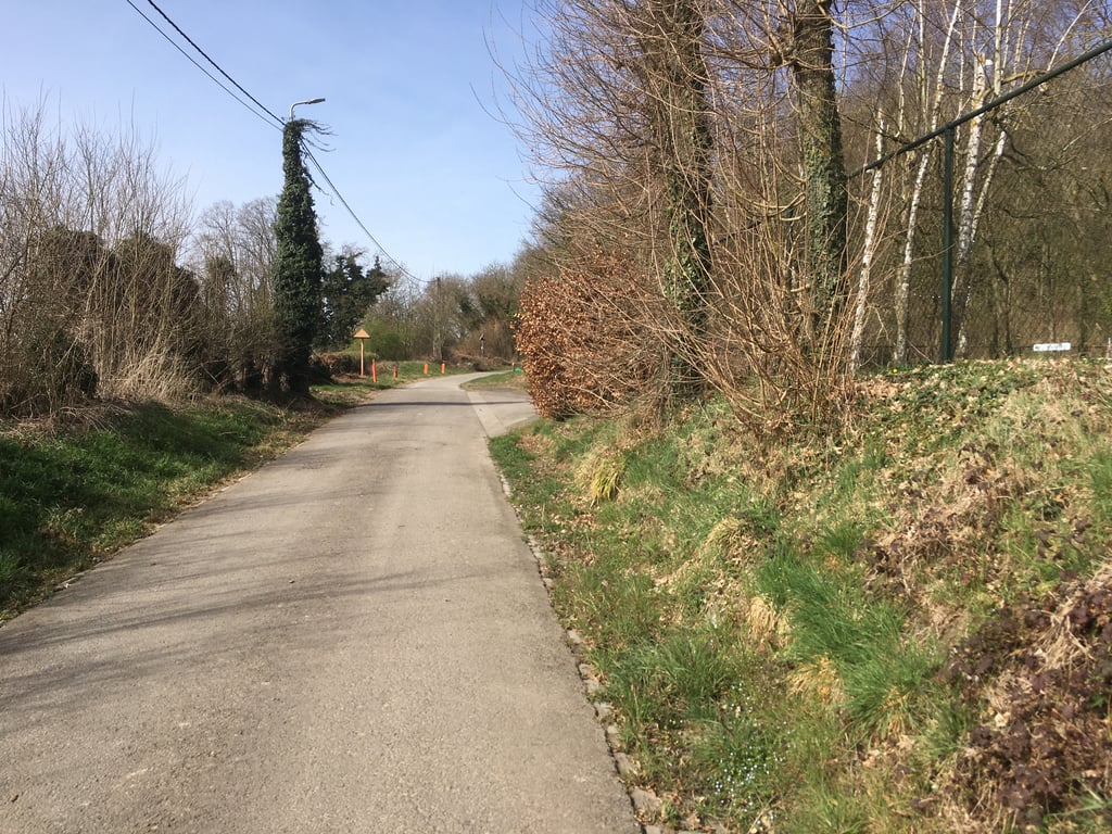
Hautes des Froidmont from Hallembaye via Thier des Bruyères is a climb in the region Haspengouw. It is 1 mi long and bridges 246 ft of vertical ascent with an average gradient of 4.4%, resulting in a difficulty score of 49. The top of the ascent is located at 463 ft above sea level. Climbfinder users shared 6 reviews of this climb and uploaded 9 photos.
Road names: Thier des Bruyères & Rue Haute Froidmont
4.0 by BikerJohanThis is an automatic translation, the original language is: Dutch.Spicy climb on the north side of Rue des Tongres from the hamlet of Hallembaye. You drive along a concrete path where you don't usually meet anyone. Path winds through open field and forest. From the top, descend briefly and then take the first road on the right for the remaining part of the climb Rue de Trez. At the top of this climb, you can then descend further to the beginning of the built-up area of Hautin-Saint-Siméon and don't have to take the busy/dull climb of Rue des Tongres... read more

Welcome! Please activate your account if you would like to share something. Look for the verification email in your inbox.
If you want to upload your photos, you need to create an account. It only takes 1 minute and it's completely free.
Spicy climb on the north side of Rue des Tongres from the hamlet of Hallembaye. You drive along a concrete path where you don't usually meet anyone. Path winds through open field and forest. From the top, descend briefly and then take the first road on the right for the remaining part of the climb Rue de Trez. At the top of this climb, you can then descend further to the beginning of the built-up area of Hautin-Saint-Siméon and don't have to take the busy/dull climb of Rue des Tongres to Hautin-Saint-Siméon
Pittige klim aan de noordkant van Rue des Tongres vanuit het buurtschap Hallembaye. Je rijdt over een betonpad waar je meestal niemand tegenkomt. Pad slingert door open veld en bos. Vanaf de top even afdalen en vervolgens de eerste weg rechtsaf voor het resterende deel van de klim Rue de Trez. Op de top van deze klim kan je dan verder afdalen naar het begin van de bebouwing van Hautin-Saint-Siméon en hoef je niet via de drukke/saaie klim van Rue des Tongres naar Hautin-Saint-Siméon
Spicy, very gentle climb over a concrete path. At the top, nice views and the necessary info plates on the surrounding nature.
Pittig, heel rustig klimmetje over een betonpad. Bovenin leuk uitzicht en de nodige infoplaatjes over de omliggende natuur.
Very nice road with no traffic, which is always a plus in Belgium. Nice view on top.
The road meanders on to the main road near Houtain Saint Simeon, very muddy here and there, it's just possible on a road bike.
Erg mooi weggetje zonder verkeer, wat in Belgie altijd een pre is. Mooi uitzicht bovenop.
Het weggetje loopt slingerend verder naar de grote weg bij Houtain Saint Simeon, hier en daar is het erg blubberig, het kan net op een racefiets.
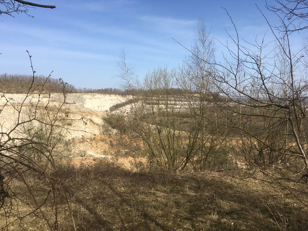
Quite a tough climb. In the beginning it is a bit of a push but then it becomes slightly flatter although the road still rises nicely. Evan later you go left past a barrier and into the forest (after this the road is a bit dirtier because of leaf litter). The road continues during a very long right-hand bend to climb steadily without giving you any further sight. Eventually the road bends to the left and becomes more undulating. From this point you have occasionally nice views of the quarry on the right. Further on out of the forest and past some (remnants of) farms to the end point where there is a (public) toilet and a BBQ hut with beautiful views.
From here you can descend steeply (with beautiful views) to the provincial road, or after a short time turn right and follow the blue cycling signs and ride along the road to Houtain-Saint-Siméon.
Best wel een pittige klim. In het begin is het even aanzetten maar daarna wordt het iets vlakker alhoewel de weg nog steeds lekker stijgt. Evan later ga je links langs een slagboom en het bos in (hierna wordt de weg wel wat viezer vanwege bladresten). De weg blijft gedurende een heel lange bocht naar rechts gewoon steeds stevig doorstijgen zonder dat je verder ergens zicht op hebt. Uiteindelijk buigt de weg naar links en wordt meer golvend. Vanaf dit punt heb je zo nu en dan mooi uitzicht op de groeve rechts. Verderop het bos uit en langs wat (restanten van) boerderijen naar het eindpunt waar een (publiek) toilet en een BBQ-hut met prachtig uitzicht is.
Vanaf hier kan je steil afdalen (met fraaie uitzichten) naar de provinciale weg, of na korte tijd rechtsaf de blauwe fietsbordjes volgen en mooi binnendoor naar Houtain-Saint-Siméon rijden.
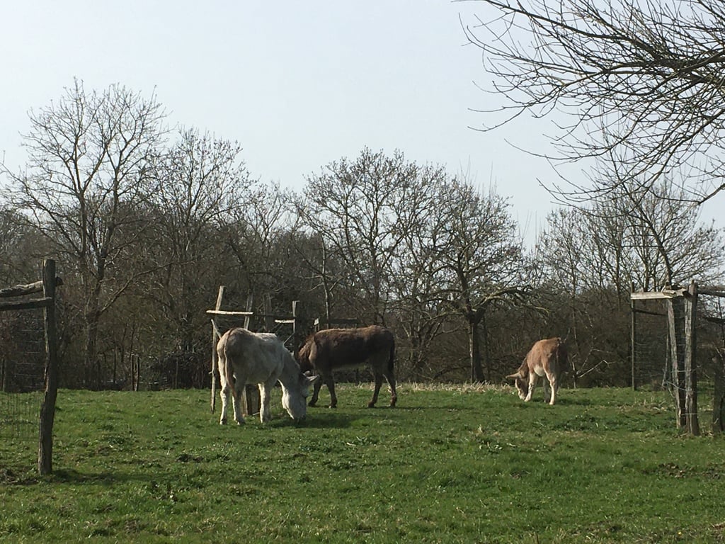
This one is also known as the Old Hallembaye, it's a good alternative for the main road between Haccourt and Bassenge, but not comparable with the real Hallembaye. At the top you end up at a farm with a viewpoint. The continuation towards Houtain St. Simeon goes up and down through the fields, here is usually a lot of dirt and stones on the bike path.
Deze is ook gekend als de Oude Hallembaye, het is een goed alternatief voor de grote weg tussen Haccourt en Bassenge, maar niet te vergelijken met de echte Hallembaye. Boven kom je uit bij een boerderij met een uitzichtsplek. Het vervolg richting Houtain St. Simeon gaat nog wat omhoog en omlaag door het veld, hier ligt er meestal veel vuil en steentjes op het fietspad.
I think also known as the "old hallembaye ". This is much nicer than the "new" which is especially steep and busy. The climb is very irregular, with a small descent. You get at the end a nice view over the valley. The ideal way to avoid the busy roads in the area. The climb continues afterwards which is certainly worthwhile.
Volgens mij ook gekend als de "oude hallembaye". Deze is vele malen mooier dan de "nieuwe" die vooral stijl en druk is. De klim is heel onregelmatig, met een klein stukje afdaling. Je krijgt op het einde een mooi uitzicht over de vallei. De ideale manier om de drukke wegen in de omgeving te mijden. De klim loopt erna zelfs nog een stukje door wat zeker ook de moeite is.
| 5 mph | 00:12:39 |
| 7 mph | 00:08:57 |
| 9 mph | 00:06:58 |
| 12 mph | 00:05:14 |
This page is better in the app