View on map
© MapLibre | OpenStreetMap contributors
1%
2%
4%
6%
8%
10%
12%
15%
20%

Gijberg from ’s-Gravenvoeren

3.0
3 reviews | Elevation profile | 8 photos
Tips nearby
Gijberg from ’s-Gravenvoeren
Your achievable time
Calculating based on your best performances...
Relaxed
Maximum
W/kg
W/kg
W/kg
Analyze your climbing performance
Detailed insight into your climbing performance & automatically check off climbs
Based on your best performances.
Your best attempt:
Number of attempts:
Elevation profile Gijberg from ’s-Gravenvoeren

Statistics

Difficulty points 18
Length 0.2 mi
Average gradient 6.5%
Steepest segment 11.3%
Total ascent 72 ft

Short recap

#74 toughest climb of Belgium Limburg
#34 most elevation gain of Voer-Region
#37 longest climb of Voer-Region
#22 average steepest climb of Belgium Limburg
Feedback about this climb?
Show climbs nearby Export to GPS device

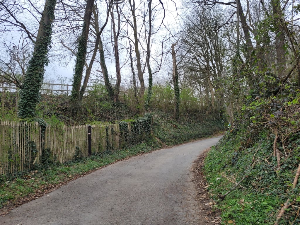
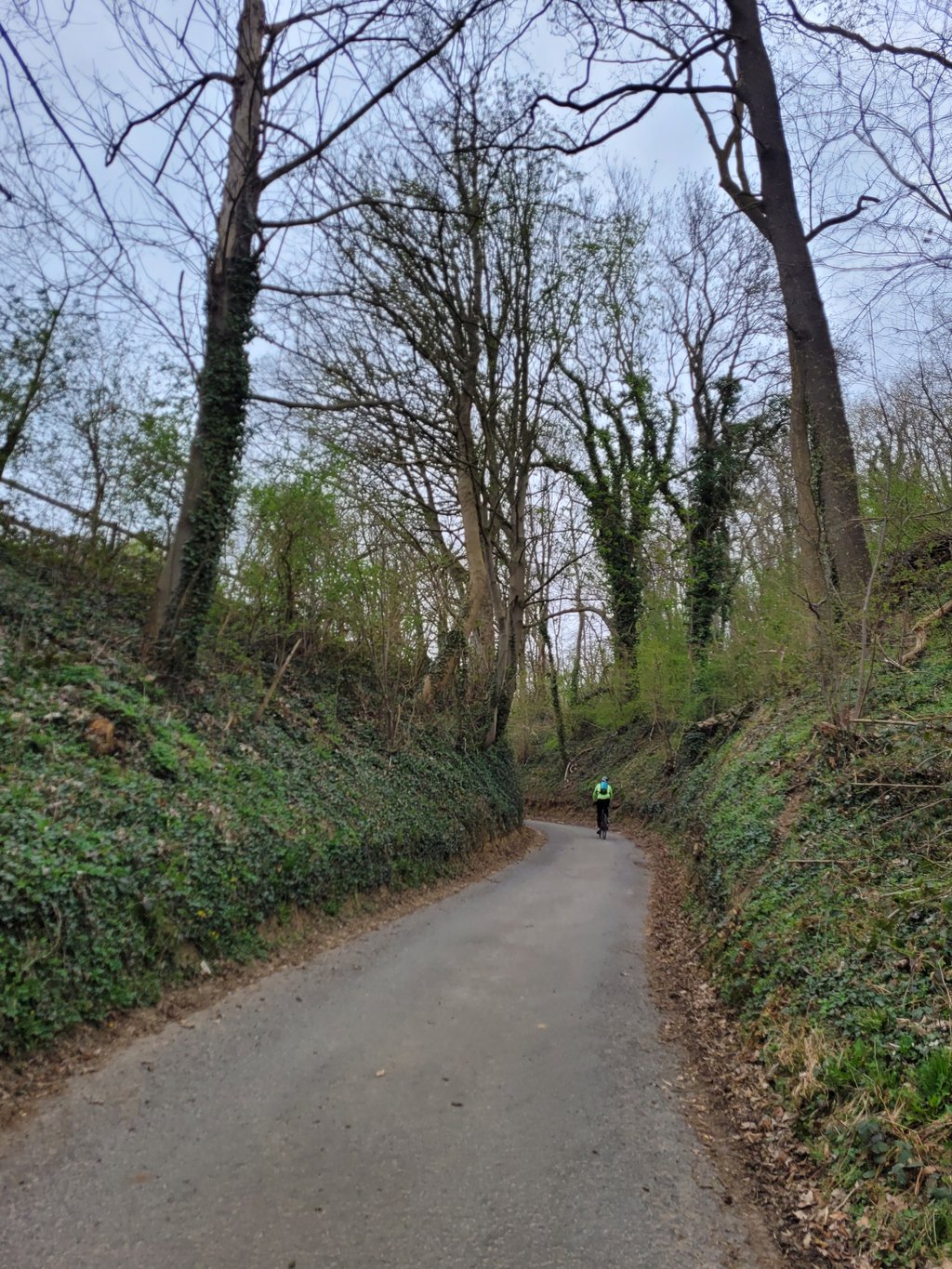
Gijberg from ’s-Gravenvoeren is a climb in the region Voer-Region. It is 0.2 mi long and bridges 72 ft of vertical ascent with an average gradient of 6.5%, resulting in a difficulty score of 18. The top of the ascent is located at 377 ft above sea level. Climbfinder users shared 3 reviews of this climb and uploaded 8 photos.

Road names: Vitschen & Gijberg

3.0 by Jarin
This is an automatic translation, the original language is: Dutch.
Nice short climb in a beautiful wooded area. Calf bite you wish it would last longer; the climb continues right up the mountain at the T-junction but unfortunately the tarmac soon ends...... read more

Photos (8)

Gijberg from ’s-Gravenvoeren
transparant thumb
transparant thumb
transparant thumb
transparant thumb

Your uploads (max 4)

Welcome! Please activate your account if you would like to share something. Look for the verification email in your inbox.

If you want to upload your photos, you need to create an account. It only takes 1 minute and it's completely free.

  • Receive free climbfinder goodies for your reviews & photos.
  • Create a bucket list and check off conquered climbs.
  • Add missing climbs.
Continue with GoogleContinue with Google Continue with FacebookContinue with Facebook Continue with AppleContinue with Apple Sign up with email
By signing up you agree to our terms of service and confirm that you have read our privacy & content policy.

Reviews (3)

5.0
4.0
3.0
2.0
1.0
Jarin
1 y 3.0 via the Climbfinder app
This is an automatic translation, the original language is: Dutch. Show original

Nice short climb in a beautiful wooded area. Calf bite you wish it would last longer; the climb continues right up the mountain at the T-junction but unfortunately the tarmac soon ends...

Leuke korte klim in een mooie bosrijke omgeving. Kuitenbijtertje waar je van zou willen dat ie langer zou doortrekken; de klim gaat bij de T-splitsing rechts verder de bergop maar dan houdt het asfalt helaas al snel op...

Dashboard
BikerJohan
1 y 3.0
This is an automatic translation, the original language is: Dutch. Show original

Short climb from Bovendorp to the Kinkenberg/Koetsweg junction. Steepest part is just before the junction. At the end you can turn left to descend again to the centre 's-Gravenvoeren. Turn right and continue to climb Snauwenberg (see info described about this climb).

Korte klim vanaf Bovendorp naar de splitsing Kinkenberg/Koetsweg. Steilste stuk zit vlak voor de splitsing. Aan het einde kan je linksaf weer afdalen naar centrum 's-Gravenvoeren. Rechtsaf ga je verder klimmen op de Snauwenberg (zie beschreven info over deze klim)

Dashboard
Fedor
4 y 3.0
This is an automatic translation, the original language is: Dutch. Show original

Very short climb. This is because until the left-hand bend there is very little rise. In the turn and afterwards it goes up fully. So we have to stomp but that does not last long because the end is soon in sight. The road is reasonable except for the sharp curve and follows a nice route. After the top you left (follow the asphalt road) a nice descent.

Heel kort klimmetje. Dit omdat tot aan de bocht naar links er nog maar weinig stijging is. Die zet in de bocht en daarna wel vol in. Even stampen dus maar dat duurt niet lang want het eind komt al gauw in zicht. De weg is redelijk op de scherpe bocht na en volgt een leuk traject. Na de top heb je linksaf (de asfaltweg volgen) een leuke afdaling.

Gijberg from ’s-Gravenvoeren
Dashboard

Climbing times

5 mph 00:02:30
7 mph 00:01:46
9 mph 00:01:23
12 mph 00:01:02

Road surface condition

0% 0% 0%
Based on 0 votes
Share your knowledge. What was the road condition during your ascent?

Traffic

0% 0% 0%
Based on 0 votes
Your experience counts. How much traffic did you encounter during the climb?

Frequently Asked Questions

Gijberg can be cycled from 2 sides. Kinkenberg from ’s-Gravenvoeren is the most popular side, but the summit can also be reached via Gijberg from ’s-Gravenvoeren.

You don't need special gearing for Gijberg from ’s-Gravenvoeren. The slope isn't long or steep enough to require much shifting down. You can conquer this climb on power alone. However, a compact gearing system with a smallest front chainring of 34 and largest rear sprocket of 28 or 30 is always nice if you enjoy cycling uphill. This helps maintain a smooth cadence.

Gijberg from ’s-Gravenvoeren is not tough enough to be assigned a mountain category. This means that even untrained cyclists can reach the top without any problems on this climb.

Gijberg from ’s-Gravenvoeren is 0.2 mi long.

The average gradient of Gijberg from ’s-Gravenvoeren is 6.5%.

Gijberg from ’s-Gravenvoeren has a steepest segment with an average gradient of 11.3%.

The summit of Gijberg from ’s-Gravenvoeren is at 377 ft.

At a slow pace of 5 mph, it takes about 00:02:30 to climb Gijberg from ’s-Gravenvoeren. At 7 mph the time is 00:01:46, and at 9 mph 00:01:23. For the fastest cyclists, 00:01:02 is an achievable time.

Gijberg from ’s-Gravenvoeren is located in the region Voer-Region in Belgium.

This page is better in the app

Climbfinder app
Climbfinder
(Free)
Open