Gaisberg from Salzburg-Aigen is a climb in the region Salzburg. It is 5.2 mi long and bridges 2720 ft of vertical ascent with an average gradient of 10%, resulting in a difficulty score of 911. The top of the ascent is located at 4150 ft above sea level. Climbfinder users shared 2 reviews of this climb and uploaded 8 photos.
Road names: Gänsbrunnstrasse & Gaisberg
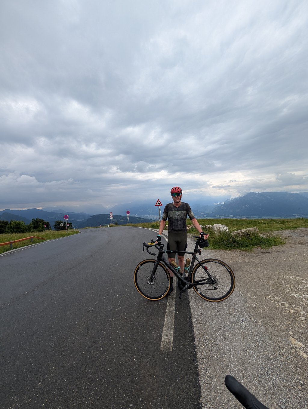
4.0 by MarcWThis is an automatic translation, the original language is: Dutch.From the Gänsbrunnweg, a narrow, quiet road leads uphill quite steeply (10% with peaks of 15%). Sometimes between fields, with beautiful views, sometimes through forests. Nice if you like trees. At a certain moment you turn right on the Gaisbergweg, where the tarmac is as smooth as a billiard cloth. Only not so flat. There again a variation of forest and view, but you are pedalling so hard that you don't see much further than the handlebars. On top again lots of views, and wind, but ... read more

Welcome! Please activate your account if you would like to share something. Look for the verification email in your inbox.
If you want to upload your photos, you need to create an account. It only takes 1 minute and it's completely free.
I agree with the other review. This is a solid thing. Actually, you climb on average at 10% with outliers upwards. Recovery sections are non-existent.
This side is very low traffic, unless you just have people passing by to go to their cottage on the ridge. Passers-by or car-collecting tourists are not really here. The road is too narrow and not the tourist way to drive up to take a photo of Salzburg from above.
Small detail, I followed the Climbfinder-gpx, but at one point I came to a junction, where the CF-gpx steered along towards the side, where you wouldn't be able to go through and the road is on private property. Since the CF route maker is pretty reliable these days, I followed the GPX and then you basically drive through private land for a while. My opinion: a mountain is not private. It doesn't even look like private. You can go through it perfectly, you can also just follow the sign of 'radtour' after 800 metres with the same road surface and steepness you come to the same place.
So normally no problem to ride this way. But an Austrian riders, did tell me that sometimes the gate of the private property is closed.
Ik kan me vinden in de andere review. Dit is een stevig ding. Eigenlijk klim je gemiddeld aan 10% met uitschieters naar boven. Recuperatie-stukken zijn er niet.
Deze zijde is zeer verkeersluw, tenzij je net mensen hebt die passeren om naar hun huisje op de bergrug te gaan. Passanten of auto-col-foto-toeristen zitten hier niet echt. De weg is te smal en niet de toeristen-manier om naar boven te autorijden om een fotootje van Salzburg te nemen van boven.
Klein detail, ik volgde de Climbfinder-gpx, maar op een gegeven moment kwam ik aan een splitsing, waarbij de CF-gpx mee richting de kant stuurde, waar je niet door zou kunnen en de weg op privé terrein ligt. Vermits de CF-routemaker tegenwoordig best wel betrouwbaar is, volgde ik de GPX en dan rij je in principe even door privé terrein. Mijn mening: een berg is geen privaat. Het ziet er zelfs niet uit als privaat. Je kan er perfect door, je kan ook gewoon het bordje van 'radtour' volgen na 800 meter met hetzelfde wegdek en steiltegraad kom je op dezelfde plek.
Dus normaal gezien geen probleem om zo te rijden. Maar een Oostenrijkse rensters, wist me wel te vertellen dat soms de poort van het privé-terrein wel dicht is.
From the Gänsbrunnweg, a narrow, quiet road leads uphill quite steeply (10% with peaks of 15%). Sometimes between fields, with beautiful views, sometimes through forests. Nice if you like trees.
At a certain moment you turn right on the Gaisbergweg, where the tarmac is as smooth as a billiard cloth. Only not so flat. There again a variation of forest and view, but you are pedalling so hard that you don't see much further than the handlebars.
On top again lots of views, and wind, but not over the center of Salzburg. There is a jump-off point for paragliders, but you don't see them on Thursday morning at half past nine. Not late August.
If you can handle the Gaisberg, you come to the Ventoux. The Gaisberg is probably a lot quieter, but gives less prestige, because nobody knows him of course.
Vanaf de Gänsbrunnweg ga je over een smalle, rustige weg behoorlijk steil (10% met uitschieters naar 15%) omhoog. Soms tussen akkers door, met mooie vergezichten, soms door bossen. Leuk als je van bomen houdt.
Op een gegeven moment ga je rechtsaf de Gaisbergweg op, waar het asfalt zo strak is als een biljartlaken. Alleen niet zo vlak. Ook daar weer een afwisseling van bos en uitzicht, maar je bent dan zo zwaar aan het trappen dat je niet veel verder kijkt dan je stuur.
Bovenop weer veel uitzicht, en wind, maar net niet over het centrum van Salzburg. Wel een afspringplaats voor paragliders, maar die zie je op donderdagochtend om half tien niet. Niet eind augustus.
Als je de Gaisberg aankan, kom je de Ventoux ook wel op. De Gaisberg is denk ik een stuk rustiger, maar geeft minder prestige, want niemand kent hem natuurlijk.
| 5 mph | 01:02:18 |
| 7 mph | 00:44:06 |
| 9 mph | 00:34:22 |
| 12 mph | 00:25:49 |
This page is better in the app