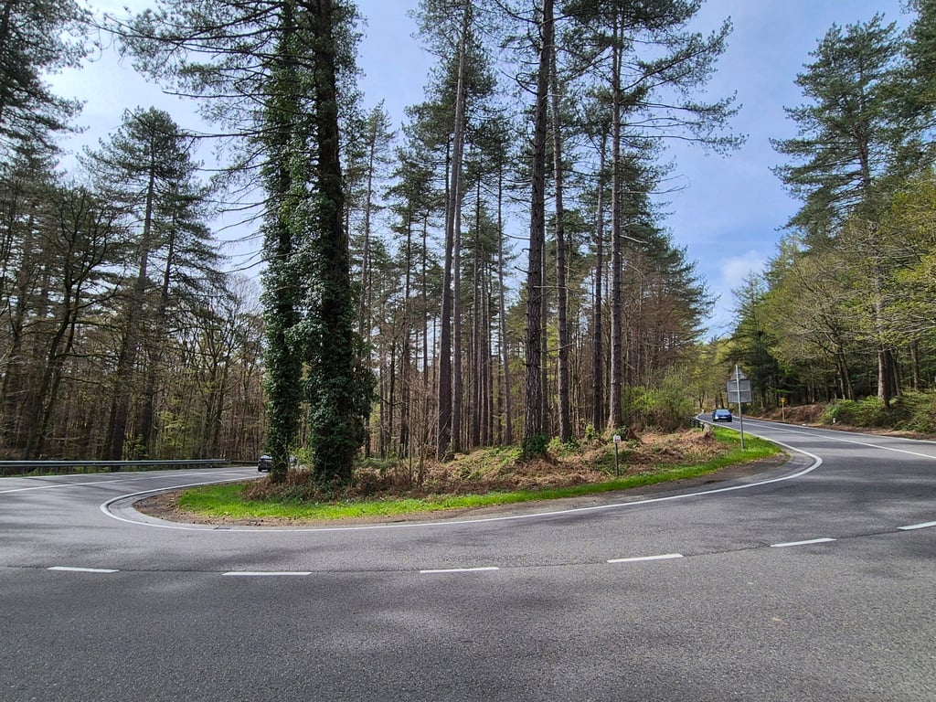
| 2 hairpin turns |
| #39 toughest climb of Pays de Liège |
| #2 most elevation gain of Pays de Liège |
| #17 longest climb of Pays de Liège |
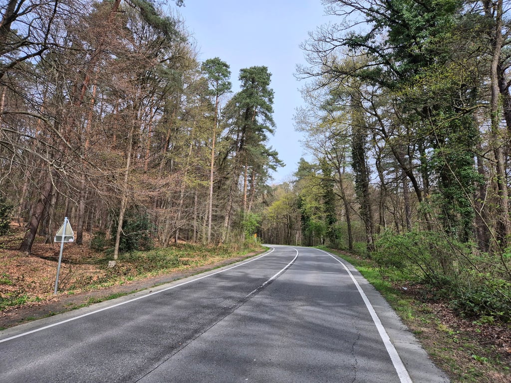
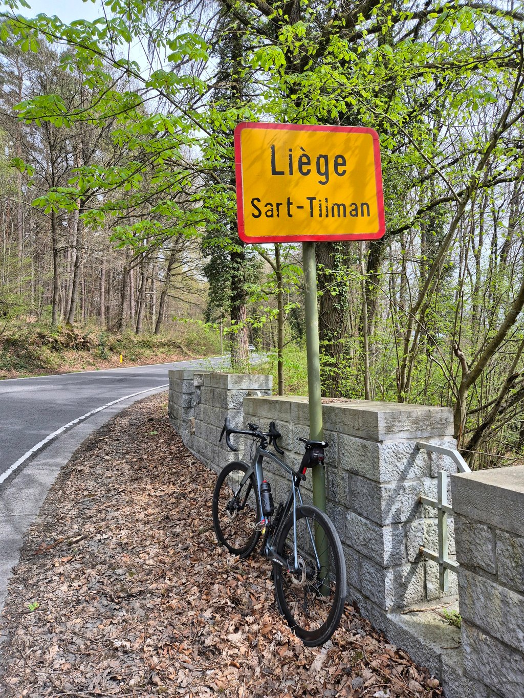
Côte du Sart-Tilman from Tilff is a climb in the region Pays de Liège. It is 2.3 mi long and bridges 633 ft of vertical ascent with an average gradient of 5.3%, resulting in a difficulty score of 105. The top of the ascent is located at 889 ft above sea level. Climbfinder users shared 7 reviews of this climb and uploaded 4 photos.
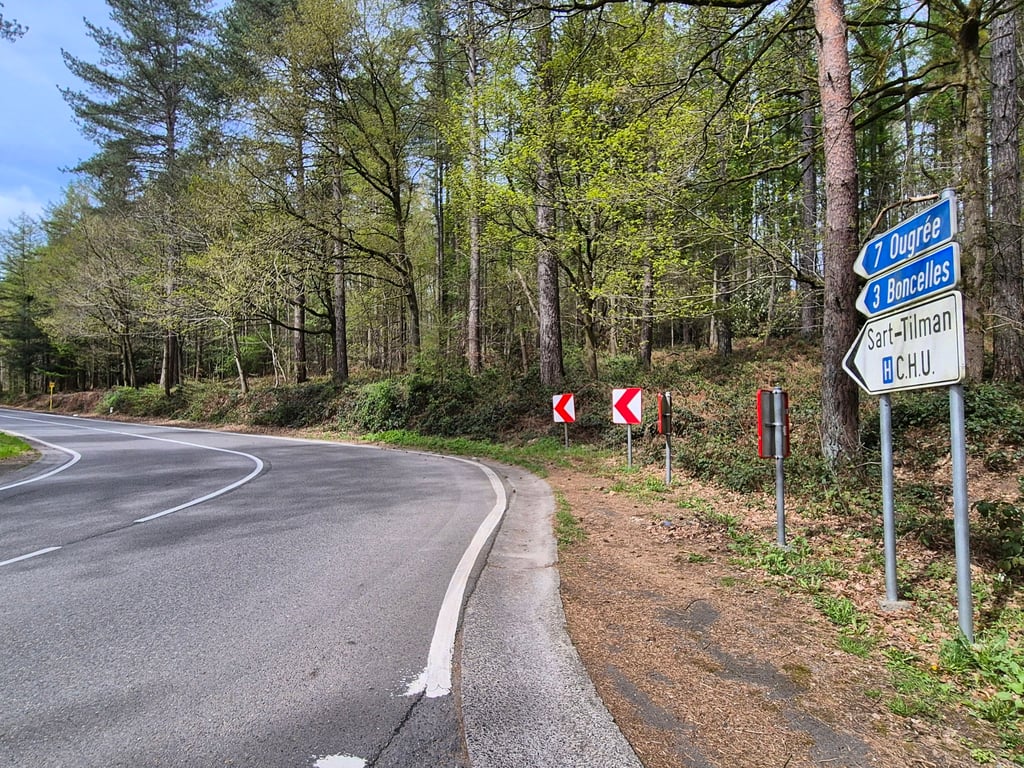
Road names: Rue Fond du Moulin, Rue de Boncelles & Rue du Vieux Frêne
2.0 by JarinThis is an automatic translation, the original language is: Dutch.Pretty nice climb and surroundings, but a lot of car traffic. Therefore not really recommended. The alternative route via Rue de Limoges is very quiet and offers a beautiful view of the Ourthe valley, but has a very steep approach!!!... read more
Welcome! Please activate your account if you would like to share something. Look for the verification email in your inbox.
If you want to upload your photos, you need to create an account. It only takes 1 minute and it's completely free.
Pretty nice climb and surroundings, but a lot of car traffic. Therefore not really recommended. The alternative route via Rue de Limoges is very quiet and offers a beautiful view of the Ourthe valley, but has a very steep approach!!!
Best mooie klim en omgeving, maar heel veel autoverkeer. Daarom niet echt een aanrader. De alternatieve route via de Rue de Limoges is heel rustig en biedt een prachtig uitzicht op de Ourthevallei, maar kent wel een heel steile aanloop!!
Frankly, I would not do this climb. It is a runner, but so insanely crowded with cars's. It was that my airbnb was near here, but otherwise I would have driven around nicely.
It is fun going through those hairpin bends and it is also not very challenging in terms of the climb an sich, but it does not outweigh the misery of the traffic.
Eerlijk gezegd zou ik deze beklimming niet doen. Het is een loper, maar zo waanzinnig druk met auto's. Het was dat mijn airbnb hier vlakbij zat, maar anders was ik lekker omgereden.
Het is wel leuk om die haarspeldbochten door te gaan en het is ook niet erg uitdagend qua beklimming an sich, maar het weegt niet op tegen de ellende van het verkeer.
Very busy road leading up from the valley to the Ourthe towards Boncelles / Plainveaux . Very good surface but prefer an alternative (Roche aux Faucons, Hout-si-Plout, Bonsegnée, ...)
Rue très fréquentée permettant de remonter de la vallée vers de l'Ourthe vers Boncelles / Plainveaux . Très bon revêtement mais préférez une alternative (Roche aux Faucons, Hout-si-Plout, Bonsegnée, ...)
Very busy road, but the other alternatives are either very steep (Roche aux faucons) or even busier (Boulevard de Colonster).
Route très fréquentée, mais les autres alternatives sont soit très pentues (Roche aux faucons) soit encore plus fréquentée (Boulevard de Colonster).
In itself an ideal mountain to put in your course as an opening slope (a real 'runner' on an almost perfect road surface), were it not for the busy car traffic. I think I inhaled more exhaust fumes during this approx. 4 km than during the whole of last year. Avoid this slope, I would say, unless perhaps at dawn. (Observation on 9 July 2022)
An sich een ideaal bergje om als openingshelling in je parcours te steken (een echte 'loper' op een nagenoeg perfect wegdek), ware er inderdaad niet het drukke autoverkeer. Ik heb gedurende deze ca. 4 km geloof ik meer uitlaatgassen ingeademd dan gedurende het hele voorbije jaar. Mijd deze helling, zou ik zeggen, tenzij misschien in het ochtendgloren. (waarneming op 9 juli 2022)
A climb like I like them. This hill of a little more than 3km offers a nice regular percentage that allows you to increase your power as you go along. This climb also has a mountain feel with its various bends from the start, some of which are hairpin bends.
The small drawback is the traffic which is very dense during the week and on Saturdays. A climb to do on Sunday morning if you want a bit of peace and quiet.
Une côte comme je les apprécie. Cette côte de un peu plus de 3km offre un beau pourcentage régulier qui permet de monter en puissance au fur et à mesure. Cette côte offre également un côté montagne avec ses différents virages dès le début dont certain en épingle.
Le petit bémol est la circulation qui est très dense en semaine et le samedi. Une côte à faire le dimanche matin si on souhaite un peu de tranquillité.
I drove it as a descent, much traffic but nice dark environment with 'hairpin bends'. Although it runs fine according to the percentages, I would not recommend it.
Heb deze als afdaling gereden, veel verkeer maar wel leuke duistere omgeving met 'haarspeldbochten'. Ondanks dat ie fijn loopt volgens de percentages zou ik 'm niet aanraden.
| 5 mph | 00:27:18 |
| 7 mph | 00:19:19 |
| 9 mph | 00:15:03 |
| 12 mph | 00:11:19 |
This page is better in the app