Tips nearby


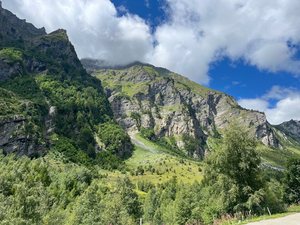
| Beautiful scenery |
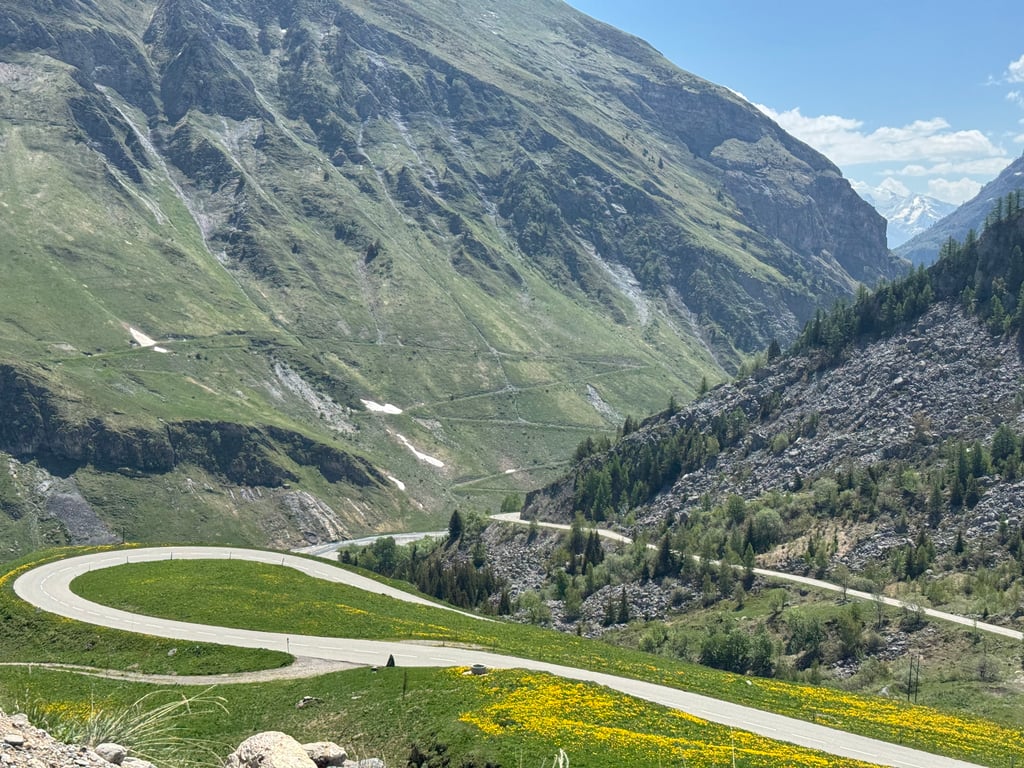
| 14 hairpin turns |
| #88 toughest climb of Savoie |
| #93 most elevation gain of Auvergne-Rhône-Alpes |
| #95 longest climb of Auvergne-Rhône-Alpes |
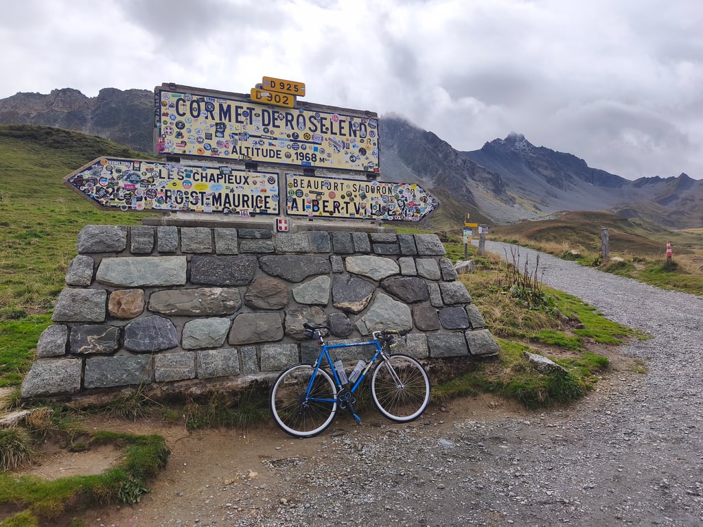
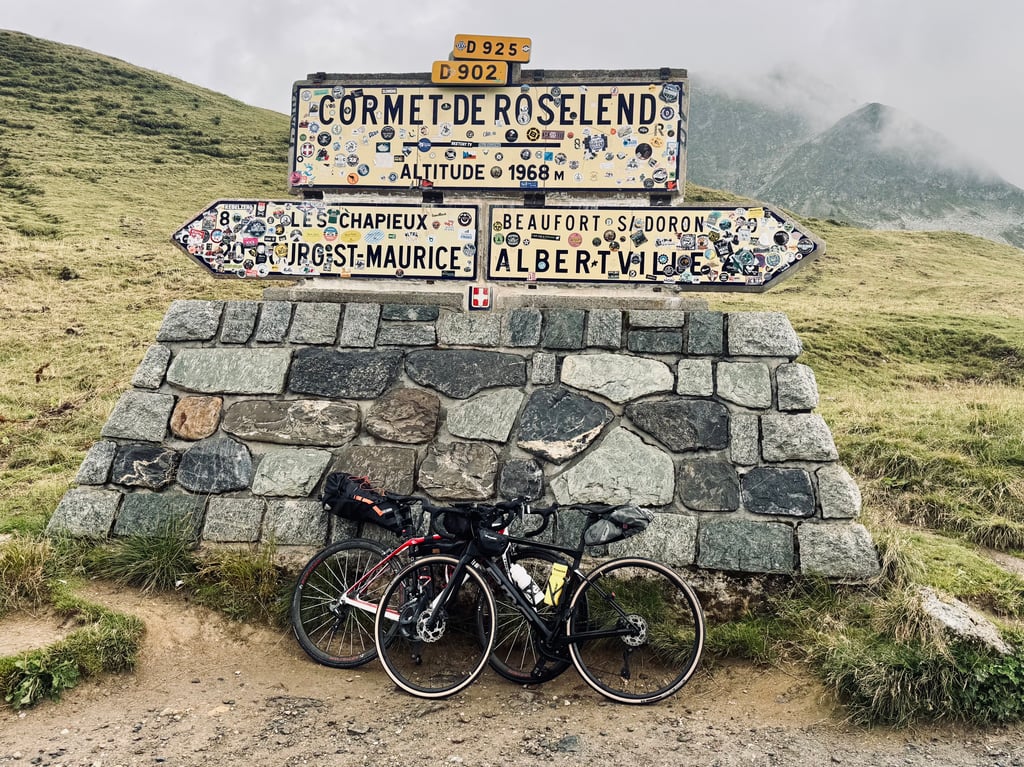
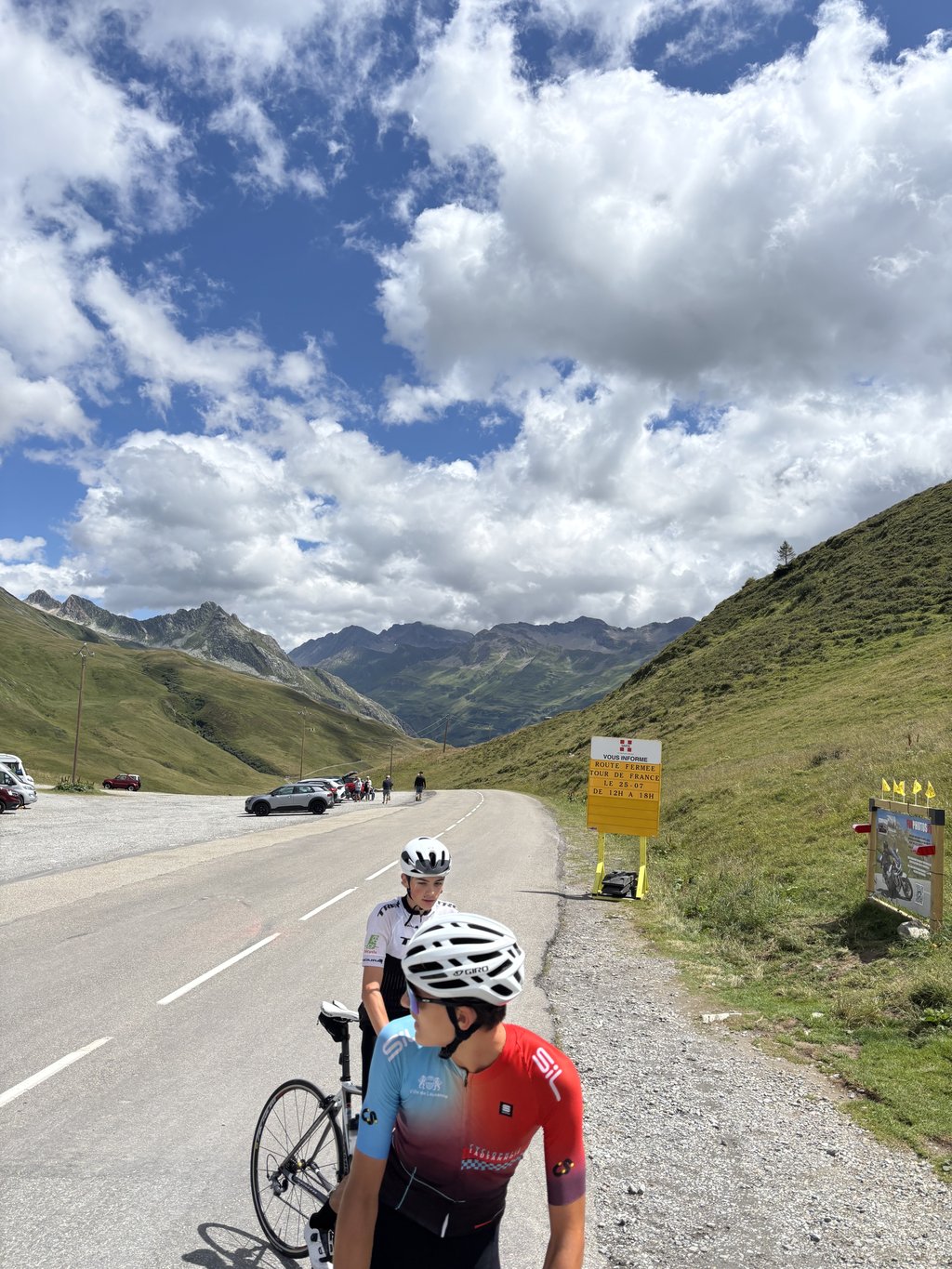
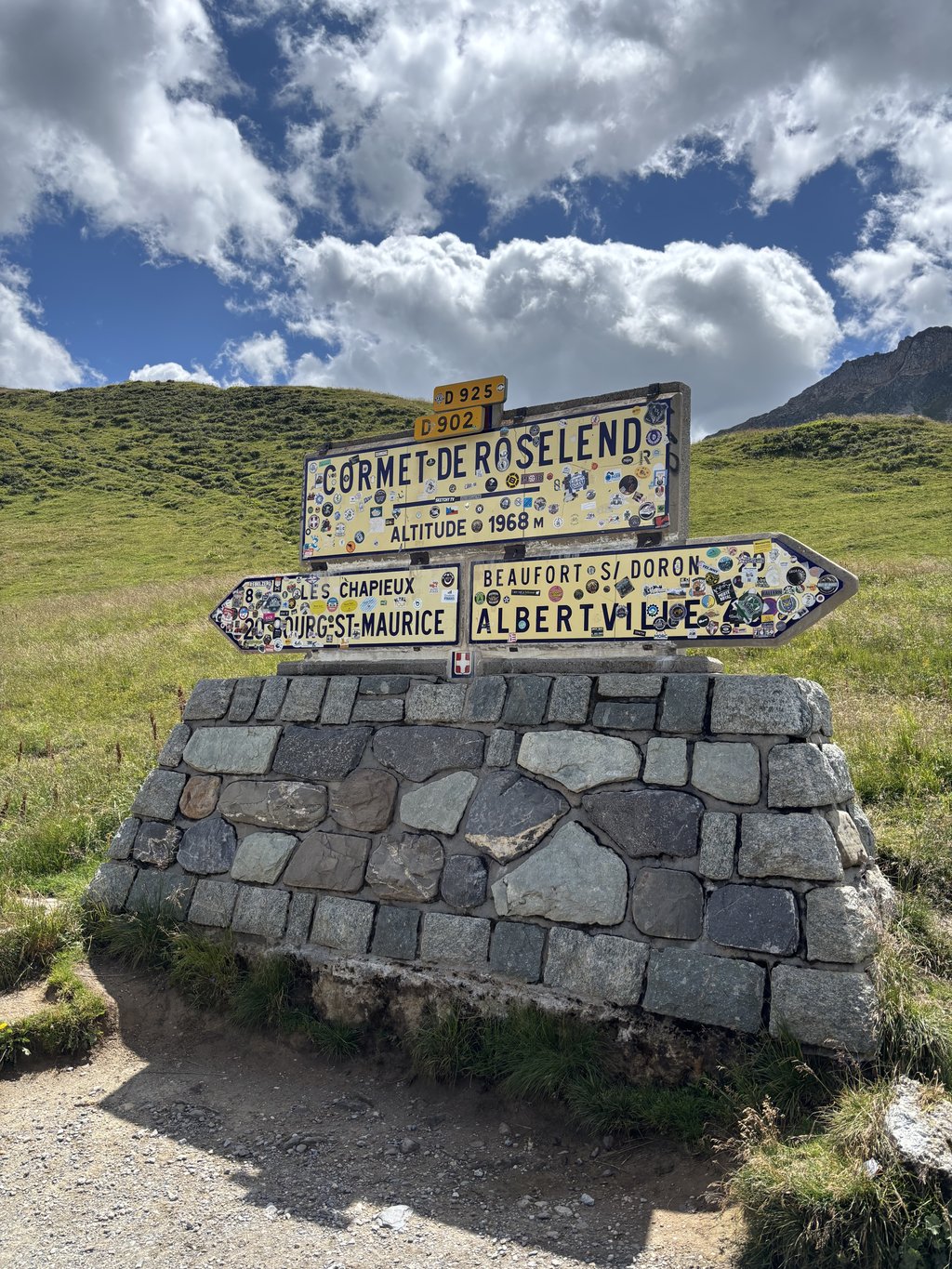
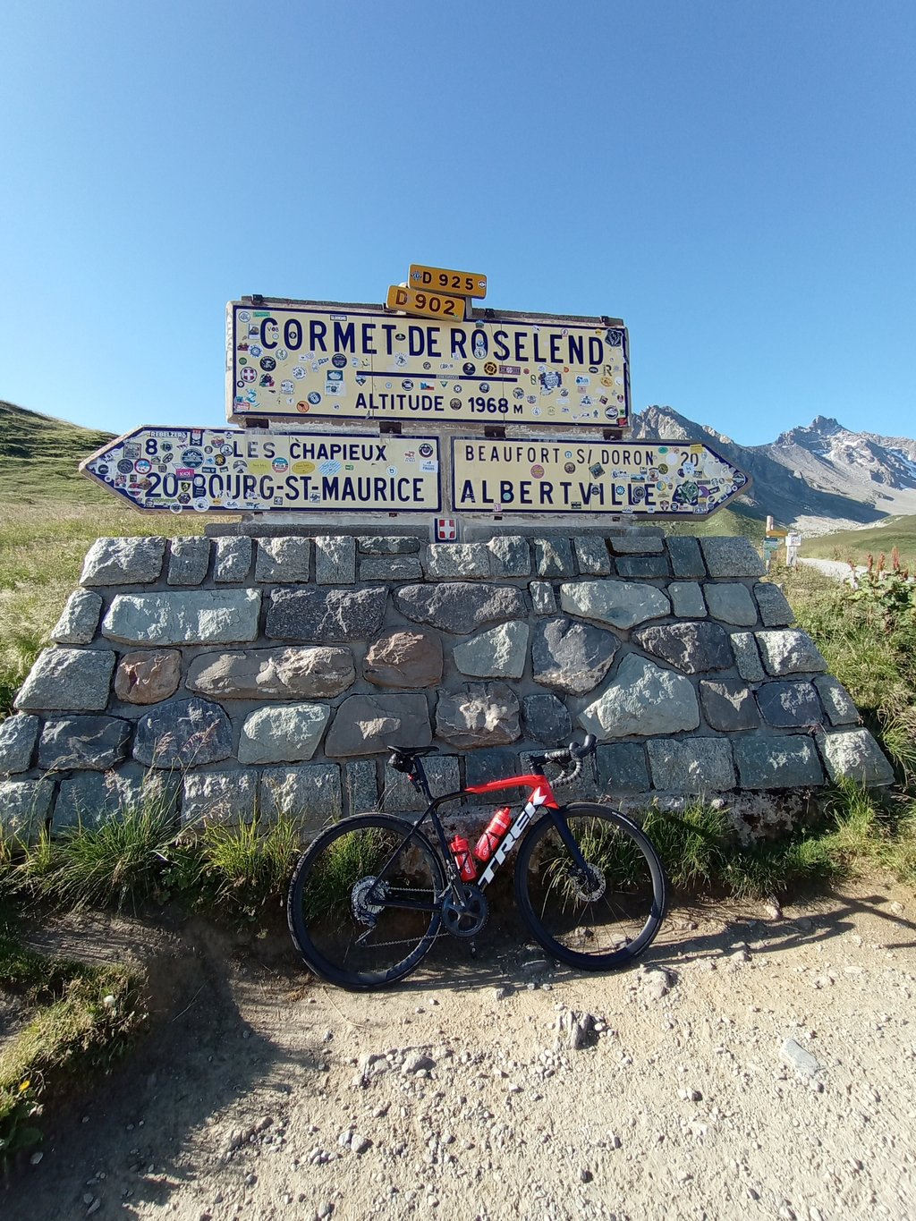
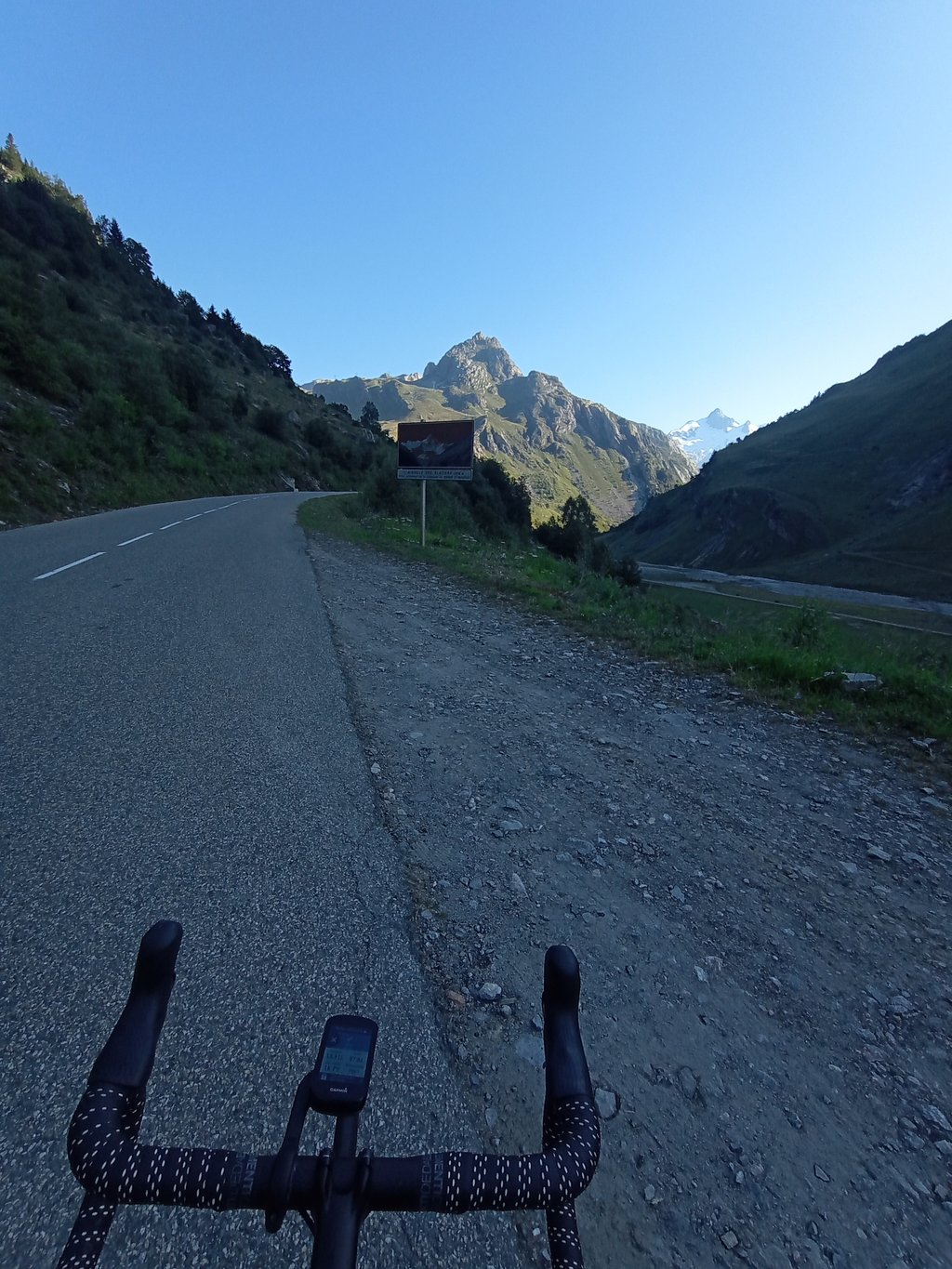
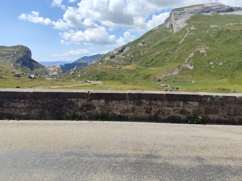
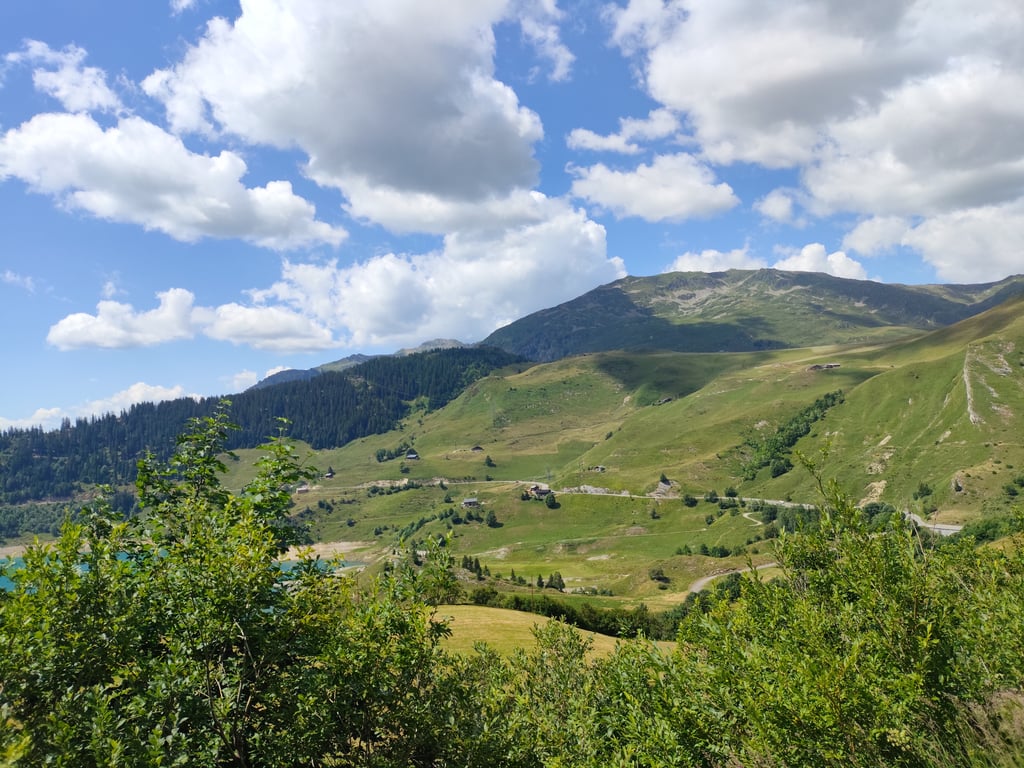
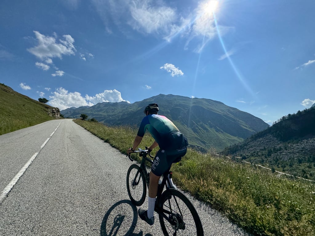
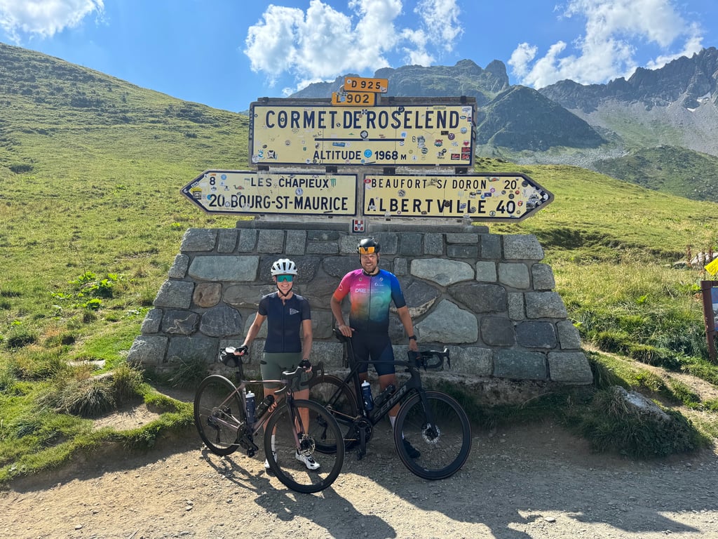
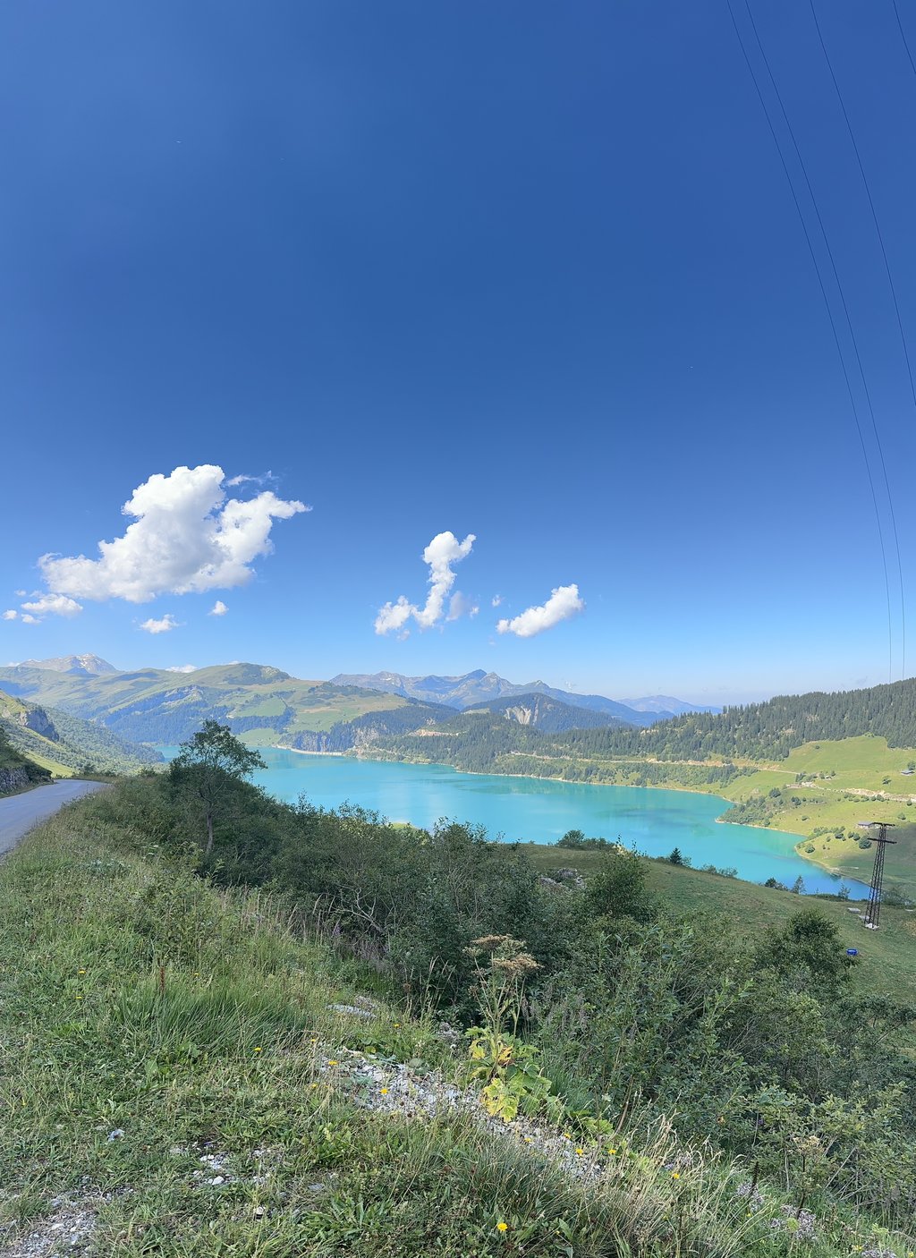
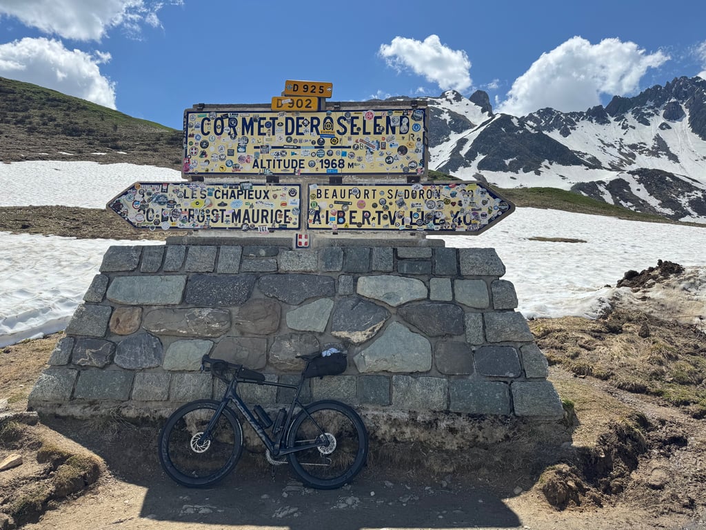
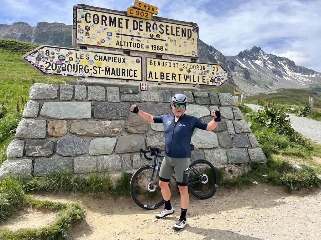
Cormet de Roselend from Bourg-Saint-Maurice is a climb in the region Savoie. It is 12 mi long and bridges 3789 ft of vertical ascent with an average gradient of 6%, resulting in a difficulty score of 803. The top of the ascent is located at 6460 ft above sea level. Climbfinder users shared 33 reviews of this climb and uploaded 59 photos.
Road name: D902
5.0 by eRVeThis is an automatic translation, the original language is: Dutch.Ascent done on 27 June'25. Weather conditions: +/- 25 degrees and at the summit it was +/- 22 degrees. This climb starts immediately from B-S-M and is about 19 km long. Very nice climb but an uneven one. Varying gradients making it harder to maintain a cycling rhythm. But definitely not too tough if you keep your own pace. About 5 km from the summit, you ride through a beautiful valley with an incredible view of the Mont Blanc massif. Stop and take some photos's and especially enjoy t... read more
Welcome! Please activate your account if you would like to share something. Look for the verification email in your inbox.
If you want to upload your photos, you need to create an account. It only takes 1 minute and it's completely free.
A really beautiful mountain pass—the most beautiful one I've ever driven through
Superschöner Pass, de schönste den ich je gefahren bin
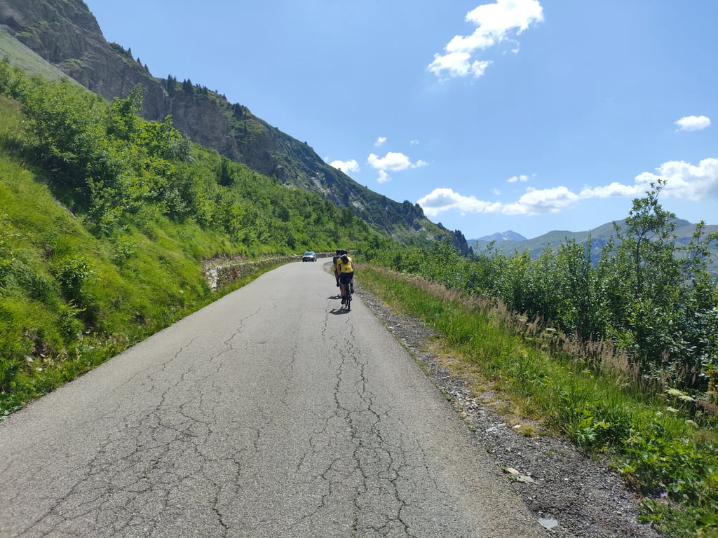
A very beautiful climb with stunning scenery as you emerge from the forest. However, there’s quite a bit of traffic, especially motorcyclists. The slope is challenging, but there are a few flat sections where you can catch your breath. The middle of the descent is very technical, with a fairly narrow road.
Très belle montée avec des paysages superbes en sortant de la forêt. Il y a cependant pas mal de circulation, en particulier des motards. La pente est exigeante mais des petits replats permettent de souffler. Le milieu de la descente est très technique avec une route assez étroite.
Wonderful ascent with great views. Also possible in summer, as a large part of the ascent is in the forest and therefore offers some protection from the sun.
Wunderbare Auffahrt mit tollen Aussichten. Auch im Sommer möglich, da ein großer Teil des Anstiegs im Wald liegt und somit etwas Schutz vor der Sonne bietet.
A very nice climb in a very wild valley, despite the fact that there can be a lot of traffic. I did it in mid-September, in mixed weather, so there wasn't too much traffic. The road is uneven both in terms of gradient and the quality of the tarmac. There's a first flat as you enter the valley and the forest, then a second as you reach the mountain pasture. It's a pass with the length and gradient typical of a good alpine climb, not too hard but demanding. The views along the way are very pleasant.
Très belle ascension dans un vallon très sauvage, malgré une circulation pouvant être importante. L'ayant fait mi-septembre, sous un temps mitigé, je n'ai pas eu trop de circulation. La route est irrégulière aussi bien en terme de pente que de qualité du bitume. Il y a un premier replat en arrivant dans le vallon et la forêt, puis un second en arrivant dans l'alpage. C'est un col à la longueur et l'inclinaison typique d'une bonne ascension alpestre, pas trop dure mais exigeante. La vue tout le long du parcours est très agréable.
Lovely climb. Quiet and nice views. Asphalt is fair to good
Heerlijke klim. Rustig en mooie uitzichten. Asfalt is redelijk tot goed
A climb to be recommended! It's long, and above all very uneven... There's a little respite around the middle of the climb, between two steeper sections. There are also two hairpin bends. The only downside is the traffic and, in places, the very average quality of the surface.
Montée à recommander ! Elle est longue, et surtout très irrégulière... Elle offre un peu de répit à peu près au milieu de l'ascension, entre deux parties plus raides. À deux reprises également, il y a une succession d'épingles à cheveux. Petit bémol quant au trafic et par endroits à la qualité très moyenne du revêtement
1st HC pass for me, departure from Bourg St Maurice: I wasn't disappointed, it's very varied with gentle slopes, even negative ones, which allow you to recover a little, and when you come out of the hairpin bends in the forest ... the landscape opens up and you're alone in the middle of a magnificent panorama!
it's actually on the way down that you realise just how much you've climbed! Highly recommended ... and for me to do again via Beaufort.
1er col HC pour moi , départ à Bourg St Maurice : je n'ai pas été déçu, c'est très varié avec des pentes douces voire négatives qui permettent une petite récupération, et quand on sort des lacets dans la forêt .. le paysage s'ouvre et on est seul au milieu d'un panorama magnifique !!
c'est en fait à la descente qu'on se rend compte de tout ce qu'on a grimpé !! Vivement conseillé donc ... et pour ma part à refaire par Beaufort
Fantastic climb, but very tough because of the changing profile! Percentage occasionally went up to 12/13% but that didn't really last long. It was very cold at the top for the last 5k, but that was probably because of the low temperatures the 2 days before!? Because of the scenery an absolute must!!! 🤩
Fantastische klim, maar erg pittig vanwege het wisselende profiel! Percentage liep af en toe op tot 12/13% maar dat duurde niet echt lang. Het was de laatste 5k wel erg koud boven, maar dat was waarschijnlijk vanwege de lage temperaturen de 2 dagen ervoor!? Vanwege de omgeving een absolute must!! 🤩
Ascent done on 27 June'25.
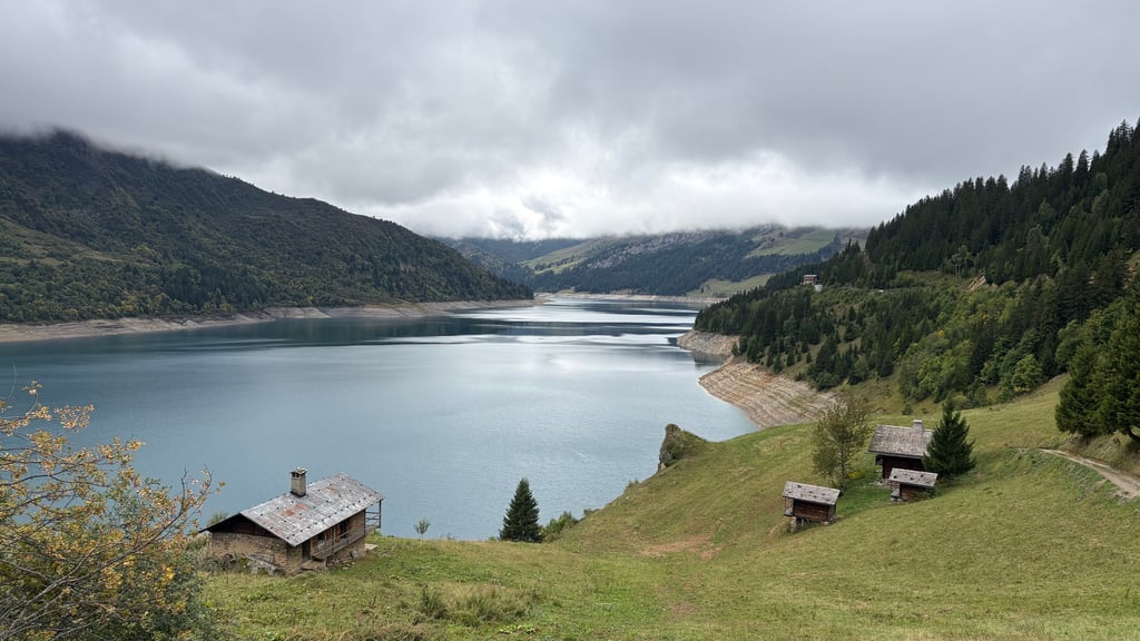
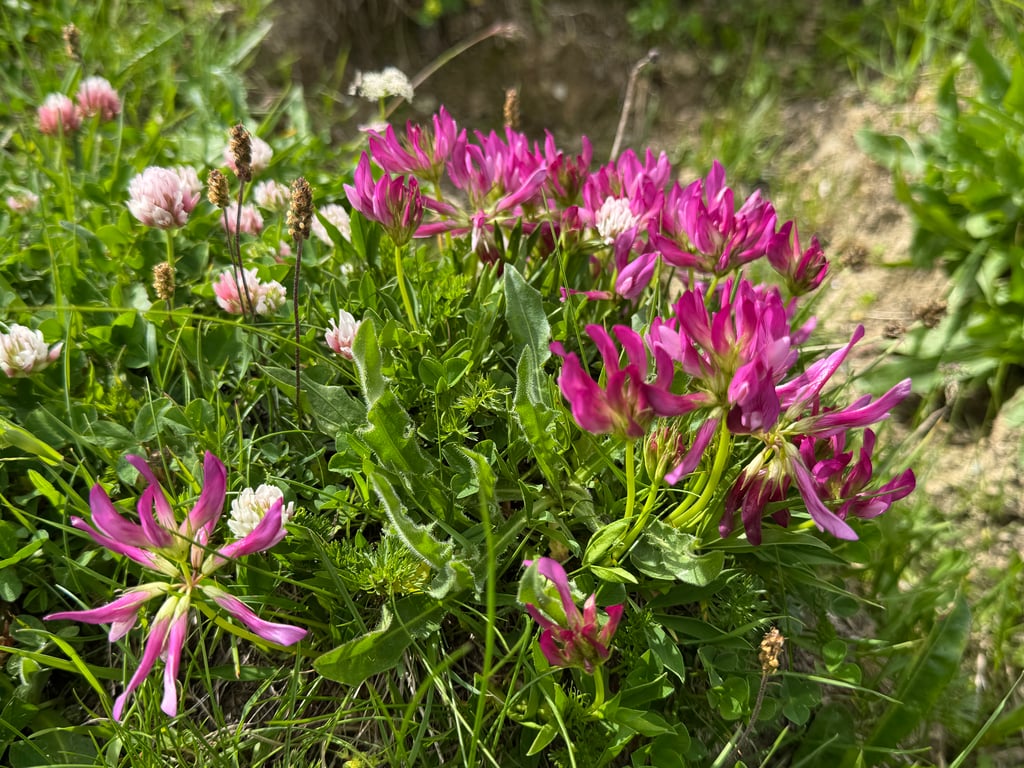
Weather conditions: +/- 25 degrees and at the summit it was +/- 22 degrees. This climb starts immediately from B-S-M and is about 19 km long. Very nice climb but an uneven one. Varying gradients making it harder to maintain a cycling rhythm. But definitely not too tough if you keep your own pace. About 5 km from the summit, you ride through a beautiful valley with an incredible view of the Mont Blanc massif. Stop and take some photos's and especially enjoy the view. Definitely do not underestimate the last kilometres and do not force yourself. Once at the top, of course, we enjoyed the beautiful scenery, the bright colours of the flowers growing on the mountain plains. Afterwards, I descended via Lake Roselend to Beaufort. Of course, this is also enjoying the beautiful views along the way. In Beaufort, I stopped to eat something before riding up the Col des Saisies.
Beklimming gedaan op 27 juni'25.
Weersomstandigheden: +/- 25 graden en op de top was het +/- 22 graden. Deze klim start onmiddellijk vanuit B-S-M en is ongeveer 19 km. lang. Zeer mooie klim maar wel een ongelijkmatige klim. Wisselende stijgingspercentages waardoor je moeilijker een fietsritme kan aanhouden. Maar zeker niet te zwaar als je je eigen tempo blijft rijden. Op ongeveer 5 km. van de top rijd je door een prachtige vallei met een ongelooflijk zicht op het Mont Blanc massief. Even stoppen en enkele foto's nemen en vooral genieten van het uitzicht. De laatste kilometers zeker niet onderschatten en je niet forceren. Eenmaal boven is het uiteraard genieten van de mooie omgeving, de felle kleuren van de bloemen die op de bergvlaktes groeien. Nadien ben ik afgedaald via het meer van Roselend naar Beaufort. Uiteraard is dit ook genieten van de prachtige zichten onderweg. In Beaufort eventjes halthouden om iets te eten om nadien de Col des Saisies op te rijden.
What can I say except that this is simply one of the most beautiful places in the world. The road is magnificent. The climb is relatively busy. The gradients are irregular, making the climb a real physical challenge. And above all, the scenery is absolutely sublime, whether in the forest or afterwards.
Que dire à part que cet endroit est l’un des plus beaux au monde, tout simplement. La route est magnifique. L’ascension relativement empruntée. Les pourcentages sont irréguliers ce qui transforme cette montée en un vrai défi physique. Et surtout les paysages absolument sublimes que ce soit dans la forêt ou apres.
I really enjoyed this climb, which was quite hard, with a grandiose finish that wasn't too steep. The first part is wooded, narrow and full of switchbacks, but gradually gives way to the high mountains and wide open spaces. Le Cormet is a must-do
J ai surkiffé cette montée, plutôt dure avec un final grandiose sans excès de pourcentage. Une 1ere partie boisée, étroite, gorgée de lacets, laisse peu à peu place à la haute montagne, aux grands espaces. Le cormet est à faire absolument
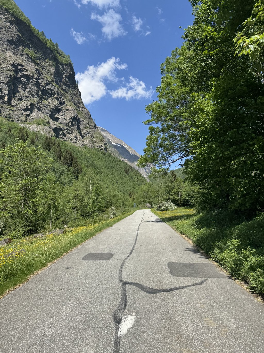
A beautiful climb that winds along a picturesque valley. The first part runs alongside a river, crossing a narrow valley surrounded by forest, which provides a pleasant feeling of coolness, especially on hot days.
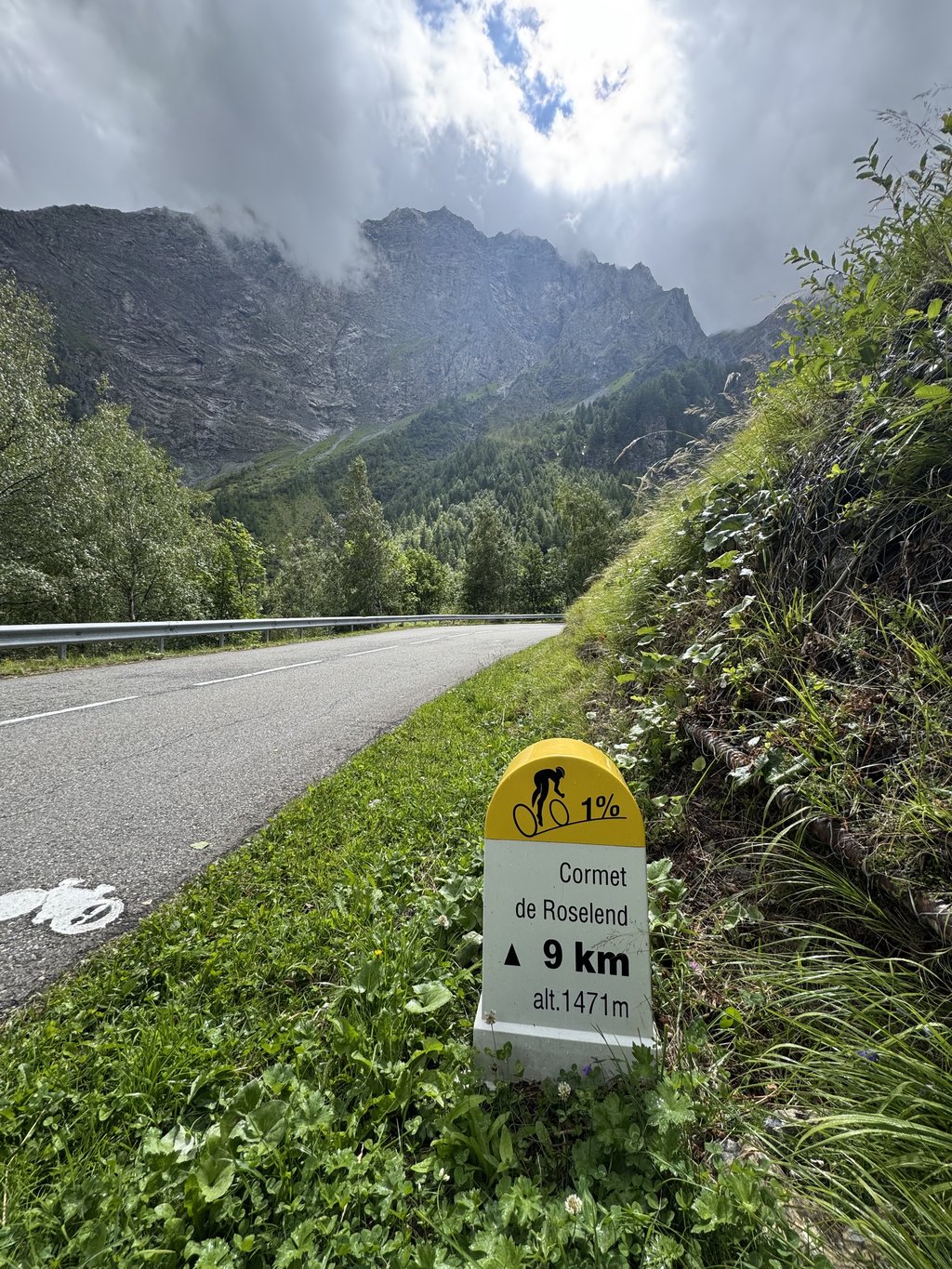
It should be noted that the official altimetry seems to be inaccurate: signs along the road indicate stretches at'1%, and others around towards 10%. Overall, the perception is that signs on the ground are more reliable. A very pleasant ascent, with a few harder sections here and there, but always surrounded by nature.
Bellissima salita che si snoda lungo una suggestiva valle. La prima parte costeggia un fiume, attraversando una valle stretta immersa nel bosco, che regala una piacevole sensazione di freschezza, soprattutto nelle giornate più calde.
Da segnalare che l’altimetria ufficiale sembra poco precisa: i cartelli lungo la strada indicano tratti all'1%, e altri intorno verso il 10%. Nel complesso, la percezione è che i segnali sul posto siano più affidabili. Un'ascesa molto piacevole, con qualche spunto più duro qua e là, ma sempre immersa nella natura.
Done at 8am during the week. No traffic, perfect asphalt, I didn't see any drinking fountains. It deserves top marks for the views along the entire climb even though the first 8/9 km, the hardest, are in the woods but even that is beautiful. I don't recognise myself in the profile of the gradients reported on this site. There are harder inclines and a couple of kilometres instead at 1%. Done again after a couple of years and I would do it again tomorrow, beautiful
Fatta alle 8 di mattina in settimana. Traffico assente , asfalto perfetto non ho visto nessuna fontanella. Merita voto massimo per il panorama lungo tutta la salita anche se i primi 8/9 km , i più duri , sono nel bosco ma anche quello bello. Non mi riconosco nel profilo delle pendenze segnalate su questo sito. Ci sono pendenze più dure e un paio di km invece al 1%. Rifatto dopo un paio d'anni e lo rifarei domani, bellissimo
The profile is not correct by any means 😂
Don't mistake the profile here on climbfinder. There is a km at -1%, which therefore bodes well for the rest.
Km at 9% average followed by 10% average. Indicated both by the signs on the side and confirmed by Garmin profile.
Bon, nice climb, nicer as other side personally, especially with view of glacier mountain. But don't underestimate it
Het profiel klopt langs geen kanten 😂
Mispak je niet aan het profiel hier op climbfinder. Er is een km aan -1%, wat dus belooft voor de rest.
Km aan 9% gemiddeld gevolgd door 10% gemiddeld. Zowel aangegeven door de bordjes aan de kant als bevestigd door Garmin profiel.
Bon, mooie klim, mooier als andere kant persoonlijk, zeker met uitzicht op de gletsjerberg. Maar onderschat hem niet
What a wonderful route with beautiful views. This really is a trip you must have done once.
Wat een heerlijke route met prachtige uitzichten. Dit is echt een tocht die je een keer gedaan moet hebben.
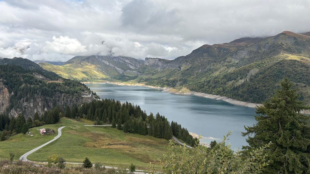
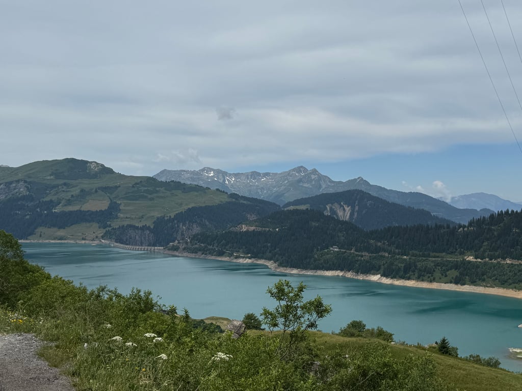
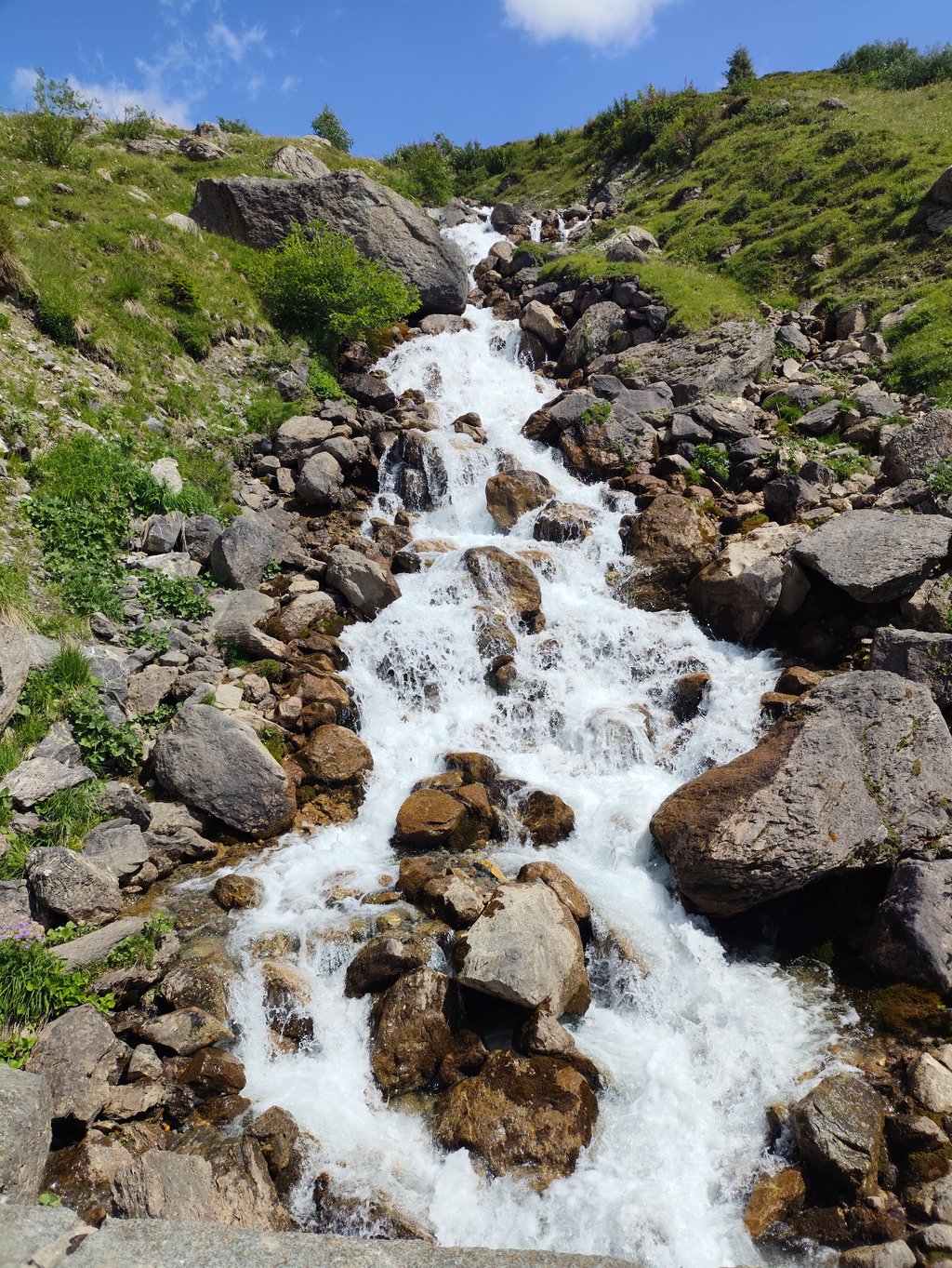
Lovely gradual climb with no really difficult sections. After the series of hairpins, there are beautiful views of the (foothills of) Mont-Blanc. The climb goes through beautiful nature with many small waterfalls and streams. Tip is to descend 8km after the summit for views of the lake (and good coffee) and to catch the beautiful last 8km of climbing the route from the other side.
In the descent, the hairpin bends do require some caution, the road surface is not always as good and there are still quite a few cars's going up (today, one was upside down in the bend as well...).
Heerlijke geleidelijke klim zonder echt moeilijke stukken. Na de serie haarspeldbochten is er prachtig uitzicht op de (uitlopers van de) Mont-Blanc. De klim gaat door mooie natuur met veel kleine watervalletjes en beekjes. Tip is wel om na de top 8km af te dalen voor uitzicht op het meer (en lekkere koffie) en om de mooie laatste 8km klimmen van de route vanaf de andere kant nog mee te pakken.
In de afdaling is bij de serie haarspeldbochten wel wat voorzichtigheid geboden, het wegdek is niet altijd even goed en er gaan nog best wat auto's naar boven (vandaag lag er ook eentje in de bocht op de kop..).
This climb is super enjoyable, first you start in the forest following the river and once you get out of the forest the scenery is really magnificent. As for the sporting side, it remains a great challenge with several kilometres of average gradients of 8%,9%,10%. The flat spot in the middle feels good
I did it one morning at 9am and didn't see a single car on the entire ascent.
Cette ascension est super agréable, d'abord on commence dans la forêt en suivant la rivière et une fois que l'on sort de la forêt le paysage est vraiment magnifique. Pour ce qui est du côté sportif ça reste un beau défi avec plusieurs kilomètres avec des pentes moyennes à 8%,9%,10%. Le replat au milieu fait du bien
Fait un matin à 9heures, je n'ai vu aucune voiture sur toute l'ascension
A great and varied climb from Bourg-Saint-Maurice to the Cormet. We even did some droving on the way up with cattle walking up the road. Unfortunately ( for cyclists) this road D902 forms part of the Route des Grandes Alpes, and as such attracts a disproportionate number of (super) car club enthusiasts. Otherwise the Alpine environment is pristine, peaceful and covered in wild flowers.
Most beautiful col starting from Bourg-Saint-Maurice, nowhere really steep giving plenty of opportunity to enjoy the beautiful scenery. Compared to the Petit Saint Bernard & Col de L'Iseran, there is little traffic (certainly no trucks).
Golden tip for experienced cyclists is to descend to Beaufort after the Roselend and then take the Col du Pré back, making a round trip of just under 100km there and back to Bourg Saint Maurice.
Mooiste col vertrekkende vanuit Bourg-Saint-Maurice, nergens echt steil waardoor er voldoende mogelijkheid is om te genieten van de prachtige omgeving. In vergelijking met de Petit Saint Bernard & Col de L'Iseran is er weinig verkeer (zeker geen vrachtwagens).
Gouden tip voor geoefende fietser is om na de Roselend af te dalen naar Beaufort en dan de Col du Pré terug te nemen en zo een rondje van net geen 100km heen en terug naar Bourg Saint Maurice te maken.
A pleasant discovery. Although I often frequent the climbs in Valle d'Aosta, I had never been past Petit St Bernard. After the long descent from the Piccolo, the climb as you enter Bourg is well signposted. Very convenient signs with the missing kilometres, gradient in the km... Much tougher climb than you might think reading the average gradient. Take into account that there is one km at -1% and one km at 1%. In the remainder always on the 7-8-9 %. Unfortunately, there are no fountains where you can refill water. There are several on the way down from the Piccolo. After the first 7 km in the forest, the remainder are very exposed to the sun. Acceptable traffic. Spectacular views. Really recommended
Una piacevole scoperta. Nonostante frequenti spesso le salite valdostane, non ero ai stato oltre il piccolo san Bernardo. Dopo la lunga discesa dal Piccolo, ben segnalata la salita appena si entra a Bourg. Comodissimi i cartelli col chilometraggio mancante, pendenza nel km... Salita molto più dura di quanto si possa pensare leggendo la pendenza media. Fate conto che c'è un km al -1% e un km al 1%. Nei restanti sempre sul 7-8-9 %. Assenti purtroppo delle fontane dove ricaricare l'acqua. Ce ne sono diverse scendendo dal Piccolo. Dopo i primi 7km nel bosco, i restanti sono molto esposti al sole. Traffico accettabile. Vista spettacolare. Davvero consigliato
The beautiful climb with lots of variety in gradient and lots of variety in natural beauty.
This is definitely a climb for the bucket list and to do more often 😀.
Het mooie beklimming met veel afwisseling in stijgingspercentage en veel afwisseling in natuurschoon.
Dit is zeker een klim voor op de bucketlist en om vaker te doen 😀.
One of the 3 passes starting from Bourg St.Maurice cycled up in August 2022.
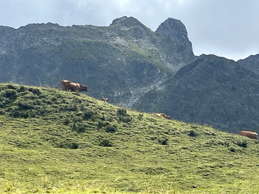
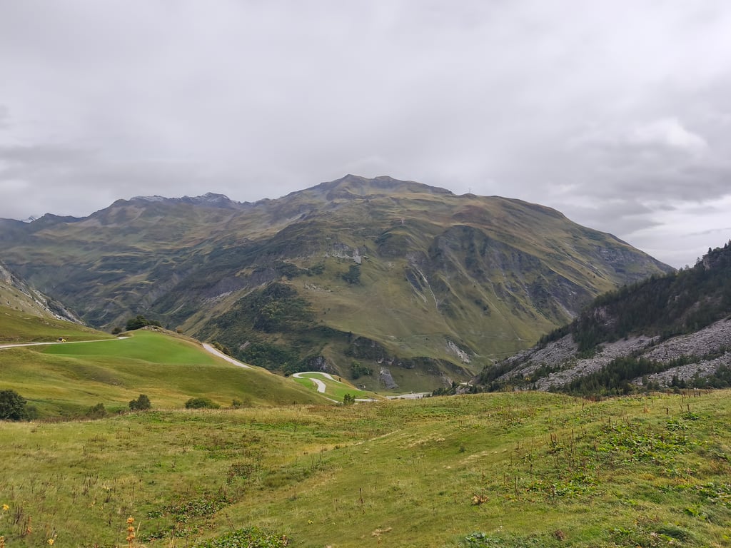
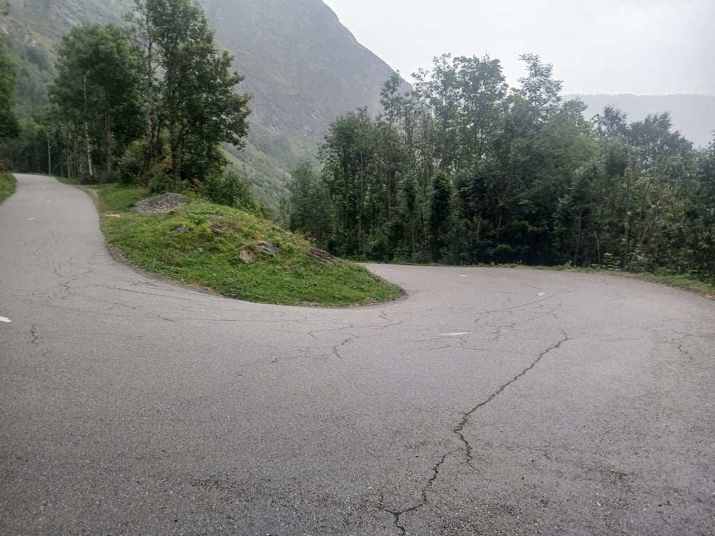
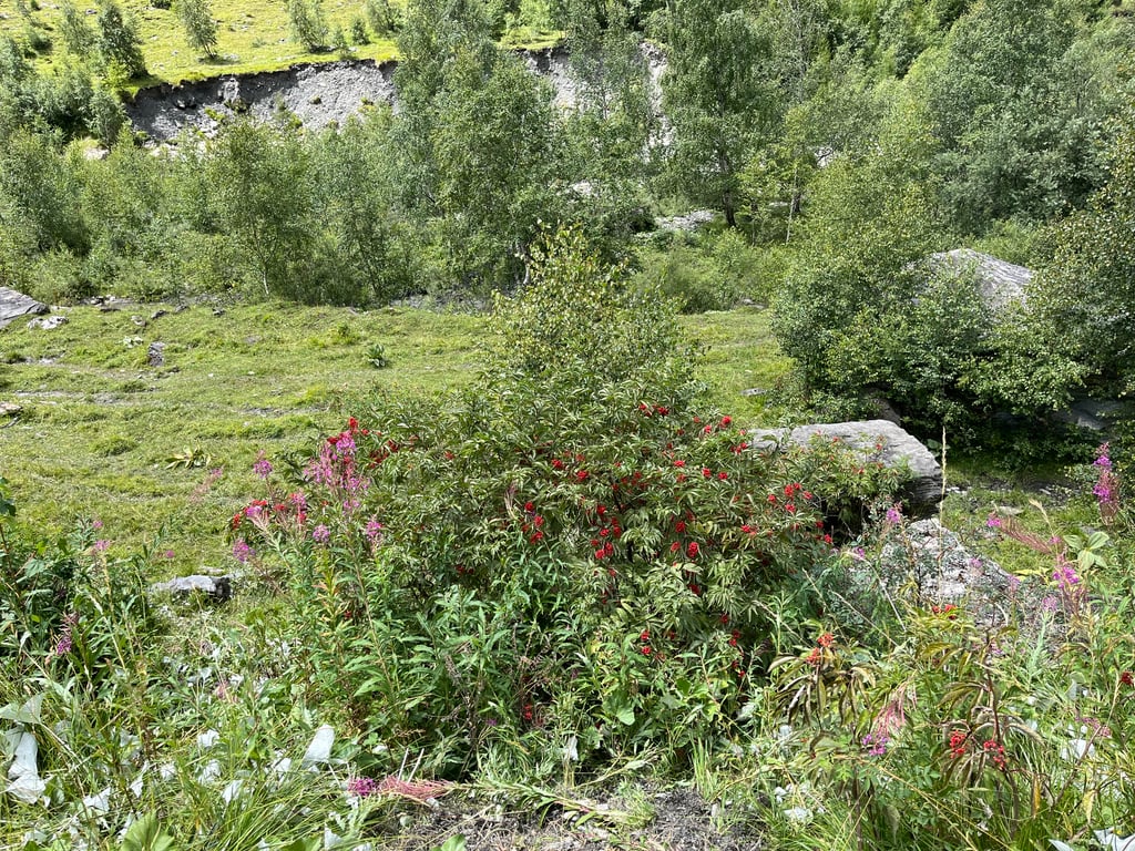
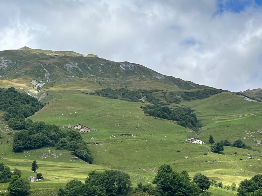
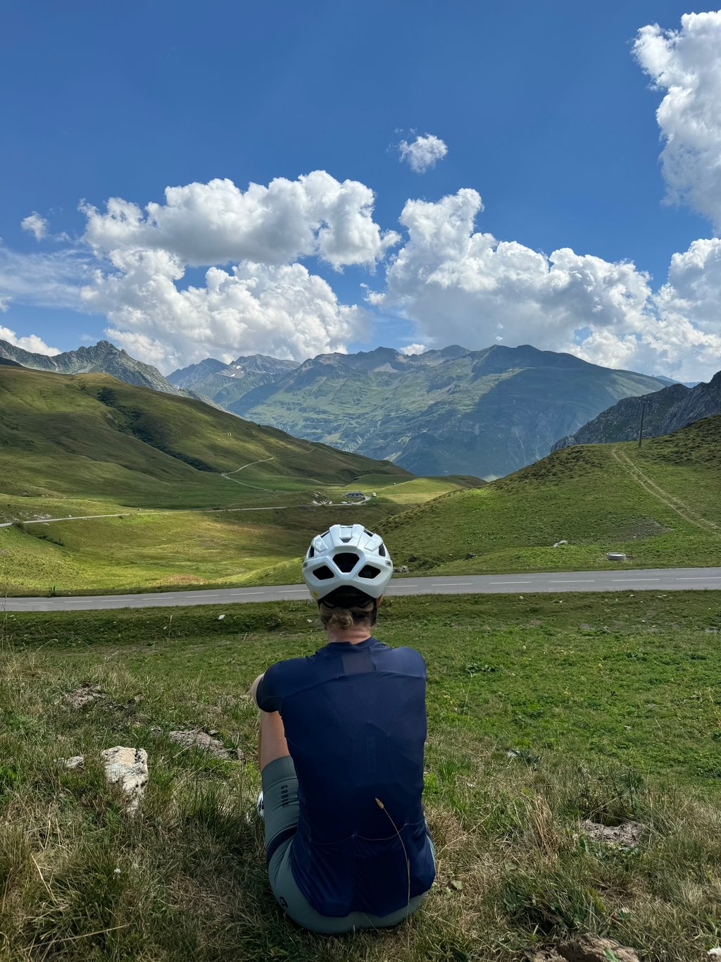
After turning off the roundabout at the start, you gain altitude immediately so the town quickly disappears beneath you. Beside a mountain river you cycle first through a gorge and then through the shady forest on a beautiful series of hairpin bends. Afterwards, you enter an open high-mountain setting for a second series of turns through alpine meadows full of cow flowers and rocks with snow-capped mountain peaks in the background. Before you reach the summit there is a fairly long "straight" stretch that seems false flat but still climbs 7%. With wind up, this was spicy. Highest point is plateau with parking and a market stall that sells drink cans in addition to regional products (cheese/meat).
There are no extreme percentages throughout the route and even 2 flatter intermezzos's . The white-yellow kilometre posts with cycling info keep you informed of this (distance to summit / % next kilometre/ altitude). 'In the morning there was little traffic,also because there is no habitation. Supply can only be done at the summit. The road surface varies in quality and width.
Not the highest, not the most famous, not the climb with the richest cycling history.
But in terms of nature among the most varied and beautiful cols of the French Alps.
Enjoy the bike from start to summit!!!!!!
Eén van de 3 passen die vertrekken in Bourg St.Maurice op gefietst in Augustus 2022.
Na het afdraaien van de rotonde bij de start win je direct hoogte zodat de stad snel onder je verdwijnt. Bezijden een bergrivier fiets je eerst door een kloof en vervolgens via een prachtige haarspeldbochtenreeks door het schaduwrijke woud. Nadien kom je terecht in een open hooggebergte decor voor een tweede bochtenreeks door alpenweides vol koeien bloemen en rotsen met besneeuwde bergpieken op de achtergrond. Voordat je de top bereikt is er nog een vrij lang "recht" stuk dat vals plat lijkt maar toch 7% klimt. Met wind op de kop was dit pittig. Hoogste punt is plateau met parking en een marktkraam dat naast regionale producten (kaas/vlees) ook drankblikjes verkoopt.
Er zijn op de gehele route geen extreme percentages en zelfs 2 vlakkere intermezzo's . De wit gele kilometerpalen met fietsinfo houden je hiervan op de hoogte (afstand tot top / % volgende kilometer/ hoogte). 's Morgens was er weinig verkeer,ook omdat er geen bewoning is. Bevoorrading kan enkel op de top. Het wegdek wisselt van kwaliteit en breedte.
Niet de hoogste, niet de bekendste, niet de klim met het rijkste wielerverleden.
Maar qua natuur bij de meest gevarieerde en mooiste cols van de Franse Alpen.
Genieten op de fiets van start tot top!!!!!!
A climb where you can really enjoy the surroundings.
As soon as you take the exit at the roundabout in Bourg St. Maurice, you leave the hustle and bustle behind you and start the climb in peace and quiet.
19km of enjoyment, and I am not exaggerating.
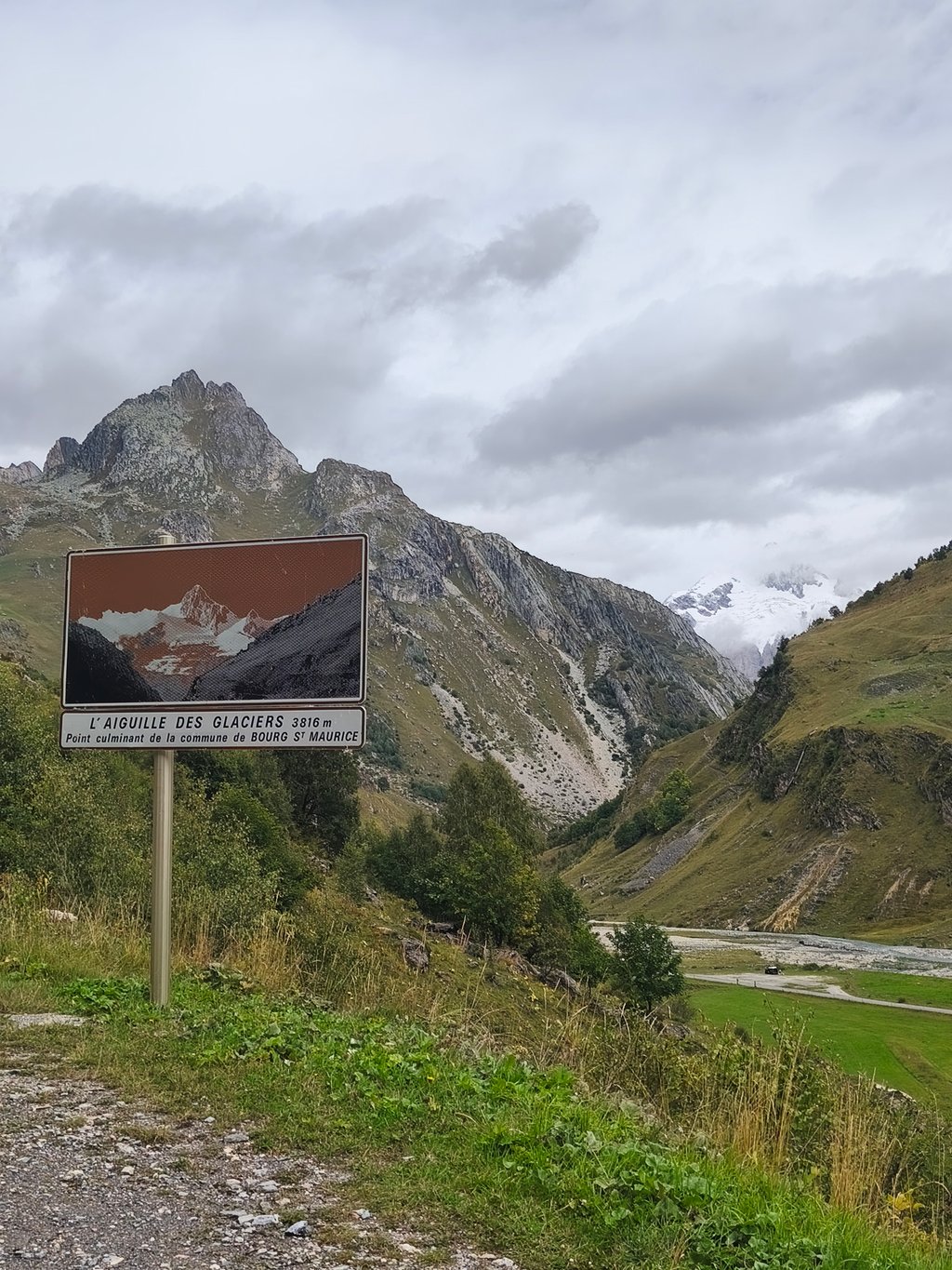
Before you enter the woods, the mountains are rough around the edges, but once you come out of the woods, the landscape is completely different. Green alpine meadows with the snowy peaks of the Aiguilles des Glaciers above.
On top of the summit, there is a market stall where you can buy something and then it is either turn around, or descend towards Lac de Roselend.
We descended for a round of the Col du Pré and that descent is great.
Een klim waar je echt kunt genieten van de omgeving.
Zo gauw je bij de rotonde in Bourg St. Maurice de afslag neemt, laat je de drukte achter je en begin je in alle rust aan de beklimming.
19km genieten, en dan overdrijf ik niet.
Voor je de bossen infietst is het gebergte ruw om je heen, eenmaal uit de bossen kom je in een heel ander landschap. Groene alpenweides met daarboven besneeuwde toppen van o.a. de Aiguilles des Glaciers.
Bovenop de top een marktkraampje om wat te kopen en dan is het of omdraaien, of afdalen richting Lac de Roselend.
Wij daalde af voor een rondje col du Pré en die afdaling mag er wezen.
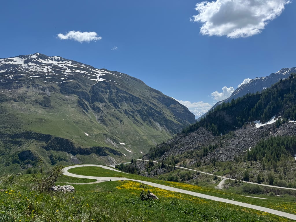
The first part from Bourg-Saint-Maurice goes between 5 and 8% until the barrier, Then, in the forest with the hairpin bends, my garmin indicated 10% several times, then there is a section until the exit to les Chapieux where the road goes almost straight up (8%) and ends with a deceptive section of almost straight up with sometimes 9% a nice finish especially with a head wind then back to Bourg-Saint-Maurice with a technical descent in the forest, a beautiful climb and descent.
het eerste gedeelte vanuit Bourg-Saint-Maurice gaat tssn 5 en 8% tot wanneer je de slagboom tegenkomt, daarna in het bos met de haarspeld bochten gaf mijn garmin meermaals 10% aan dan volgt er een tussenstuk tot aan de afslag les Chapieux waarna de weg bijna rechtdoor omhoog loopt ( 8%) en eindigt met een bedrieglijk stukje bijna rechte weg omhoog met soms 9% een leuke afsluiter zeker met tegenwind daarna terug naar Bourg-Saint-Maurice met in het bos een technische afdaling prachtige klim en afdaling
One of the few passes where the wilderness has been preserved, the side via Bourg ST Maurice is a little less difficult than via Beaufort.
There is a cycle path between Aime and Bourg St Maurice, which is well maintained and very pleasant. It runs along the Isère, sheltered from car traffic.
In Aime take the direction of Macot la plagne, the start of the piste is just at the bottom of the descent on the banks of the Isère,
In Bourg St Maurice at the roundabout in front of the train station take direction Les Chapieux, Cormet de Roselend, the first 5kms the slope is quiet between 1.5 to 5.5% , follow 6kms steeper 6.5 to 8% until the entrance of the Chapieux valley, you can blow a little on 2kms except if the wind as it is often the case is of the part, resumption of the slope until the top in a decoration of rock and waterfall, the last 2 kilometers are rectilinear and that undermines the moral.
Good ballad and prudence
Un des rares cols où le caractère sauvage a été préservé , le versant par Bourg ST Maurice est un peu moins difficile que par Beaufort.
Une piste cyclable existe entre Aime et Bourg ST Maurice , bien entretenue, très agréable, elle longe l’Isère à l’abri de la circulation automobile, je vous indique comment la trouver car sans être médisant les indications sont plus que légères.
Dans Aime prendre direction Macot la plagne, le départ de la piste se trouve juste en bas de la descente au bord de l’Isère,
Dans Bourg St Maurice au rond point face à la gare prendre direction Les Chapieux, Cormet de Roselend, les 5 premiers kilomètres la pente est tranquille entre 1,5 à 5,5% , suit 6kms plus pentus 6,5 à 8% jusqu’à l’entré de la vallée des Chapieux, vous pouvez soufflez un peu sur 2kms sauf si le vent comme c’est souvent le cas est de la partie, reprise de la pente jusqu’au sommet dans un décor de rocher et de cascade, les 2 derniers kilomètres sont rectilignes et ça mine le moral.
Bonne Ballade et prudence
Really nice climb. Magnificent views of glaciers to and on the montblanc back.
Nice gradual descent with many long straights. Beware of idiots with cars that overtake after 11 hours. Not harmless! Later in the morning and afternoon.
All in all highly recommended.
Echt mooie klim. Schitterend uitzicht op gletsjers heen en op de montblanc terug.
Mooie geleidelijke afdaling met veel lange recht stukken. Let wel op debielen met autos die inhalen omhoog na 11 uur . Niet ongevaarlijk ! Later in de sochtend en middag.
Al met al vette aanrader.
Climb with nice views on e.g. glaciers and a good gradient. In the beginning of the col the road surface is a bit less (many pieces of new tarmac over the old, patchwork), after 4 to 5 km the road surface is much better.
There is little traffic on the col, mainly motorcycles and cars. Road too narrow here and there and corners too sharp for trucks.
A wonderful col to enjoy beautiful views.
Beklimming met mooi uitzicht op o.a. gletsjers en een prima stijgingspercentage. In het begin van de col is het wegdek iets minder (veel stukjes nieuw asfalt over het oude, lappendeken), na 4 à 5km wordt het wegdek stukken beter.
Er is weinig verkeer op de col, voornamelijk motoren en auto's. Weg hier en daar te smal en bochten te scherp voor vrachtwagens.
Een heerlijke col om onderweg te genieten van prachtige uitzichten.
An absolute must, what a beautiful col! Starting from the village, through the forest and then into the open meadows with beautiful views. Also the hairpin bends through the forest and the last four kilometers before the top are a must. The gradient of the last kilometer I can not place, I thought 6 or 8% and certainly not 13%. Road surface is fine and if it is dry you can easily descend. If you are in the area, do it!
Een absolute aanrader, wat een prachtige col! Startend vanuit het dorp, door het bos en dan de open weides in met prachtig uitzicht. Ook de haarspeldbochten door het bos en de laatste vier kilometer voor de top zijn een aanrader. Het stijgingspercentage van de laatste kilometer kan ik niet plaatsen, is dacht ik 6 of 8% en zeker geen 13%. Wegdek is prima en als het droog is kan je prima afdalen. Als je in de buurt bent, doen!
This col is from now on high on my list! What a beautiful environment and what a great col to cycle up! Nowhere is it too heavy, but it's punchy enough!
Deze col staat vanaf nu hoog op mijn lijstje! Wat een prachtige omgeving en wat een heerlijke col om omhoog te fietsen! Nergens is hij te zwaar maar wel pittig genoeg!
One of the most beautiful cols, less known but a must if you're in the area.
een van de mooiste cols,minder bekend maar een must als je in de buurt bent.
| 5 mph | 02:24:39 |
| 7 mph | 01:42:24 |
| 9 mph | 01:19:48 |
| 12 mph | 00:59:57 |
This page is better in the app