| #48 toughest climb of Belgian Luxembourg |
| #30 most elevation gain of Semois Valley |
| #43 longest climb of Semois Valley |
| #95 average steepest climb of Belgian Luxembourg |
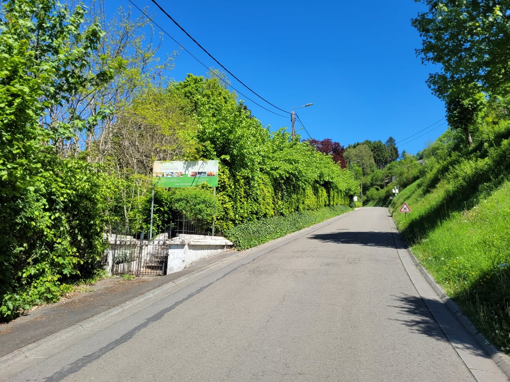
Col du Saty / Les Enclaves via La Voie Jocquée is a climb in the region Semois Valley. It is 1.3 mi long and bridges 505 ft of vertical ascent with an average gradient of 7.3%, resulting in a difficulty score of 138. The top of the ascent is located at 1217 ft above sea level. Climbfinder users shared 7 reviews of this climb and uploaded 9 photos.
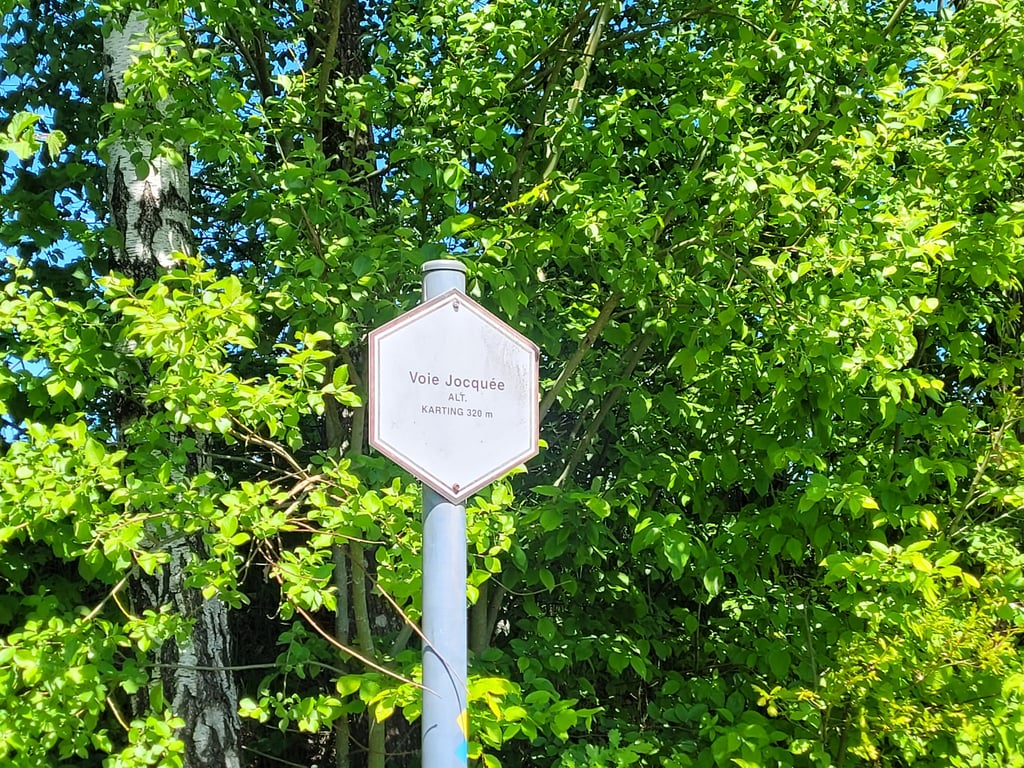
Road names: Voie Jocquée, Buhan & les Enclaves
3.0 by JarinThis is an automatic translation, the original language is: Dutch.Wow, the first stretch is really steep and that while just cycling between houses! The road then continues steeply for quite a while and only after the right-hand bend does the climb weaken somewhat. At the top is an open-air go-kart track, which is very busy in good weather. ... read more

Welcome! Please activate your account if you would like to share something. Look for the verification email in your inbox.
If you want to upload your photos, you need to create an account. It only takes 1 minute and it's completely free.
Wow, the first stretch is really steep and that while just cycling between houses! The road then continues steeply for quite a while and only after the right-hand bend does the climb weaken somewhat. At the top is an open-air go-kart track, which is very busy in good weather.
Wow, het eerste stuk is echt steil en dat terwijl je gewoon tussen huizen doorfietst! De weg trekt daarna nog een heel stuk steil door en pas na de bocht na rechts zwakt de klim enigszins af. Op de top ligt een openluchtkartbaan waar het met goed weer erg bedrijvig is.
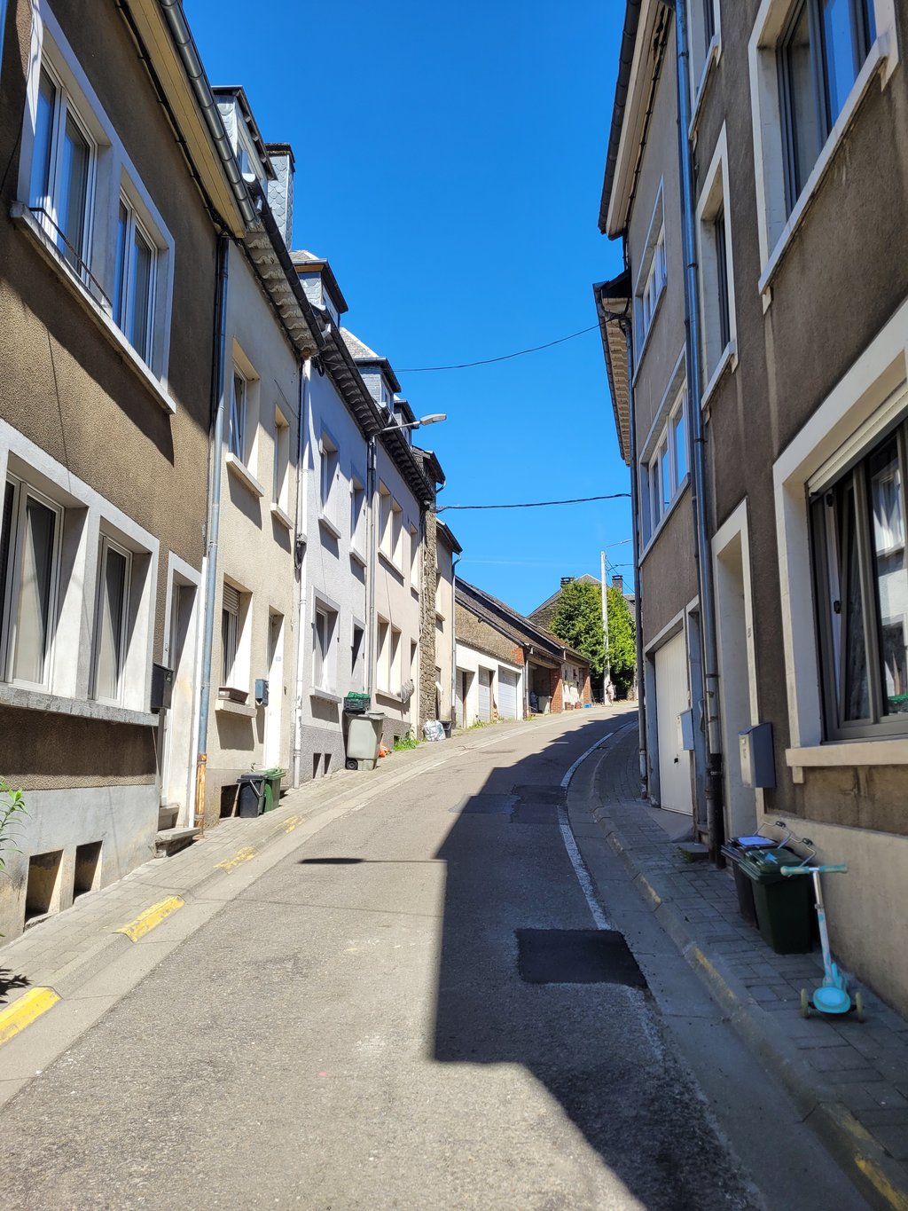
Not for sensitive souls. It is quite steep and quite long. Because you ride a large part through the built-up area of Bouillon, you run the risk of having to hold back or stop as well. Especially in the last stretch, the asphalt is not always good either.
Niet voor de gevoelige zielen. Het is vrij steil en vrij lang. Doordat je een groot stuk door de bebouwde kom van Bouillon rijdt heb je nog het risico dat je moet inhouden of stoppen ook. Vooral in het laatste stuk is de asfalt ook niet altijd goed.
Fairly steep and long continuing climb with little room to enjoy a view. In the built-up area, the road is the steepest. At the bridge over the N89, the steep climbing is over and you climb a little further to the top, where you can descend Les Enclaves, an even steeper road to get to a picturesque spot on the Semois.
Behoorlijk steile en lang doortrekkende klim met weinig ruimte om van een uitzicht te genieten. In de bebouwde kom is de weg het steilst. Bij de brug over de N89 is het stevige klimmen voorbij en klim je nog een beetje door naar de top, waar je Les Enclaves kunt afdalen, een nog steilere weg om bij een pittoreske plek aan de Semois te komen.
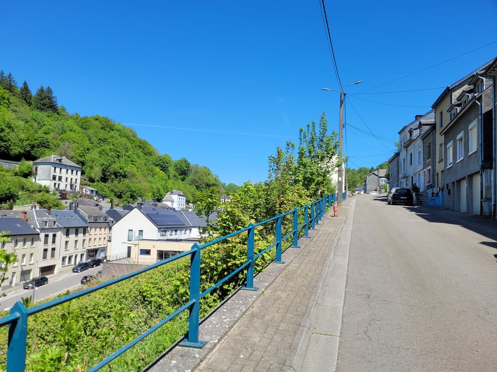
Really a beast of a climb, but so worth it! A narrow and steep road to start with beautiful views of Bouillon if you can see behind you. Then you enter the open landscape at the top of the plateau. If you take the descent from les Enclaves after this be sure to pay attention, at the bottom there is a sharp bend that requires full braking.
Echt een beest van een klim, maar zo de moeite waard! Een smalle en steile weg om te beginnen met prachtige uitzichten over Bouillon als je achter je kan kijken. Daarna kom je in het open landschap boven op het plateau terecht. Als je de afdaling van les Enclaves hierna neemt zeker opletten, beneden is er een scherpe bocht waar je vol voor in de remmen moet gaan.
A really steep and hard climb out of beautiful Bouillon; one of the steepest climbs in the area. On the opposite side of the Col du Saty, the very beautiful descent "Les Enclaves" is worthwhile.
Ein wirklich steiler und harter Anstieg aus dem wunderschönen Bouillon heraus; einer der steilsten Anstiege der Gegend. Auf der Gegenseite des Col du Saty lohnt die sehr schöne Abfahrt "Les Enclaves".
Amai. With a youth hostel and a hotel at the top of this slope, for many it will be the last slope of the day. Well, then I have good news: it is the steepest you will encounter. If it wasn't such a narrow road in the centre of Bouillon, it would be a great finish for a race à la Flèche Wallonne. Good courage. As a reward, a beautiful view over Bouillon awaits you at the top.
Amai. Met een jeugdherberg en een hotel bovenaan deze helling, zal het voor velen de laatste helling van de dag zijn. Wel, dan heb ik goed nieuws: het is het steilste dat je zult tegenkomen. Mocht het niet zo'n smalle weg zijn in het centrum van Bouillon, zou het een prachtige aankomst zijn voor een koers à la Waalse Pijl. Goeie moed. Als beloning wacht u boven een prachtig zicht over Bouillon.
I did this during my bikepacking adventure in Wallonia, with an empty stomach and a bike with bags. That's why I couldn't really enjoy the beautiful view over the valley on the left. Fortunately, the road was quiet and in good condition.
gedaan tijdens mijn bikepack-avontuur in Wallonie, met een lege maag en een fiets met tassen. Daarom heb ik helaas niet echt kunnen genieten van het prachtige uitzicht over de vallei aan de linkerkant. De weg was gelukkig wel rustig en in een goede staat.
| 5 mph | 00:15:52 |
| 7 mph | 00:11:14 |
| 9 mph | 00:08:45 |
| 12 mph | 00:06:34 |
This page is better in the app