View on map
© MapLibre | OpenStreetMap contributors
1%
2%
4%
6%
8%
10%
12%
15%
20%

Col du Noyer from Saint Etienne en Dévoluy

0 reviews | Elevation profile | 0 photos
Tips nearby
Your achievable time
Calculating based on your best performances...
Relaxed
Maximum
W/kg
W/kg
W/kg
Analyze your climbing performance
Detailed insight into your climbing performance & automatically check off climbs
Based on your best performances.
Your best attempt:
Number of attempts:
Elevation profile Col du Noyer from Saint Etienne en Dévoluy

Statistics

Difficulty points 278
Length 4.6 mi
Average gradient 5.4%
Steepest segment 11.6%
Total ascent 1332 ft

Short recap

6 hairpin turns
#95 most elevation gain of Hautes Alpes
#77 longest climb of Hautes Alpes
Feedback about this climb?
Show climbs nearby Export to GPS device

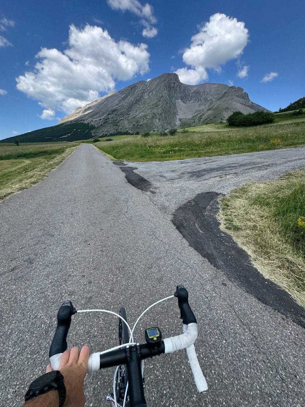
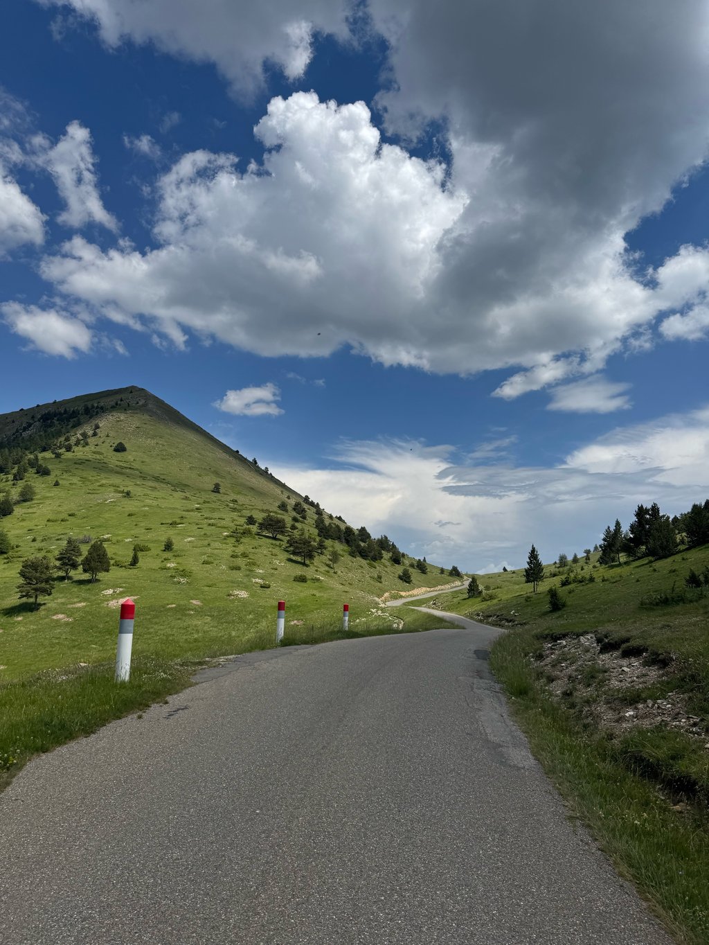
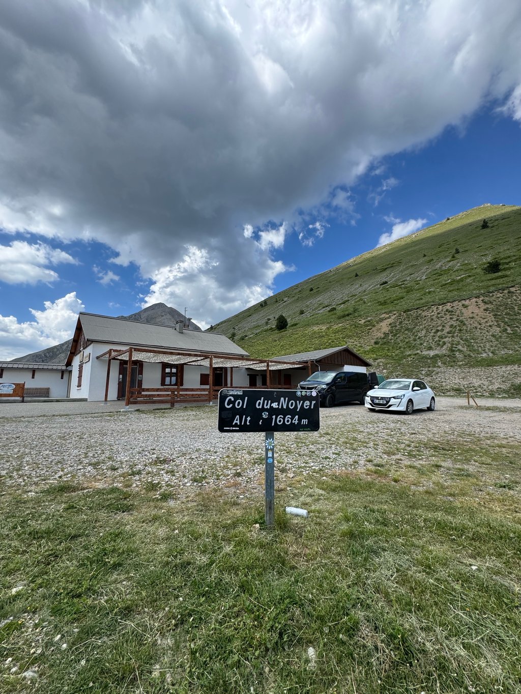
Col du Noyer from Saint Etienne en Dévoluy is a climb in the region Hautes Alpes. It is 4.6 mi long and bridges 1332 ft of vertical ascent with an average gradient of 5.4%, resulting in a difficulty score of 278. The top of the ascent is located at 5456 ft above sea level. Climbfinder users shared 0 reviews of this climb and uploaded 0 photos.

Road names: Route des Stations (D 17), D 417, Route du Col du Noyer (D 417) & Route du Col du Noyer (D 17)

Photos (0)

transparant thumb
transparant thumb
transparant thumb
transparant thumb
transparant thumb
transparant thumb

Your uploads (max 4)

Welcome! Please activate your account if you would like to share something. Look for the verification email in your inbox.

If you want to upload your photos, you need to create an account. It only takes 1 minute and it's completely free.

  • Receive free climbfinder goodies for your reviews & photos.
  • Create a bucket list and check off conquered climbs.
  • Add missing climbs.
Continue with GoogleContinue with Google Continue with FacebookContinue with Facebook Continue with AppleContinue with Apple Sign up with email
By signing up you agree to our terms of service and confirm that you have read our privacy & content policy.

Reviews (0)

5.0
4.0
3.0
2.0
1.0

Climbing times

5 mph 00:56:00
7 mph 00:39:39
9 mph 00:30:54
12 mph 00:23:12

Road surface condition

100% 0% 0%
Based on 1 vote
Share your knowledge. What was the road condition during your ascent?

Traffic

0% 100% 0%
Based on 1 vote
Your experience counts. How much traffic did you encounter during the climb?

Frequently Asked Questions

Col du Noyer can be cycled from 3 sides. Col du Noyer from Le Noyer is the most popular side, but the summit can also be reached via Col du Noyer from Pont de Giers & Col du Noyer from Saint Etienne en Dévoluy.

You don't need special gearing for Col du Noyer from Saint Etienne en Dévoluy. The slope isn't long or steep enough to require much shifting down. You can conquer this climb on power alone. However, a compact gearing system with a smallest front chainring of 34 and largest rear sprocket of 28 or 30 is always nice if you enjoy cycling uphill. This helps maintain a smooth cadence.

Col du Noyer from Saint Etienne en Dévoluy is a 3rd-category climb. Almost anyone can handle this climb, as long as you have a bike with climbing gears. If you have little training, you will probably need to shift down significantly. For experienced riders, Col du Noyer from Saint Etienne en Dévoluy is not a problem.

Col du Noyer from Saint Etienne en Dévoluy is 4.6 mi long.

The average gradient of Col du Noyer from Saint Etienne en Dévoluy is 5.4%.

Col du Noyer from Saint Etienne en Dévoluy has a steepest segment with an average gradient of 11.6%.

The summit of Col du Noyer from Saint Etienne en Dévoluy is at 5456 ft.

At a slow pace of 5 mph, it takes about 00:56:00 to climb Col du Noyer from Saint Etienne en Dévoluy. At 7 mph the time is 00:39:39, and at 9 mph 00:30:54. For the fastest cyclists, 00:23:12 is an achievable time.

Col du Noyer from Saint Etienne en Dévoluy is located in the region Hautes Alpes in France.

This page is better in the app

Climbfinder app
Climbfinder
(Free)
Open