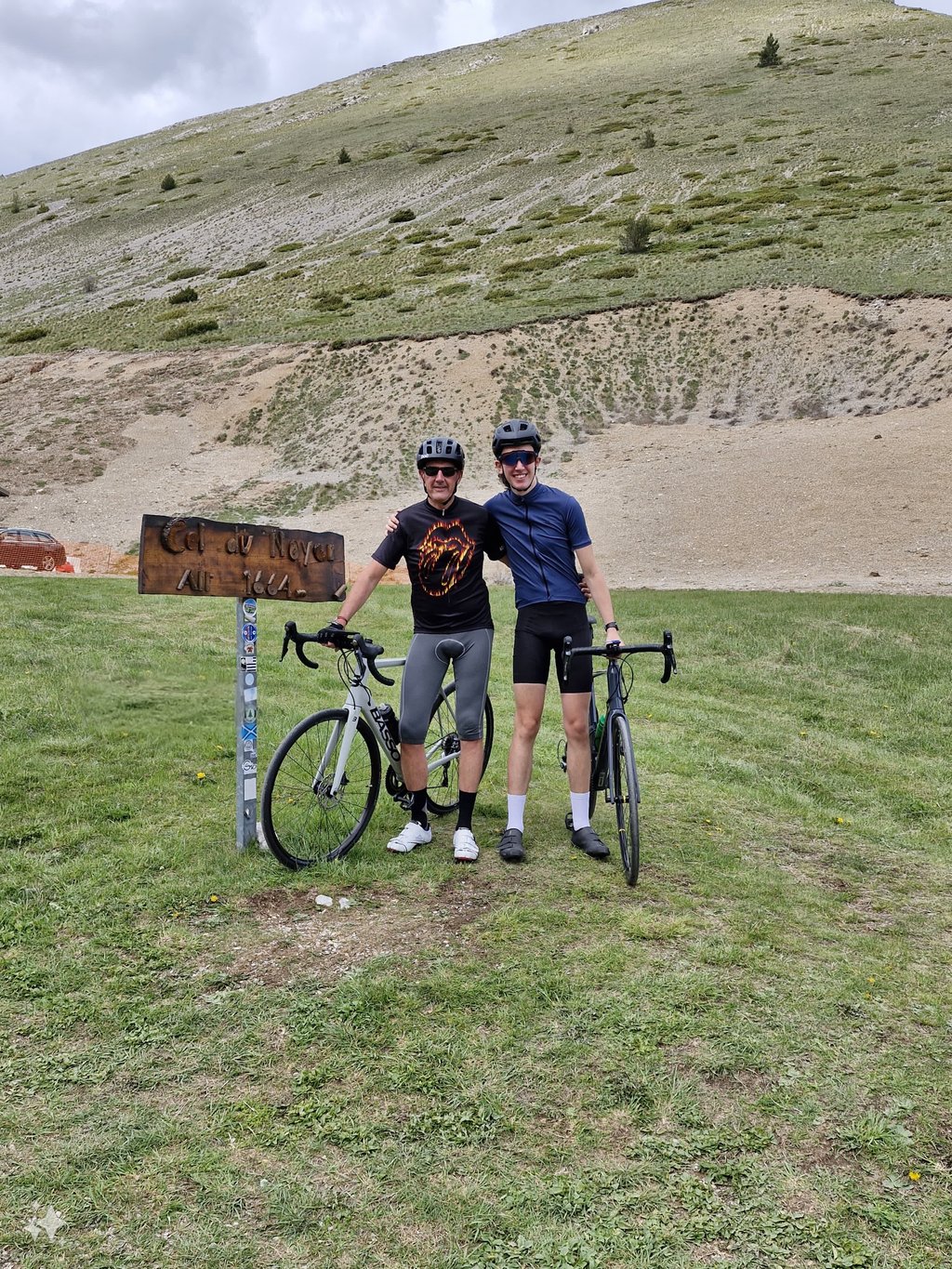
Col du Noyer is a climb in the region Hautes Alpes. It is 3.9 mi long and bridges 1772 ft of vertical ascent with an average gradient of 8.6%, resulting in a difficulty score of 508. The top of the ascent is located at 5459 ft above sea level. Climbfinder users shared 4 reviews of this climb and uploaded 20 photos.
Road name: Les Cassés et costa amare
4.0 by cyclofollisThis is an automatic translation, the original language is: French.Col du Noyer from Le Noyer as part of the Tour du Dévoluy ( 54 kms and 1200 m of vertical drop) . The 13/08/2022 between 9h30 and 10h30 . Second to last km (between 2 and 1 of the pass : 11,4 % average indicated ; very hard and heat ++ sometimes . Age 75 and gear 28x28 . Beautiful and possible !... read more
Welcome! Please activate your account if you would like to share something. Look for the verification email in your inbox.
If you want to upload your photos, you need to create an account. It only takes 1 minute and it's completely free.
A bad memory of getting hungry just outside the hamlet of Le Noyer... but what a beautiful place! The scenery is breathtaking, and the final stretch is as spectacular as it is challenging, especially when it’s hot.
The reward awaits at the end: access to the heart of the beautiful Dévoluy mountain range.
Mauvais souvenir avec une fringale à la sortie du hameau du Noyer...mais qu'est-ce que c'est beau ! Les paysages sont à couper le souffle et le final est aussi spectaculaire que difficile, surtout si il fait chaud.
La récompense est au bout avec l'accès au coeur du joli massif du Dévoluy.
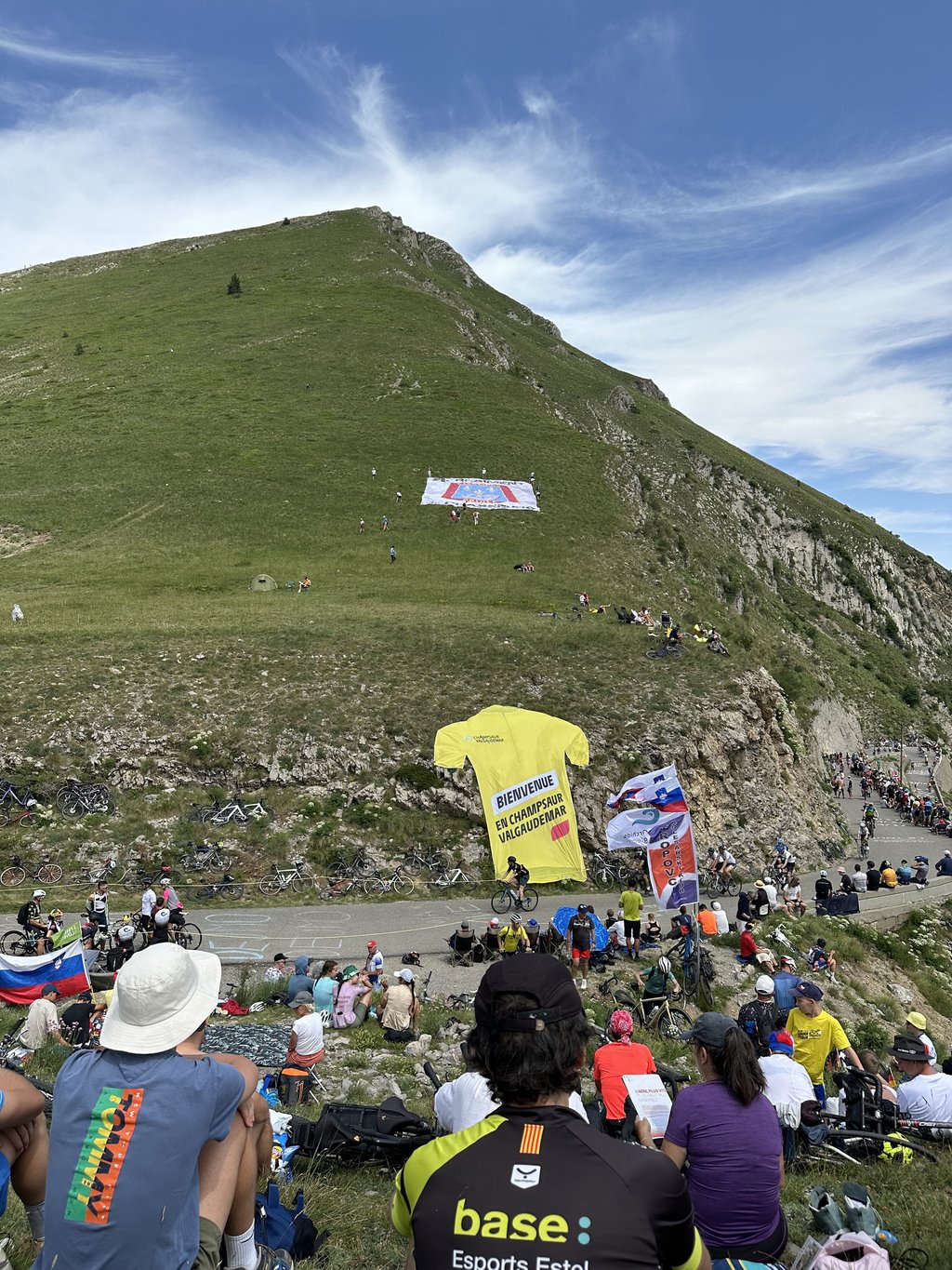
Col du noyer spotted on 19 May 24 to prepare for the tdf stage on 17 July.
What an experience on this pass! Fabulous views and some rather confusing sections. What a great memory. Especially during the Tour!
Col du noyer repéré le 19 mai 24 pour préparer l’étape du tdf le 17 juillet.
Quelle expérience sur ce col ! Une vue fabuleuse et des passages assez déroutants. Quel bon souvenir. Surtout lors du passage du tour !
Col du Noyer from Le Noyer as part of the Tour du Dévoluy ( 54 kms and 1200 m of vertical drop) . The 13/08/2022 between 9h30 and 10h30 . Second to last km (between 2 and 1 of the pass : 11,4 % average indicated ; very hard and heat ++ sometimes . Age 75 and gear 28x28 . Beautiful and possible !
Col du Noyer depuis le Noyer dans le cadre du tour du Dévoluy ( 54 kms et 1200 m de dénivellé) . Le 13/08/2022 entre 9h30 et 10h30 . Avant dernier Km (entre 2 et1 du col : 11,4 % moyen indiqué ; très dur et chaleur ++ parfois . Age 75 et braquet 28x28 . Beau et possible !
Beautiful short climb with nice views and little traffic. The second last kilometre is a tough one with percentages up to 15%. The last kilometre is an opportunity to catch your breath and continue to the top. Be careful, at the top you have to pass the hut on the mountain to finish the climb.
6,5 kilometers of climbing from the village of Le Noyer. The approach can be from different sides. If you come from Poligny, the approach is on average 4% with some up and down, if you come from La Coue, the approach is 5 to 6 percent and the total climb to the top is over 12 kilometers. Be sure to arrive early to avoid the heat in summer.
Prachtige korte klim met mooie vergezichten en weinig autoverkeer. De een na laatste kilometer hakt er stevig in met percentages tot boven de 15%. De laatste kilometer kun je op adem komen en nog even doortrekken tot de top. Let op, boven op de top nog even voorbij de berghut op de berg fietsen om de klim ook echt af te maken.
6,5 kilometer klimwerk vanuit het dorp Le Noyer. De aanloop kan vanaf verschillende kanten. Kom je vanuit Poligny dan is de aanloop gemiddeld 4% met wat op en af, kom je vanaf La Coue dan is de aanloop 5 a 6 procent en is de totale klim tot aan de top ruim 12 kilometer. Zorg dat je vroeg bent om de warmte voor te zijn in de zomer.
| 5 mph | 00:47:10 |
| 7 mph | 00:33:23 |
| 9 mph | 00:26:01 |
| 12 mph | 00:19:33 |
This page is better in the app