Tips nearby


| Beautiful scenery |
| 13 hairpin turns |
| #65 toughest climb of La Maurienne |
| #61 most elevation gain of La Maurienne |
| #58 longest climb of La Maurienne |
| #63 average steepest climb of La Maurienne |
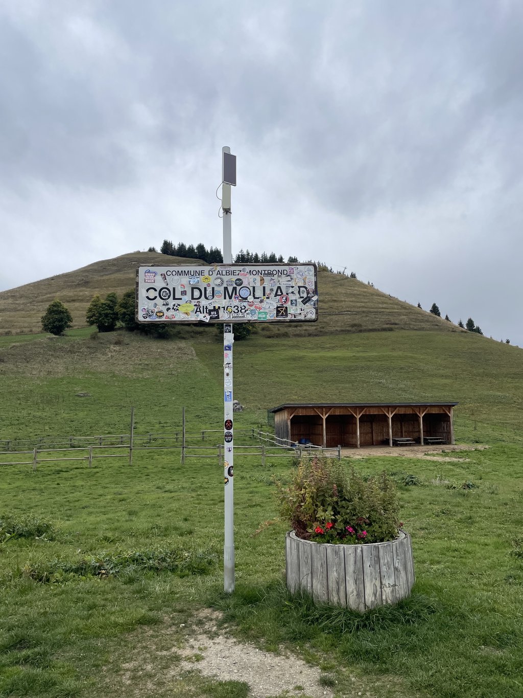
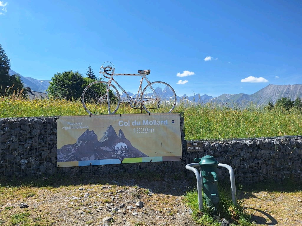
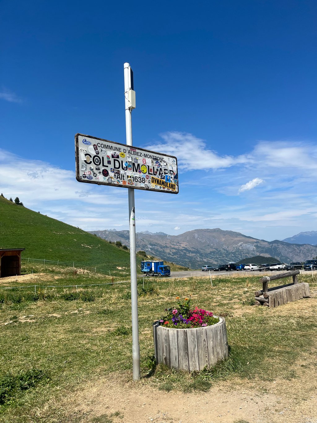
Col du Mollard from Belleville is a climb in the region La Maurienne. It is 3.7 mi long and bridges 1342 ft of vertical ascent with an average gradient of 6.8%, resulting in a difficulty score of 321. The top of the ascent is located at 5354 ft above sea level. Climbfinder users shared 9 reviews of this climb and uploaded 6 photos.
Road name: D90
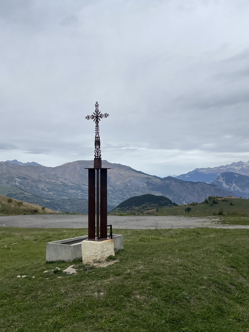
3.0 by ZjaquezThis is an automatic translation, the original language is: Dutch.It really was a nice break from what would otherwise have been an endless descent to St. Jean de Maurienne. And there was a handy water pump at the pass!... read more
Welcome! Please activate your account if you would like to share something. Look for the verification email in your inbox.
If you want to upload your photos, you need to create an account. It only takes 1 minute and it's completely free.
It really was a nice break from what would otherwise have been an endless descent to St. Jean de Maurienne. And there was a handy water pump at the pass!
Inderdaad een fijne onderbreking van een anders eindeloze afdaling naar St Jean de Maurienne. En op de col een fijne waterpomp!
Climbed Col du Mollard as the 2nd summit in a loop including Croix de Fer and start from Saint Jean de Maurienne. The climb is quiet with good asphaltation, and the gradients are fairly moderate so it was quickly done in less than 20 minutes. Even if the climb itself is nothing to speak of, the visual experience from the top is astonishing with 360 degree panorama view of all the surrounding mountain massifs. As an extra detour after doing Croix de Fer, I can recommend it, but it can be skipped if you wish to descend more directly to Saint Jean de Maurienne.
Ride this in October as part of the ‘Golden Marmotte’ route which takes in CDF, Mollard, Telegraphe and Galibier. Easiest climb of the day but still a good test, and the views close to Albiez are stunning - you can see so many tall peaks and the road surface is never in doubt so you can just wind your way to the top. The descent to Villagondran is epic.
The shortest and easiest of the three climbing routes to the Col du Mollard was picked up in the descent from the Croix de Fer via the D926 (direction St.Jean de Maurienne).
After passing the small river dam (Barrage de Belleville) and you turn off the main road right via a bridge over the L'Arvan mountain river, the climb starts. A spicy start in the forest and then winding through some small villages in a more open mountain environment. Cycling on from La Saussaz halfway, you can recuperate for a while and after the summery empty Le Mollard, which can be seen from far away, you reach the highest plateau.
Magnificent 360° view where especially the three peaks of the Aiguilles d'Arves stand out. There is drink and food and a water source.
Throughout the climb, there was hardly any traffic on the not-so-good tarmac.
Nice extra that you can cycle along coming from the Croix de Fer!
Kortste en "gemakkelijkste" van de drie klimroutes naar de Col du Mollard meegepikt in de afdaling van de Croix de Fer via de D926 (richting St.Jean de Maurienne).
Na passeren van de smalle rivier stuwdam (Barrage de Belleville) en je de hoofdweg rechts via een brug over de L'Arvan bergrivier afdraait start de klim. Even pittig beginnen in het bos om daarna in een meer open bergomgeving door enkele kleine dorpjes te kronkelen. Doorfietsen van La Saussaz halfweg is even recupereren en na het van ver te zien zomers lege Le Mollard, bereik je het hoogste plateau.
Prachtig 360° uitzicht waar vooral de drie pieken van de Aiguilles d'Arves in het oog springen. Er is drank en eetgelegenheid en een waterbron.
Gehele klim was er amper verkeer op het niet zo beste asfalt.
Mooi extra dat je kan meefietsen komende van de Croix de Fer!
Climb that starts in the forest and winds to more open landscape. Ends in the hamlet of Le Mollard, visible from halfway up. Nice winding road, asphalt sometimes a bit less. Harder than the profile shows, but nothing to compare with the big ones in the neighbourhood of course.
Klimmetje dat start in het bos en kronkelt naar meer open landschap. Eindigt in het gehucht Le Mollard dat vanaf halverwege zichtbaar. Leuke kronkelende weg, asfalt soms net iets minder. Lastiger dan het profiel toont, maar niks te vergelijken uiteraard met de kleppers buiten categorie in de buurt
Climbing which is not bad but which is quickly passed, to wake up the legs it makes the taff!
Montée qui grimpe pas mal mais qui est rapidement passée, pour réveiller les jambes ça fait le taff !
Done: 18 - 09 -2020
I did Saint Jean de Maurienne via the Belleville dam to Col du Mollard (HC route)
Fait: 18 - 09 -2020
Moi j'ai fait Saint Jean de Maurienne par le barrage de Belleville à Col du Mollard (tracé HC)
Climb is 6km. Other side is longer, from the valley. The Col du Mollard is good to combine after you come from the Croix de Fer and fine to ride as a boucle with the Col du Glandon. Never busy on the Mollard and the descent to St. Jean de Maurienne is beautiful and easy to drive.
Klim is wel 6km. Andere kant is langer, vanuit het dal. De Col du Mollard is goed te combineren nadat je van de Croix de Fer komt en prima te rijden als een boucle met ook de Col du Glandon. Nooit druk op de Mollard en de afdaling naar St.Jean de Maurienne loppt mooi en is vlot te rijden.
Very nice col but according to me it is 14 km
Zeer mooie col maar volgens mij is hij 14 km
| 5 mph | 00:44:55 |
| 7 mph | 00:31:48 |
| 9 mph | 00:24:47 |
| 12 mph | 00:18:37 |
This page is better in the app