View on map
© MapLibre | OpenStreetMap contributors
1%
2%
4%
6%
8%
10%
12%
15%
20%

Col Haut de Ribeauvillé from Ribeauvillé

3.3
7 reviews | Elevation profile | 7 photos
Tips nearby
Col Haut de Ribeauvillé from Ribeauvillé
transparant thumb
Your achievable time
Calculating based on your best performances...
Relaxed
Maximum
W/kg
W/kg
W/kg
Analyze your climbing performance
Detailed insight into your climbing performance & automatically check off climbs
Based on your best performances.
Your best attempt:
Number of attempts:
Elevation profile Col Haut de Ribeauvillé from Ribeauvillé

Statistics

Difficulty points 301
Length 6.7 mi
Average gradient 4.7%
Steepest segment 10.3%
Total ascent 1657 ft

Short recap

Beautiful scenery
10 hairpin turns
#65 toughest climb of Upper Rhine
#68 most elevation gain of Grand Est
#66 longest climb of Grand Est
Feedback about this climb?
Show climbs nearby Export to GPS device

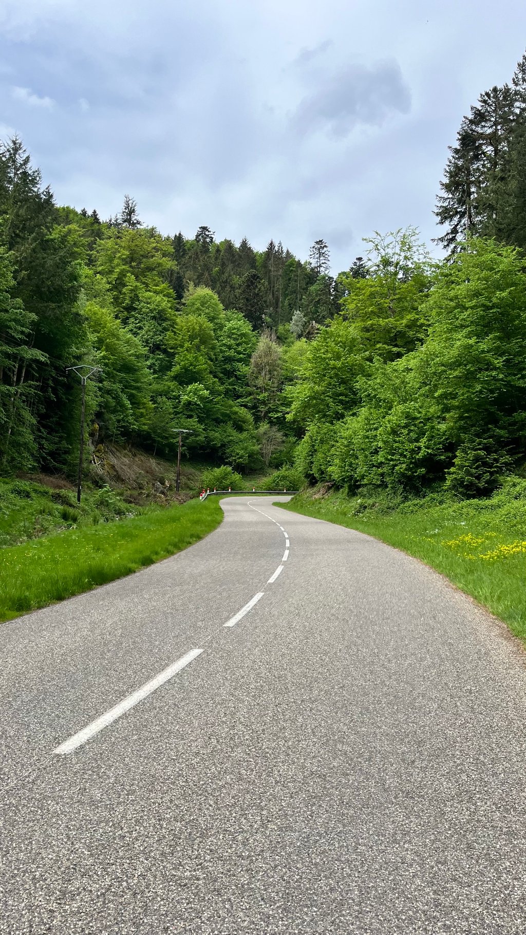
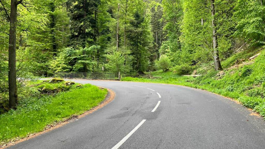
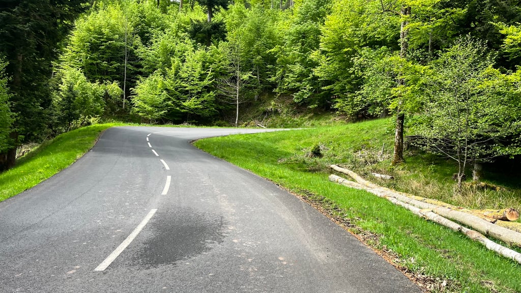
Col Haut de Ribeauvillé from Ribeauvillé is a climb in the region Upper Rhine. It is 6.7 mi long and bridges 1657 ft of vertical ascent with an average gradient of 4.7%, resulting in a difficulty score of 301. The top of the ascent is located at 2441 ft above sea level. Climbfinder users shared 7 reviews of this climb and uploaded 7 photos.
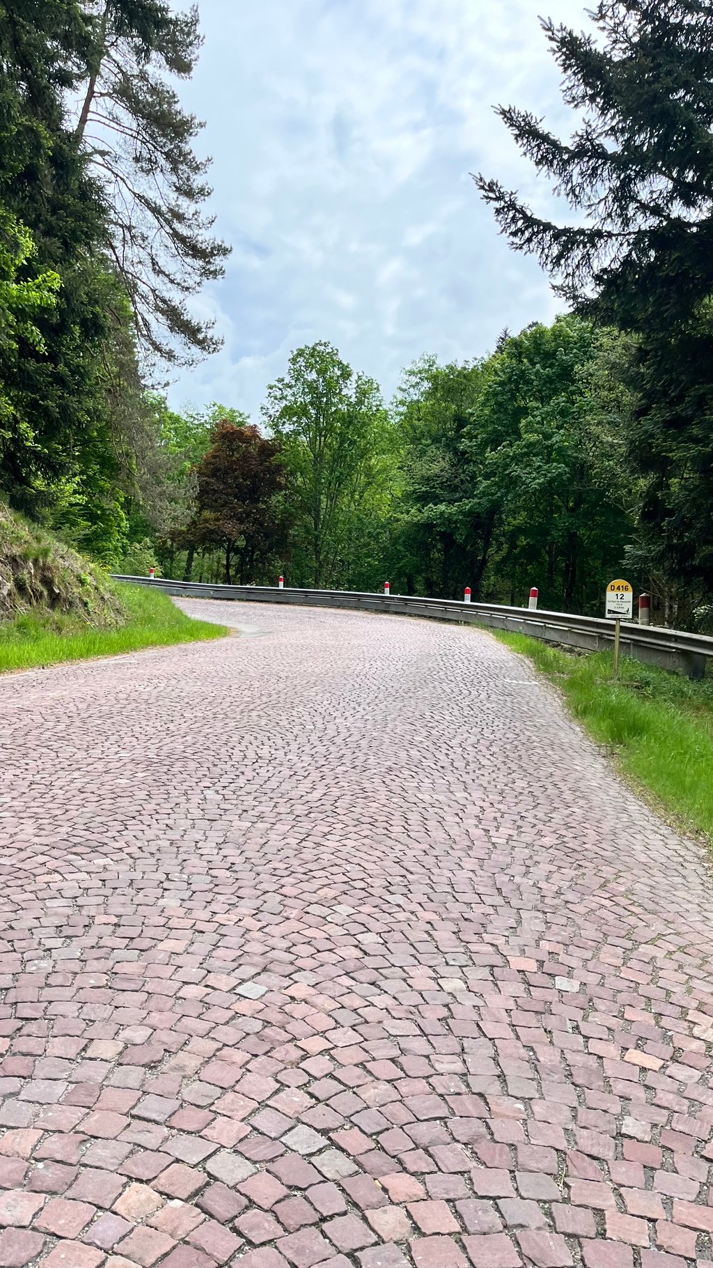
Road name: D416

3.0 by NicodeBree
This is an automatic translation, the original language is: Dutch.
A wonderful climb. Nice and even and a good road surface, with of course some typical paved bends. Nice to ride up like this.... read more

Photos (7)

Col Haut de Ribeauvillé from Ribeauvillé
transparant thumb
transparant thumb
transparant thumb
transparant thumb
transparant thumb

Your uploads (max 4)

Welcome! Please activate your account if you would like to share something. Look for the verification email in your inbox.

If you want to upload your photos, you need to create an account. It only takes 1 minute and it's completely free.

  • Receive free climbfinder goodies for your reviews & photos.
  • Create a bucket list and check off conquered climbs.
  • Add missing climbs.
Continue with GoogleContinue with Google Continue with FacebookContinue with Facebook Continue with AppleContinue with Apple Sign up with email
By signing up you agree to our terms of service and confirm that you have read our privacy & content policy.

Reviews (7)

5.0
4.0
3.0
2.0
1.0
ted_gluxe
1 y 4.0 via the Climbfinder app

Lovely climb, very pleasant gradients, but as the others have mentioned - careful with the cobblestone bends on the downhill

Col Haut de Ribeauvillé from Ribeauvillé
Dashboard
HansChristianB
1 y 3.0

A fine climb. Lot of time in the forrest which is nice but limits the beautiful views in the direction of Ribeauvillé. Continue on nice road without much traffic to Aubure where you get some nice scenery

Dashboard
hardloper_marco
1 y 3.0
This is an automatic translation, the original language is: Dutch. Show original

Fine route. Take care when descending if coming from the other side. Two sections with cobbles.

Prima route. Let op bij het afdalen als je van de andere kant komt. Twee stukken met keitjes.

Dashboard
Herve2023
2 y 3.0
This is an automatic translation, the original language is: French. Show original

The road is quiet and in good condition. The gradient is gentle and gradual, with percentages around 7% in the last 4 km.
At the entrance to the valley, you can admire the castles of St Ulrich and Haut-Ribeaupierre. The rest of the route takes place in the forest.
The descent is winding for the first few kilometres. Watch out for the two cobbled sections in the bends.

La route est calme et en bon état. La pente est douce et progressive, avec des pourcentage autour de 7% dans les 4 derniers km.
A l'entrée de la vallée, vous pouvez admirer les châteaux de St Ulrich et du Haut-Ribeaupierre. La suite du parcours se déroule en forêt.
La descente est sinueuse dans les premiers km. Attention aux deux secteurs pavés dans des virages.

Dashboard
Kokostrof
2 y 3.0
This is an automatic translation, the original language is: Dutch. Show original

Few, if any, views, but a nice climb.
Some sections had just been resurfaced with pitch and pebbles. This did cause sticky pebbles on the tyres and some black stripes on my white bike.

Weinig of geen vergezichten, maar wel een leuke klim.
Sommige stukken waren net terug aangelegd met pek en steentjes. Dit zorgde wel voor klevende steentjes aan de banden en enkele zwarte strepen op mijn witte fiets.

Dashboard
Xamras
3 y 4.0
This is an automatic translation, the original language is: French. Show original

Easy on the first half, doable on the second half. Little traffic, nice road, no view but very quiet. 2-3 twists and turns on city cobblestones quite nice to do.

Facile sur sa première moitié, faisable sur sa deuxième moitié. Peu de trafic, belle route, pas de vue mais très calme. 2-3 lacets en pavés de ville assez sympas à faire.

Dashboard
NicodeBree
4 y 3.0
This is an automatic translation, the original language is: Dutch. Show original

A wonderful climb. Nice and even and a good road surface, with of course some typical paved bends. Nice to ride up like this.

Een heerlijk beklimming. Lekker gelijkmatig en een prima wegdek, met natuurlijk enkele typische geplaveide bochten. Lekker om zo omhoog te rijden.

Col Haut de Ribeauvillé from Ribeauvillé
Dashboard

Climbing times

5 mph 01:20:41
7 mph 00:57:07
9 mph 00:44:30
12 mph 00:33:26

Road surface condition

100% 0% 0%
Based on 4 votes
Share your knowledge. What was the road condition during your ascent?

Traffic

100% 0% 0%
Based on 4 votes
Your experience counts. How much traffic did you encounter during the climb?

Frequently Asked Questions

Col Haut de Ribeauvillé can be cycled from 3 sides. Col Haut de Ribeauvillé via Ferme Stocky is the most popular side, but the summit can also be reached via Col Haut de Ribeauvillé from Sainte Marie aux Mines & Col Haut de Ribeauvillé from Ribeauvillé.

You don't need special gearing for Col Haut de Ribeauvillé from Ribeauvillé. The slope isn't long or steep enough to require much shifting down. You can conquer this climb on power alone. However, a compact gearing system with a smallest front chainring of 34 and largest rear sprocket of 28 or 30 is always nice if you enjoy cycling uphill. This helps maintain a smooth cadence.

Col Haut de Ribeauvillé from Ribeauvillé is a serious climb and falls into the 2nd category. With a good basic fitness level, even without much cycling experience, you can complete this climb just fine. However, a bike with climbing gears is a must. Without experience or training, it will be really tough – but that’s part of the challenge!

Col Haut de Ribeauvillé from Ribeauvillé is 6.7 mi long.

The average gradient of Col Haut de Ribeauvillé from Ribeauvillé is 4.7%.

Col Haut de Ribeauvillé from Ribeauvillé has a steepest segment with an average gradient of 10.3%.

The summit of Col Haut de Ribeauvillé from Ribeauvillé is at 2441 ft.

At a slow pace of 5 mph, it takes about 01:20:41 to climb Col Haut de Ribeauvillé from Ribeauvillé. At 7 mph the time is 00:57:07, and at 9 mph 00:44:30. For the fastest cyclists, 00:33:26 is an achievable time.

Col Haut de Ribeauvillé from Ribeauvillé is located in the region Upper Rhine in France.

This page is better in the app

Climbfinder app
Climbfinder
(Free)
Open