Tips nearby


| 6 hairpin turns |
| #44 toughest climb of La Maurienne |
| #37 most elevation gain of La Maurienne |
| #33 longest climb of La Maurienne |
| #69 average steepest climb of La Maurienne |
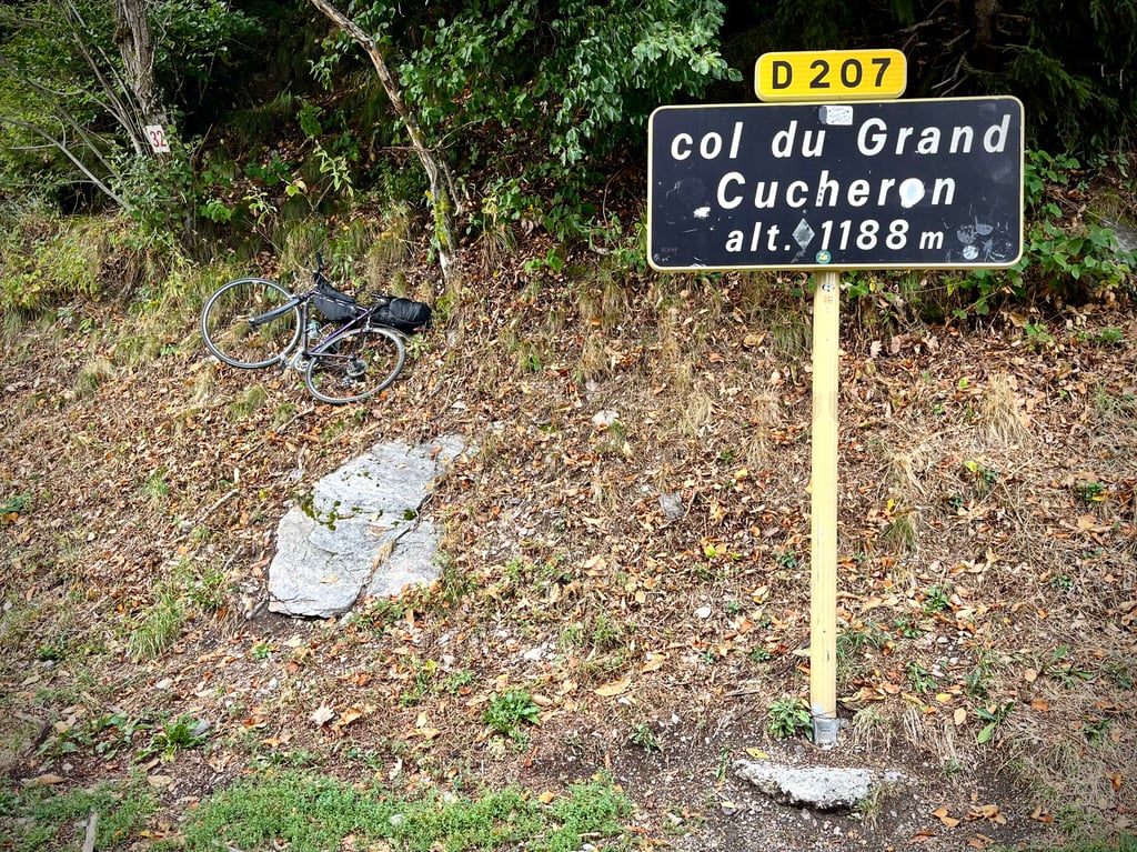
Col du Grand Cucheron from La Corbière is a climb in the region La Maurienne. It is 7.5 mi long and bridges 2648 ft of vertical ascent with an average gradient of 6.7%, resulting in a difficulty score of 618. The top of the ascent is located at 3930 ft above sea level. Climbfinder users shared 7 reviews of this climb and uploaded 12 photos.
Road names: D207 & Route du col
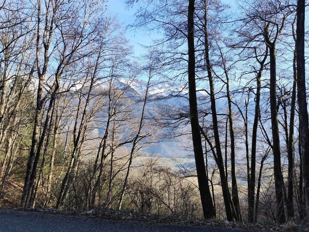
4.0 by TomJonesThis is an automatic translation, the original language is: French.How quiet it was, in bright sunshine on 1 January 2026. Not a single car in sight, a clear view of the snow-capped peaks thanks to the absence of leaves on the trees. The climb was a little difficult on the day after the festivities, with temperatures of 0 degrees at the bottom....... read more
Welcome! Please activate your account if you would like to share something. Look for the verification email in your inbox.
If you want to upload your photos, you need to create an account. It only takes 1 minute and it's completely free.
How quiet it was, in bright sunshine on 1 January 2026. Not a single car in sight, a clear view of the snow-capped peaks thanks to the absence of leaves on the trees. The climb was a little difficult on the day after the festivities, with temperatures of 0 degrees at the bottom....
Quel calme, fait sous un grand soleil le 1er janvier 2026. Pas une voiture, une vue dégagée sur les sommets enneigés grâce aux feuilles absentes des arbres. Montée un peu difficile en ce lendemain de fête par 0 degrés en bas....
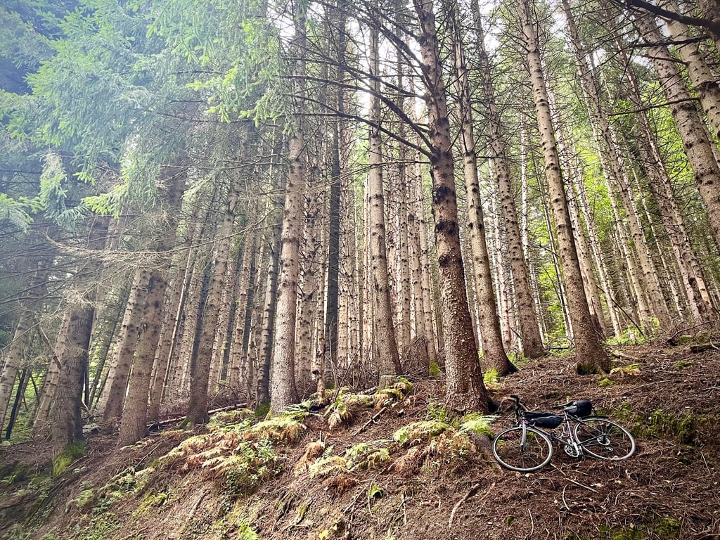
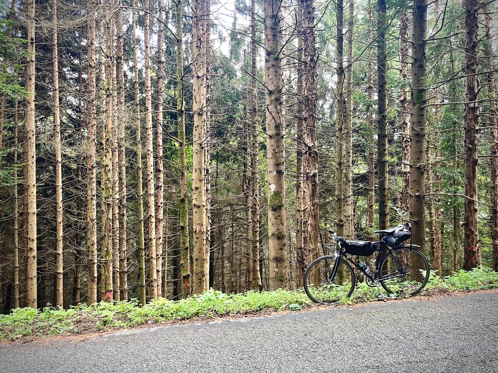
Recommended for those with a passion for the forest and a need for absolute peace and quiet!
The first part is gentle. The second, considerably heavier. The kilometre at 9% offers some tougher sections.
The road surface is a patchwork of everything the "Ponts et Chaussées" have known how to do. This road has been patched up many times and by people who obviously didn't agree on the methods and materials! Asphalt and tarmac patches dot the route. It doesn't hinder the climb in any way. It's more noticeable on the way down.
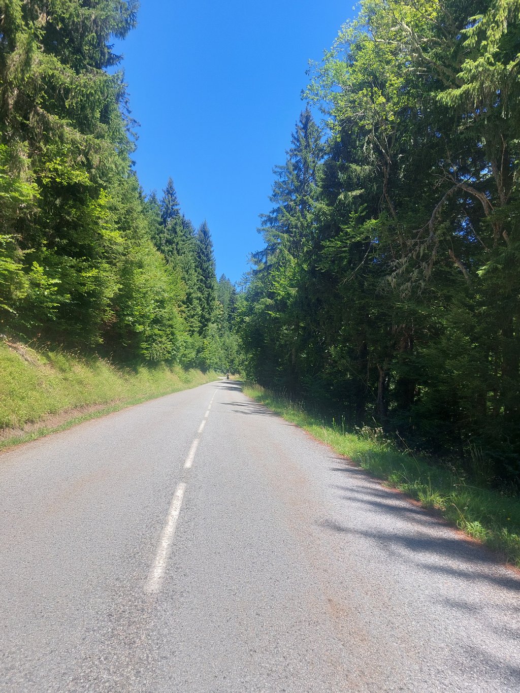
Nobody on this road! In fact, it's quite understandable as there are more exciting passes nearby.
This climb is pleasant but not really exhilarating.
Three stars for the peace and quiet and the beautiful trees.
À recommander à ceux qui aiment passionnément la forêt et ont besoin de calme absolu !
La première partie est douce. La seconde, nettement plus lourde. Le kilomètre à 9% propose des passages corsés.
Le revêtement de la route est un patchwork de tout ce que les « Ponts et Chaussées » savent faire.
Cette route a été raccommodée de nombreuses fois et par des gens qui visiblement n’étaient d’accord, ni sur les méthodes, ni sur les matériaux ! Des pansements de bitume et de macadam jalonnent le parcours. Ça ne gêne en rien la montée. Ça se ressent davantage lors de la descente.
Personne sur cette route !
En réalité, ça se comprend assez bien tant il y a de cols plus excitants pas loin.
Cette ascension est agréable mais elle n’est pas vraiment ébouriffante.
Trois étoiles pour le calme et les beaux arbres.
Climb that really starts when you enter the forest. Well sheltered by the trees, but a moderate to poor road surface. Nowhere really steep.
Klim die pas echt begint als je het bos binnenrijdt. Goed beschut door de bomen, maar een matig tot slecht wegdek. Nergens echt steil.
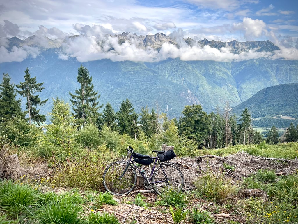
Nice mountain, starts quietly but second half is hard work. No views from the summit.
Leuke berg, begint rustig maar tweede helft is het flink doorwerken. Geen uitzicht vanaf de top.
Done this morning, nice pass, although done at 11:30 am in the middle of the doldrums. the footing by the Corbière is deceptive, it starts quietly, before the exit of the hamlet Le Champs where then it doesn't stop between 7 and 11% until the summit, the surface is not too bad, on the descent it hits a bit at times. On the other hand, there are very few people on the ascent.
Fait ce matin, col sympa, quoique fait à 11h30 en plein cagnard. le pied par la Corbière est trompeur ça part tranquille, avant la sortie du hameau Le Champs où ensuite ça n'arrête plus entre 7 et 11% jusqu'au sommet, le revêtement est pas trop mal, en descente ça tape un peu par moment. Par contre très peu de monde dans l'ascension.
I did it from this side and the start is easier than from Aiguebelle, it's a pity that the latter is not listed on Climbfinder because it has the most difference in altitude.
See the attached map in photo.
Je l'ai fait de ce coté et le départ est plus facile que par Aiguebelle, c'est dommage que cette dernière ne soit pas répertoriée sur Climbfinder car c'est celle qui possède le plus de dénivelé.
Voir la carte jointe en photo.
Climbed on 19/09/2018 in the evening from RP Route de l'etang (Resto Le Saint Pierre). It was still quite difficult to get back down before dark. Nice steady climb, through the forest and some alpine meadows. Beautiful views. Good road surface.
Montée le 19/09/2018 en soirée depuis RP Route de l'etang (Resto Le Saint Pierre). Il était encore assez difficile de redescendre avant la nuit. Belle montée régulière, à travers la forêt et quelques alpages. De magnifiques panoramas. Bonne surface de la route.
| 5 mph | 01:30:17 |
| 7 mph | 01:03:55 |
| 9 mph | 00:49:48 |
| 12 mph | 00:37:25 |
This page is better in the app