Tips nearby


| 16 hairpin turns |
| #91 toughest climb of Savoie |
| #78 most elevation gain of Savoie |
| #74 longest climb of Savoie |
| #68 average steepest climb of La Maurienne |
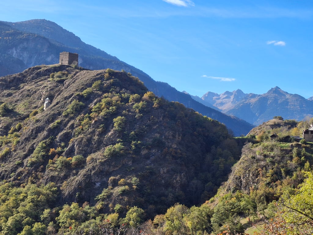
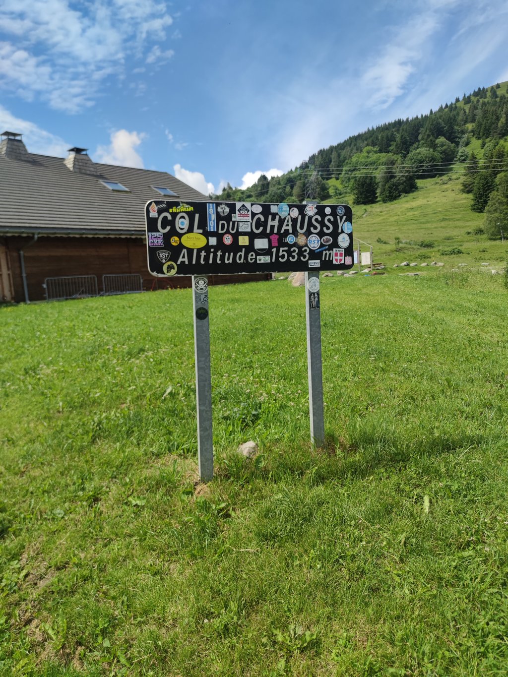
Col du Chaussy from Hermillon is a climb in the region La Maurienne. It is 9.8 mi long and bridges 3461 ft of vertical ascent with an average gradient of 6.7%, resulting in a difficulty score of 797. The top of the ascent is located at 5030 ft above sea level. Climbfinder users shared 3 reviews of this climb and uploaded 5 photos.
Road name: D77
4.0 by MarcoBardo89This is an automatic translation, the original language is: Italian.Done during a longer tour to go up to Col De la Madeleine. Pretty little hill, the village above is nice. Very very nice to be able to fit it into the Lacets de Montvernier climb.... read more
Welcome! Please activate your account if you would like to share something. Look for the verification email in your inbox.
If you want to upload your photos, you need to create an account. It only takes 1 minute and it's completely free.
Done during a longer tour to go up to Col De la Madeleine. Pretty little hill, the village above is nice. Very very nice to be able to fit it into the Lacets de Montvernier climb.
Fatto durante un giro più lungo per andare fino al Col De la Madeleine. Colletto carino, il paese sopra è bello. Molto molto bello riuscire ad inserirlo nella salita dei Lacets de Montvernier.
Slightly less picturesque than climbing along the Lacets de Montvernier, but also a beautiful side to climb the Col du Chaussy, from St-Jean-de-Morienne. For a shorter ride, if you don't want to continue climbing to the col, you can also descend along the lacets.
Iets minder pittoresk dan de beklimming langs de Lacets de Montvernier, maar ook een prachtige kant om de Col du Chaussy te beklimmen, vanuit St-Jean-de-Morienne. Wil je voor een kortere rit niet doorklimmen tot de col, dan kan je ook afdalen langs de lacets.
Done on August 19, 2009
The climb starts at the Hermillon roundabout, straight through the village with fresh water fountains.
An impeccable road with wide curves.... and no shade, but not at all. The slope is rough but regular until the village of Montvernier
Turn right towards Montpascal and it goes up again and again, still in wide twists and turns, the road is not so good, a few short passages (not many) in the shade of the trees are really good.
The road becomes narrower and narrower until a magnificent passage in cornice, by place the% are impressive but do not last.
Entering and crossing the village of Montpascal, there are then about 2kms left on a still severe slope to reach the summit.
Conclusion: the ascent to the Col de Chaussy via Hermillon of 15kms is an interesting alternative to the no less picturesque one via the famous Montvernier laces. I think of a similar difference in altitude Sommet du Col Alt1533 Hermillon Alt 486M=1047M a little more because a slight descent between Le Chatel and Montvernier generates a loss of altitude of about 60M.
From St Jean de Maurienne, just take the direction of Chambéry, 3kms after crossing the bridge over the motorway to enter the village of Hermillon.
Then it is all indicated.
Good road, be careful.
Fait le 19 aout 2009
La montée commence dès le rond-point de Hermillon ,traversée en ligne droite du village avec fontaines d'eau fraiche.
Une route impeccable et en larges lacets…. et pas d’ombre, mais alors pas du tout. La pente est rude mais régulière jusqu’au village de Montvernier
Prendre à droite direction Montpascal et ça monte encore et encore, toujours en larges lacets, la route rend moins bien, quelques brefs passages ( peu nombreux ) à l’ombre des arbres font un bien fou.
La route devient de plus en plus étroite jusqu’à un magnifique passage en corniche, par endroit les% sont impressionnants mais ne durent pas.
Entrée et traversée du village de Montpascal, il reste alors environ 2kms dans une pente toujours sévère pour atteindre le sommet.
Conclusion : la montée au col de Chaussy via Hermillon d’une longueur de 15kms est une variante intéressante face à celle non moins pittoresque par les célèbres lacets de Montvernier. Je pense d’une dénivellation similaire Sommet du Col Alt1533 Hermillon Alt 486M=1047M un peu plus car une légère descente entre Le Chatel et Montvernier génère une perte d'altitude d'environ 60M.
En partant de St Jean de Maurienne, il suffit de prendre la direction Chambéry, 3kms après traverser le pont qui enjambe la voie rapide et l’autoroute pour entrer dans le village de Hermillon.
Ensuite c’est tout indiqué.
Bonne route, Soyez prudents.
| 5 mph | 01:58:09 |
| 7 mph | 01:23:38 |
| 9 mph | 01:05:11 |
| 12 mph | 00:48:58 |
This page is better in the app