| 11 hairpin turns |
| #25 toughest climb of Haute Savoie |
| #15 most elevation gain of Haute Savoie |
| #28 longest climb of Haute Savoie |
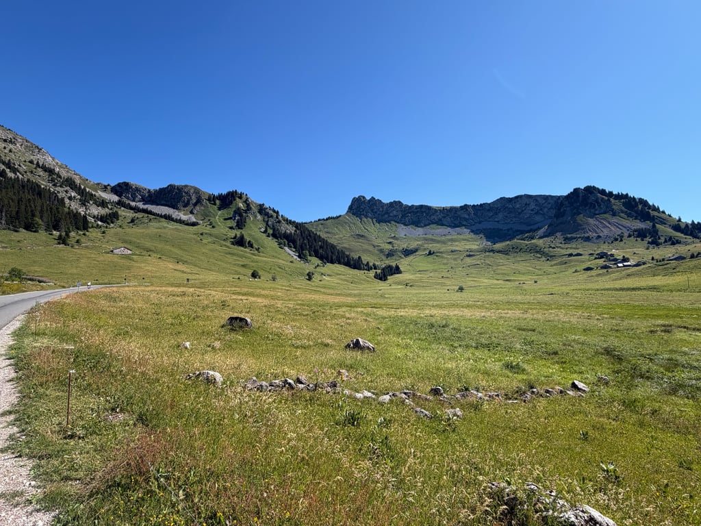
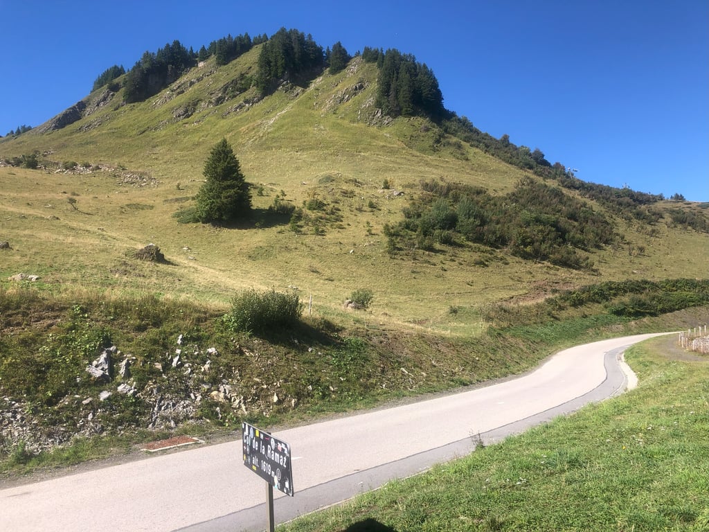
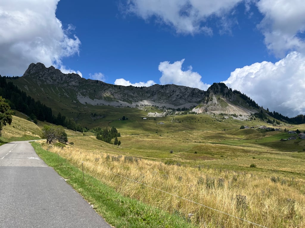
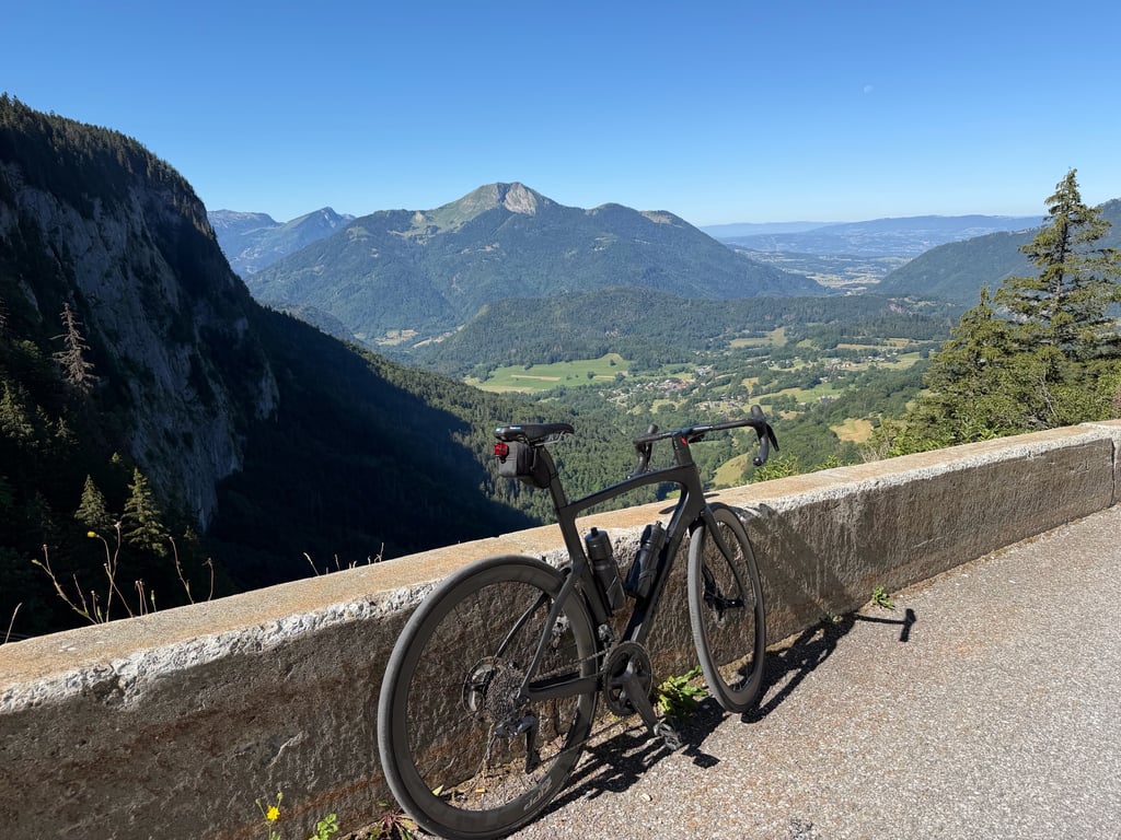
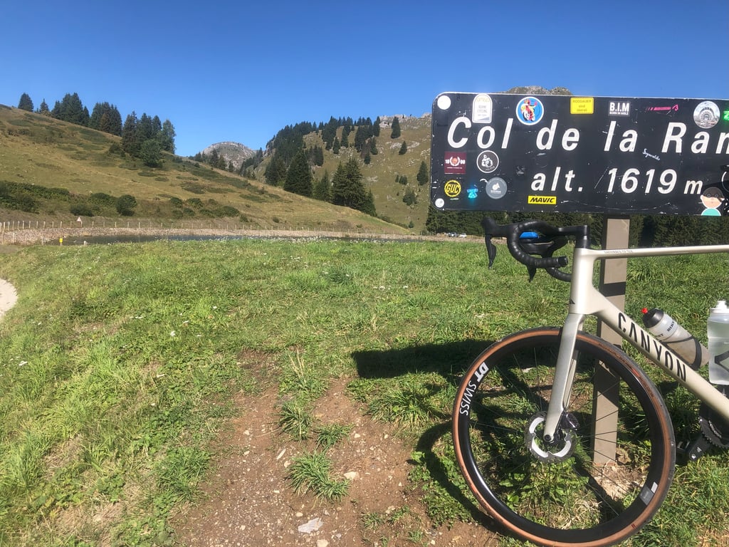
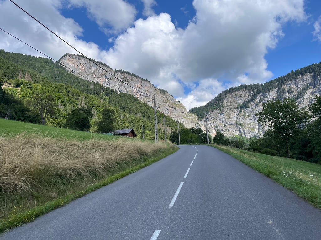
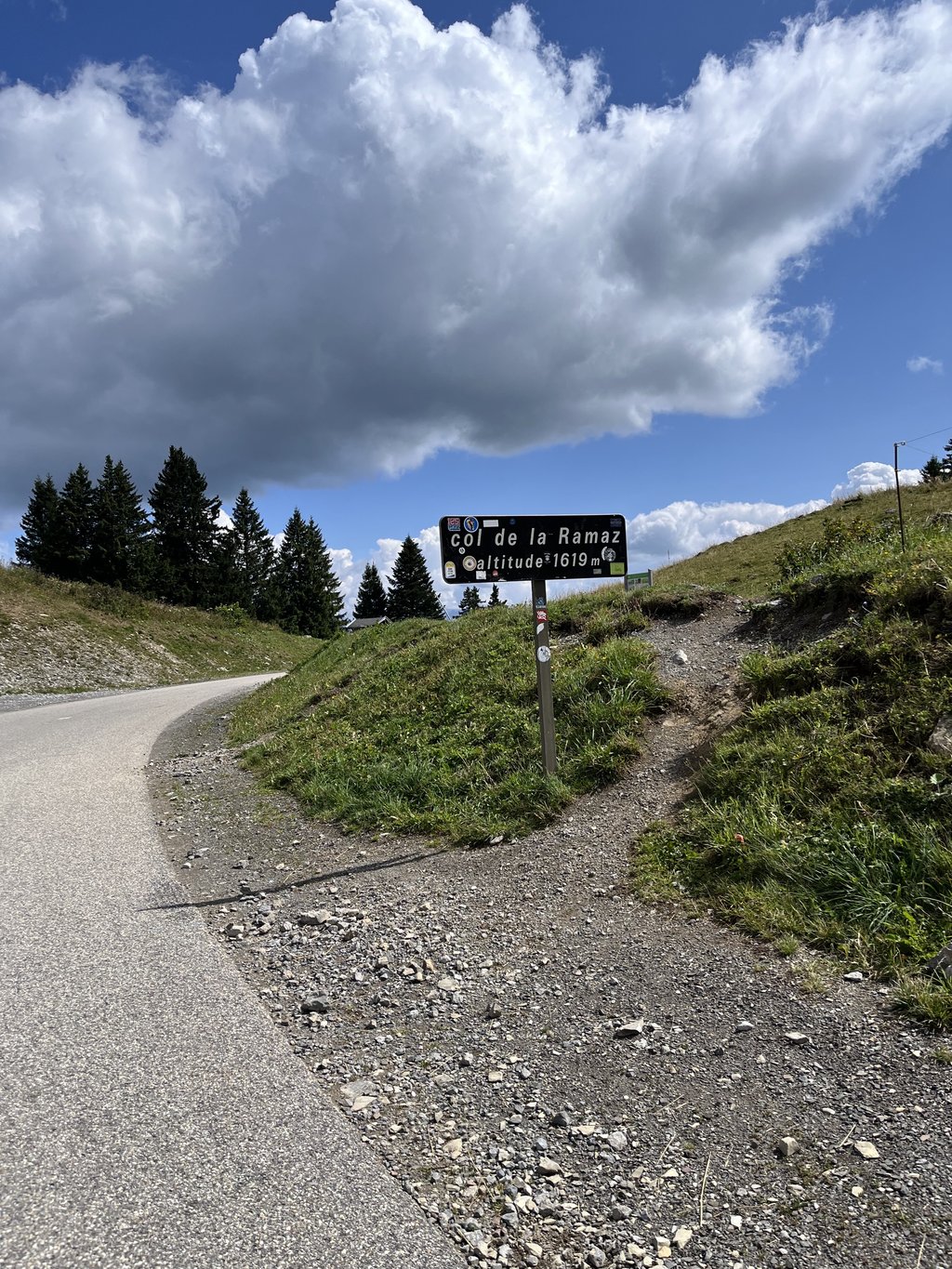
Col de la Ramaz is a climb in the region Haute Savoie. It is 8.3 mi long and bridges 3094 ft of vertical ascent with an average gradient of 7%, resulting in a difficulty score of 770. The top of the ascent is located at 5115 ft above sea level. Climbfinder users shared 13 reviews of this climb and uploaded 19 photos.
Road name: D308
4.0 by PONPONThis is an automatic translation, the original language is: French.I did this climb twice, once during the operation "route fermée" with a snack at the top. Super nice, especially since the weather was good.... read more
Welcome! Please activate your account if you would like to share something. Look for the verification email in your inbox.
If you want to upload your photos, you need to create an account. It only takes 1 minute and it's completely free.
Beautiful surroundings, though it was quite a struggle in the heat. The tunnel offers a way out, but it’s actually very steep. Definitely worth doing!
Prachtige omgeving, wel flink afgezien in de hitte. Tunnel biedt uitkomst maar is juist erg steil. Sowieso doen!
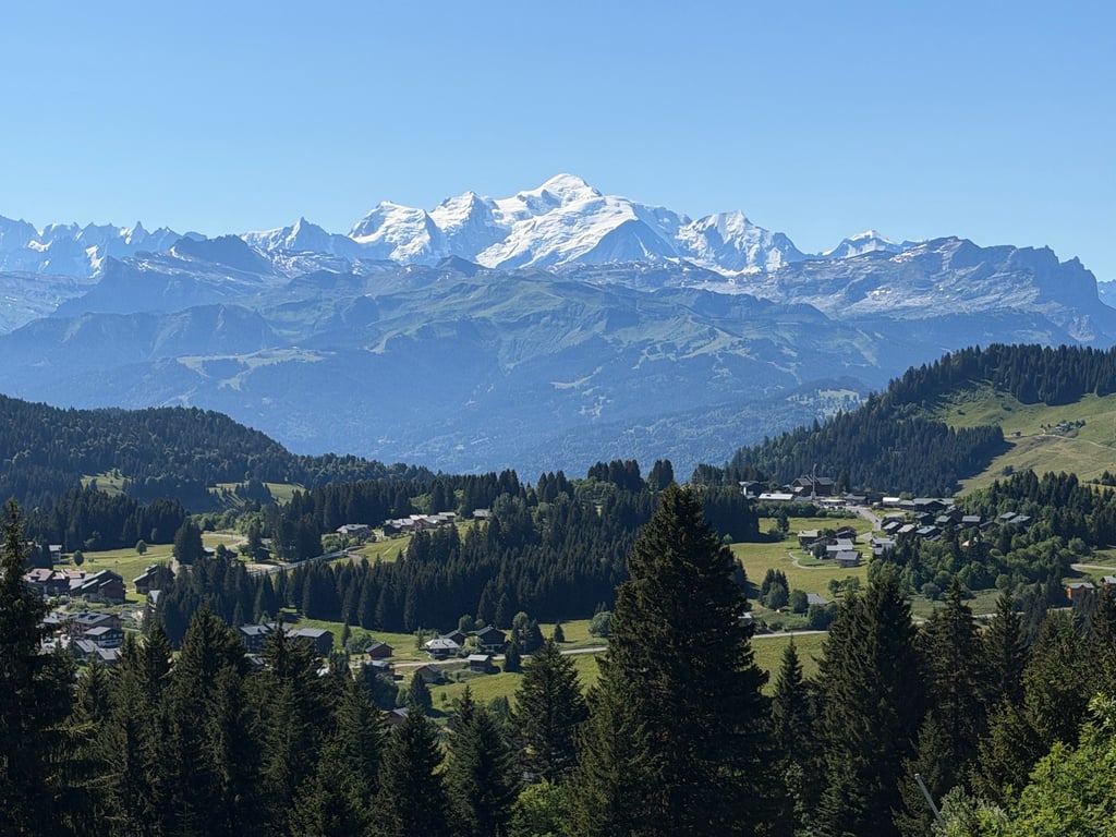
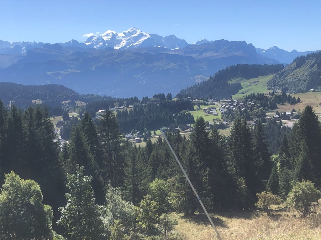
Tougher than the profile suggests. Open terrain, so there are beautiful views. You can often see Mont Blanc as you climb👌🏼 The toughest section goes partly through a tunnel—yikes! Other than that, it’s really nice and there isn’t too much traffic.
Pittiger dan profiel doet vermoeden. Open en dus mooie uitzichten. Vaak zie je de Mont Blanc liggen tijdens het klimmen👌🏼Lastigste stuk gaat gedeeltelijk door een tunnel, boe! Verder echt heel nice en niet teveel verkeer.
Very nice climb, fairly constant gradient until the tunnels. Those are spicy for a while. After that, it's enjoyable until the top.
Erg mooie beklimming, redelijk constante stijgingspercentage tot aan de tunnels. Die zijn even pittig. Daarna is het genieten tot aan de top.
Great climb with great views. Especially steep as you enter the little tunnel and then you enter a different landscape and it's a short stretch to the top. First part of d descent after that is also beautiful with views of Mont Blanc.
Geweldige klim met mooie uitzichten. Vooral steil als je het tunneltje in gaat en daarna kom je in een ander landschap terecht en is het nog een klein stukje tot de top. Eerste stuk van d afdaling is daarna ook prachtig met uitzicht op de Mont Blanc.
Really irregular but good climb with amazing views. By irregular, I mean an average around 8% even with a descent around messy and more than 12% right before and in the sommand tunnel.
Nice climb, but it seemed harder than on the profile :D
Belle montée, qui m'a semblée plus dure que sur le profil :D
A magnificent climb with a steep section, but a great route, so if you can, go for it!
Une magnifique montée avec un passage bien raide mais une super route, si vous pouvez foncez la faire !!
I really enjoyed this climb, it has everything, a steady taxing gradient, quiet roads phenomenal views, after the tunnel it’s like heading into a different world, very pretty with lots of inquisitive cows.
A nice, tough climb just the way we like it. Quite steady and demanding, with a steep last kilometre before Sommand. Once you reach Sommand, enjoy the scenery, you've done the hardest part. The last 3 kilometres to the pass are much cooler.
Une belle montée bien costaud comme on aime. Plutôt régulière et exigeante avec un gros dernier kilomètre avant Sommand bien raide. Une fois arrivé à Sommand, profitez du paysage, vous avez fait le plus dur. Les 3 derniers kilomètres jusqu'au col sont bien plus cool.
What can I say? This one is tough. The initial salvo out of Mieussy gets the legs warmed up, but this climb has a lot of exposure to the south - it can get very hot on this climb, best to tackle it early in the day if you can. The steepest portion is under the avalanche shelters, where the grade pips from 10 to 12 percent as the shade provides little in the way of comfort. Once you emerge into the ski station area things get easier for a spell before a last push to the top of the col. The scenery on this climb is stunning and worth the suffering to get to the goods. Be sure to hydrate and eat well before the climb and to have your bidons topped off before you start. This was the fourth categorized climb of the 2023 Etape du Tour.
Beautiful climb. Real alpine climb. A runner. A little over halfway there is a tough section, but arriving at the ski village of Sommand 4km from the end you've had the worst of it. Lots of nice open plains, especially on top
Mooie klim. Echte alpenklim. Een loper. Iets over de helft zit een zwaar stuk, maar aangekom bij het skidorp Sommand op 4km van het einde heb je het ergste gehad. Veel mooie open vlaktes, vooral bovenop
Painful because of its length and because of that terribly steep part after you are already very tired. But a very nice climb, one and all enjoyment when you look around you, that plateau above, you come from a barren rocky tunnel road suddenly in a mountain bowl full of flowers and wooden houses and pure beauty. You almost forget that the road still rises considerably the last few kilometers.
Pijnlijk door zijn lengte en door dat vreselijk steile stuk nadat je al erg vermoeid bent. Wel een heel mooie klim, een en al genieten als je om je heen kijkt, dat plateau boven ook, je komt vanuit een kale rotsige tunnelige weg ineens in een bergkom vol bloemen en houten huisjes en pure mooiheid. Je vergeet bijna dat de weg nog flink stijgt de laatste paar kilometer.
I did this climb twice, once during the operation "route fermée" with a snack at the top.
Super nice, especially since the weather was good.
J'ai fait cette montée à 2 reprises dont une fois lors de l'opération "route fermée" avec collation au sommet.
Super sympa d'autant que la météo était au RDV.
| 5 mph | 01:40:24 |
| 7 mph | 01:11:05 |
| 9 mph | 00:55:23 |
| 12 mph | 00:41:37 |
This page is better in the app