| 9 hairpin turns |
| #17 toughest climb of Haute Savoie |
| #12 most elevation gain of Haute Savoie |
| #7 longest climb of Haute Savoie |
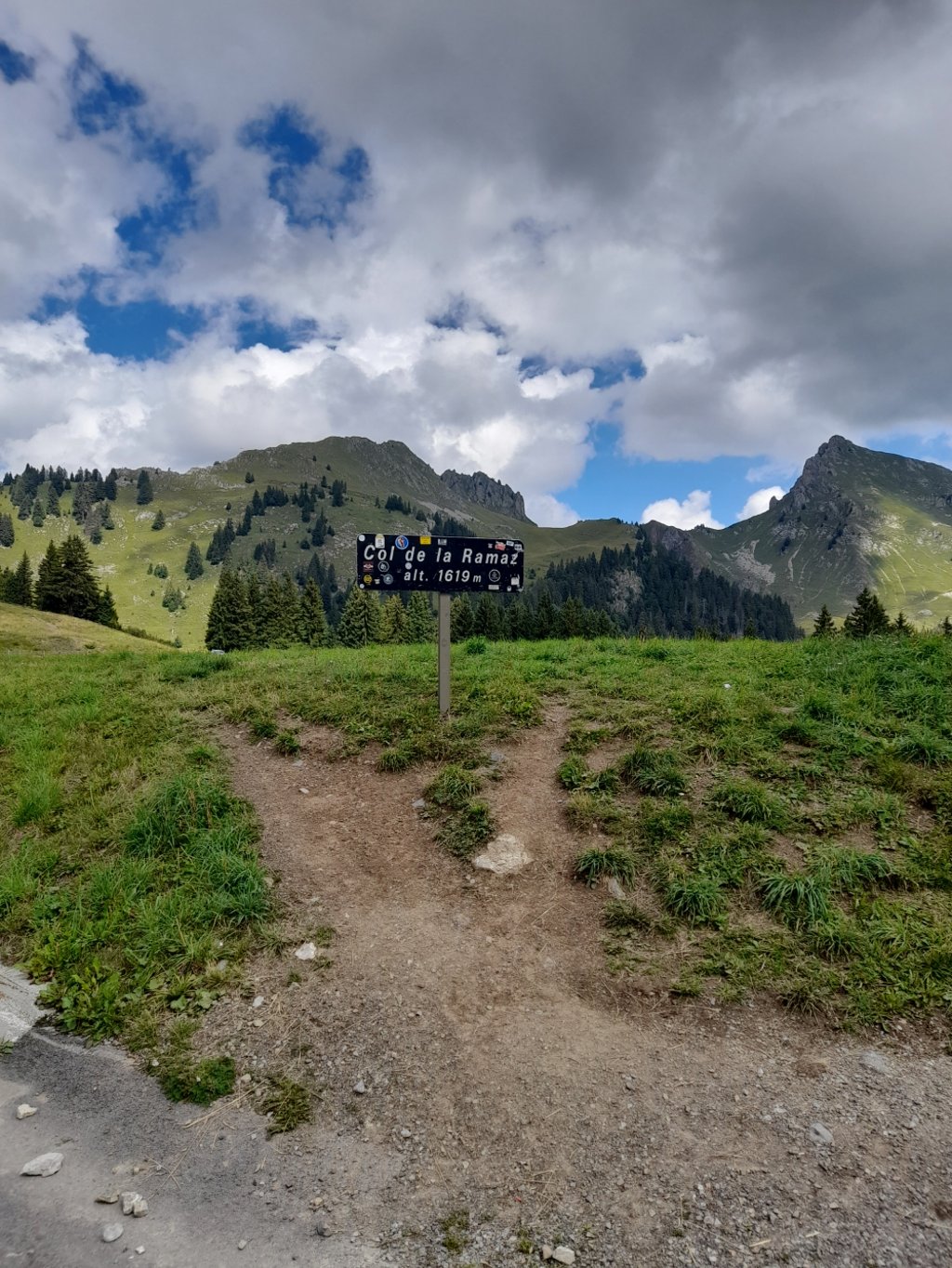
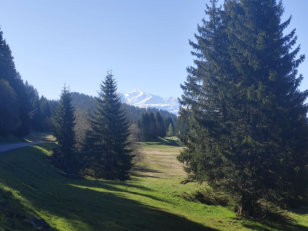
Col de la Ramaz from Taninges is a climb in the region Haute Savoie. It is 10.6 mi long and bridges 3363 ft of vertical ascent with an average gradient of 6%, resulting in a difficulty score of 824. The top of the ascent is located at 5443 ft above sea level. Climbfinder users shared 4 reviews of this climb and uploaded 8 photos.
Road names: D902, D907, D328 & D308
3.0 by Herve2023This is an automatic translation, the original language is: French.Very nice climb, undoubtedly more strenuous on this side than by the western route, which is the better known. A 4km section at 9-10%, past Fry (with one or two steep sections at 12%) gives this climb a definite sporting character. The last few kilometres are easy. The view at the top of the pass is very pleasant. Similarly, the first few kilometres of the climb (on the D902) offer a fine view over the valley. The road is in good condition. At around 1000m, do not continue on the road to... read more

Welcome! Please activate your account if you would like to share something. Look for the verification email in your inbox.
If you want to upload your photos, you need to create an account. It only takes 1 minute and it's completely free.
Very nice climb, undoubtedly more strenuous on this side than by the western route, which is the better known.
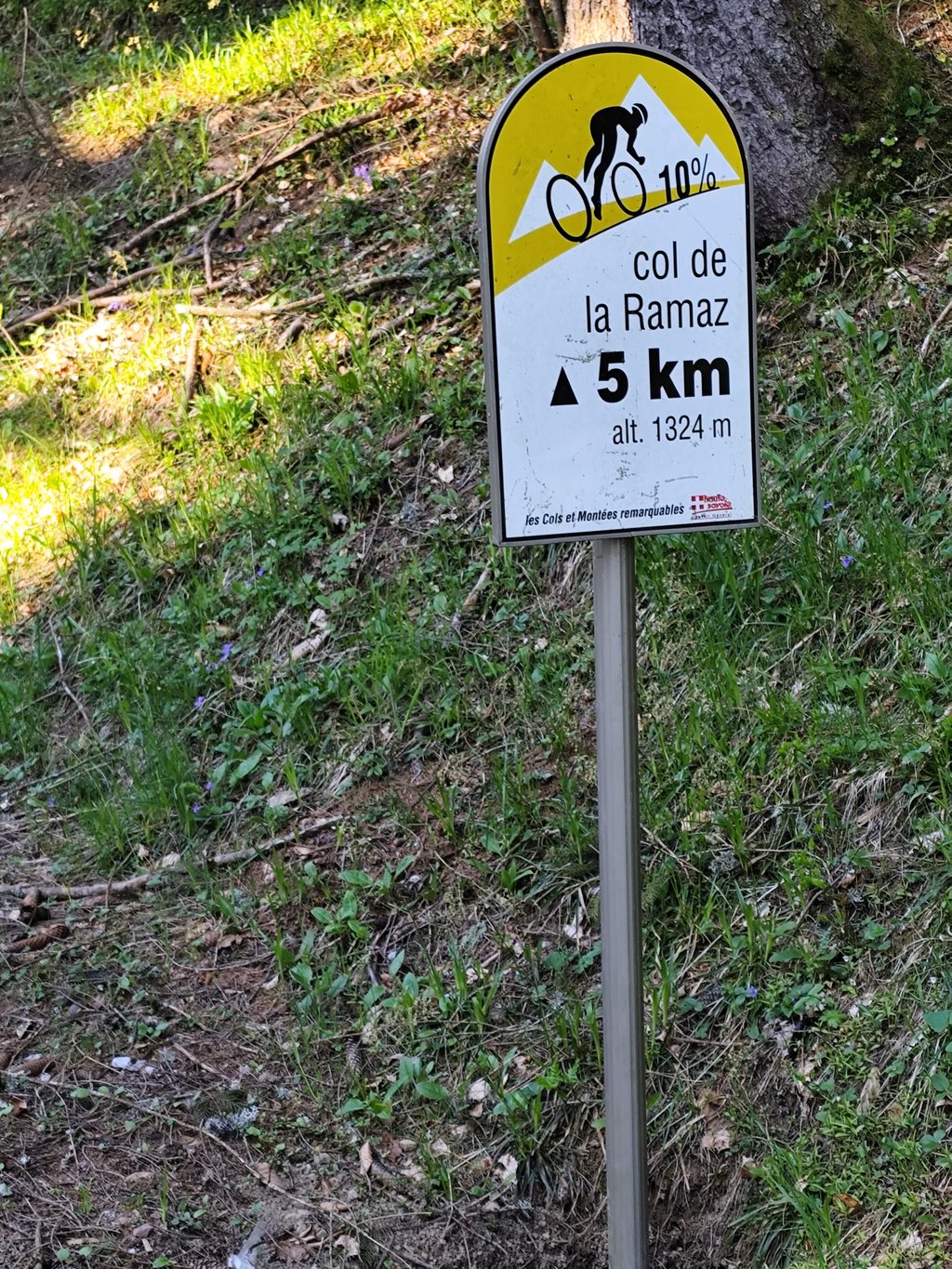
A 4km section at 9-10%, past Fry (with one or two steep sections at 12%) gives this climb a definite sporting character.
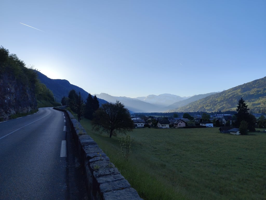
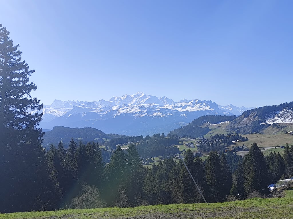
The last few kilometres are easy. The view at the top of the pass is very pleasant. Similarly, the first few kilometres of the climb (on the D902) offer a fine view over the valley.
The road is in good condition.
At around 1000m, do not continue on the road to Les Gets, but take the D307 to Fry and then the D308 to the pass.
Très belle montée, sans doute plus relevé de ce côté-ci que par la route ouest qui est la plus connue.
Un passage de 4km à 9-10%, après Fry (avec l'un ou l'autre raidillon à 12%) donne à cette ascension un caractère sportif affirmé.
Les derniers km sont faciles. La vue au sommet du col est très agréable. De même, les premiers km de l'ascension (sur la D902) offrent une belle vue sur la vallée.
La route est en bon état.
Vers 1000m d'altitude, ne pas poursuivre sur la route qui mène aux Gets, mais prendre la D307 vers Fry puis la D308 pour poursuivre jusqu'au col.
1 May, my 16th mountain pass. How beautiful it is! The climb starts calmly on a beautiful road with little traffic ( it was 7:00 in the morning). Then things get tougher, 3 km at 10% and one at 9% before the reward, the plateau in Praz de Lys. The last kilometre is harder than mentioned here, 9%
Le 1er mai, mon 16 ème col. Que c'est beau !!! La montée commence calmement sur une belle route peu passante ( il était 7h00 du matin ). Ensuite les choses se corses, 3 km à 10% etun à 9% avant la récompense, le replat dans le Praz de Lys. Le dernier kilomètre est plus dur que mentionné ici, 9%
First stretch is lovely and quiet and not too heavy, great for getting into the rhythm. From Fry, you get onto a slightly busier and, above all, much heavier road. Over four kilometres through the forest where it barely gets below 10 per cent. Once you arrive in the ski village of Pra de Lyz, it gets easier and you have beautiful views. The last kilometre is again difficult, but by now you have the nerve to do this again. The descent to Mieussy is fine. Wide road, good tarmac
Eerste stuk is heerlijk rustig en niet te zwaar, prima om in het ritme te komen. Vanaf Fry kom je op een wat drukkere en vooral veel zwaardere weg. Ruim vier kilometer door het bos waar het nauwelijks onder de 10 procent komt. Eenmaal aangekomem in het skidorp Pra de Lyz wordt het makkelijker en heb je schitterende uitzichten. De laatste kilometer is weer moeilijk, maar hier heb je inmiddels wel weer puf voor. De afdaling naar Mieussy is prima. Brede weg, goed asfalt
For this climb, the site gives the alternative over the busy, through road over the col near Les Gets. Recommend the indications for the col start at the Route du Rond. No through motorised traffic. First laver through the village and then climb along the flank of the mountain past Rond alternating between open and shady. Before Fry, turn left and then 'geht's los'. Enjoyment is briefly delayed with 4km around 10%. This is followed by beautiful open terrain with mountain peaks all around. The 5 km that follows is pure enjoyment of the beautiful scenery. At the top there is no catering, just a bench by a small lake (not to be entered). The beautiful descent ends at Anthon at the junction to Taninges (left) or St. Jeoire (right
Voor deze klim geeft de site het alternatief over de drukke, doorgaande weg over de col bij Les Gets. De aanduidingen voor de col beginnen bij de Route du Rond aanbevelen. Geen doorgaand gemotoriseerd verkeer. Eerst laverend door het dorpje en vervolgens langs de flank van de berg voorbij Rond afwisselend open en schaduwrijk klimmen. Voor Fry links en dan 'geht's los'. Het genieten wordt even uitgesteld met 4 km rond 10%. Daarna volgt mooi open terrein met rondom de bergtoppen. De 5 km die dan volgt is puur genieten van het prachtige landschap. Bovenaan is geen horeca, slechts een bank bij een meertje (niet te betreden). De prachtige afdaling eindigt bij Anthon bij de splitsing naar Taninges (links) of St. Jeoire (rechts
| 5 mph | 02:08:32 |
| 7 mph | 01:31:00 |
| 9 mph | 01:10:55 |
| 12 mph | 00:53:16 |
This page is better in the app