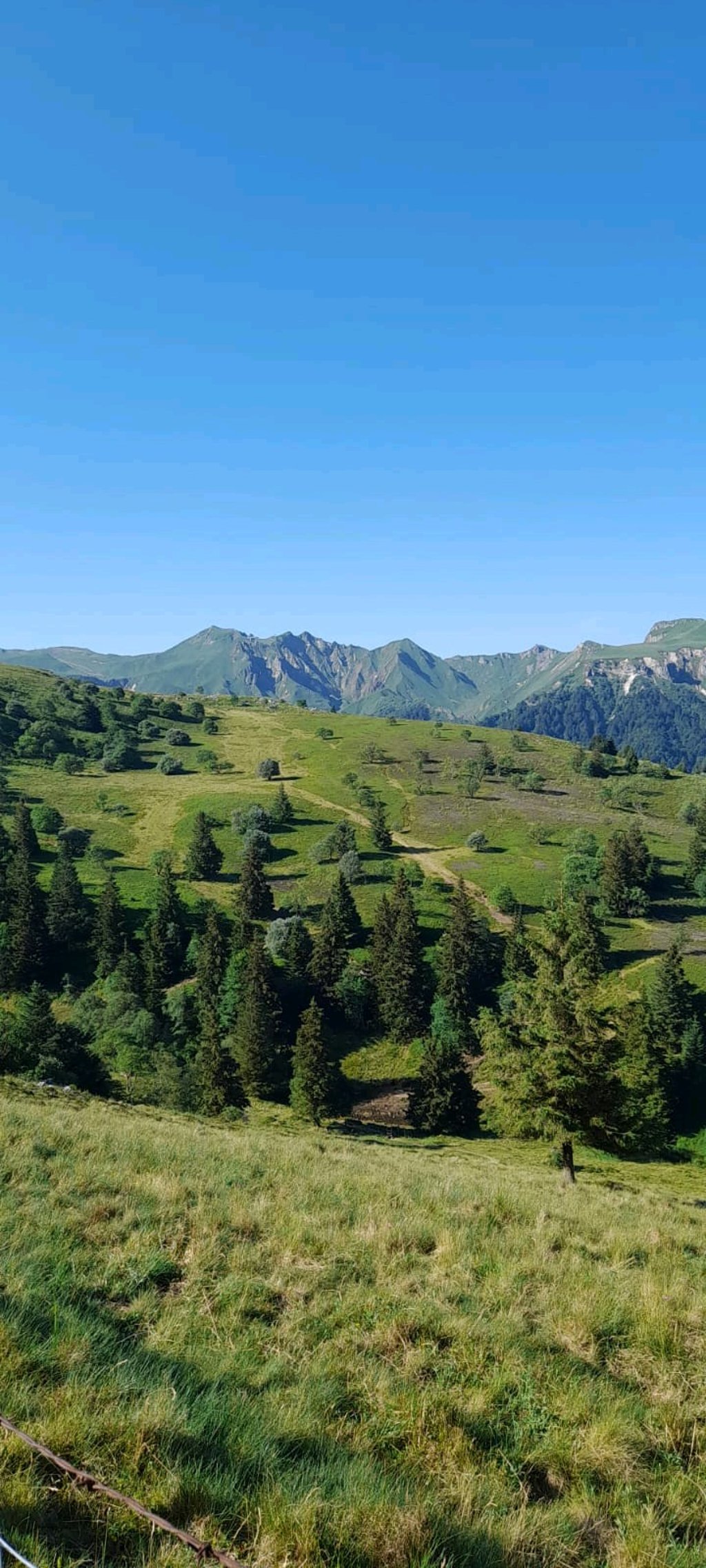
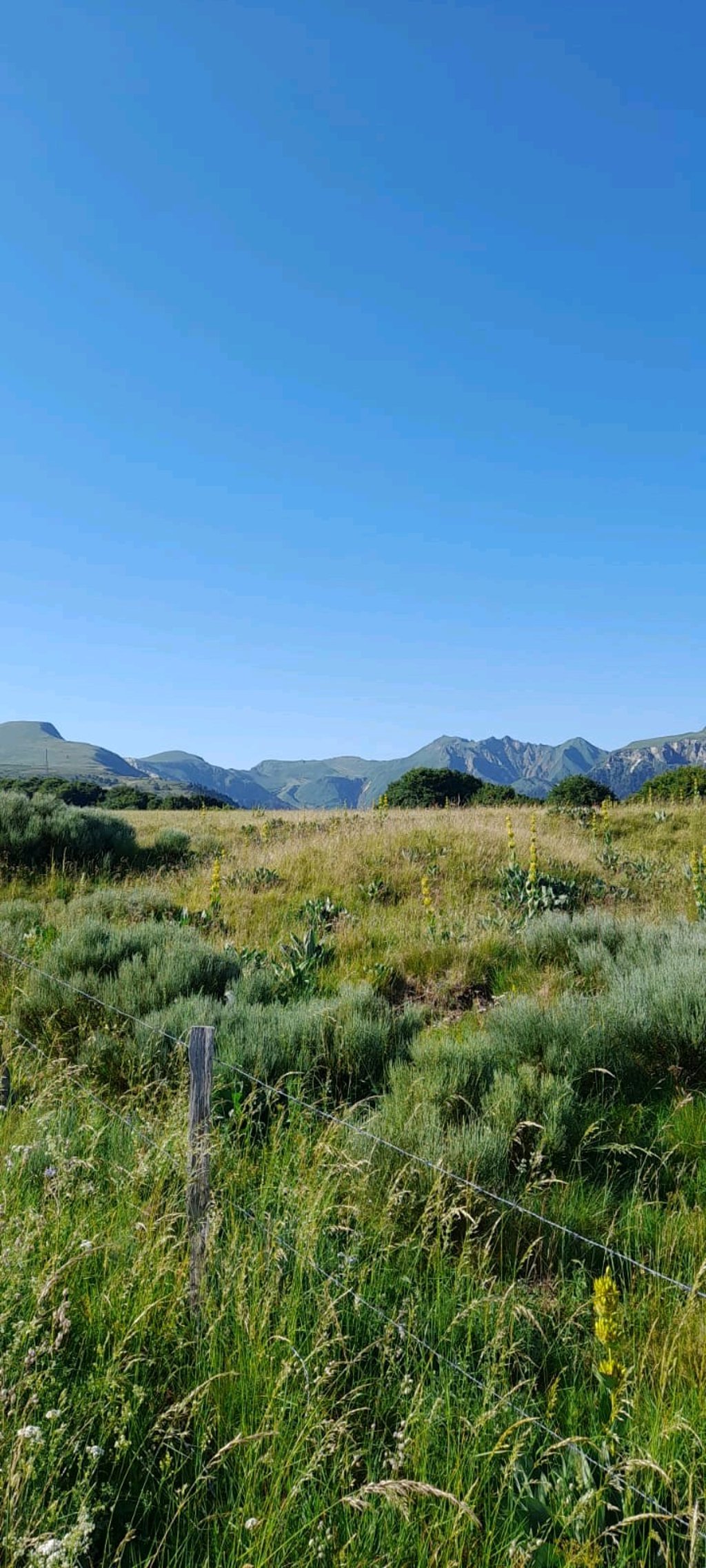
| Beautiful scenery |
| 8 hairpin turns |
| #67 toughest climb of Puy-de-Dôme |
| #57 most elevation gain of Puy-de-Dôme |
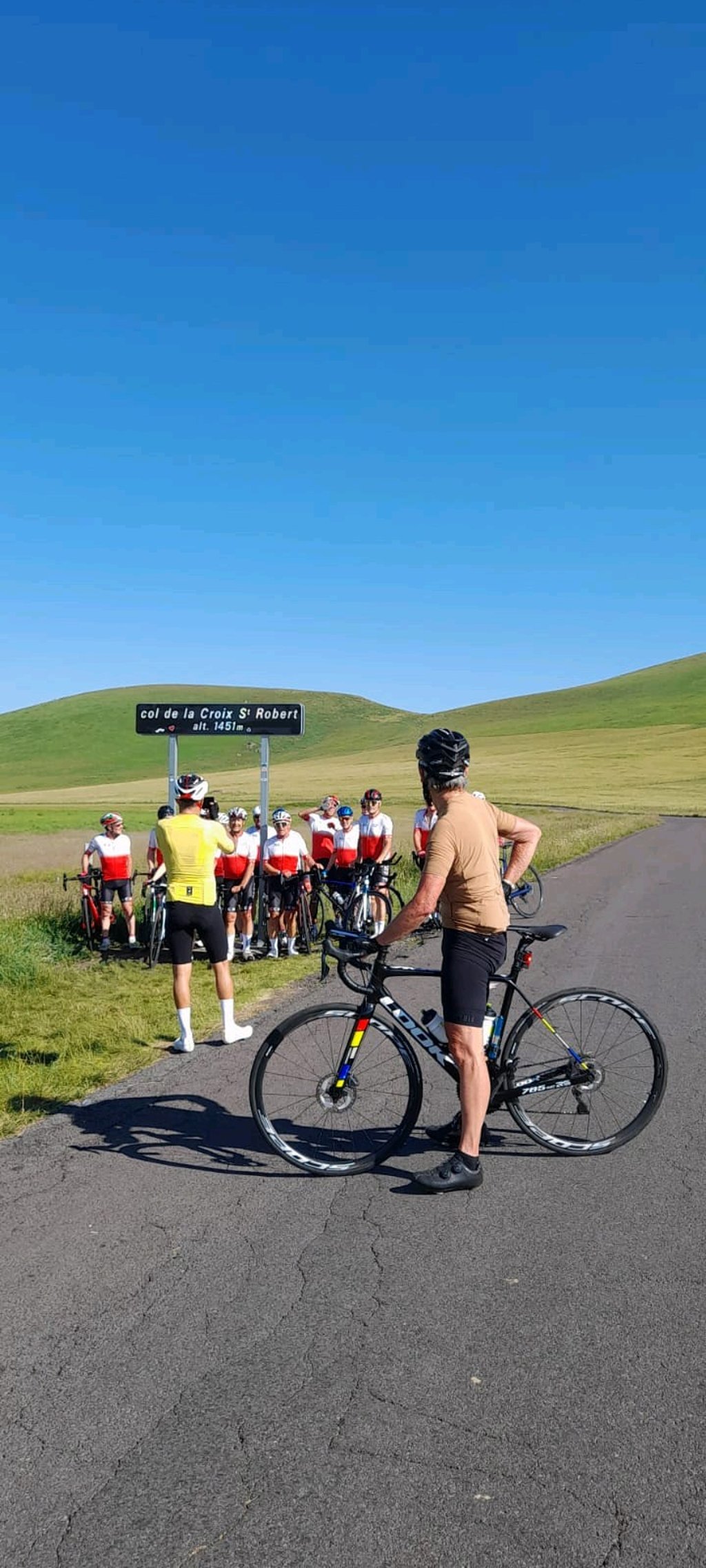
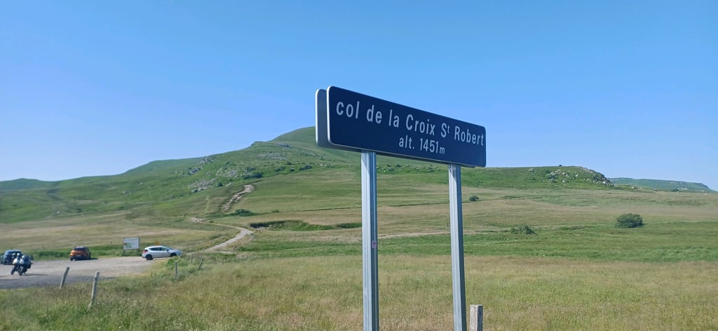
Col de la Croix Saint Robert is a climb in the region Puy-de-Dôme. It is 3.6 mi long and bridges 1194 ft of vertical ascent with an average gradient of 6.3%, resulting in a difficulty score of 248. The top of the ascent is located at 4760 ft above sea level. Climbfinder users shared 8 reviews of this climb and uploaded 8 photos.
Road name: D36
5.0 by John DoeThis is an automatic translation, the original language is: French.Superb climb from Mont-Dore, with sublime views of the Sancy, puy de l'Angle, the Capucin...👍... read more

Welcome! Please activate your account if you would like to share something. Look for the verification email in your inbox.
If you want to upload your photos, you need to create an account. It only takes 1 minute and it's completely free.
Fantastic climb, challenging at the start, then enjoying the scenery. And the descent towards Chambon is an extremely fine reward.
Fantastische klim, uitdagend in het begin, daarna genieten van het landschap. En de afdaling richting Chambon is een uitermate fijne beloning.
The driven with very bad weather. Rain, fog, strong winds and gusts and cold. The wind gusts on the descent did make it dangerous. With good weather probably totally fine.
De gereden met zeer slecht weer. Regen, misten, stevige wind en windvlagen en koud. De windvlagen in de afdaling maakten deze wel gevaarlijk. Met mooi weer waarschijnlijk helemaal prima.
Probably my favourite climb in the Sancy. The steepest gradients are on the straight after the hairpins at the start. The rest of the climb is not too difficult: the surface is good and the middle of the climb is gentle. The views of the Sancy are splendid, and the descent to Chambon (which is the route used by the famous Mont Dore hill climb) is as technical as it is enjoyable. A must-do if you're in the area!
Sans doute ma montée favorite dans le Sancy. Les pourcentages les plus raides sont dans la ligne droite qui suit les épingles du départ. Le reste de l'ascension n'est pas trop difficile : le revêtement est bon, le milieu de l'ascension est doux. Les vues sont splendides sur le Sancy, et la descente vers Chambon (qui est la route empruntée par la célèbre course de côte du Mont Dore) est aussi technique que plaisante. À faire absolument si vous êtes dans la région !
A nice, steady climb that's not too difficult, with a great view at the finish and a great descent, perfect surface, well worth doing!
Belle montée plutôt régulière et pas trop difficile avec une super vue à l’arrivée et une belle descente, revêtement nickel, à faire !
Climbed from Mont Dore on 08/08/2023 after the Col de la Croix St-Morand, the start in the wooded section at +8% is enough to break the legs, but from KM 2, you arrive on more regular %, and a splendid setting.
The last kilometre is very rolling, followed by a nice descent with a much better surface.
Gravi depuis Mont Dore ce 08/08/2023 après le Col de la Croix St-Morand, le départ dans la partie boisée a + de 8% à de quoi casser les pattes, mais à partir du KM 2, on arrive sur des % + réguliers, et un cadre splendide.
Le dernier KM est très roulant, qui s'enchaine sur une belle descente avec un revêtement bien meilleur.
Climbed several times, notably 2x in 2 days last year, more regular than the other side, nice views on both sides, notably when you pass the first half with a view of Lac Chambon at the top.
Grimpée plusieurs fois, notamment 2x en 2 jours l'an dernier, plus régulier que l'autre côté, Belle vue de chaque côté, notamment quand on passe la première moitié avec au sommet une vue sur le Lac Chambon.
Superb climb from Mont-Dore, with sublime views of the Sancy, puy de l'Angle, the Capucin...👍
Superbe montée depuis le Mont-Dore, avec des vues sublimes sur le Sancy, puy de l'Angle, le Capucin...👍
Did this climb in 2011. Nice and gradual with some hairpin bends. First in forest, later open. Unfortunately, it was grey during my climb, but the views are nice. The area is quiet (especially on the rainy day I did this ride), but it is a through road.
Deze klim in 2011 gedaan. Mooi geleidelijk met een aantal haarspeldbochten. Eerst in het bos, later open. Helaas was het grijs tijdens mijn klim, maar het uitzicht is mooi. De omgeving is rustig (zeker op de regenachtige dag dat ik deze tocht heb gereden), maar het is wel een doorgaande weg.
| 5 mph | 00:43:29 |
| 7 mph | 00:30:47 |
| 9 mph | 00:23:59 |
| 12 mph | 00:18:01 |
This page is better in the app