Tips nearby


| 35 hairpin turns |
| Bad road |
| #97 toughest climb of Auvergne-Rhône-Alpes |
| #88 most elevation gain of Auvergne-Rhône-Alpes |
| #77 longest climb of Savoie |
| #62 average steepest climb of Annecy |
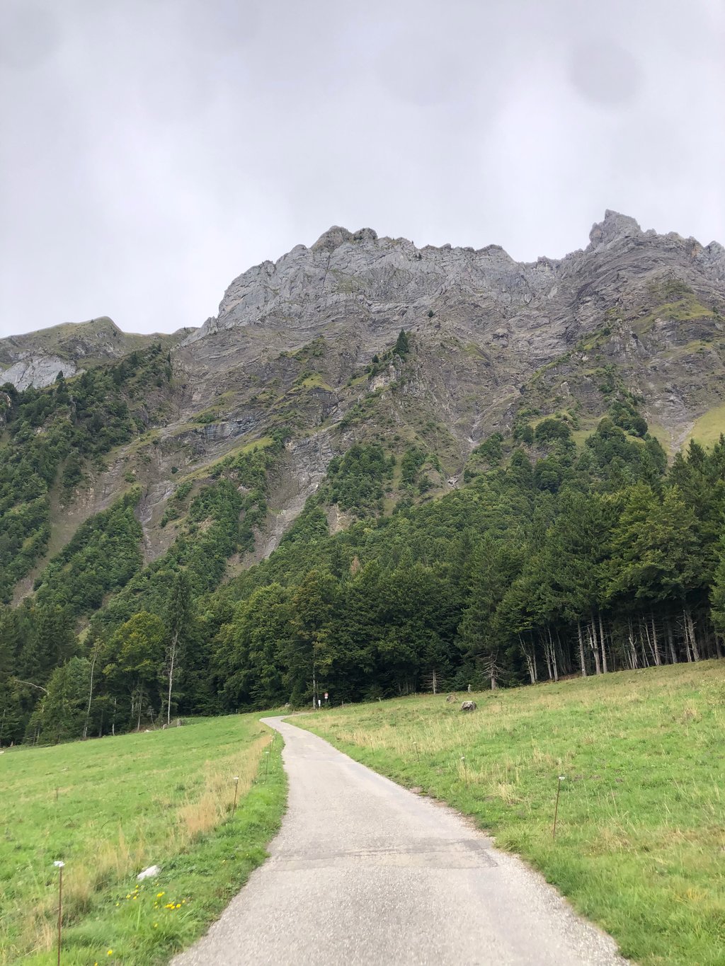
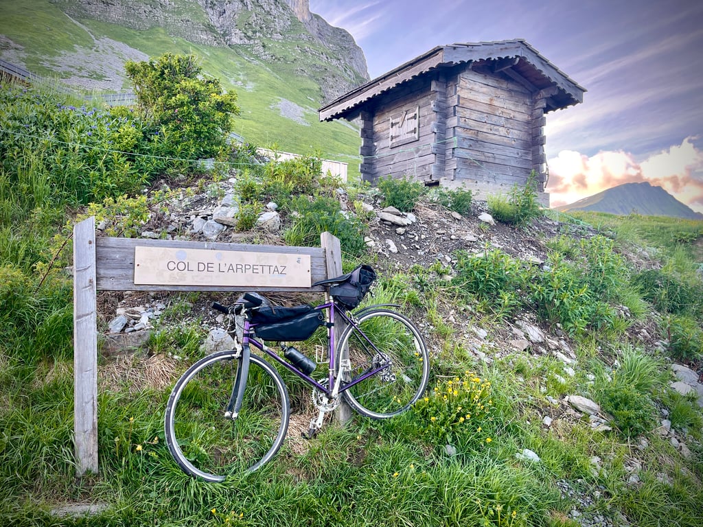
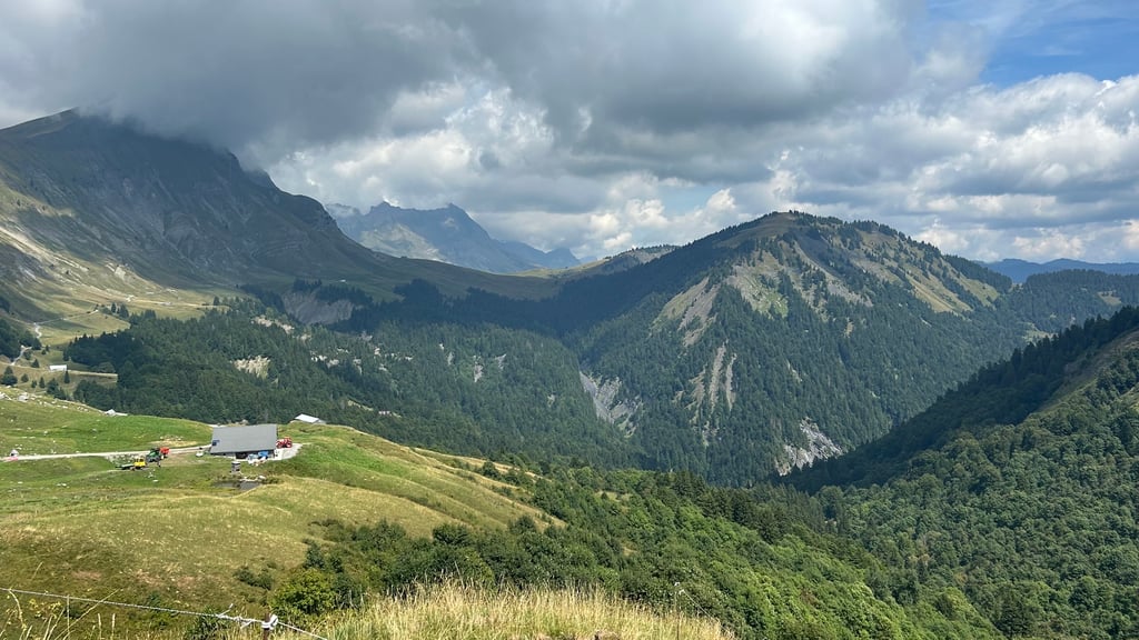
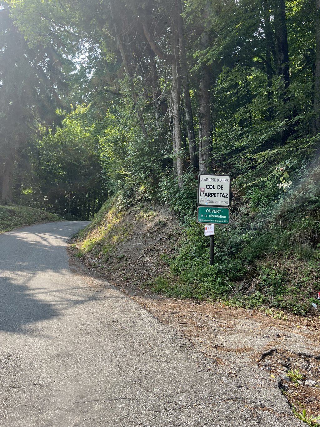
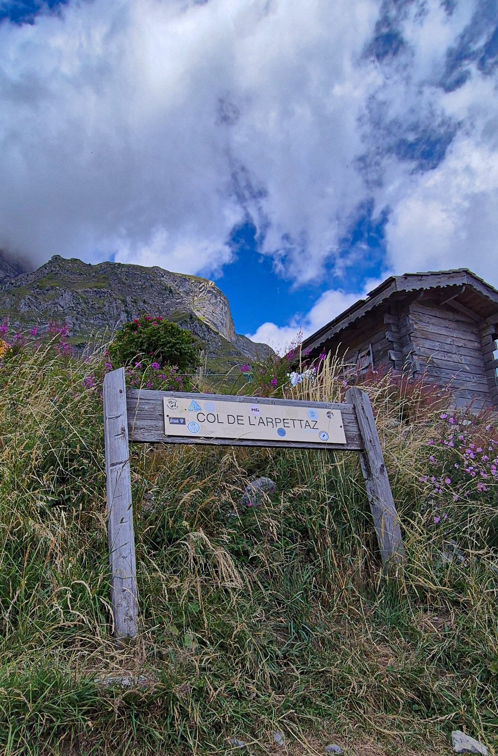
Col de l'Arpettaz from Ugine via Mont Dessous is a climb in the region Annecy. It is 9.7 mi long and bridges 3839 ft of vertical ascent with an average gradient of 7.5%, resulting in a difficulty score of 933. The top of the ascent is located at 5190 ft above sea level. Climbfinder users shared 15 reviews of this climb and uploaded 70 photos.
Road names: Avenue André Pringolliet, Rue Louis Zénone, Chemin de Pierre Martine, Route des Monts, Route du Col, Route des Montagnes & Route de Praz Véchin
5.0 by sergenavetatThis is an automatic translation, the original language is: French.Done on Saturday, July 17, 2021 after several days of intense rain ( a picture shows the water running down the road ) Living not far from the foot, I climbed this pass several times, from Ugine 3 or 4 different versions allow access, then from Mont-Dessous there is only one road. I took exactly the same route as the one described on ClimbFinder and I was surprised by the difficulty of the rue Louis Zenone ( which allows to reach Pierre-Martine ) 550M at 10,7 % of average Then until Mont-De... read more
Welcome! Please activate your account if you would like to share something. Look for the verification email in your inbox.
If you want to upload your photos, you need to create an account. It only takes 1 minute and it's completely free.
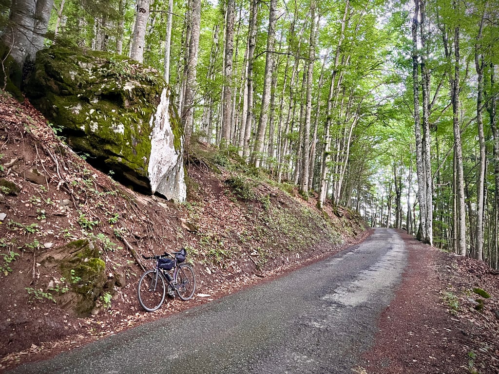
Based on Komoot and Climbfinder, I took the gamble. Asphalt is not great everywhere, but uphill is not a problem. The irregularities are what make the climb difficult, but the sections through the forest are pleasant and cool. Downhill is very careful, so take it easy and enjoy the views!
Op basis van Komoot en Climbfinder de gok gewaagd. Asfalt is niet overal geweldig, maar omhoog is dat niet z’n probleem. De onregelmatigheden is wat de klim moeilijk maakt, maar daar staan de stukken door het bos tegenover qua sfeer en verkoeling. Afdaling is goed opletten, dus vooral rustig aan en genieten van dr uitzichten!
So, no, it's true, this road isn't exactly a billiard table. But it will spice up the descent and won't really hinder the ascent.
Don't underestimate this pass. It's a serious one.
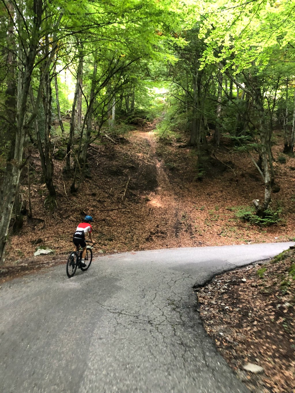
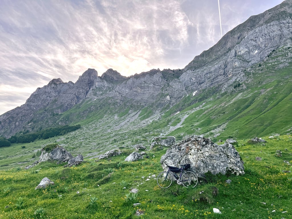
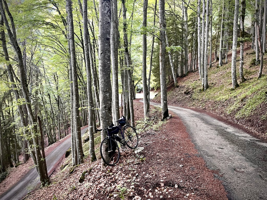
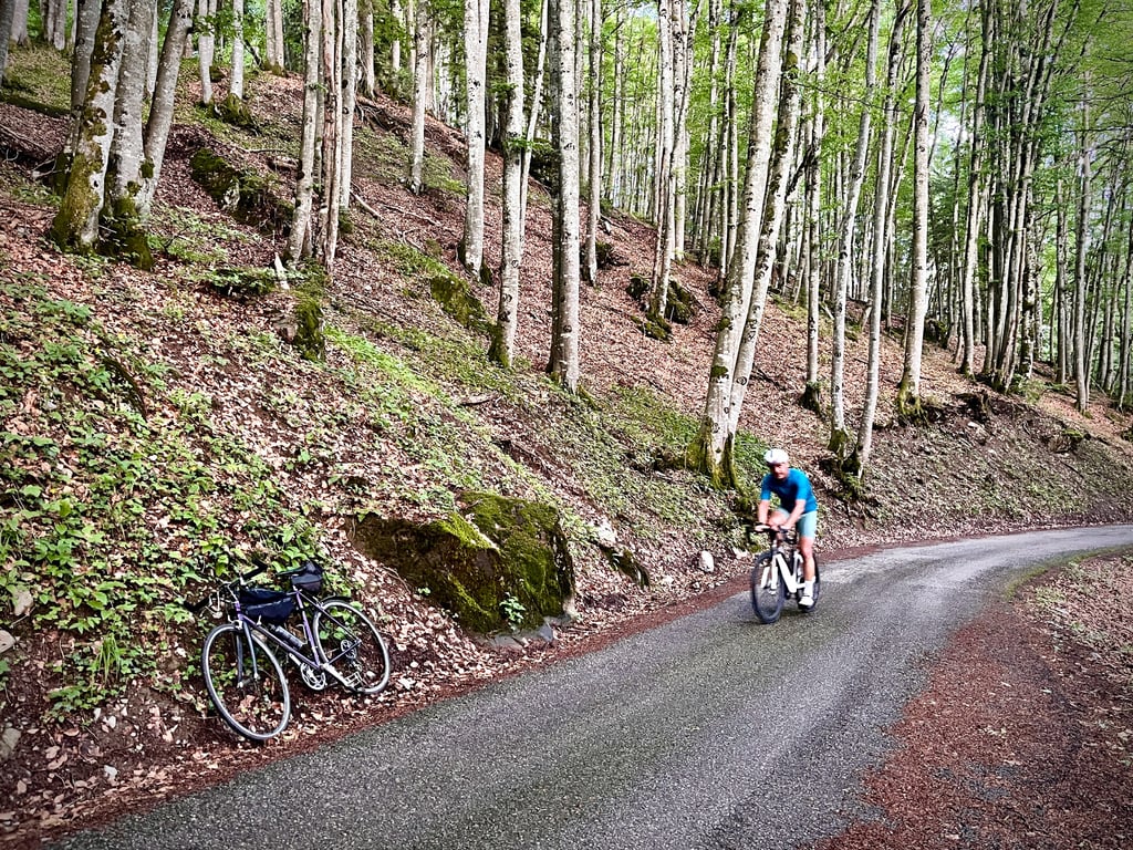
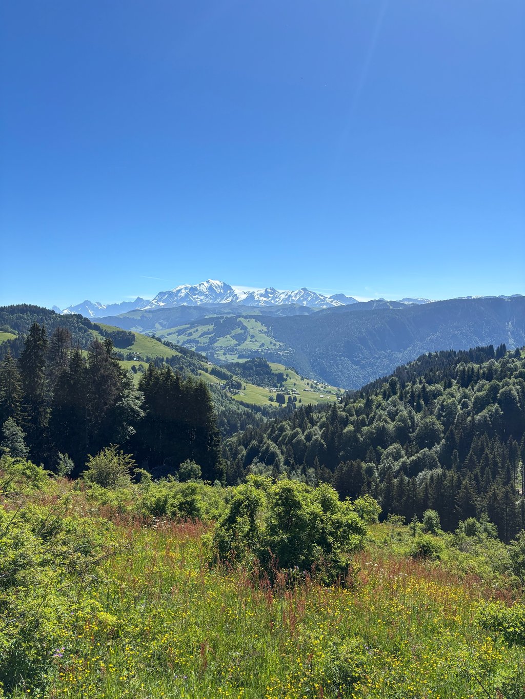
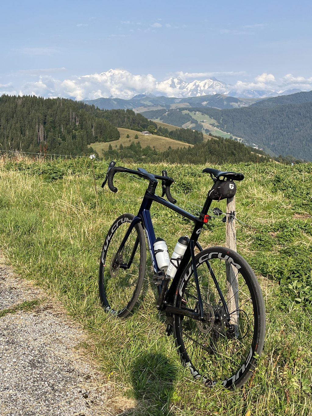
The Tour de France shuns it, but probably more for the tricky and risky helicopter overflights than for its undeniable qualities. At least, that's what the local cyclists say. It's a beautiful pass. It's varied. Both in terms of scenery and gradient. The forest sections are quite beautiful. And the hairpins! Numerous, very numerous and sumptuous! Impossible to get bored here. Up here, the scenery is powerful. View of Mont Blanc, 50km away.
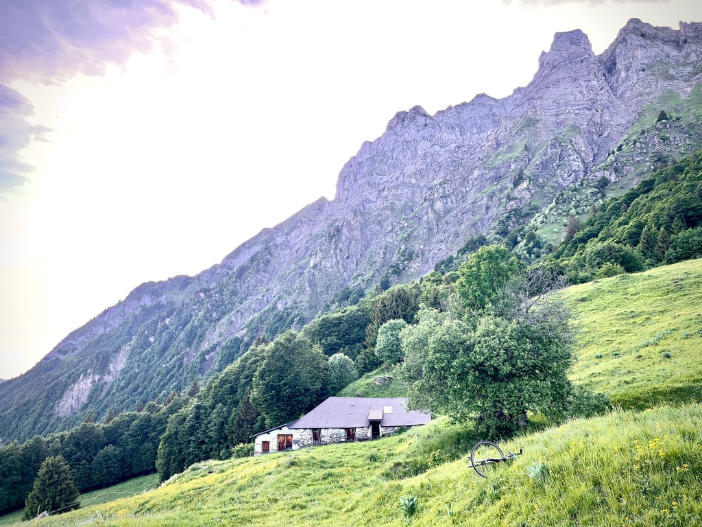
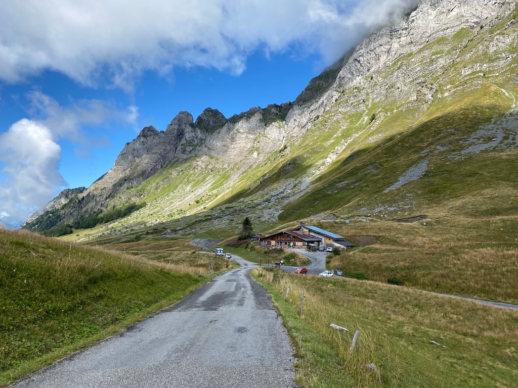
The welcome at the refuge was extremely warm and we talked about gravel and fixie.
The descent is great. The gravels are something to watch out for.
My score would be more like 4.5, but you have to make up for the comment by the person who gave this pass 2 stars, because there were "low clouds"!
Albertville's best pass, isn't it?
Alors, non, c’est vrai, cette route n’est pas exactement un tapis de billard. Mais, ça pimentera la descente et ne gênera pas franchement l’ascension.
Ne pas sous estimer ce col. Il est sérieux.
Le Tour de France le boude mais probablement plus pour des questions de survols délicats et risqués d’hélicoptères, que pour ses qualités indéniables. C’est en tout cas, ce que défendent les cyclistes locaux. Il est beau, ce col. Il est varié. Tant en termes de paysages, que de pourcentages. Les parties en forêt sont plutôt belles. Et les épingles ! Nombreuses, très nombreuses et somptueuses ! Impossible de s’ennuyer ici. Là-haut, les paysages sont puissants. Vue sur le Mont Blanc qui est à 50km.
L’accueil au refuge a été extrêmement chaleureux et nous avons discuté gravel et fixie.
La descente est géniale. Ça tabasse fort et les gravillons sont à surveiller.
Ma note serait plutôt 4,5, mais il faut absolument compenser le commentaire de l’individu qui a donné 2 étoiles à ce col, parce qu’il y avait « des nuages bas » !
Le meilleur col d’Albertville, non ?
Done on 13 September 2025, good weather conditions - great ascent - surface not great not recommended for the descent the descent to Héry seems a little better to me. No traffic at all, not a car in sight.
Fait le 13 Septembre 2025, bonnes conditions météo - super montée - revêtement pas terrible pas recommandé pour la descente la descente vers Héry me semble un peu plus quali. Pas fréquenté du tout, pas une voiture croisée.
Difficult but pleasant ascent with little traffic and varied landscapes between mountain pastures, forests and mountains
Monteée difficile mais agréable car peu de circulation et paysages variés entre alpages forêts et montagnes
Tough climb on a quiet road. First past farms, then a lot in t forest (nice and cool!) and the last few kilometres with nice views, with the view of Mont Blanc at the top as the ultimate reward! The climb is punchily steep throughout, and at the same time somewhat irregular. Percentage changes constantly, so you have to be able to cope with that. The road surface is rough but had few loose pebbles. Also on the other side, the tarmac is of moderate quality for the first few kilometres of the descent, but on that side the beautiful views for longer 🙂
Stevige klim op een rustige weg. Eerst langs boerderijtjes, dan veel in t bos (lekker koel!) en de laatste paar kilometers met mooie uitzichten, met het uitzicht op de Mont Blanc op de top als ultieme beloning! De klim is overal pittig stijl, en tegelijk ook wat onregelmatig. Percentage wisselt voortdurend, dus daar moet je wel tegen kunnen. Het wegdek is ruw maar had weinig losse steentjes. Ook aan de andere kant is het asfalt de eerste kilometers van de afdaling matig van kwaliteit, maar aan die kant wel langer de mooie vergezichten 🙂
A nice climb with quite a few hairpins, the road surface is just not great. For climbing it is fine, but not for descending. Lots of holes and loose gravel, better to descend on the other side.
Een leuke klim met flink wat haarspeldbochten, het wegdek is alleen niet geweldig. Om te klimmen prima maar niet om te dalen. Veel gaten en los grind, je kunt beter aan de andere kant dalen.
Beautiful climb and surroundings. With stunning views. The road surface is very bad but uphill certainly doable. Especially in the Forest, the climb is very irregular so it is sometimes difficult to find a rhythm. My advice is to go down via the other side, where the road is also not good, but better. The view of the valley is also worthwhile, by the way.
Prachtige klim en omgeving. Met een schitterende uitzicht. Het wegdek is erg slecht maar omhoog zeker wel te doen. Vooral in het Bos is de klim erg onregelmatig waardoor het soms wel lastig is om een ritme te vinden. Mijn advies is, ga via de andere kant naar beneden, daar is de weg ook niet goed, maar wel beter. Het uitzicht op de vallei is trouwens ook de moeite waard.
Beautiful climb in very nice surroundings.
Hardly encountered any traffic.
Asphalt not so good in some places.
Definitely recommended for cycling, but wise to descend slowly.
Prachtige klim in een hele mooie omgeving.
Bijna geen verkeer tegen gekomen.
Asfalt is op sommige plekken niet zo goed.
Zeker een aanrader om te fietsen, maar verstandig om rustig af te dalen.
Very nice climb on quiet road where you are only accompanied by cows. You meander from corner to corner up a steep road that constantly stays above 8%. At some stretches you cycle briefly at 7% which feels like recovering but the inside bends can easily get above 10%. Asphalt leaves much to be desired and this side is not recommended for descending. For the descent, I recommend the route via Hauteville where the tarmac is significantly better. The road is still easily accessible by bike, though. The view at the top over the nearby area is more than worth it. This climb is really worthwhile when in the area.
Zeer mooie klim over rustige weg waar je alleen door de koeien vergezelt wordt. Je slingert van bocht naar bocht naar boven op een steile weg die constant boven de 8% blijft. Bij sommige stukken fiets je even op 7% wat als bijkomen voelt maar de binnenbochten kunnen makkelijk boven de 10% geraken. Asfalt laat de wensen over en deze kant is niet aan te raden om af te dalen. Voor de afdaling raad ik de route via Hauteville aan waar het asfalt beduidend beter is. De weg is wel nog goed bereikbaar per fiets. Het uitzicht op de top over de nabije omgeving is meer dan de moeite waard. Deze klim is echt de moeite waard wanneer in de buurt.
Lovely ride done for the 2nd time, this time only with cloudy weather and no views of the Mont Blanc massif. Lots of hairpin turns, a few steep sections and mostly in the shade of the forest.
Note: outward route is occasionally over moderate tarmac but doable. Return route via La Lierre, lots of new gravel on the tarmac which makes descending and cornering a bit tricky.
Mooie tocht voor de 2e keer gedaan, nu alleen met bewolkt weer en geen uitzicht op het Mont Blanc massief. Veel haarspeldbochten, een paar steile stukken en meestal in de schaduw van het bos.
Let op: heenweg is af en toe over matig asfalt maar goed te doen. Terugweg via La Lierre, veel nieuw gravel op het asfalt waardoor het afdalen en het bochtenwerk een beetje trikkie is.
A really nice pass to climb. Most of the climb is done in the shade in the forest. This can be appreciated on hot cheeks. The road surface is really bad. The other side is a bit better but not much better.
Col vraiment agréable à grimper. La grande majorité se fait à l'ombre dans la forêt. Ce qui peut être appréciable les joues de chaleur. La surface de la route est vraiment mauvaise. L'autre versant est un peu mieux mais pas beaucoup plus.
Here no signs with distances and percentages, the climb starts calm but once you're out of the buildings it gets steeper. From here on you ride from one hairpin to another through the forest but closer to the top there are meadows and it gets more open with nice views of the valley and higher mountains. The narrow road is bad with many pits and cracks but for me this does not spoil the fun on this beautiful climb without traffic. I do not recommend this side to descend, because the state of the road is dangerous and there are many blind curves. Rounding the col completely gives a beautiful descent on the other side.
Hier geen bordjes met afstanden en stijgingspercentages, de klim begint rustig maar eens je buiten de bebouwing bent wordt het steiler. Vanaf hier rijd je van de ene naar de andere haarspeldbocht door het bos maar dichter bij de top zijn er weides en wordt het meer open met mooie uitzichten op de vallei en hoger gelegen bergen. De smalle weg is slecht met veel putten en scheuren maar voor mij bederft dit de pret niet op deze prachtige beklimming zonder verkeer. Ik raad wel deze kant af om af te dalen, want hiervoor is de staat van het wegdek wel gevaarlijk en zijn er veel blinde bochten. De col volledig ronden geeft een prachtige afdaling op de andere zijde.
Did this climb in 2021. Unfortunately many low hanging clouds. The road surface is bad and there is no indication on the way how many km you have left. I have not met any other cyclists, so if you like quiet this is fine ... I found him through the circumstances disappointing. Via the other side went down. Beautiful view from that side
Heb deze beklimming gedaan in 2021. Helaas veel laag hangende bewolking. Het wegdek is slecht en er wordt onderweg niet aangegeven hoeveel km je nog moet. Ik ben geen enkele andere fietser tegen gekomen, dus hou je van rust is deze prima... ik vond hem door de omstandigheden tegenvallen. Via de andere kant naar beneden gegaan. Mooie uitzicht vanaf die kant
Done on Saturday, July 17, 2021 after several days of intense rain ( a picture shows the water running down the road )
Living not far from the foot, I climbed this pass several times, from Ugine 3 or 4 different versions allow access, then from Mont-Dessous there is only one road.
I took exactly the same route as the one described on ClimbFinder and I was surprised by the difficulty of the rue Louis Zenone ( which allows to reach Pierre-Martine ) 550M at 10,7 % of average
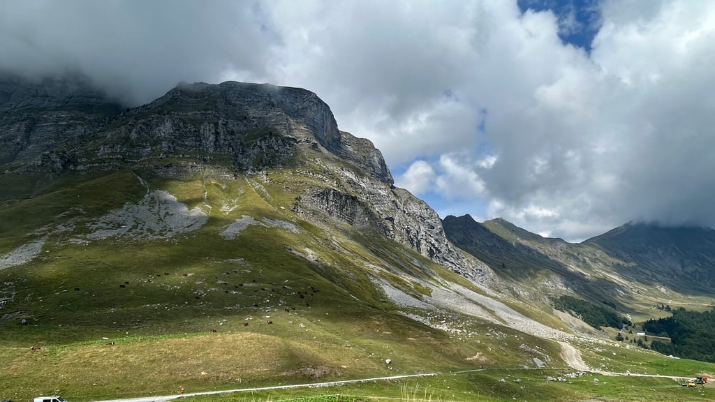
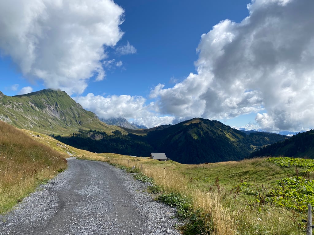
Then until Mont-Dessous it is a succession of flats, slight descents and small bumps, after that the slope becomes more regular is quite steep.
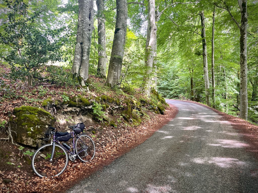
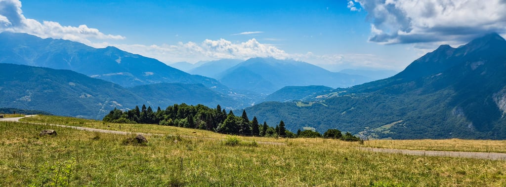
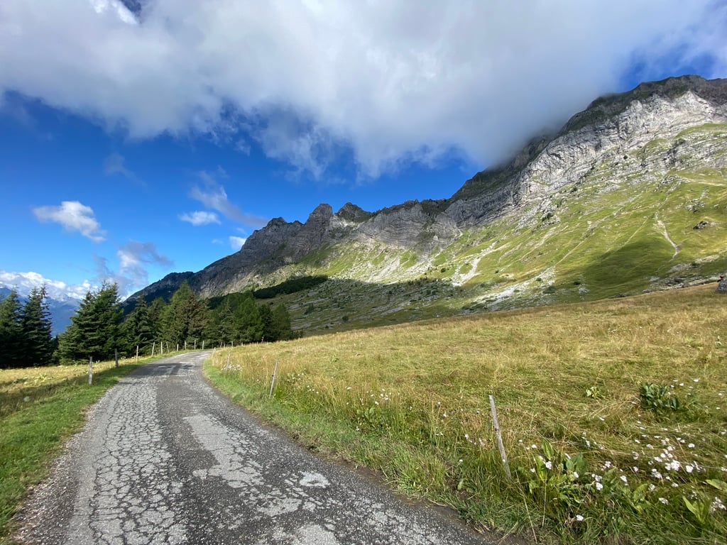
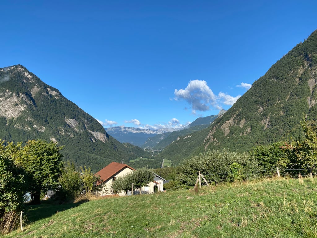
A large part of it is in the woods despite some gaps in the trees that give beautiful views of the neighboring massifs and the valley.
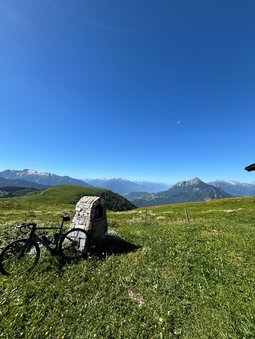
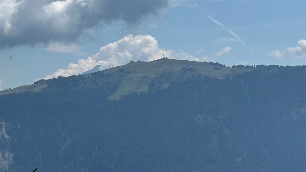
The last 2 km before the summit are clear, in the middle of the mountain pastures, on a steep slope and seem endless.
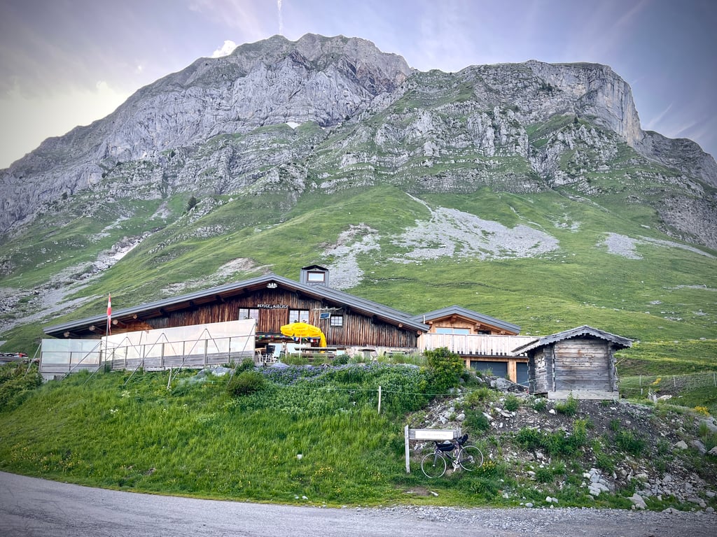
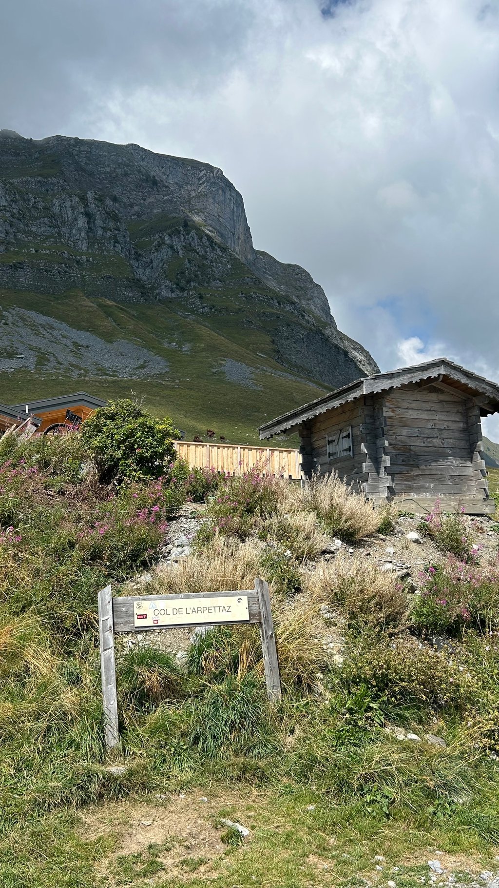
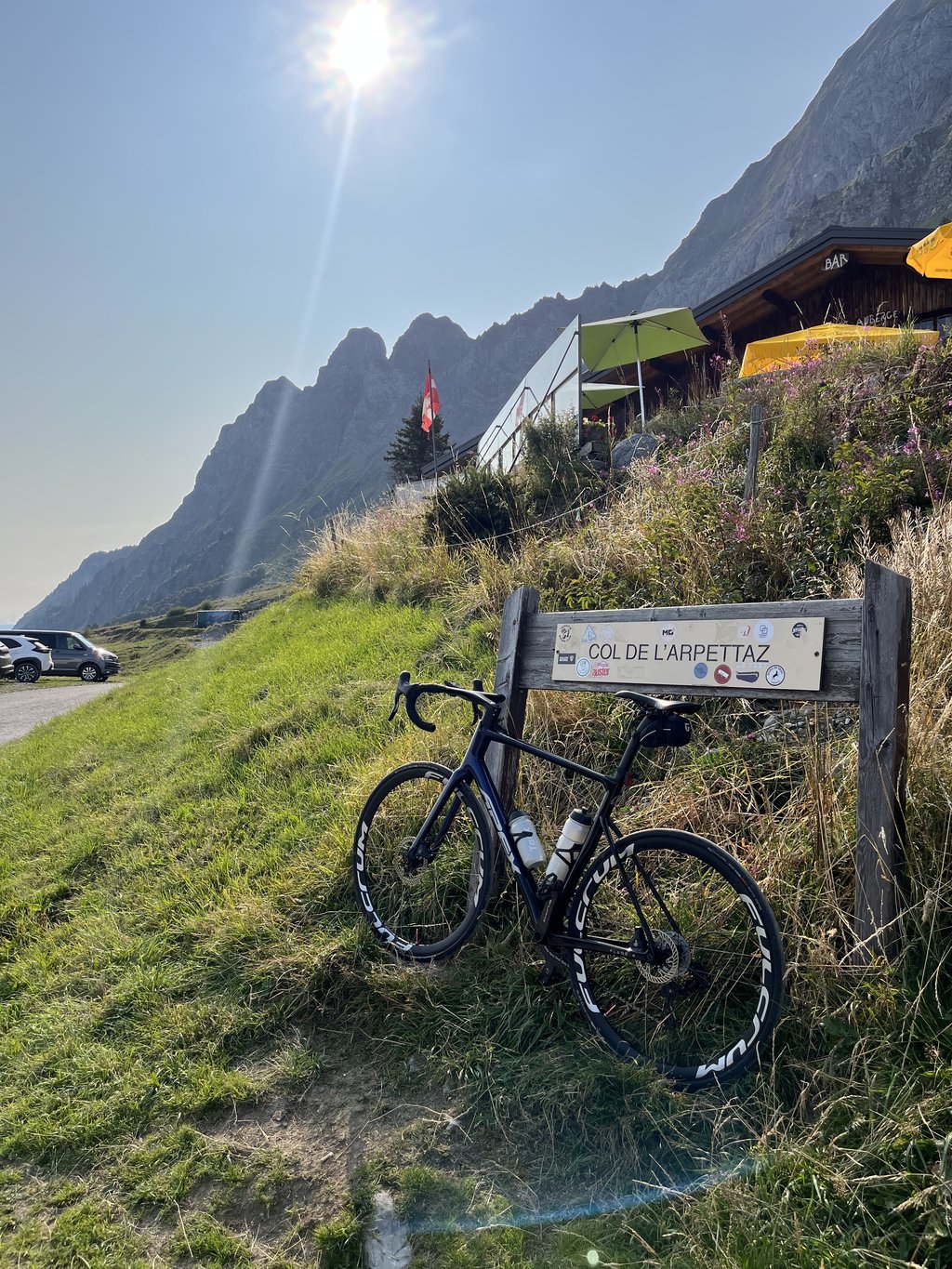
The inn at the pass is a good place to stop for a rest.
In summary: a relatively long (15km) and difficult climb with little respite after Mont-Dessous, mostly in the shade.
The asphalt is fine for the first 3/4 of the climb, but it is very bad as you approach the summit.
Traffic is light in the morning, but very present in summer at certain times of the day.
I didn't see any drinking water fountain during the climb but there are several pumps at the Ugine lake at the edge of the bike path.
Have a good ride and be careful
Fait le samedi 17 juillet 2021après plusieurs jours de pluie intense ( une photo montre l’eau qui ruisselle sur la route )
Habitant pas très loin du pied, j’ai escaladé ce col à plusieurs reprises, au départ d’Ugine 3 ou 4 versions différentes en permettent l’accès, ensuite à partir de Mont-Dessous il ne reste qu’une route.
J’ai emprunté exactement la même route que celle décrite sur ClimbFinder et j’ai été surpris par la difficulté de la rue Louis Zenone ( qui permet de rejoindre Pierre-Martine ) 550M à 10,7 % de moyenne
Ensuite jusqu’à Mont-Dessous c’est une succession de plats, légères descentes et petites bosses, après la pente devient plus régulière est assez forte.
Une grande partie s’effectue dans les bois malgré quelques trouées dans les arbres qui donnent de belles vues sur les massifs voisins et la vallée.
Les 2 derniers kilomètres avant le sommet sont dégagés, au milieu des alpages, dans une pente forte et paraissent interminables.
L’auberge du col permet une halte salutaire.
En résumé : une ascension relativement longue ( 15km ) et difficile avec peu de répit après Mont-Dessous, à l’ombre en grande partie.
Sur les 3/4 le bitume est correct mais à l’approche du sommet très dégradé.
Circulation Faible le matin, mais bien présente en été à certaines heures de la journée.
Je n’ai pas aperçu de fontaine d’eau potable lors de l’ascension mais il y a plusieurs pompes au plan d’eau à Ugine au bord de la piste cyclable.
Bonne route et prudence
A climb with very little traffic!
First part goes through the woods. There are few pieces where you can catch your breath.
On top is 1 mountain hut where you can drink / eat something.
Asphalt is bad (2019)
The higher you get, the more beautiful the views become
Een klim met ontzettend weinig verkeer!!
Eerste stuk gaat door de bossen heen. Er zijn weinig stukken waar je even op adem kunt komen.
Bovenop staat 1 berghut waar je wat kunt drinken/eten.
Asfalt is slecht (2019)
Hoe hoger je komt, hoe mooier de uitzichten worden
| 5 mph | 01:57:16 |
| 7 mph | 01:23:01 |
| 9 mph | 01:04:42 |
| 12 mph | 00:48:36 |
This page is better in the app