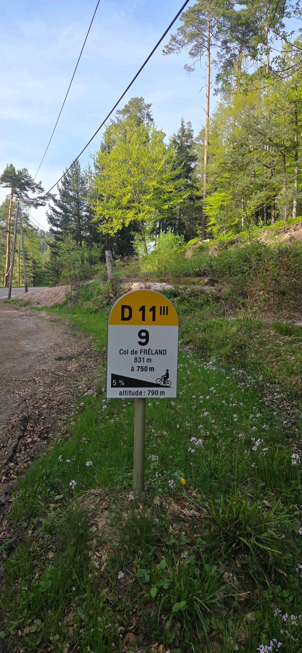
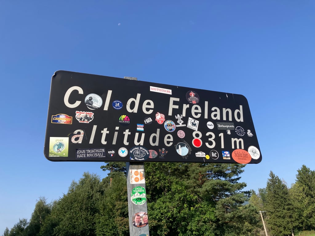
Col de Freland from Beblenheim is a climb in the region Upper Rhine. It is 9.4 mi long and bridges 2073 ft of vertical ascent with an average gradient of 4.2%, resulting in a difficulty score of 409. The top of the ascent is located at 2726 ft above sea level. Climbfinder users shared 8 reviews of this climb and uploaded 12 photos.
Road names: Route de Riquewihr au Rhin, Geheyweg, Route de Colmar, Avenue Jacques Preiss, Avenue Méquillet, Ursprungweg & Route de Fréland
3.0 by hardloper_marcoThis is an automatic translation, the original language is: Dutch.Nice climb from Riquewhir with quite steep sections at the start. After the climb flatter and partly descending. Gets a bit dangerous at Ursprung with big holes in the road. Nice in hot weather though, as it is almost completely in the shade... read more
Welcome! Please activate your account if you would like to share something. Look for the verification email in your inbox.
If you want to upload your photos, you need to create an account. It only takes 1 minute and it's completely free.
Lovely quiet climb through the forest, very little traffic. From Col de Freland descended to Ribeauvillé. Also a good road and easy clear section. Nb. Some turns with clinkers, well signposted though.
Heerlijk rustige klim door het bos, heel weinig verkeer. Vanaf Col de Freland afgedaald naar Ribeauvillé. Ook een goede weg en makkelijke overzichtelijke afdeling. Nb. Aantal bochten met klinkers, wel goed aangegeven.
Climbed from Zellenberg on a very hot day (34 degrees) but still relatively cool in the morning through the forest. Very quiet ascent and reasonably good road surface.
Vanuit Zellenberg beklommen op een hele warme dag (34 graden) maar in de ochtend nog relatief koel door het bos. Zeer rustige opgang en redelijk goed wegdek.
Nice climb from Riquewhir with quite steep sections at the start. After the climb flatter and partly descending. Gets a bit dangerous at Ursprung with big holes in the road.
Nice in hot weather though, as it is almost completely in the shade
Leuke klim vanuit Riquewhir met flink steile stukken in het begin. Na de klim vlakker en deels dalend. Wordt een stukje gevaarlijk bij Ursprung met grote gaten in de weg.
Wel lekker bij warm weer, want ongeveer volledig in de schaduw
Nice, quiet, shady but irregular climb. From Riquewihr (nice village) it goes up for a while, you ride out of the crowds and into a nice and green forest. The road surface varies from nice to fine. It is difficult to find a pace because it is quite irregular, although this gives you some nice 'resting moments'. Actually, the real climb finishes at Col de Brudermatt (then it is 4.6km to 7.5% according to Strava). After that, it goes up and down slightly. Be careful in this stretch not to ride through one of the big potholes. Once you are on the road to Fréland, the road surface is good, a bit more traffic but still not much and the ascent is not too bad.
All in all, a fun, unfamiliar and irregular climb!
Mooie, rustige, schaduwrijke maar onregelmatige beklimming. Vanuit Riquewihr (leuk dorpje) gaat het al even lekker omhoog, je rijdt de drukte uit en komt in een mooi en groen bos. Het wegdek verschilt van lekker tot prima. Het is lastig om een tempo te vinden omdat ie nogal onregelmatig is, al heb je daardoor ook lekker wat 'rustmomentjes'. Eigenlijk is de echte beklimming klaar bij Col de Brudermatt (dan is ie 4,6km à 7,5% volgens Strava). Daarna gaat het licht omhoog en naar beneden. Pas in dit stuk wel op dat je niet door een van de grote kuilen rijdt. Als je op de weg naar Fréland zit is het wegdek goed, iets meer verkeer maar alsnog niet veel en de stijging valt goed mee.
Al met al een leuke, onbekende en onregelmatige klim!
It's not easy to find the road out of Riquewihr. You have to go around the ramparts, then first take a small road towards Hunawihr, heading north-west. At the entrance to the forest there's a fork in the road: don't take Hunawihr on the right, but continue straight on (there's no signposting, just a few signs for footpaths).
From here, a narrow forest road climbs between 8 and 9% into the forest. After 2km, there's a one-kilometre flat then a new section at 8%. The slope then becomes gentler to reach a plateau at an altitude of around 700m. At the end you reach the departmental road, on 3-4% gradients. The forest road is in fair condition, apart from a few potholes in the lower section. It's best not to go down this road. I only passed one car... and one bus! (I still wonder what it was doing there, on such a narrow mountain road!).
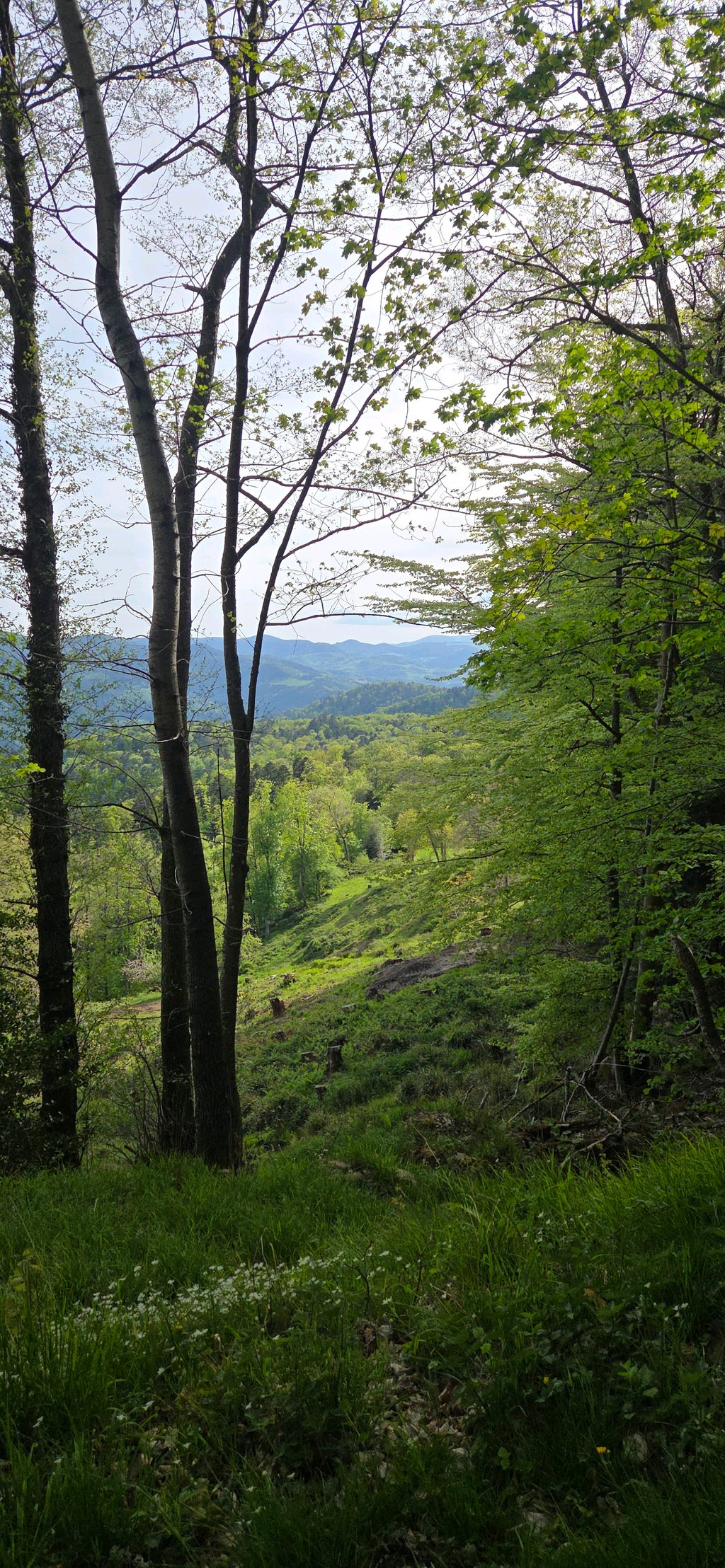
As far as the scenery was concerned, there weren't many views on the way up, but a few on the plateau. Just after the Fréland pass, the view opens up as you reach the village of Aubure.
La route n'est pas évidente à trouver à la sortie de Riquewihr. Il faut contourner les remparts, puis prendre d'abord une petite route vers Hunawihr, vers le nord-ouest. A l'entrée de la forêt se trouve une bifurcation : ne pas prendre Hunawihr, à droite, mais continuer tout droit (il n'y a pas de panneau indicateur, juste quelques panonceaux pour les chemins de randonnées).
A partir de là, une route forestière étroite monte entre 8 et 9% dans la forêt. Après 2km, s'ensuit un replat d'un km puis une nouvelle section à 8%. La pente s'adoucit ensuite pour atteindre un plateau vers 700m d'altitude. On rejoint à la fin la route départementale, dans des pentes de 3-4%. La route forestière est dans un état correct, mis à part quelques nids de poule dans la partie basse. Il est préférable de ne pas descendre par cette route. Je n'ai croisé qu'une seule voiture... et un autobus ! (Je me demande encore ce qu'il faisait là, sur une route de montagne aussi étroite !)
Pour ce qui concerne le paysage : peu de vues dans la partie montante, quelques unes sur le plateau. Juste après le col de Fréland, la vue se dégage lorsque l'on arrive dans la village d'Aubure.
I descended this one and found it life-threatening. After you take the turnoff to Riquewihr, the road becomes narrow, through the forest, huge potholes and little visibility. If there is a car coming in the opposite direction, you have to hope the car wants to pull over a bit.
Only recommended to climb.
Ik ben deze afgedaald en vond hem levensgevaarlijk. Nadat je de afslag naar Riquewihr genomen hebt wordt de weg smal, door het bos, enorme gaten in het wegdek en weinig zicht. Als er een auto in tegengestelde richting komt moet je hopen dat de auto een beetje aan de kant wil.
Enkel aan te raden om te beklimmen.
Nice climb on a narrow road through the forest. The start is hard and after a flatter section the climb really picks up speed. After the last hairpins, you've had the hardest part and it's great to roll out. The only disappointment is the (almost) lack of views.
Leuke klim over een smalle weg door het bos. Begin is even aanpoten en na een vlakker deel trekt de klim nog echt een keer goed aan. Na de laatste haarspeldbochten heb je het zwaarste gehad en is het heerlijk uitbollen. Enige wat tegenvalt is het (bijna) gebrek aan uitzicht.
The first few kilometres are the toughest; after four kilometres it goes up and down, mainly through the woods. Very quiet, you can hear your tyres on the road and the birds in the forest. Nice climb to get into it.
De eerste kilometers zijn het zwaarst, na vier kilometer gaat het op en neer, voornamelijk door de bossen. Heel erg rustig, je hoort je bandjes over het wegdek en de vogeltjes in het bos. Lekkere klim om er in te komen.
| 5 mph | 01:53:19 |
| 7 mph | 01:20:13 |
| 9 mph | 01:02:31 |
| 12 mph | 00:46:58 |
This page is better in the app