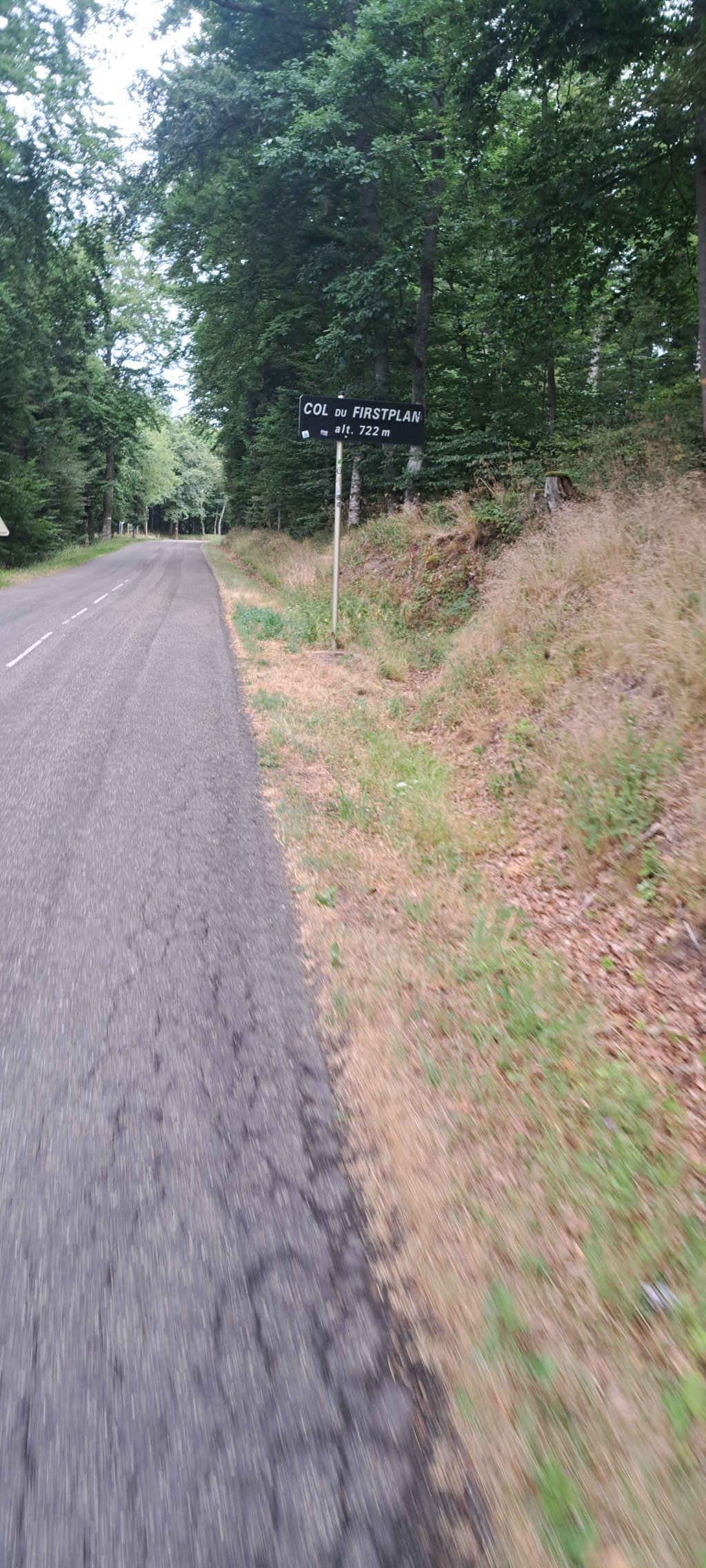
Col de Firstplan from Gueberschwihr is a climb in the region Upper Rhine. It is 7.1 mi long and bridges 1942 ft of vertical ascent with an average gradient of 5.2%, resulting in a difficulty score of 433. The top of the ascent is located at 2369 ft above sea level. Climbfinder users shared 7 reviews of this climb and uploaded 7 photos.
Road names: D15 & D40
3.0 by DembouzThis is an automatic translation, the original language is: French.Rather irregular percentage with the 2 descents. However, it's not busy.... read more
Welcome! Please activate your account if you would like to share something. Look for the verification email in your inbox.
If you want to upload your photos, you need to create an account. It only takes 1 minute and it's completely free.
Rather irregular percentage with the 2 descents. However, it's not busy.
Pourcentage assez irrégulier avec les 2 descentes. Cependant ce n'est pas fréquenté.
The first part is tough, until the second hairpin. You do have a nice view over the village and the valley, though. Then it runs through a quiet forest, goes down a bit and then up again. I found that quite irritating because you don't get into a nice rhythm. After the second part downhill, you get to a nice bit of climbing, from here you can keep going steadily to the top.
Het eerste deel is zwaar, tot de tweede haarspeldbocht. Wel heb je een mooi uitzicht over het dorp en het dal. Daarna loopt ie door een rustig bos, gaat ie een stukje naar beneden en weer omhoog. Dat vond ik vrij irritant want je raakt niet in een lekker ritme. Na het tweede stuk naar beneden kom je op een lekker stukje beklimming, vanaf hier kun je lekker constant doortrekken naar de top.
It starts hard after Gueberschwir for 3km, but then it's pretty easy, but it's still the hardest climb compared to Osenbach or Soutzbach.
Ca commence fort après Gueberschwir sur 3KM, mais ensuite c'est plutôt facile, mais ca reste quand même la montée la plus dure comparer à celle d'Osenbach ou de Soutzbach.
Like many others, probably chose this climb as a 'warm-up' for the Grand Ballon, but got pretty wrong about it... seriously steep beast with strips going above 12%. It is fortunately not too long, but seriously creeps into the legs. After the first 4 tough kilometres, we took a turn towards Osenbach. And just when you think you're at the top, there's another annoying spur that sours the legs completely...
But otherwise a beautiful, very quiet col : when I climbed it (Friday 16/9/22) I barely met 2 cars, 1 motard and 1 cyclist... and 2 wild deer 👍
Net zoals vele anderen waarschijnlijk deze klim gekozen als ‘opwarmer’ voor de Grand Ballon, maar er me behoorlijk aan mispakt... serieus steil beestje met stroken die boven de 12% gaan. Hij is gelukkig niet al te lang, maar kruipt serieus in de benen. Na de eerste 4 zware kilometers afslag richting Osenbach genomen. En net als je denkt dat je boven bent komt er nog een ambetante uitloper zodat de benen helemaal verzuren...
Maar voorts een prachtige, zeer rustige col : toen ik hem beklom (vrijdag 16/9/22) kwam ik amper 2 auto’s, 1 motard en 1 fietser tegen... en 2 wilde herten 👍
We left from Eguisheim, just to take in a small mountain before we get to the real thing: the Grand Ballon. We drove to Guebershiwhr via Voegtlinshoffen. That's already a very nice route through the vineyards (highly recommended). And then the climb started, the first part is hard work, but very nice (make sure you don't acidify here because it will be hard at the end). With a few descents in it where you can 'cool down'. The road surface is fine, it was not very busy, but, it can be. Because many motorcyclists use this Col as a route to the Col du Grand Ballon.
Vertrokken vanuit Eguisheim, even een Colletje mee pakken voor dat we het echte werk: de Grand Ballon gaan doen. Via Voegtlinshoffen naar Guebershiwhr gereden. Dat is al een erg mooie route door de wijngaarden (aanrader). En toen begon de klim, het eerste stuk is wel even aanpoten, maar erg mooi (Let wel op dat je je hier niet verzuurt want dan krijg je het zwaar aan het einde) Daarna verloopt het geleidelijk omhoog. Met een paar afdalingen erin waar je even kunt ‘afkoelen’. Het wegdek is prima, heel druk was het niet, maar, dat kan het wel zijn. Want veel motorrijders gebruiken deze Col als route naar de Col du Grand Ballon.
Do not underestimate the Cote de Gueberschwihr. It is quite steep and you can really wrong yourself, what happened to me. After a short but nice descent you arrive at the Firstplan. That is 3.5 km climb. These are not so hard anymore. You pedal constantly at percentages of 6% - 7% and after the steeper sections you already had on the Gueberschwihr, they feel great.
Onderschat de Cote de Gueberschwihr niet. Die is flink steil en daarop kun je jezelf flink vergalopperen, wat mij ook overkwam. Na een korte maar lekkere afdaling kom je op de Firstplan. Dat is dan nog 3,5km klimmen. Die zijn niet zo zwaar meer. Je trapt constant percentages van 6% - 7% en na de steilere stroken die je op de Gueberschwihr al hebt gehad voelen die heerlijk.
Beware of the profile of this climb! From the foot, this climb is very irregular with portions at +10% then easier parts and this almost all the way. Only the last 3 kilometers, after a short descent, is regular with +- 7% slope.
Attention au profil de cette ascension ! Dès le pied, cette montée est très irrégulière avec des portions à +10% puis des parties plus faciles et ce presque tout le long. Il n'y a que les 3 derniers kilomètres qui, après une courte descente, est régulière avec +- 7% de pente.
| 5 mph | 01:25:11 |
| 7 mph | 01:00:19 |
| 9 mph | 00:47:00 |
| 12 mph | 00:35:18 |
This page is better in the app