View on map
© MapLibre | OpenStreetMap contributors
1%
2%
4%
6%
8%
10%
12%
15%
20%

Col de Champ-Laurent via Valgelon la Rochette

3.0
1 review/story | Elevation profile | 3 photos
Tips nearby
Col de Champ-Laurent via Valgelon la Rochette
transparant thumb
transparant thumb
transparant thumb
transparant thumb
transparant thumb
Your achievable time
Calculating based on your best performances...
Relaxed
Maximum
W/kg
W/kg
W/kg
Analyze your climbing performance
Detailed insight into your climbing performance & automatically check off climbs
Based on your best performances.
Your best attempt:
Number of attempts:
Elevation profile Col de Champ-Laurent via Valgelon la Rochette

Statistics

Difficulty points 566
Length 10.5 mi
Average gradient 5%
Steepest segment 9.6%
Total ascent 2733 ft

Short recap

17 hairpin turns
#55 longest climb of Savoie
Feedback about this climb?
Show climbs nearby Export to GPS device

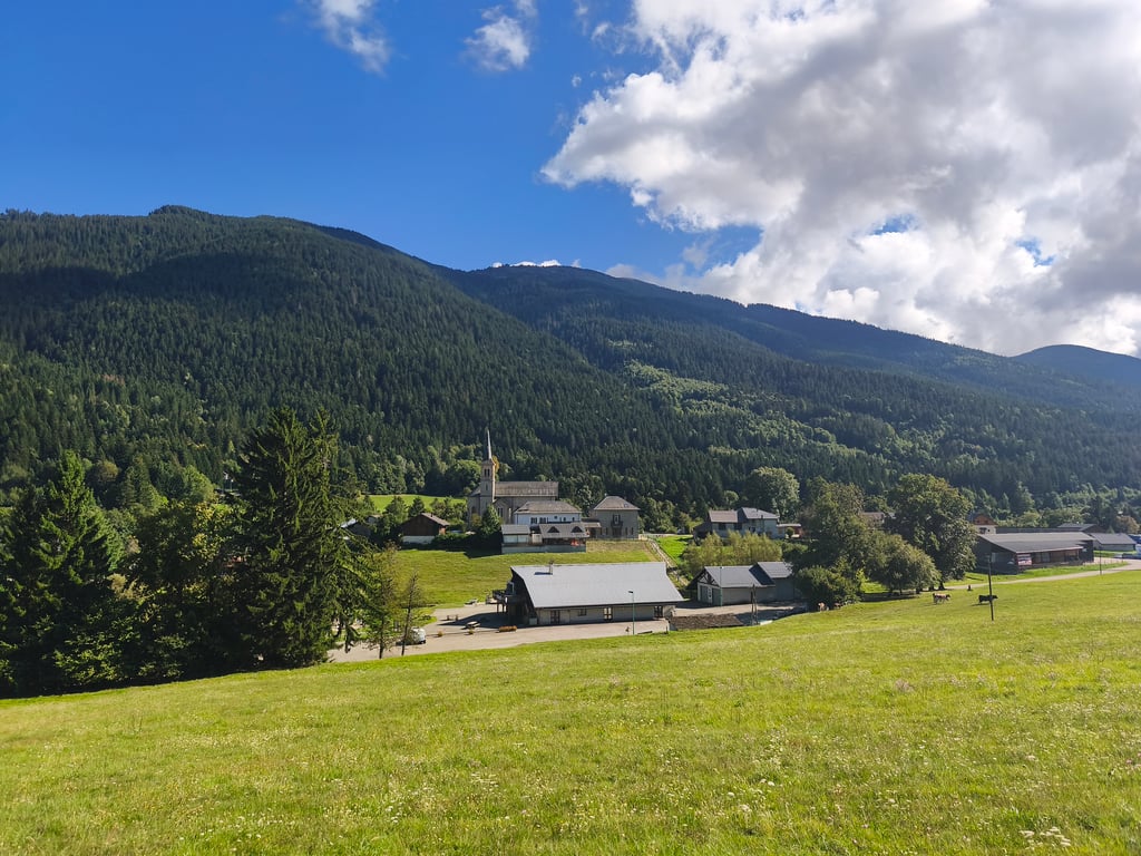
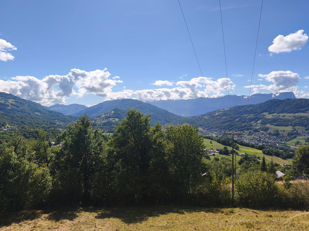
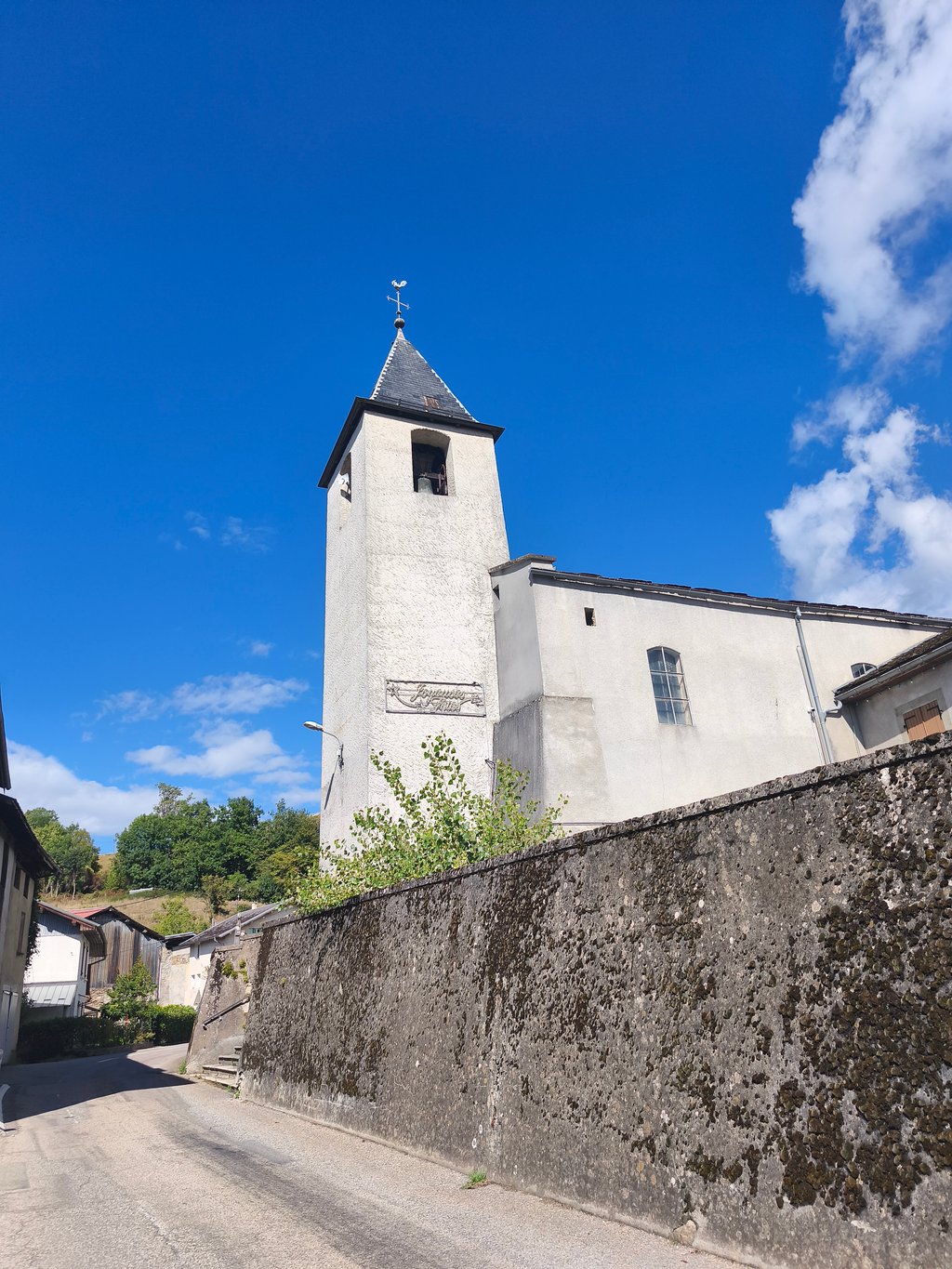
Col de Champ-Laurent via Valgelon la Rochette is a climb in the region Savoie. It is 10.5 mi long and bridges 2733 ft of vertical ascent with an average gradient of 5%, resulting in a difficulty score of 566. The top of the ascent is located at 3655 ft above sea level. Climbfinder users shared 1 review/story of this climb and uploaded 3 photos.

Road names: D23, D24 & D207

3.0 by Seb38
This is an automatic translation, the original language is: French.
A country route up the Vallée des Huiles, the road is rarely steep, quite good and very quiet. The final section, when you leave the road leading to Grand Cucheron, is steeper for 4 kilometres. Perfect for a pleasant walk in an unspoilt and secluded setting.... read more

Photos (3)

Col de Champ-Laurent via Valgelon la Rochette
transparant thumb
transparant thumb
transparant thumb

Your uploads (max 4)

Welcome! Please activate your account if you would like to share something. Look for the verification email in your inbox.

If you want to upload your photos, you need to create an account. It only takes 1 minute and it's completely free.

  • Receive free climbfinder goodies for your reviews & photos.
  • Create a bucket list and check off conquered climbs.
  • Add missing climbs.
Continue with GoogleContinue with Google Continue with FacebookContinue with Facebook Continue with AppleContinue with Apple Sign up with email
By signing up you agree to our terms of service and confirm that you have read our privacy & content policy.

Reviews (1)

5.0
4.0
3.0
2.0
1.0
Seb38
9 Mo 3.0
This is an automatic translation, the original language is: French. Show original

A country route up the Vallée des Huiles, the road is rarely steep, quite good and very quiet. The final section, when you leave the road leading to Grand Cucheron, is steeper for 4 kilometres. Perfect for a pleasant walk in an unspoilt and secluded setting.

Route champêtre en remontant la vallée des Huiles, la route est moyennement raide, plutôt bonne et très calme. Après le charmant village de La Table, une petite descente nous mène au replat du Bourget-en-Huile. La partie finale lorsque l'on quitte la route qui mène au Grand Cucheron est plus pentue pendant 4 petits kilomètres. Parfait pour une ballade agréable dans un cadre préservé et isolé.

Dashboard

Climbing times

5 mph 02:06:12
7 mph 01:29:20
9 mph 01:09:37
12 mph 00:52:18

Road surface condition

100% 0% 0%
Based on 1 vote
Share your knowledge. What was the road condition during your ascent?

Traffic

100% 0% 0%
Based on 1 vote
Your experience counts. How much traffic did you encounter during the climb?

Frequently Asked Questions

You don't need special gearing for Col de Champ-Laurent via Valgelon la Rochette. The slope isn't long or steep enough to require much shifting down. You can conquer this climb on power alone. However, a compact gearing system with a smallest front chainring of 34 and largest rear sprocket of 28 or 30 is always nice if you enjoy cycling uphill. This helps maintain a smooth cadence.

Col de Champ-Laurent via Valgelon la Rochette is a serious climb and falls into the 2nd category. With a good basic fitness level, even without much cycling experience, you can complete this climb just fine. However, a bike with climbing gears is a must. Without experience or training, it will be really tough – but that’s part of the challenge!

Col de Champ-Laurent via Valgelon la Rochette is 10.5 mi long.

The average gradient of Col de Champ-Laurent via Valgelon la Rochette is 5%.

Col de Champ-Laurent via Valgelon la Rochette has a steepest segment with an average gradient of 9.6%.

The summit of Col de Champ-Laurent via Valgelon la Rochette is at 3655 ft.

At a slow pace of 5 mph, it takes about 02:06:12 to climb Col de Champ-Laurent via Valgelon la Rochette. At 7 mph the time is 01:29:20, and at 9 mph 01:09:37. For the fastest cyclists, 00:52:18 is an achievable time.

Col de Champ-Laurent via Valgelon la Rochette is located in the region Savoie in France.

This page is better in the app

Climbfinder app
Climbfinder
(Free)
Open