View on map
© MapLibre | OpenStreetMap contributors
1%
2%
4%
6%
8%
10%
12%
15%
20%

Col de Champ-Laurent from Les Curtets via Montmalfou

3.0
1 review/story | Elevation profile | 3 photos
Tips nearby
Col de Champ-Laurent from Les Curtets via Montmalfou
transparant thumb
transparant thumb
transparant thumb
transparant thumb
transparant thumb
Your achievable time
Calculating based on your best performances...
Relaxed
Maximum
W/kg
W/kg
W/kg
Analyze your climbing performance
Detailed insight into your climbing performance & automatically check off climbs
Based on your best performances.
Your best attempt:
Number of attempts:
Elevation profile Col de Champ-Laurent from Les Curtets via Montmalfou

Statistics

Difficulty points 623
Length 7.4 mi
Average gradient 6.8%
Steepest segment 11.5%
Total ascent 2657 ft

Short recap

Beautiful scenery
Hidden gem
16 hairpin turns
Feedback about this climb?
Show climbs nearby Export to GPS device

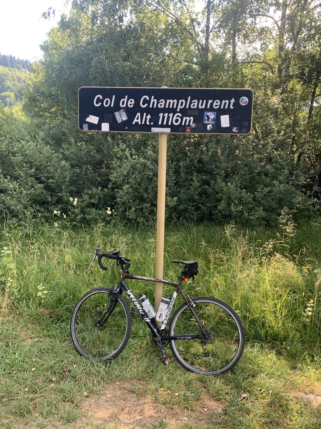
Col de Champ-Laurent from Les Curtets via Montmalfou is a climb in the region Savoie. It is 7.4 mi long and bridges 2657 ft of vertical ascent with an average gradient of 6.8%, resulting in a difficulty score of 623. The top of the ascent is located at 3661 ft above sea level. Climbfinder users shared 1 review/story of this climb and uploaded 3 photos.

Road names: Route des Côtes, Route de Montmalfou, Route de Montmalfou, Route de Clapigny & Route du Col
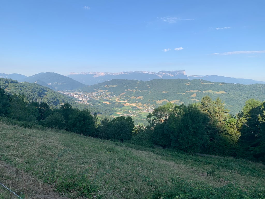
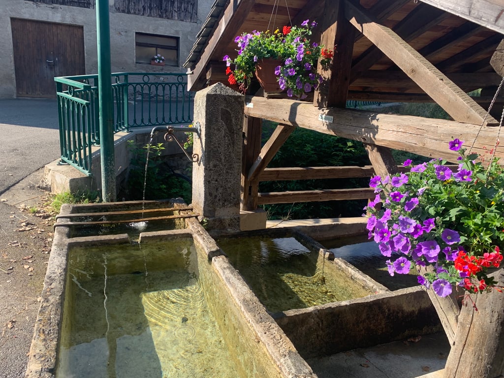
3.0 by thegymshoe
This is an automatic translation, the original language is: English.
Very quiet climb in the trees most of the way and sheltered from the blazing sun. Nice views peeking through the at times. Plenty of refills possible at the fountains.Very pleasant !... read more

Photos (3)

Col de Champ-Laurent from Les Curtets via Montmalfou
transparant thumb
transparant thumb
transparant thumb

Your uploads (max 4)

Welcome! Please activate your account if you would like to share something. Look for the verification email in your inbox.

If you want to upload your photos, you need to create an account. It only takes 1 minute and it's completely free.

  • Receive free climbfinder goodies for your reviews & photos.
  • Create a bucket list and check off conquered climbs.
  • Add missing climbs.
Continue with GoogleContinue with Google Continue with FacebookContinue with Facebook Continue with AppleContinue with Apple Sign up with email
By signing up you agree to our terms of service and confirm that you have read our privacy & content policy.

Reviews (1)

5.0
4.0
3.0
2.0
1.0
thegymshoe
11 Mo 3.0 via the Climbfinder app

Very quiet climb in the trees most of the way and sheltered from the blazing sun. Nice views peeking through the at times. Plenty of refills possible at the fountains.Very pleasant !

Dashboard

Climbing times

5 mph 01:29:09
7 mph 01:03:07
9 mph 00:49:11
12 mph 00:36:57

Road surface condition

100% 0% 0%
Based on 1 vote
Share your knowledge. What was the road condition during your ascent?

Traffic

100% 0% 0%
Based on 1 vote
Your experience counts. How much traffic did you encounter during the climb?

Frequently Asked Questions

Col de Champ-Laurent from Les Curtets via Montmalfou is a challenging ascent. For this type of climbing, we recommend mountain gearing, specifically a compact system. This means a small front chainring of 34 teeth, combined with a rear cassette where, depending on your level, strength, and experience, you choose a sprocket with 30, 32, or even 34 teeth. Remember that a smooth cadence is always more efficient!

Col de Champ-Laurent from Les Curtets via Montmalfou is a first-category climb: long and tough. Do not underestimate this climb. Many famous Tour de France cols fall into this category. Prepare for a long, challenging ride. Only well-trained riders will reach the top smoothly. Make sure you have a road bike with climbing gears and enough training; otherwise, it will be a struggle.

Col de Champ-Laurent from Les Curtets via Montmalfou is 7.4 mi long.

The average gradient of Col de Champ-Laurent from Les Curtets via Montmalfou is 6.8%.

Col de Champ-Laurent from Les Curtets via Montmalfou has a steepest segment with an average gradient of 11.5%.

The summit of Col de Champ-Laurent from Les Curtets via Montmalfou is at 3661 ft.

At a slow pace of 5 mph, it takes about 01:29:09 to climb Col de Champ-Laurent from Les Curtets via Montmalfou. At 7 mph the time is 01:03:07, and at 9 mph 00:49:11. For the fastest cyclists, 00:36:57 is an achievable time.

Col de Champ-Laurent from Les Curtets via Montmalfou is located in the region Savoie in France.

This page is better in the app

Climbfinder app
Climbfinder
(Free)
Open