Tips nearby


| Beautiful scenery |
| Hidden gem |
| 8 hairpin turns |
| #57 toughest climb of Occitania |
| #31 most elevation gain of Hautes-Pyrénées |
| #35 longest climb of Hautes-Pyrénées |
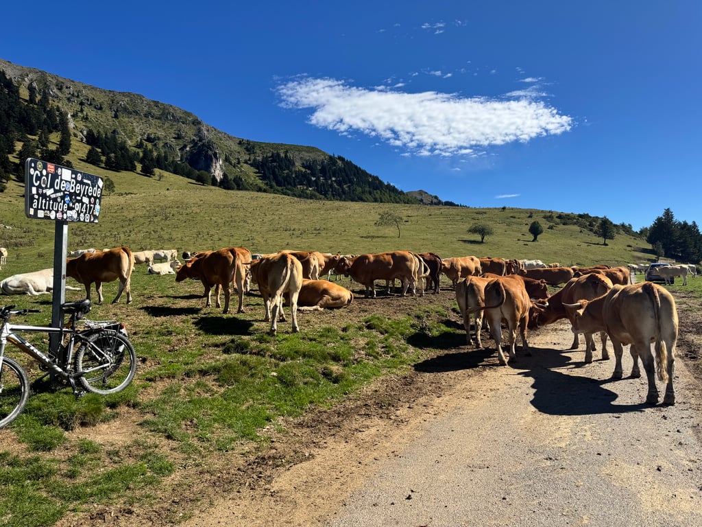
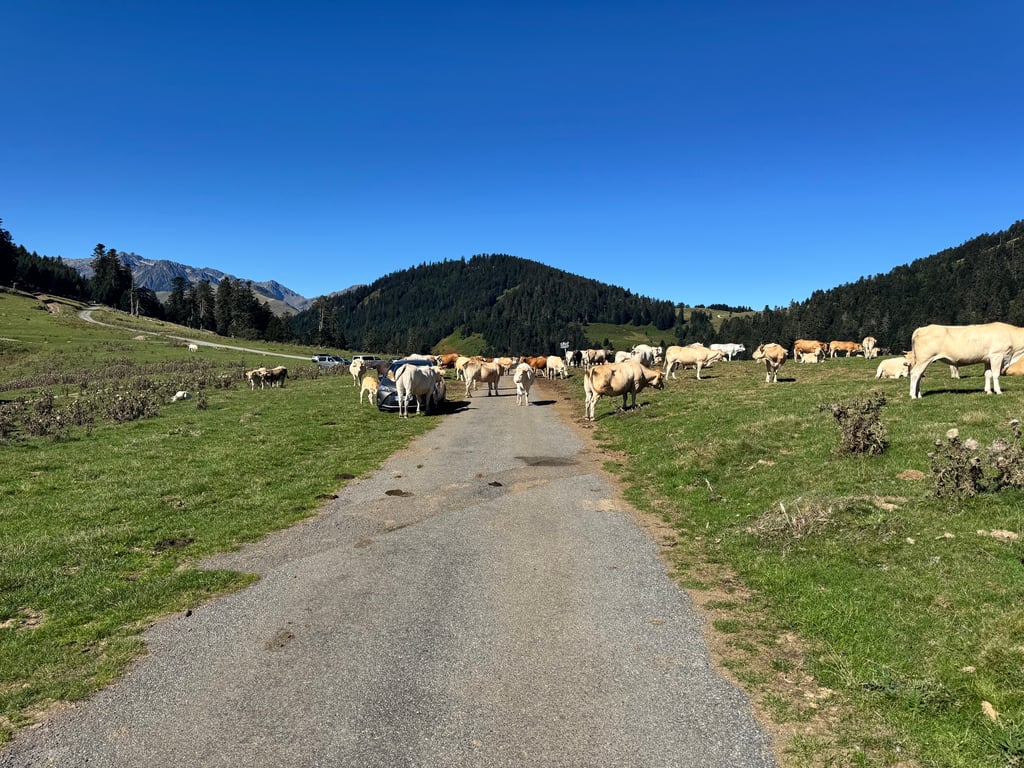
Col de Beyrède is a climb in the region Hautes-Pyrénées. It is 6.7 mi long and bridges 2572 ft of vertical ascent with an average gradient of 7.3%, resulting in a difficulty score of 734. The top of the ascent is located at 4669 ft above sea level. Climbfinder users shared 2 reviews of this climb and uploaded 3 photos.
Road names: Route de Beyrède & Route du Col
4.0 by JoostfietstThis is an automatic translation, the original language is: Dutch.Nice climb if you want a change from the Aspin. The start is very steep (especially if you take the southernmost variant from the D929 (First option from Arreau). Then it's easy for a few km and then 3 very irregular and steep kilometres start with peaks of up to 15%. At the top, we had to trudge through the grass to avoid the big cows. An adventurous arrival, then. From the summit, you can descend on the other side and end up on the Col d'Aspin road. For this, you do have to go for ... read more
Welcome! Please activate your account if you would like to share something. Look for the verification email in your inbox.
If you want to upload your photos, you need to create an account. It only takes 1 minute and it's completely free.
Nice climb if you want a change from the Aspin. The start is very steep (especially if you take the southernmost variant from the D929 (First option from Arreau). Then it's easy for a few km and then 3 very irregular and steep kilometres start with peaks of up to 15%. At the top, we had to trudge through the grass to avoid the big cows. An adventurous arrival, then. From the summit, you can descend on the other side and end up on the Col d'Aspin road. For this, you do have to go for 3km on a very bad road with occasional gravel. On a road bike it was fine for us if you just take it easy. Nice thing is that you can make a lap of it that way!
Leuke klim als je eens wat anders wil dan de Aspin. Het begin is erg steil (zeker als je de zuidelijkste variant pakt vanaf de D929 (Eerste optie vanuit Arreau). Daarna is het een paar km rustig aan en dan beginnen 3 erg onregelmatige en steile kilometers met uitschieters tot 15%. Boven op de top moesten wij door het gras banjeren om de grote koeien te ontwijken. Een avontuurlijke aankomst dus. vanaf de top kun je aan de andere kant afdalen en kom je uiteindelijk op de weg van de Col d’Aspin uit. Hiervoor moet je wel 3km over een erg slechte weg met zo nu en dan grind. Op een racefiets was het voor ons prima te doen als je gewoon rustig aan doet. Leuke is dat je er zo een rondje van kunt maken!
Heb deze col gedaan. Is erg lastig met flink steile stukken. Hij haalt wat dat betreft alle energie uit je. Eerste deel loopt grotendeels door het bos waardoor je niet veel uitzicht hebt. Uiteindelijk wordt het open en na nog een paar kilometer ben je boven. Ik heb deze col gedaan omdat die deel uitmaakt van BIGcycling.eu. De Aspin vond ik mooier. Daarom geef ik deze 3 sterren. De afdaling aan de andere kant was afgesloten en de twee alternatieven waren allebei onverhard dus ik ben dezelfde weg terug gegaan.
| 5 mph | 01:20:28 |
| 7 mph | 00:56:58 |
| 9 mph | 00:44:24 |
| 12 mph | 00:33:21 |
This page is better in the app