Col de Geine via Col d'Aiguières is a climb in the region Drôme. It is 4.8 mi long and bridges 1880 ft of vertical ascent with an average gradient of 7.4%, resulting in a difficulty score of 448. The top of the ascent is located at 3291 ft above sea level. Climbfinder users shared 5 reviews of this climb and uploaded 6 photos.
Road name: D526
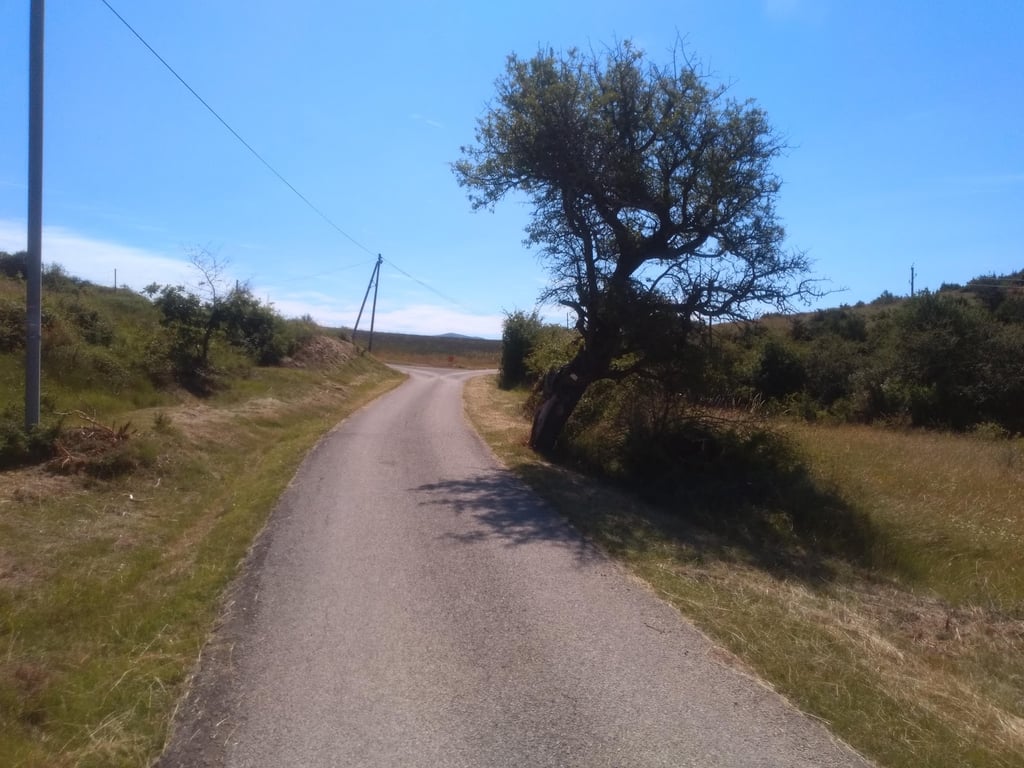
3.0 by SeanThis is an automatic translation, the original language is: English.A quiet road which leads to nowhere in particular! It was hard to determine where the actual top is, from maps and segments it appears to be at a fork in the road although the road climbs to the left to a private residence. The climb has some steep sections but in general you can tap out a steady rhythm most of the way. As you approach the top the road is broken in places but it isn’t a problem as you can use the whole road as it is so quiet. Worth a visit if you are taking in the cols in the ... read more
Welcome! Please activate your account if you would like to share something. Look for the verification email in your inbox.
If you want to upload your photos, you need to create an account. It only takes 1 minute and it's completely free.
A nice and quiet climb that ends in the middle of nowhere. Definitely worth a detour if you are in the neighbourhood of Buis les Baronnies.
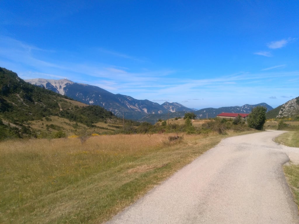
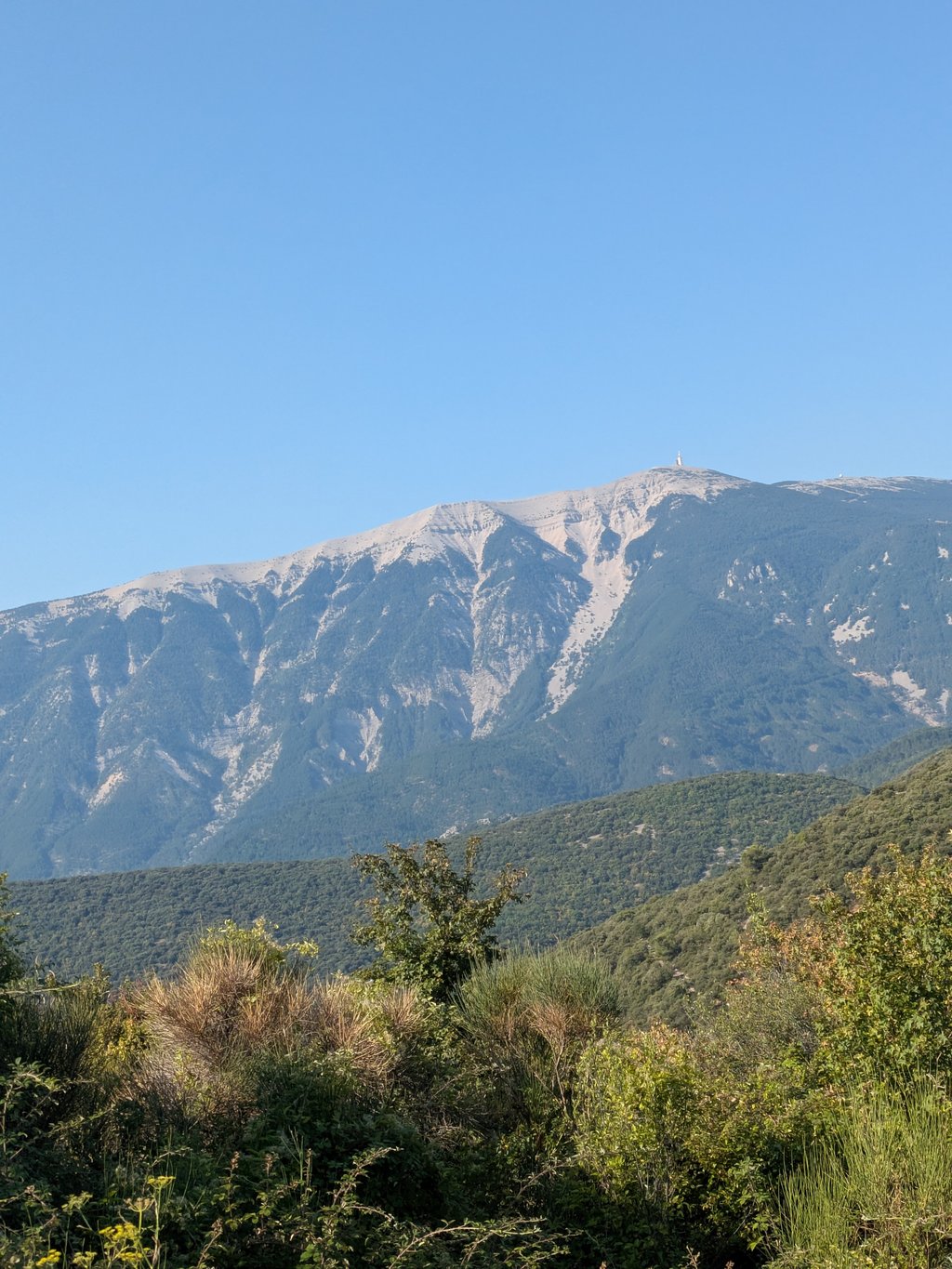
It starts with moderate gradients as you go through a scenic portal between two rocks (a mini gorge of sorts). Then comes a few hairpins and you are into the village where the hairpins continues. Gradient is still manageable but steep. Afterwards you are really starting to get out into the middle of nowhere, but you can find comfort in a long drag with lower percentages. As always, when there is a plateu on a climb, you know that road must necessarily go up at some point again, and it really does. The last 2 or 3 kilometers are filled with shorter ramps where the gradients are 10-15 %, but as you ascend through trees, you also start to notice the landscape opening up. At the top of the col (where the road splits), you will have the feeling of being at peace and in isolation with a marvelous Ventoux outlook to enjoy. In my opinion, one of the must-do climbs in the area north of Ventoux.
It was a good experience, the pass is nice even if there are no signs. There's a great view of the Ventoux and very little traffic.
Ce fut une bonne expérience, le col est sympa même si pas de panneau. On a une super vue sur le Ventoux, peu de circulation.
A quiet road which leads to nowhere in particular! It was hard to determine where the actual top is, from maps and segments it appears to be at a fork in the road although the road climbs to the left to a private residence. The climb has some steep sections but in general you can tap out a steady rhythm most of the way. As you approach the top the road is broken in places but it isn’t a problem as you can use the whole road as it is so quiet. Worth a visit if you are taking in the cols in the area.
A very pleasant climb. It's a climb with an average gradient of 7.4, but with some fairly steep ramps that are hard on the legs. Once you reach the top, you have to turn back. A very technical descent on a very narrow road in poor condition.
ascension très agréable à faire. Une ascension avec une moyenne de 7.4 mais avec des rampes assez raides qui coupent les jambes. Une fois arrivé au sommet, vous pourrez admirer le magnifique paysage avec vue sur le Mont Ventoux. Après il vous faut rebrousser chemin, La Descende est très technique sur une route très étroite et en mauvais état.
This climb was part of a tour from Montbrum, sault, Mount Ventoux, and via D72 back. At the start you have to pass a narrow rock opening to follow the road. With the Ventoux and some other climbs already in your legs, this is a really tough piece of road where at the end you wonder what it is for and where it goes. There are quite a few 10 to 11 km sections in it. At the top there are a few more houses and something of a farm and a little church or something, no idea what it was. On many places you have a view over the valley and of course the Mont Ventoux. I thought it was worthwhile to visit.
Deze klim even mee gepakt in een rondje vanuit Montbrum, sault, Mount Ventoux, en via D72 weer terug. Bij de start moet je door een smalle rots opening om de weg verder te volgen. Met de Ventoux en wat andere klimmetjes al in de benen is dit toch echt wel een pittig stukje weg waar je tegen het eind afvraagt waar het voor is en waar het heen gaan. Er zitten aardig wat stukjes van 10 tot 11% in. Boven staan nog een paar huizen en iets van een boerderij en een Kerkje of zoiets, geen idee wat het was. Op veel plaatsen heb je uitzicht over het dal en natuurlijk de Mont Ventoux. Ik vond het in elk geval de moeite waard om even mee te pakken.
| 5 mph | 00:58:25 |
| 7 mph | 00:41:21 |
| 9 mph | 00:32:13 |
| 12 mph | 00:24:12 |
This page is better in the app