View on map
© MapLibre | OpenStreetMap contributors
1%
2%
4%
6%
8%
10%
12%
15%
20%

Le Chambon from Chanteloube

3.8
5 reviews | Elevation profile | 14 photos
Tips nearby
Le Chambon from Chanteloube
Your achievable time
Calculating based on your best performances...
Relaxed
Maximum
W/kg
W/kg
W/kg
Analyze your climbing performance
Detailed insight into your climbing performance & automatically check off climbs
Based on your best performances.
Your best attempt:
Number of attempts:
Elevation profile Le Chambon from Chanteloube

Statistics

Difficulty points 211
Length 2.2 mi
Average gradient 7.3%
Steepest segment 12.6%
Total ascent 863 ft

Short recap

Beautiful scenery
Hidden gem
4 hairpin turns
#60 toughest climb of Briançon
#60 most elevation gain of Briançon
#58 longest climb of Briançon
#72 average steepest climb of Hautes Alpes
Feedback about this climb?
Show climbs nearby Export to GPS device

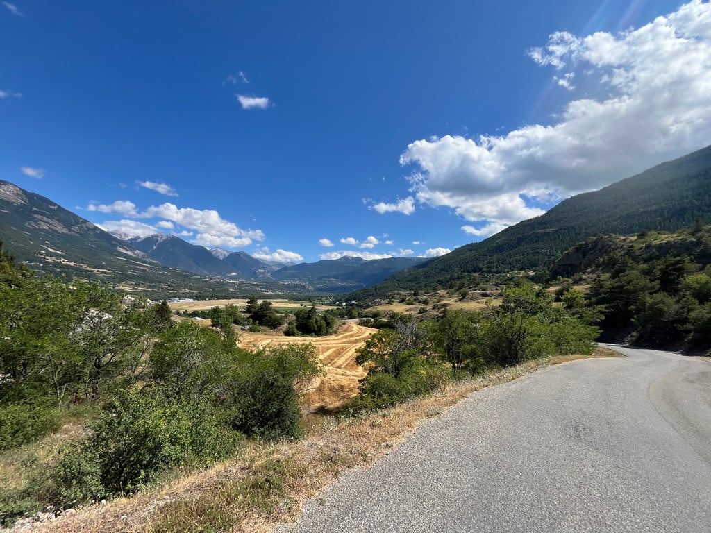
Le Chambon from Chanteloube is a climb in the region Briançon. It is 2.2 mi long and bridges 863 ft of vertical ascent with an average gradient of 7.3%, resulting in a difficulty score of 211. The top of the ascent is located at 3835 ft above sea level. Climbfinder users shared 5 reviews of this climb and uploaded 14 photos.

Road name: D38

4.0 by TheoG65
This is an automatic translation, the original language is: French.
Do at the end of a loop containing the izoard to return to Briancon, a purge under the sun, but the landscapes are very beautiful and no traffic.... read more

Photos (14)

Le Chambon from Chanteloube
transparant thumb
transparant thumb
transparant thumb
transparant thumb

Your uploads (max 4)

Welcome! Please activate your account if you would like to share something. Look for the verification email in your inbox.

If you want to upload your photos, you need to create an account. It only takes 1 minute and it's completely free.

  • Receive free climbfinder goodies for your reviews & photos.
  • Create a bucket list and check off conquered climbs.
  • Add missing climbs.
Continue with GoogleContinue with Google Continue with FacebookContinue with Facebook Continue with AppleContinue with Apple Sign up with email
By signing up you agree to our terms of service and confirm that you have read our privacy & content policy.

Reviews (5)

5.0
4.0
3.0
2.0
1.0
TheoG65
3 Mo 4.0 via the Climbfinder app
This is an automatic translation, the original language is: French. Show original

Do at the end of a loop containing the izoard to return to Briancon, a purge under the sun, but the landscapes are very beautiful and no traffic.

Faites à la fin d’une boucle contenant l’izoard pour revenir vers Briancon, une purge sous le soleil, mais les paysages sont très beau et aucune circulation

Dashboard
KaiFlorianM
10 Mo 3.0 via the Climbfinder app
This is an automatic translation, the original language is: German. Show original

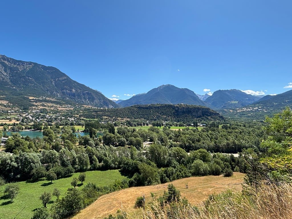
Part of the Boucle d'Izoard. For us, this was one of two ways to get back to our campsite. So it was often the end of a longer journey and therefore usually hurt. But the light traffic and the great view made up for it a little.

Teil der Boucle d‘Izoard. Für uns eine von zwei Möglichkeiten, zurück zu unserem Campingplatz zu gelangen. Es war also oft der Abschluss einer längeren Fahrt und tat daher meist weh. Aber der geringe Verkehr und die tolle Aussicht entschädigt dafür ein wenig.

Dashboard
YetiJ
10 Mo 4.0 via the Climbfinder app

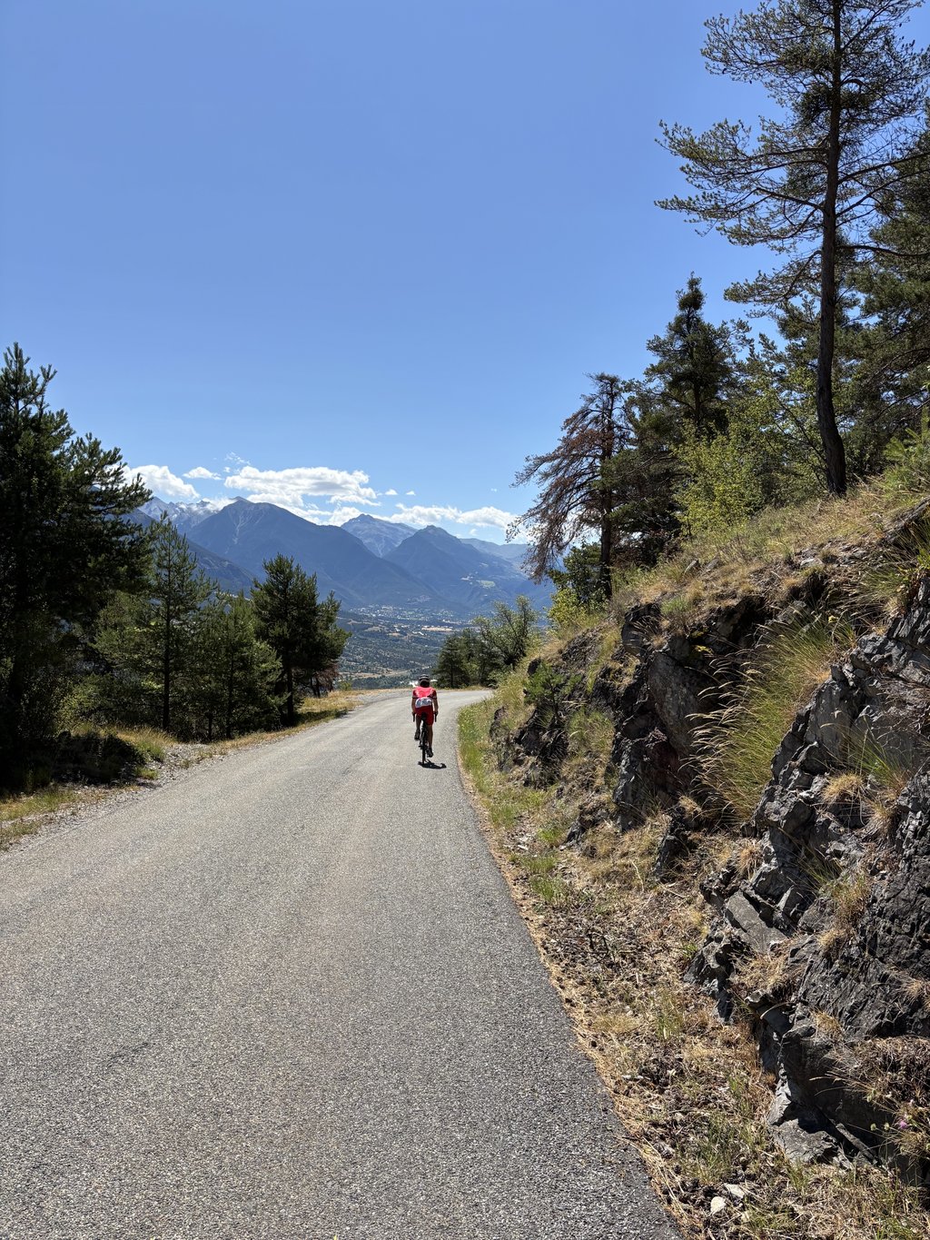
While not a legendary Col, this is certainly a climb worth doing. Solid gradients, lots of twists and turns, and lovely scenery down the valley, all with next to no traffic. If the conditions are right, look out for gliders launching from the airfield.

Le Chambon from Chanteloube
Dashboard
Jeroen
4 y 5.0
This is an automatic translation, the original language is: Dutch. Show original

A beautiful climb on a road which is a better alternative than the busy N94 which runs parallel to it. A nice 4 km steep climb or just to enjoy. Beautiful surroundings, winding road and good road surface. Oh, and very quiet too. Not to be missed if you're in the region.

Prachtig klimmetje op een weg die een beter alternatief is dan de drukke N94 die er evenwijdig aan ligt. Even lekker 4 kilometer beuken of gewoon genieten. Prachtige omgeving, kronkelend weggetje en een goed wegdek. Oh, en lekker rustig ook. Mag je eigenlijk niet missen als je in de regio bent.

Dashboard
Rogier
5 y 3.0 00:11:05 (12.2 mph)
This is an automatic translation, the original language is: Dutch. Show original

What a wonderful and beautiful climb this is. A great view, a fine gradient and especially if you continue to Ponteil a considerable climb. From the shorter work around Briançon and Embrun, this is in my opinion one of the best. Nice to do together with the Izoard, Risoul, Vars or together with other top climbers in the area such as Mont Dauphin, Le Gros, Le Villard etc.

Wat een heerlijke en mooie klim is dit. Een geweldig uitzicht, een fijn stijgingspercentage en zeker als je doorklimt naar Ponteil een flinke klim. Van het kortere werk rondom Briançon en Embrun is dit wat mij betreft een van de mooiste. Leuk om samen te doen met de Izoard, Risoul, Vars of samen met andere toppers in de buurt zoals Mont Dauphin, Le Gros, Le Villard etc.

Le Chambon from Chanteloube
Dashboard

Climbing times

5 mph 00:27:06
7 mph 00:19:11
9 mph 00:14:57
12 mph 00:11:14

Road surface condition

100% 0% 0%
Based on 3 votes
Share your knowledge. What was the road condition during your ascent?

Traffic

100% 0% 0%
Based on 3 votes
Your experience counts. How much traffic did you encounter during the climb?

Frequently Asked Questions

Le Chambon from Chanteloube is a challenging ascent. For this type of climbing, we recommend mountain gearing, specifically a compact system. This means a small front chainring of 34 teeth, combined with a rear cassette where, depending on your level, strength, and experience, you choose a sprocket with 30, 32, or even 34 teeth. Remember that a smooth cadence is always more efficient!

Le Chambon from Chanteloube is a 3rd-category climb. Almost anyone can handle this climb, as long as you have a bike with climbing gears. If you have little training, you will probably need to shift down significantly. For experienced riders, Le Chambon from Chanteloube is not a problem.

Le Chambon from Chanteloube is 2.2 mi long.

The average gradient of Le Chambon from Chanteloube is 7.3%.

Le Chambon from Chanteloube has a steepest segment with an average gradient of 12.6%.

The summit of Le Chambon from Chanteloube is at 3835 ft.

At a slow pace of 5 mph, it takes about 00:27:06 to climb Le Chambon from Chanteloube. At 7 mph the time is 00:19:11, and at 9 mph 00:14:57. For the fastest cyclists, 00:11:14 is an achievable time.

Le Chambon from Chanteloube is located in the region Hautes Alpes in France.

This page is better in the app

Climbfinder app
Climbfinder
(Free)
Open