| Famous climb |
| #38 toughest climb of Flanders |
| #32 most elevation gain of Flemish Brabant |
| #42 average steepest climb of Flanders |
Bruine Put is a climb in the region Pajottenland. It is 0.4 mi long and bridges 217 ft of vertical ascent with an average gradient of 9.3%, resulting in a difficulty score of 69. The top of the ascent is located at 354 ft above sea level. Climbfinder users shared 16 reviews of this climb and uploaded 5 photos.
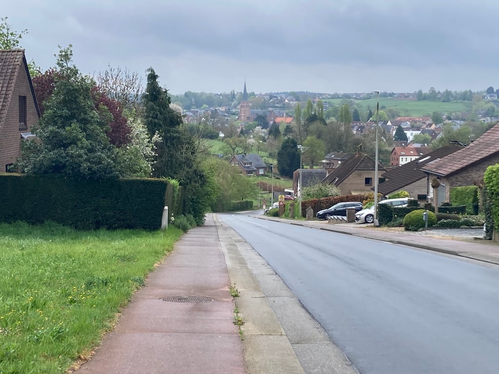
Road name: Lotsesteenweg
4.0 by GriezwardThis is an automatic translation, the original language is: Dutch.Short but tough gradient from the edge of the Pajottenland towards the Brussels hinterland. The climb is fairly constant with some stretches in the double digits, putting you in the red quickly despite its limited length. A typical effort climb where maintaining the pace is more important than recuperating.... read more
Welcome! Please activate your account if you would like to share something. Look for the verification email in your inbox.
If you want to upload your photos, you need to create an account. It only takes 1 minute and it's completely free.
Short but tough gradient from the edge of the Pajottenland towards the Brussels hinterland. The climb is fairly constant with some stretches in the double digits, putting you in the red quickly despite its limited length. A typical effort climb where maintaining the pace is more important than recuperating.
Korte maar stevige helling vanuit de rand van het Pajottenland richting het Brusselse achterland. De klim is vrij constant met enkele stroken in de dubbele cijfers, waardoor je snel in het rood zit ondanks de beperkte lengte. Een typische inspanningklim waar het tempo behouden belangrijker is dan recupereren.
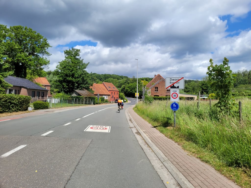
Nice and not too long climb from Dworp. On two parts of the climb the gradient goes into the double digits. If you are in the area definitely do it.
Mooie en niet te lange klim vanuit Dworp. Op twee delen van de klim gaat het stijgingspercenage in de dubbele cijfers. Als je in de buurt bent zeker doen.
Well-known coast to do at least once, but not more than that because of the traffic. Avoid the cycle path on the pavement...
Côte très connue à faire au moins une fois, mais pas plus vu le trafic. Piste cyclable sur le trottoir à éviter...
Whew, what a tough long climb. Obviously ironic because of its long history as a climb in the Brabantse Pijl. There is a cycle path next to it but it is narrow and with sometimes poorly laid cobbles so I preferred the tight asphalt. On Sundays it is fortunately not really busy with car traffic. The climb keeps on going, even long into the forest. When you leave the forest the worst is done but you still have to conquer a stretch of false flat before descending again. At the top, you have a great view of the Brussels skyline in the distance.
Oef, wat een pittige lange klim. Uiteraard ironisch vanwege z'n lange geschiedenis als klim in de Brabantse Pijl. Er loopt een fietspad naast maar dat is smal en met soms slecht liggende klinkers dus ik verkoos het strakke asfalt. Op zondag is het er gelukkig niet echt druk met autoverkeer. De klim blijft maar doortrekken, ook nog lang in het bos. Als je het bos uitrijdt is het ergste gedaan maar moet je nog een stuk vals plat bedwingen voordat je weer afdaalt. Bovenaan heb je een prachtig uitzicht op de skyline van Brussel in de verte.
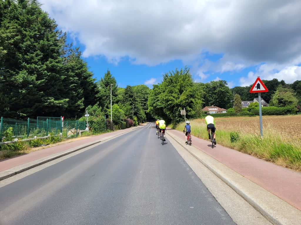
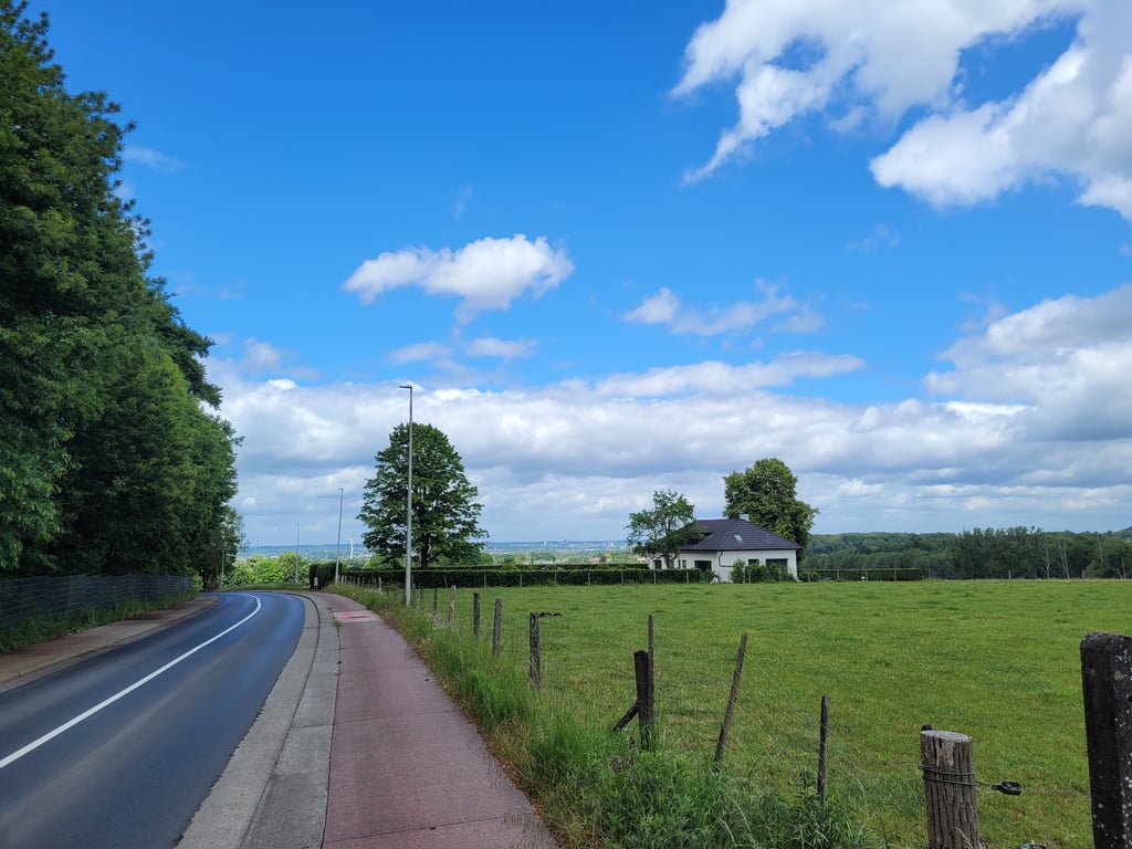
Good measure of your fitness, but gets especially nice when you get into the country roads above right. I often do it offroad by mtb or cross bike.
Goede graadmeter voor je conditie, maar wordt vooral mooi als je boven rechts de landwegen in gaat. Ik doe ‘m vaak offroad met de mtb of crossfiets.
I was very surprised by its difficulty, I thought it would be shorter and less steep, but it's still 700m. As for the percentages, I had a maximum of 16% on my counter and it was difficult but I managed to keep up a good pace all the way to the top. Indeed, nice cycle path that's not impacted by mud in winter.
Fort surpris par sa difficulté, je la pensais plus courte et moins pentue mais elle fait tout de même 700m. Du côté des pourcentages, j'ai eu un max à 16% sur mon compteur et c'était difficile mais j'ai réussi à garder un bon rythme jusqu'au sommet. En effet, belle piste cyclable qui n'est pas impactée par la boue en hiver.
The region's big test for occasional cyclists. The cycle path is in very good condition on the way up, with a pleasant downhill section behind. If you continue towards Beersel, you'll find a few more hair-raising climbs, particularly after the roundabout.
Le gros test de la region pour les cyclistes occasionnels. Piste cyclable en tres bon etat pour la montee, et agreable descente derriere sur la chaussee. Si on continue la route vers Beersel, d'autres petites cotes casse-pattes sont au menu, notamment apres le rond-point.
Surprisingly tough hill south of Brussels, with nice views at the top. Percentages don't lie. Road is quiet, which makes it difficult to balance bike path and road.
Verrassend zware heuvel ten zuiden van Brussel, waar je op de top mooi uitzicht over hebt. Percentages liegen er niet om. Weg is rustig, wat de afweging fietspad-weg lastig maakt
A nice steep and fairly constant climb up where I broke down quite a bit. The bike path is good to ride. It is in good shape, both up and down. At the top you have a nice view on the region of Brussels.
Een mooie steile en vrij constante klim omhoog waar ik toch behoorlijk kapot ging. Het fietspad kun je prima berijden. Het ligt er goed bij, zowel naar boven als naar beneden. Op de top heb je ook een leuk uitzicht op de regio Brussel
The best way to enter the Bruineput. The cycle path is in a good shape, although it sometimes slopes a bit with the accesses. In the right hand bend it's always a bit of a death trap when you go full speed from the start. Certainly worthwhile to conquer.
Plus point: when the weather is good, the top has a beautiful view on Brussels with the Tour du Midi, the Palace of Justice and even the Atomium.
Dé kant om de Bruineput op te rijden. Het fietspad ligt er goed bij, al helt deze soms nogal mee met opritten. In de bocht naar rechts is het toch elke keer een beetje doodgaan wanneer je van bij het begin vol gaat. Zeker de moeite om te bedwingen.
Pluspunt: bij goed weer is er boven een prachtig uitzicht op Brussel met de Zuidertoren, het Justitiepaleis en zelfs het atomium.
The classic of the region. This is one of those climbs where you think "I'll flash up here in one go" but you can easily misjudge it because you have two steep sections and you only see the top at the last minute.
De klassieker uit de regio. Dit is zo'n klim waarvan je denkt " ik flits hier in een ruk naar boven" maar je kan je gemakkelijk op verkijken omdat je twee steile stroken hebt en de top pas op het laatste moment zie
A steep climb, fortunately with a good cycle path (and there aren't many in the area :-( )).
Toch wel een stevig klimmetje, gelukkig wel met een goed fietspad (en die zijn er niet veel in de buurt :-( )
One of the most solid climbs in the region, more difficult on this side than on the other. At the top, in good weather, there is a surprising view of Brussels.
Une des ascensions les plus solides de la région, plus difficile de ce côté que sur son autre versant. Au sommet, par beau temps, point de vue surprenant sur Bruxelles.
| 5 mph | 00:05:19 |
| 7 mph | 00:03:45 |
| 9 mph | 00:02:56 |
| 12 mph | 00:02:12 |
This page is better in the app