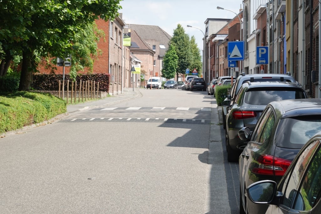
Bosstraat from Boom is a climb in the region Rupelstreek. It is 0.4 mi long and bridges 69 ft of vertical ascent with an average gradient of 3.2%, resulting in a difficulty score of 7. The top of the ascent is located at 95 ft above sea level. Climbfinder users shared 11 reviews of this climb and uploaded 11 photos.
This is an automatic translation, the original language is: Dutch.
Nice running slope nearby, which you can take on the big plateau. The first part up to the turn is a bit steeper, but if you start too hard here you can still fall down on the spur. For me this is always a good indicator of fitness: if you can keep up the speed on the spur till the end, your condition is usually good....read more
Photos (11)
Welcome! Please activate your account if you would like to share something. Look for the verification email in your inbox.
This is an automatic translation, the original language is: Dutch.
Show original
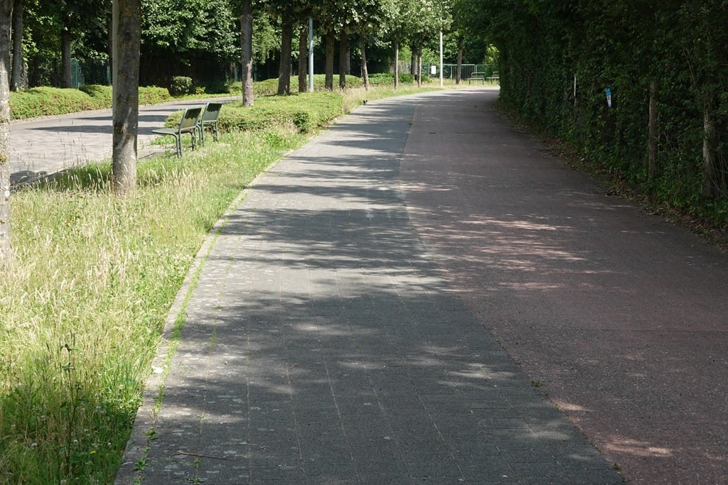
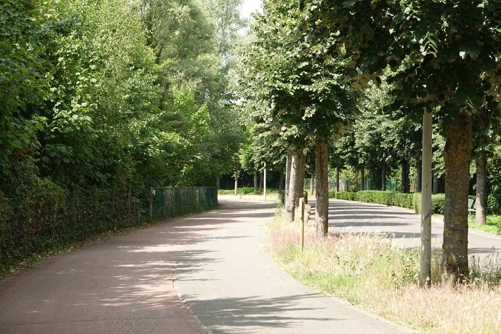
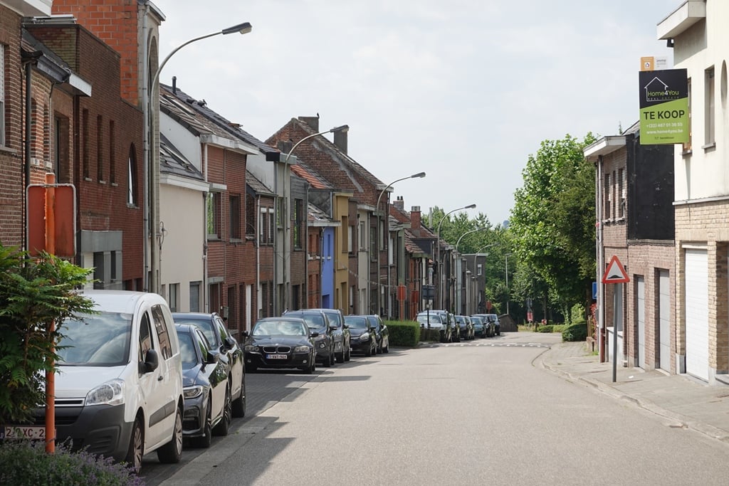
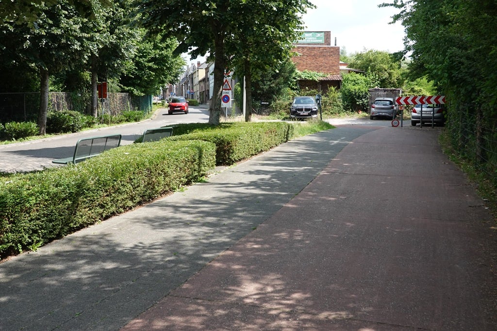
Nice climb that runs partly via a cycle path through greenery and then continues along a street along and between houses. At the end of the cycle path, you have to make a sharp corner that takes the momentum out of it. It's better to cycle on the road from the start then.
Aardige klim die deels via een fietspad door het groen loopt en daarna verder loopt via een straat langs en tussen de huizen. Op het eind van het fietspad moet je een scherpe hoek maken die de vaart er uit haalt. Dan kan je beter vanaf het begin op de weg fietsen.
Als je hier in de streek woont moet je of terwijl richting Asse en omstreken trekken want buiten de Bosstraat heb je niet veel in de buurt. Je kan hier wel een lokaal toertje doen zodat je altijd de bosstraat als "beklimming" kan doen. Maar dit is niet voor elke week.
This is an automatic translation, the original language is: Dutch.
Show original
This is by far the most difficult slope to negotiate in this area. Nice road surface but can be dangerous in the transition from the cycle path (up to the bend) to the motorway when it is busy. This slope is known from the past because then there was a yearly bicycle festival organised "storming van de bosstraat" called.
In deze omgeving veruit de meest "moeilijke" helling om te bedwingen. Mooi wegdek maar kan gevaarlijk zijn bij de overgang van het fietspad (tot aan de bocht) naar de autoweg indien het druk is. Deze helling is gekend van vroeger want toen werd er een jaarlijks fietsfestijn georganiseerd "bestorming van de bosstraat" genaamd.
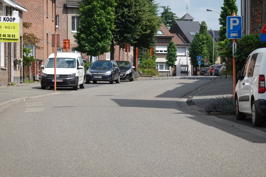
Voor de mensen die in de buurt wonen is dit veruit de meest beruchte beklimming, veel hoogtemeters heb je namelijk niet in deze omgeving. Hij is niet stijl en ook niet lang dus je kan er lekker op punchen van begin tot einde. Let wel op voor het verkeer want halverwege is er een bocht waarna een wegversmalling volgt, dit kan voor problemen zorgen met tegenliggende voertuigen. Al bij al dus niet een bepaald mooie of moeilijke klim, maar toch de moeite om eens te passeren bij gebrek aan beter.
This is an automatic translation, the original language is: Dutch.
Show original
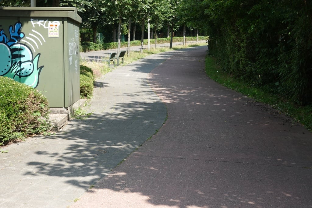
Nearby the most 'challenging' slope. But you can go up with a big gear. At the bottom you first ride on a red bicycle path (attention cyclists from opposite direction also ride on this) and then on the left side of the road. If there is no rush hour, it is very quiet.
In de buurt de meest 'uitdagende' helling. Maar je kan met een groot verzet naar boven. Onderaan rijdt je eerst op rood fietspad (opgelet fietsers uit tegenovergestelde richting rijden hier ook op) om vervolgens links op de weg te komen. Indien geen spitsuur is het er erg kalm.
This is an automatic translation, the original language is: Dutch.
Show original
Fixed climb on the shorter tours in winter. Allows you to not completely lose your climbing legs. And for those who want to try the Bosstraat a few times in a row, you can ride around De Schorre and end up back at the foot. :-)
Vaste klim op de kortere tochten in de winter. Laat je toe om de klimbenen niet helemaal kwijt te spelen. En voor diegenen die de Bosstraat een paar keer na mekaar willen proberen, kan je rond De Schorre rond rijden en terug aan de voet terecht komen. :-)
This is an automatic translation, the original language is: Dutch.
Show original
You can hardly call this a slope. This is more like a false flat. Just a big slab upwards. Not much, but around here everything is flat. There are tougher viaducts than this.
Dit kan je bezwaarlijk een helling noemen. Dit is eerder vals plat. Gewoon grote plaat naar boven. Stelt niet veel voor, maar hier in de buurt is nu eenmaal alles vlak. Er zijn zwaardere viaducten dan dit.
This is an automatic translation, the original language is: Dutch.
Show original
Nice running slope nearby, which you can take on the big plateau. The first part up to the turn is a bit steeper, but if you start too hard here you can still fall down on the spur. For me this is always a good indicator of fitness: if you can keep up the speed on the spur till the end, your condition is usually good.
Leuk lopende helling in de buurt, die je op de grote plateau kunt nemen. Eerste deel tot aan de bocht is iets steiler, maar wanneer je hier te hevig start kan je zeker nog stilvallen op de uitloper. Voor mij steeds een goede waardemeter voor de conditie: Als je de snelheid goed kunt aanhouden op de uitloper tot het einde, zit de conditie meestal goed.
Share your knowledge. What was the road condition during your ascent?
Traffic
65% 35% 0%
Based on 17 votes
Your experience counts. How much traffic did you encounter during the climb?
Frequently Asked Questions
You don't need special gearing for Bosstraat from Boom. The slope isn't long or steep enough to require much shifting down. You can conquer this climb on power alone. However, a compact gearing system with a smallest front chainring of 34 and largest rear sprocket of 28 or 30 is always nice if you enjoy cycling uphill. This helps maintain a smooth cadence.
Bosstraat from Boom is not tough enough to be assigned a mountain category. This means that even untrained cyclists can reach the top without any problems on this climb.
Bosstraat from Boom is 0.4 mi long.
The average gradient of Bosstraat from Boom is 3.2%.
Bosstraat from Boom has a steepest segment with an average gradient of 4.4%.
The summit of Bosstraat from Boom is at 95 ft.
At a slow pace of 5 mph, it takes about 00:04:58 to climb Bosstraat from Boom. At 7 mph the time is 00:03:31, and at 9 mph 00:02:44. For the fastest cyclists, 00:02:03 is an achievable time.