View on map
© MapLibre | OpenStreetMap contributors
1%
2%
4%
6%
8%
10%
12%
15%
20%

Bosentino from Mattarello

2.2
6 reviews | Elevation profile | 4 photos
Tips nearby
Bosentino from Mattarello
transparant thumb
transparant thumb
transparant thumb
transparant thumb
Your achievable time
Calculating based on your best performances...
Relaxed
Maximum
W/kg
W/kg
W/kg
Analyze your climbing performance
Detailed insight into your climbing performance & automatically check off climbs
Based on your best performances.
Your best attempt:
Number of attempts:
Elevation profile Bosentino from Mattarello
paved
cobbles
paved

Statistics

Difficulty points 410
Length 5.3 mi
Average gradient 5.7%
Steepest segment 19.9%
Total ascent 1621 ft

Short recap

3 hairpin turns
Feedback about this climb?
Show climbs nearby Export to GPS device

Bosentino from Mattarello is a climb in the region Trento. It is 5.3 mi long and bridges 1621 ft of vertical ascent with an average gradient of 5.7%, resulting in a difficulty score of 410. The top of the ascent is located at 2247 ft above sea level. Climbfinder users shared 6 reviews of this climb and uploaded 4 photos.

Road names: Via Giulio Catoni, Via Guido Poli, Via del Castèl, Strada delle Novaline & Strada della Fricca

This is an automatic translation, the original language is: French.
As the rating grid says, only to be done if it's on the way, which was my case. The view at the top is nice though, and the other comments say it all.... read more

Photos (4)

Bosentino from Mattarello
transparant thumb
transparant thumb

Your uploads (max 4)

Welcome! Please activate your account if you would like to share something. Look for the verification email in your inbox.

If you want to upload your photos, you need to create an account. It only takes 1 minute and it's completely free.

  • Receive free climbfinder goodies for your reviews & photos.
  • Create a bucket list and check off conquered climbs.
  • Add missing climbs.
Continue with GoogleContinue with Google Continue with FacebookContinue with Facebook Continue with AppleContinue with Apple Sign up with email
By signing up you agree to our terms of service and confirm that you have read our privacy & content policy.

Reviews (6)

5.0
4.0
3.0
2.0
1.0
jeremy_ponpon
1 Mo 2.0 via the Climbfinder app
This is an automatic translation, the original language is: French. Show original

As the rating grid says, only to be done if it's on the way, which was my case. The view at the top is nice though, and the other comments say it all.

Comme le dit la grille de notation, à faire seulement si c'est sur le chemin, ce qui était mon cas. La vue en haut est quand même chouette, les autres commentaires disent l'essentiel.

Dashboard
ankamuc
9 Mo 2.0 via the Climbfinder app
This is an automatic translation, the original language is: German. Show original

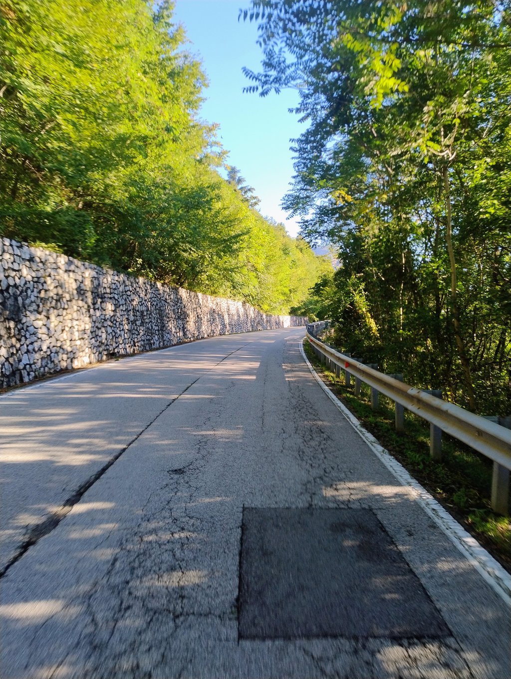
At the bottom of the climb there are two or three very steep ramps. One has up to 17 %. Only in the upper part does the ascent become more even and easier to ride. The further up you get, the more the traffic increases, but overall it is not a really nice pass. We had to ride it on the way to our actual destination, the Manghen Pass

Unten am Anstieg gibt es zwei oder drei sehr steiler Rampen. Einer hat bis zu 17 %. Erst im oberen Teil wird der Anstieg gleichmäßiger und findet seinen Tritt und es lässt sich leichter fahren. Umso weiter oben man ist umso mehr nimmt aber auch der Verkehr zu insgesamt ist es kein wirklich schöner Pass . Wir mussten ihn fahren auf dem Weg zu unserem eigentlichen Ziel, dem Manghen Pass

Dashboard
FHBiker
10 Mo 1.0
This is an automatic translation, the original language is: Dutch. Show original

Had to do this climb to get back to Caldonazzo after climbing Monte Bondone. Certainly the start is not a fun climb. Busy road and fairly steep. Second part is more fun on a narrow road through orchards. At this part, the road is just not that good.

Deze beklimming moeten doen om weer terug in Caldonazzo te komen, nadat ik de Monte Bondone heb beklommen. Zeker het begin is geen leuke klim. Drukke weg en redelijk steil. Tweede deel is leuker op een smalle weg door boomgaarden. Bij dit deel is de weg alleen niet zo goed.

Dashboard
Jochen6911
1 y 3.0
This is an automatic translation, the original language is: Dutch. Show original

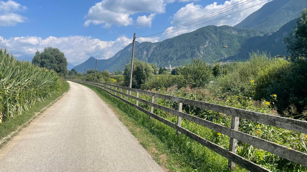
Done this climb from Trento. Climb runs nicely, not difficult. The bit on a bad path through vineyards and mountains on the right makes it worthwhile

Deze klim gedaan vanuit Trento. Klim loopt lekker, niet moeilijk. Het stuk over een slecht pad door de wijngaarden en bergen aan rechterzijde maakt het de moeite waard

Dashboard
Joeri
2 y 2.0
This is an automatic translation, the original language is: Dutch. Show original

The section on the provincial road is not particularly interesting. Fortunately, the last (almost flat) kilometres are on a narrow road between fields.

Het gedeelte over de provinciale weg is niet bijster interessant. Gelukkig gaan de laatste (bijna vlakke) kilometers over een smal weggetje tussen velden door.

Bosentino from Mattarello
Dashboard
Favoloso
3 y 3.0 00:34:00 (9.4 mph)
This is an automatic translation, the original language is: Dutch. Show original

The first part of the climb contains quite steep sections, nice pictures through the vineyards. Second part on a provincial road. Road surface is fine, little traffic.

Het eerste deel van de klim bevat flink steile stukken, mooie plaatjes door de wijngaarden. Tweede deel over een provinciale weg. Het wegdek is prima, weinig verkeer.

Bosentino from Mattarello
Dashboard

Climbing times

5 mph 01:04:29
7 mph 00:45:39
9 mph 00:35:34
12 mph 00:26:43

Road surface condition

67% 33% 0%
Based on 3 votes
Share your knowledge. What was the road condition during your ascent?

Traffic

33% 67% 0%
Based on 3 votes
Your experience counts. How much traffic did you encounter during the climb?

Frequently Asked Questions

You don't need special gearing for Bosentino from Mattarello. The slope isn't long or steep enough to require much shifting down. You can conquer this climb on power alone. However, a compact gearing system with a smallest front chainring of 34 and largest rear sprocket of 28 or 30 is always nice if you enjoy cycling uphill. This helps maintain a smooth cadence.

Bosentino from Mattarello is a serious climb and falls into the 2nd category. With a good basic fitness level, even without much cycling experience, you can complete this climb just fine. However, a bike with climbing gears is a must. Without experience or training, it will be really tough – but that’s part of the challenge!

Bosentino from Mattarello is 5.3 mi long.

The average gradient of Bosentino from Mattarello is 5.7%.

Bosentino from Mattarello has a steepest segment with an average gradient of 19.9%.

The summit of Bosentino from Mattarello is at 2247 ft.

At a slow pace of 5 mph, it takes about 01:04:29 to climb Bosentino from Mattarello. At 7 mph the time is 00:45:39, and at 9 mph 00:35:34. For the fastest cyclists, 00:26:43 is an achievable time.

Bosentino from Mattarello is located in the region Trento in Italy.

This page is better in the app

Climbfinder app
Climbfinder
(Free)
Open