| Beautiful scenery |
| Hidden gem |
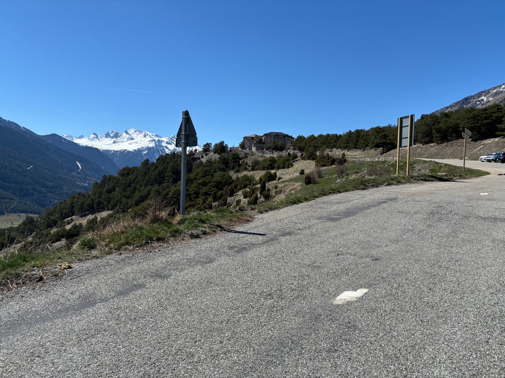
| 19 hairpin turns |
| #92 toughest climb of Savoie |
| #87 most elevation gain of Savoie |
| #80 longest climb of Savoie |
| #76 average steepest climb of La Maurienne |
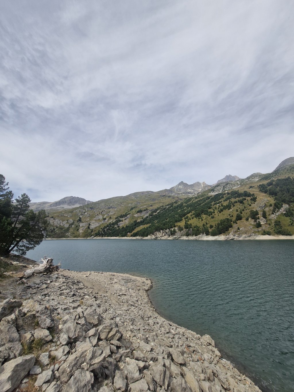
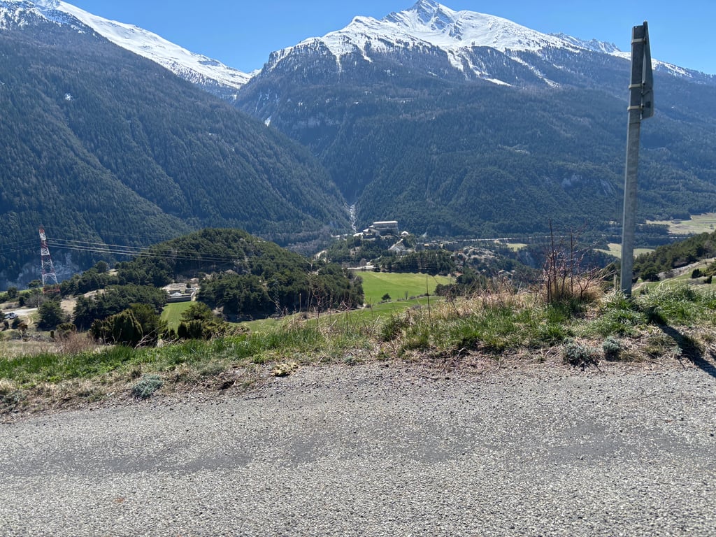
Barrage de Plan d'Aval is a climb in the region La Maurienne. It is 9.6 mi long and bridges 3209 ft of vertical ascent with an average gradient of 6.3%, resulting in a difficulty score of 795. The top of the ascent is located at 6594 ft above sea level. Climbfinder users shared 9 reviews of this climb and uploaded 22 photos.
Road names: D215G & D215
3.0 by SiiBeiRThis is an automatic translation, the original language is: English.Mooie klim in een mooie omgeving. Sommige plaatsen wegdek in mindere staat. In het voorjaar niet volledig toegankelijk in het ski seizoen.... read more
Welcome! Please activate your account if you would like to share something. Look for the verification email in your inbox.
If you want to upload your photos, you need to create an account. It only takes 1 minute and it's completely free.
Mooie klim in een mooie omgeving. Sommige plaatsen wegdek in mindere staat. In het voorjaar niet volledig toegankelijk in het ski seizoen.
19 June 2025 late morning
The first part was easy up to Aussois then I found it quite hard but I was hot and starting to run out of energy!
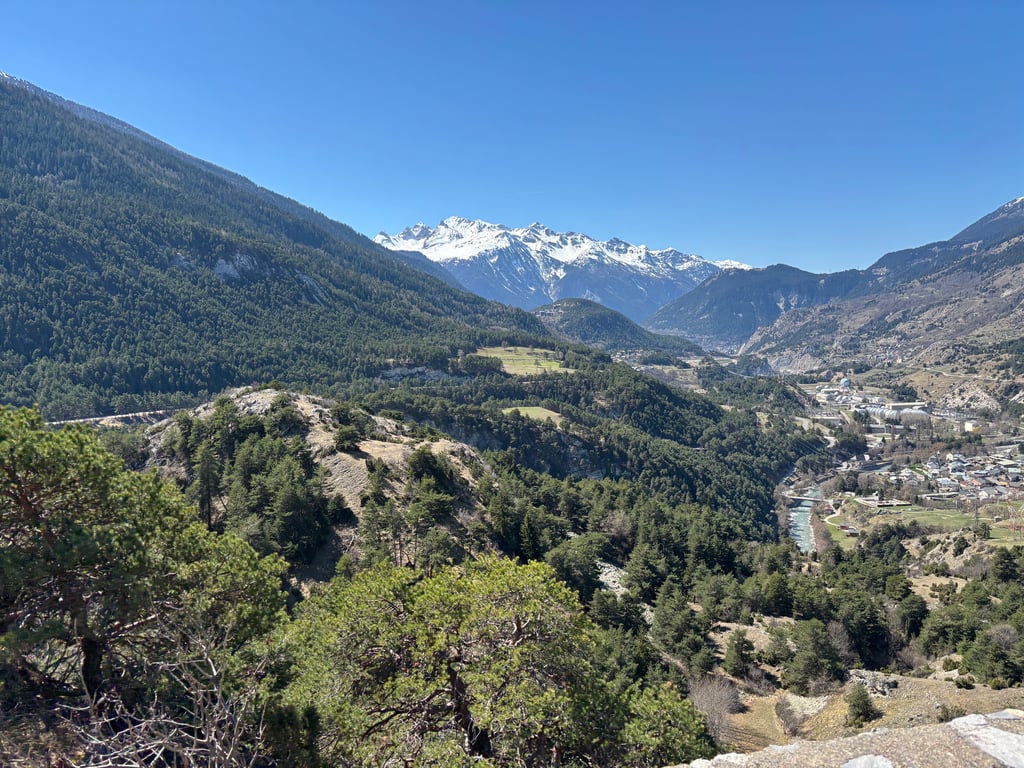
Beautiful panorama on the opposite side but I was still rather disappointed with the climb...
19 juin 2025 fin de matinée
Facile dans sa première partie jusqu'à Aussois ensuite je l'ai trouvé assez dure mais j'avais chaud et commençais à manquer de jus !
Beau panorama sur le versant opposé mais j'ai été quand même assez déçu de cette montée...
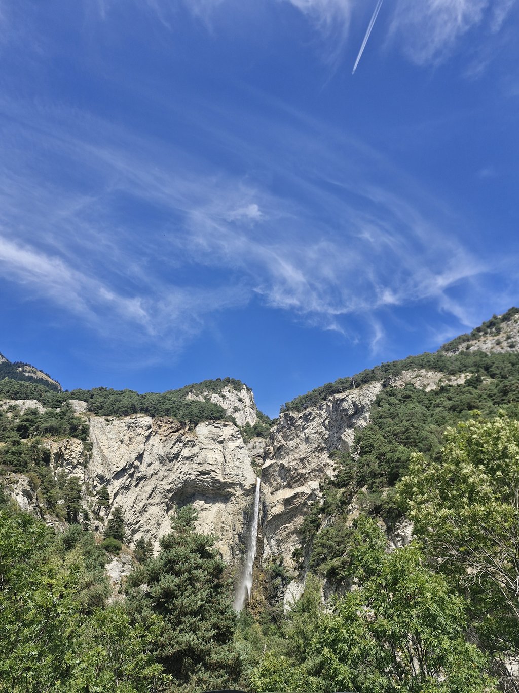
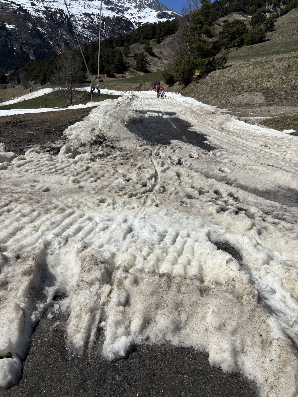
Delicious climb which I started from the east. From Aussois follow then 5 leaden kilometers before you reach Barrage de Plan d'Aval. In between you can enjoy beautiful panoramas. At the top you will find a large parking lot for the many hikers. Possibly you can still go higher via a gravel road, but that seemed to me not appropriate.
Heerlijke klim die ik vanuit het oosten heb aangevat. Vanuit Aussois volgen er dan 5 loodzware kilometers alvorens je Barrage de Plan d'Aval bereikt. Tussendoor geniet je van prachtige panorama's. Op de top vind je een grote parking voor de vele wandelaars die je er aantreft. Eventueel kan je nog hogerop via een grindweg, maar dat leek me niet aangewezen.
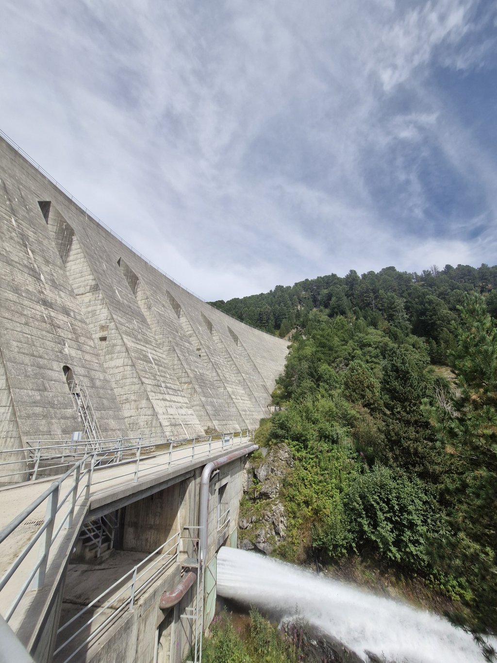
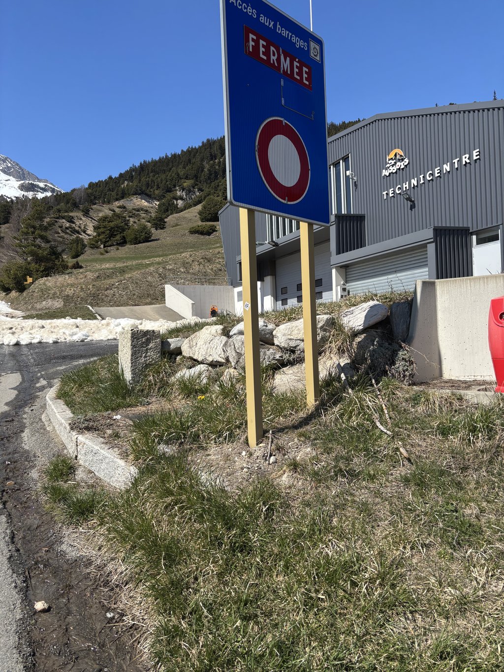
Beautiful col long and heavy. The beginning is difficult you have a big wide road where it does not seem very steep but you feel it already go up well do it quietly because it gets steeper. In the description is that you have a restaurant at the top this is not true. The top is at the sign barrage (see photo) then I am a small piece descended and climbed up a wall to then arrive at a parking lot which turns into a gravel road. Here come hikers and they hike to the eateries. This is not to do with the bike. So refill in Aussois.
Mooie col lang en zwaar. Het begin is lastig je heb een grote brede weg waar het niet heel steil lijkt maar je voelt het al goed omhoog gaan doe hier rustig aan want het word steiler. In de omschrijving staat dat je aan de top een restaurant hebt dit klopt niet. De top is bij het bordje barrage (zie foto) daarna ben ik een klein stukje afgedaald en een muur omhoog geklommen om vervolgens bij een parkeerplaats aan te komen wat veranderd in een grindweg. Hier komen hikers en die hiken naar de eetgelegenheden. Dit is met de fiets niet te doen. Dus aanvullen in Aussois.
A good challenge without being too complicated: there are several rests to breathe and the high gradients follow each other over 5km max. It's a very pleasant climb to do!
Un bon challenge sans pour autant être trop compliqué : on a plusieurs replats pour souffler et les pourcentages élevés s'enchaînent sur 5km max. C'est une montée super agréable à faire !
Nice climb, road in good condition (I did it several years ago, coming back from the Galibier, so my memories may not be perfect), with little traffic
Chouette ascension, route de mémoire en bon état (je l'ai faite il y a plusieurs années, en revenant du Galibier, donc mes souvenirs peuvent ne pas être parfaits), avec assez peu de trafic
Climb is really beautiful, but a lot spicier than indicated in the chart above. This is really a typical unknown alpine climb. Long, and very ungainly. The road surface is not very good, but the road is quite wide. The gradients vary between 5 and 15 %.
Klim is echt schitterend, maar wel een stuk pittiger dan hierboven in de grafiek staat aangegeven. Dit is echt zo'n typische onbekende alpen klim. Lang,en ontzettend lomp. Het wegdek is net niet lekker, maar de weg is wel vrij breed. De stijginspercentages varieren tussen de 5 en 15 %.
We did this climb on the first day of our trip in the Alps. It is much harder than indicated above. The 10% section is really 4.5 to 5 km and according to Strava sometimes goes towards 12/13%. The beginning is not difficult and until the last village it is not super special. Then a good climb.
Deze klim deden we op de eerste dag van onze trip in de Alpen. Hij is veel lastiger dan hierboven aangegeven. Het 10% stuk duurt echt 4,5 á 5 km en gaat volgens Strava ook soms richting de 12/13%. Het begin is niet lastig en tot het laatste dorp is hij niet super speciaal. Daarna wel prima klim.
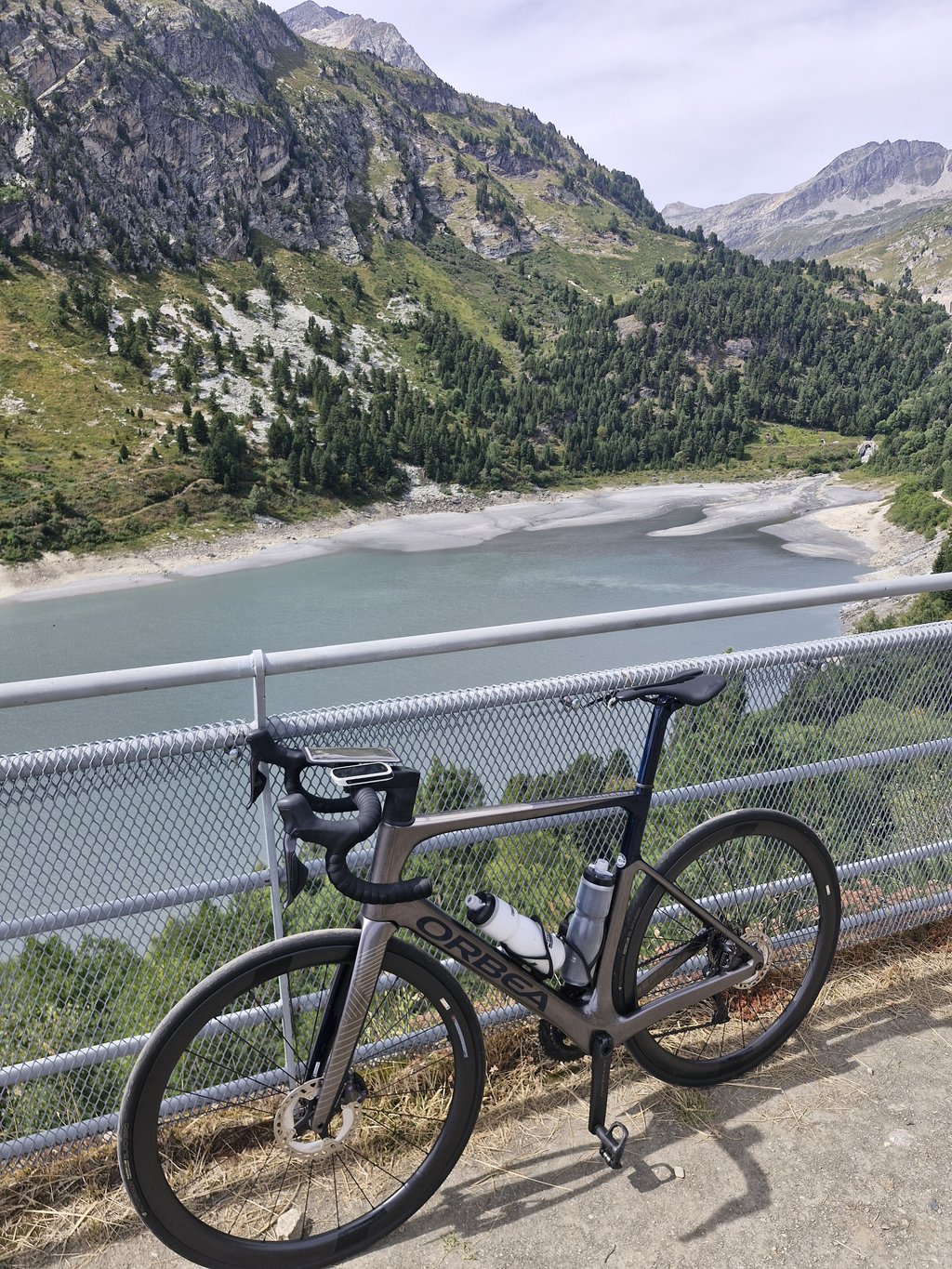
Wonderful ride! Really a must. Very tough in the second half (I was hanging in the ropes), but very rewarding. Castles, alpine meadows, goats cheering you on, a beautiful reservoir to finish it off. The road is fine and the big bonus was that there was very little traffic.
Prachtige rit! Echt een aanrader. Heel pittig in de tweede helft (ik hing in de touwen), maar bijzonder de moeite waard. Kastelen, alpenweides, geiten die je aanmoedigen, een fraai stuwmeer om het af te sluiten. De weg is prima en de grote bonus was dat er heel erg weinig verkeer is.
| 5 mph | 01:55:47 |
| 7 mph | 01:21:58 |
| 9 mph | 01:03:53 |
| 12 mph | 00:47:59 |
This page is better in the app