View on map
© MapLibre | OpenStreetMap contributors
1%
2%
4%
6%
8%
10%
12%
15%
20%

Aubin

3.0
3 reviews | Elevation profile | 9 photos
Tips nearby
Aubin
Aubin
Aubin
Aubin
Aubin
Aubin
Aubin
Aubin
Your achievable time
Calculating based on your best performances...
Relaxed
Maximum
W/kg
W/kg
W/kg
Analyze your climbing performance
Detailed insight into your climbing performance & automatically check off climbs
Based on your best performances.
Your best attempt:
Number of attempts:
Elevation profile Aubin

Statistics

Difficulty points 69
Length 1.9 mi
Average gradient 4.2%
Steepest segment 7.8%
Total ascent 413 ft
Feedback about this climb?
Show climbs nearby Export to GPS device

Aubin is a climb in the region Pays de Herve. It is 1.9 mi long and bridges 413 ft of vertical ascent with an average gradient of 4.2%, resulting in a difficulty score of 69. The top of the ascent is located at 781 ft above sea level. Climbfinder users shared 3 reviews of this climb and uploaded 9 photos.

Road names: Rue du Vicinal, Aubin, Rue Marnières & Rue du Colonel d'Ardenne

This is an automatic translation, the original language is: Dutch.
Varied climb that starts quietly but gradually gains character. The long straight section toward Aubin requires considerable strength, after which the road winds further uphill past open vistas and historic sites.... read more

Photos (9)

Aubin
Aubin
Aubin
Aubin
Aubin
Aubin
Aubin
Aubin
Aubin
transparant thumb
transparant thumb
transparant thumb

Your uploads (max 4)

Welcome! Please activate your account if you would like to share something. Look for the verification email in your inbox.

If you want to upload your photos, you need to create an account. It only takes 1 minute and it's completely free.

  • Receive free climbfinder goodies for your reviews & photos.
  • Create a bucket list and check off conquered climbs.
  • Add missing climbs.
Continue with GoogleContinue with Google Continue with FacebookContinue with Facebook Continue with AppleContinue with Apple Sign up with email
By signing up you agree to our terms of service and confirm that you have read our privacy & content policy.

Reviews (3)

5.0
4.0
3.0
2.0
1.0
Piekpionier
3 w 3.0
This is an automatic translation, the original language is: Dutch. Show original

Varied climb that starts quietly but gradually gains character. The long straight section toward Aubin requires considerable strength, after which the road winds further uphill past open vistas and historic sites.

Gevarieerde klim die rustig begint maar geleidelijk meer karakter krijgt. Het lange rechte stuk richting Aubin vraagt behoorlijk wat kracht, waarna de weg verder omhoog slingert langs open uitzichten en historische plekken.

Dashboard
Fedor
4 y 3.0
This is an automatic translation, the original language is: Dutch. Show original

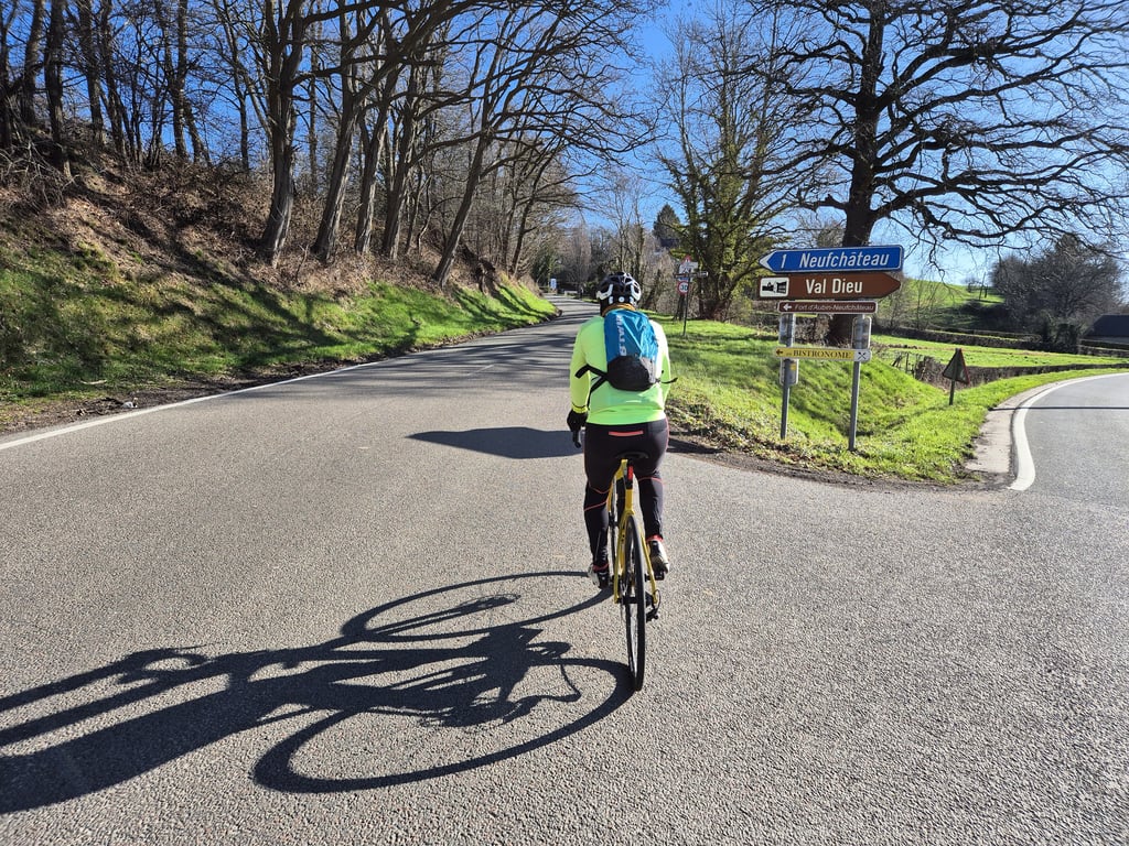
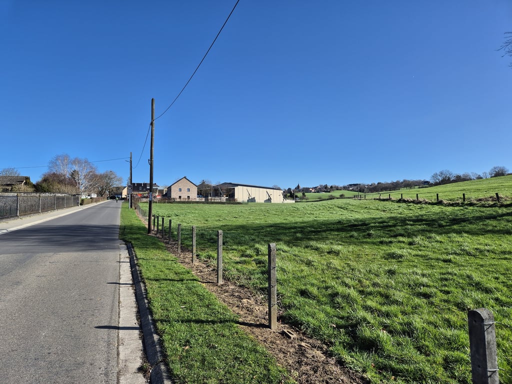
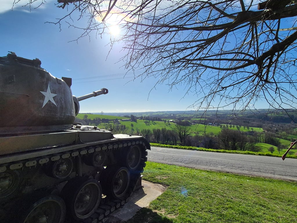
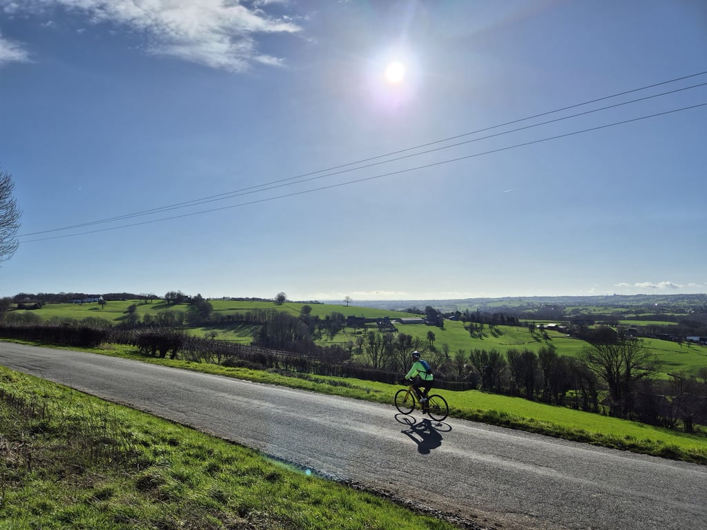
A varied climb. After a relaxed start in pleasant surroundings, you come across a long straight part between the houses, where the second part goes up like a sturdy runner towards Aubin. You can feel this. Then the road winds up until you reach the fortress, from there a flat part and a final climb to the crossroads. The last part has nice views to the right (e.g. Les Waides) and lots of war history.

Een gevarieerde klim. Na een relaxed begin in een aangename omgeving kom je tussen de huizen een lang recht stuk tegen waarbij het tweede deel als een stevige loper flink omhoog loopt richting Aubin. Dit voel je wel. Daarna kronkelt de weg verder omhoog tot je bij het fort komt, vandaar een vlak stuk en een eindklimmetje naar de kruising. Het laatste deel heeft fraai uitzicht naar rechts (op o.a. Les Waides) en veel oorlogshistorie.

Aubin
Aubin
Aubin
Aubin
Aubin
Dashboard
PelotonDesArdennes
5 y 3.0
This is an automatic translation, the original language is: Dutch. Show original

For people who do not like the steep work, this is a great alternative to Les Waides.
Also as a descent certainly fun - you have then left of you a beautiful view.

Voor de mensen die niet van het steile werk houden is dit een prima alternatief voor Les Waides.
Ook als afdaling zeker leuk - je hebt dan links van je een prachtig uitzicht.

Dashboard

Climbing times

5 mph 00:22:30
7 mph 00:15:56
9 mph 00:12:25
12 mph 00:09:19

Road surface condition

100% 0% 0%
Based on 1 vote
Share your knowledge. What was the road condition during your ascent?

Traffic

100% 0% 0%
Based on 1 vote
Your experience counts. How much traffic did you encounter during the climb?

Frequently Asked Questions

Aubin can be cycled from 8 sides. Les Waides from Val-Dieu is the most popular side, but the summit can also be reached via Fêchereux from Val-Dieu, Aubin, Les Waides from Mortroux, Fêchereux from Mortroux, La Heydt, Bois de Winerotte from Warsage & Affnay from Warsage.

You don't need special gearing for Aubin. The slope isn't long or steep enough to require much shifting down. You can conquer this climb on power alone. However, a compact gearing system with a smallest front chainring of 34 and largest rear sprocket of 28 or 30 is always nice if you enjoy cycling uphill. This helps maintain a smooth cadence.

Aubin falls into the 5th category. With good fitness, you can ride it up with speed and power. If you have less training, shift down and climb smoothly.

Aubin is 1.9 mi long.

The average gradient of Aubin is 4.2%.

Aubin has a steepest segment with an average gradient of 7.8%.

The summit of Aubin is at 781 ft.

At a slow pace of 5 mph, it takes about 00:22:30 to climb Aubin. At 7 mph the time is 00:15:56, and at 9 mph 00:12:25. For the fastest cyclists, 00:09:19 is an achievable time.

Aubin is located in the region Liège Province in Belgium.

This page is better in the app

Climbfinder app
Climbfinder
(Free)
Open