| Beautiful scenery |
| Hidden gem |
| 18 hairpin turns |
| #55 toughest climb of Trentino-South Tyrol |
| #88 most elevation gain of Trentino-South Tyrol |
| #82 longest climb of Bolzano |
| #76 average steepest climb of Bolzano |
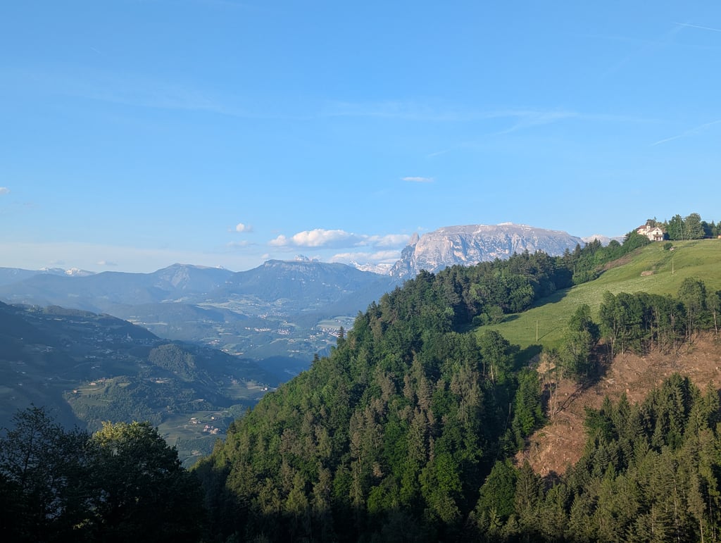
Schneiderwiesen from Bolzano is a climb in the region Bolzano. It is 11.2 km long and bridges 1095 m of vertical ascent with an average gradient of 9.8%, resulting in a difficulty score of 1170. The top of the ascent is located at 1365 m above sea level. Climbfinder users shared 4 reviews of this climb and uploaded 1 photo.
Road names: Via Campegno, Via al Colle & Seitner Strasse
2.0 by GianlucaPThis is an automatic translation, the original language is: Italian.First section very hard and sunny (to be avoided on hot summer afternoons) the asphalt is not very good in the first half, then improves in the middle section, and finally the last few kilometres after the cable car are almost a dirt road... read more
Welcome! Please activate your account if you would like to share something. Look for the verification email in your inbox.
If you want to upload your photos, you need to create an account. It only takes 1 minute and it's completely free.
First section very hard and sunny (to be avoided on hot summer afternoons) the asphalt is not very good in the first half, then improves in the middle section, and finally the last few kilometres after the cable car are almost a dirt road
Primo tratto molto duro e soleggiato (da evitare nei caldi pomeriggi d'estate) l'asfalto non è molto buono nella prima metà poi migliora nella parte centrale, infine gli ultimi km, dopo la funivia sono quasi una strada sterrata
The ascent of the Col is famous to the people of Bolzano. Tough and never lets up with gradients always in double figures. It is excellent for testing your condition and cycling safely as there is almost no traffic. When you arrive at the farmstead, you can turn back by descending via La Costa towards the pine forest.
La salita del Colle è famosa ai Bolzanini. Dura e non molla mai con pendenza sempre a 2 cifre. Ottima per testare la propria condizione e pedalare in sicurezza dato che il traffico e pressoché nullo. Arrivati al maso si può tornare indietro scendendo per La Costa direzione pineta.
Not recommended. The climb is tough, but steady. The views are limited during the climb and the road surface is poor. I could not finish the last 1200 metres from the village because my rear wheel skidded on the loose stones. The reward is therefore minimal, except for a few elderly people with Nordic walking sticks.
Geen aanrader. De klim is zwaar, maar regelmatig. Het uitzicht is beperkt tijdens de klim en het wegdek is matig. De laatse 1200 meter vanuit het dorpje kon ik ook niet afmaken, want mijn achterwiel slipte over de lossen steentjes. De beloning is dan ook, op enkele bejaarden met Nordicwalk sticks na, summier.
Nice, but steep climb. It is nice that it is quite regular (although with these percentages it is questionable whether everyone agrees). Road surface was very variable. New asphalt alternated with real goat tracks. Did the descent the other way, the road was really good to new everywhere. At the top a restaurant to recover... Although the views on the way are nicer than on top.
Leuke, maar steile klim. Fijn is wel dat deze vrij regelmatig is (al is het maar de vraag met deze percentages of iedereen het daarmee eens is). Wegdek was zeer wisselend. Nieuw asfalt afgewisseld met echt stukjes geitenpad. Afdaling de andere kant gedaan, daar was de weg overal echt goed tot nieuw. Bovenop een restaurant om bij te komen... al zijn de uitzichten onderweg mooier dan bovenop.
| 7 km/h | 01:35:36 |
| 11 km/h | 01:00:50 |
| 15 km/h | 00:44:37 |
| 19 km/h | 00:35:13 |
This page is better in the app