Rue Grétry is a climb in the region Pays de Herve. It is 1.1 km long and bridges 65 m of vertical ascent with an average gradient of 5.7%, resulting in a difficulty score of 54. The top of the ascent is located at 286 m above sea level. Climbfinder users shared 2 reviews of this climb and uploaded 4 photos.
Road names: Rue Grétry & Sarémont
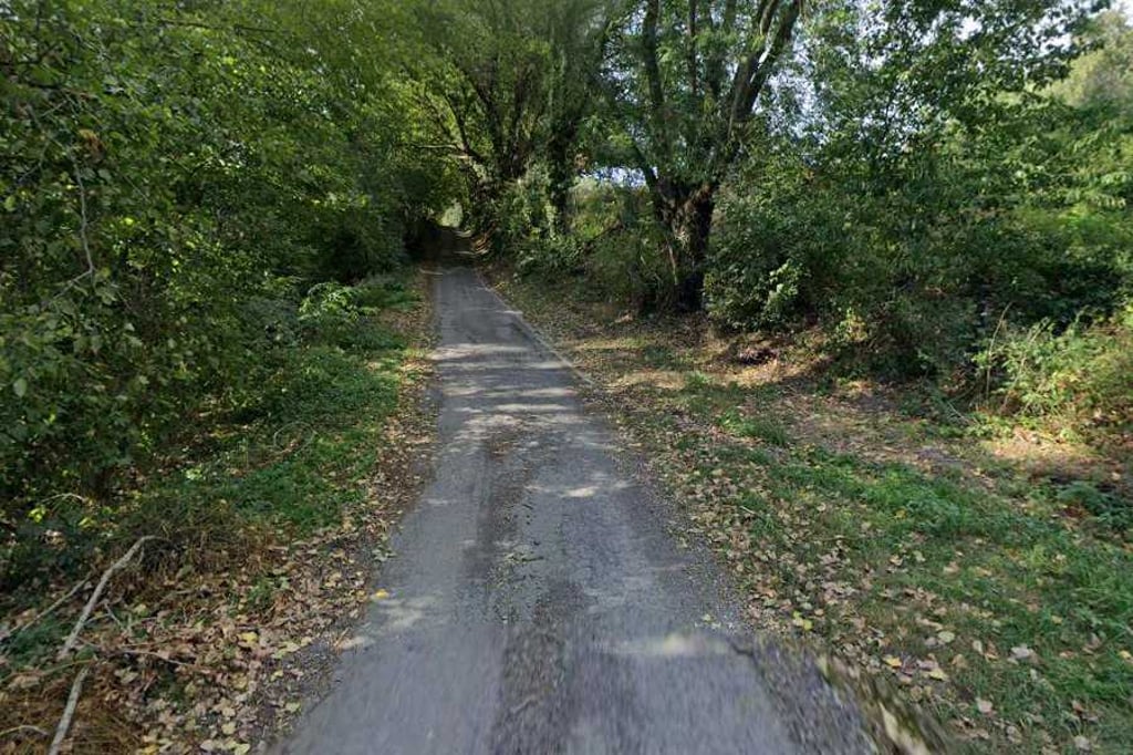
3.0 by PiekpionierThis is an automatic translation, the original language is: Dutch.After the descent through the forest on bad road surface, this climb immediately starts with a tough opening section on rough asphalt. Then the gradient gradually decreases and you can roll on more leisurely.... read more
Welcome! Please activate your account if you would like to share something. Look for the verification email in your inbox.
If you want to upload your photos, you need to create an account. It only takes 1 minute and it's completely free.
After the descent through the forest on bad road surface, this climb immediately starts with a tough opening section on rough asphalt. Then the gradient gradually decreases and you can roll on more leisurely.
Na de afdaling door het bos op slecht wegdek begint deze klim meteen met een stevig openingsstuk over ruw asfalt. Daarna neemt de helling geleidelijk af en kun je rustiger doorrollen.
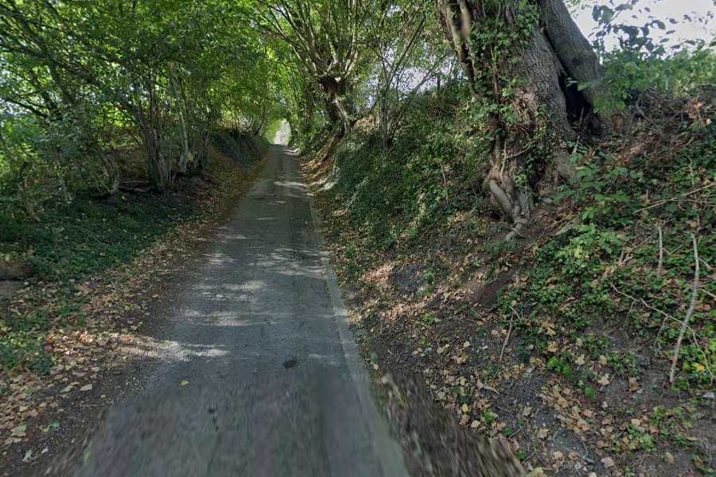
From Mur du Couvent, you descend Rue Grétry on a deplorably bad road through the forest. At the bottom of the valley after passing the Rau de Bolland stream, the climb begins on a still poor road surface. The first 250 metres are the steepest. Then the next 250 metres flatten out further. After that, it is rolling out to the summit on Sarémont.
Vanaf Mur du Couvent daal je over een erbarmelijk slechte weg door het bos Rue Grétry af. Onder in het dal na passage van de beek Rau de Bolland begint de klim over een nog steeds slecht wegdek. De eerste 250 meter zijn het steilst. Daarna vlakken de volgende 250 meter veder af. Daarna is het uitbollen tot aan de top op Sarémont.
| 7 km/h | 00:09:41 |
| 11 km/h | 00:06:10 |
| 15 km/h | 00:04:31 |
| 19 km/h | 00:03:34 |
This page is better in the app