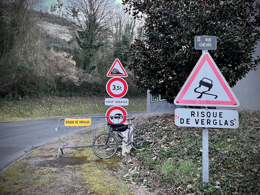
Rue chèvre is a climb in the region Maine-et-Loire. It is 0.4 km long and bridges 58 m of vertical ascent with an average gradient of 13.8%, resulting in a difficulty score of 80. The top of the ascent is located at 89 m above sea level. Climbfinder users shared 3 reviews of this climb and uploaded 8 photos.
This is an automatic translation, the original language is: French.
This is no joke!
A hill worthy of the name, with real difficulty! I had a tough time of it, but it's definitely worth the diversions, with its vineyards, troglodyte cellars, views over the Loire and guaranteed effort.
...read more
Photos (8)
Welcome! Please activate your account if you would like to share something. Look for the verification email in your inbox.
This is an automatic translation, the original language is: French.
Show original
This is no joke!
A hill worthy of the name, with real difficulty! I had a tough time of it, but it's definitely worth the diversions, with its vineyards, troglodyte cellars, views over the Loire and guaranteed effort.
This is an automatic translation, the original language is: French.
Show original
Now that's a pretty urban hill!
It's a tough climb, but still quite accessible, and offers a lovely view over the Loire valley. A great climb to include in your discovery of this Saumur hillside.
En voilà une jolie côte urbaine !
Ça grimpe fort, mais reste tout à fait accessible, et offre une jolie vue sur leval de Loire. Une belle ascension à compter dans une découverte de ce coteau saumurois.
This is an automatic translation, the original language is: French.
Show original
Saumur offers some very interesting climbs. They are short but intense.
This would be the most difficult. But it's not the one with the highest percentage.
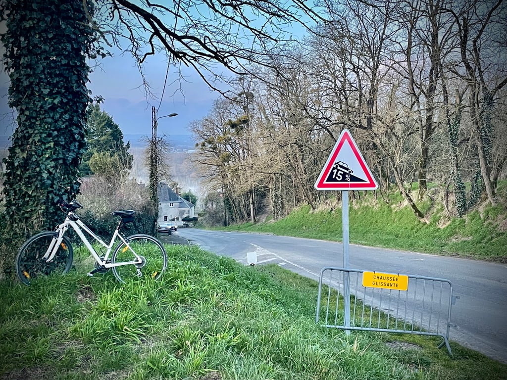
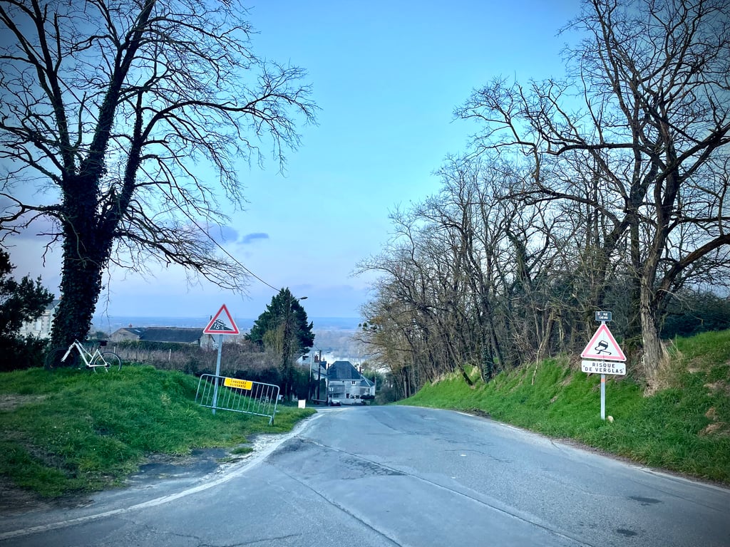
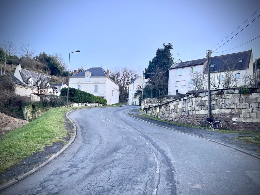
Unlike the other short climbs that criss-cross this hillside, the Rue Chèvre is a real road used by motorists.
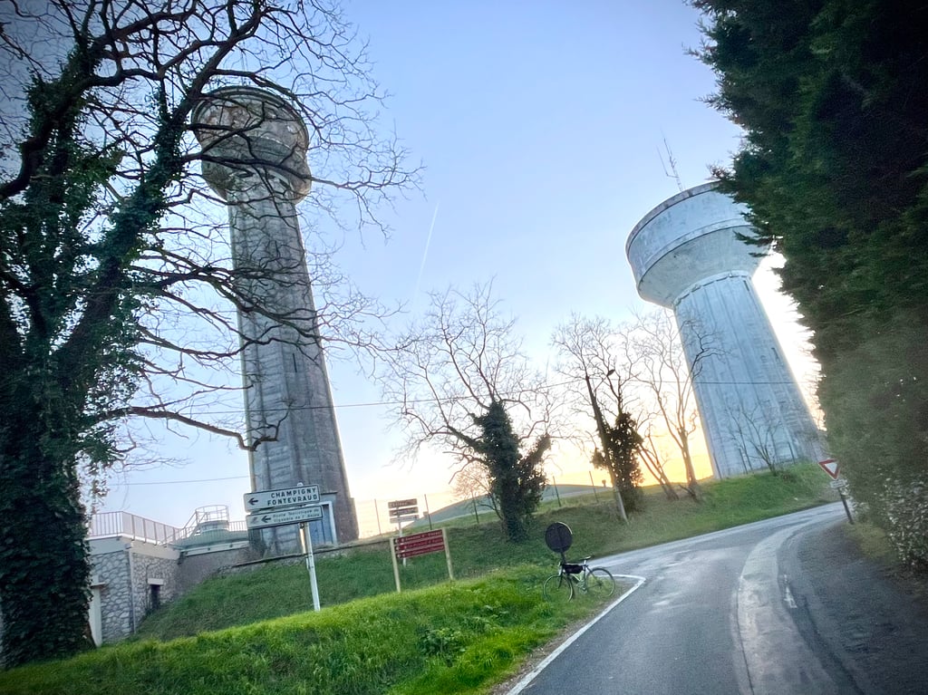
At the top are two imposing water towers.
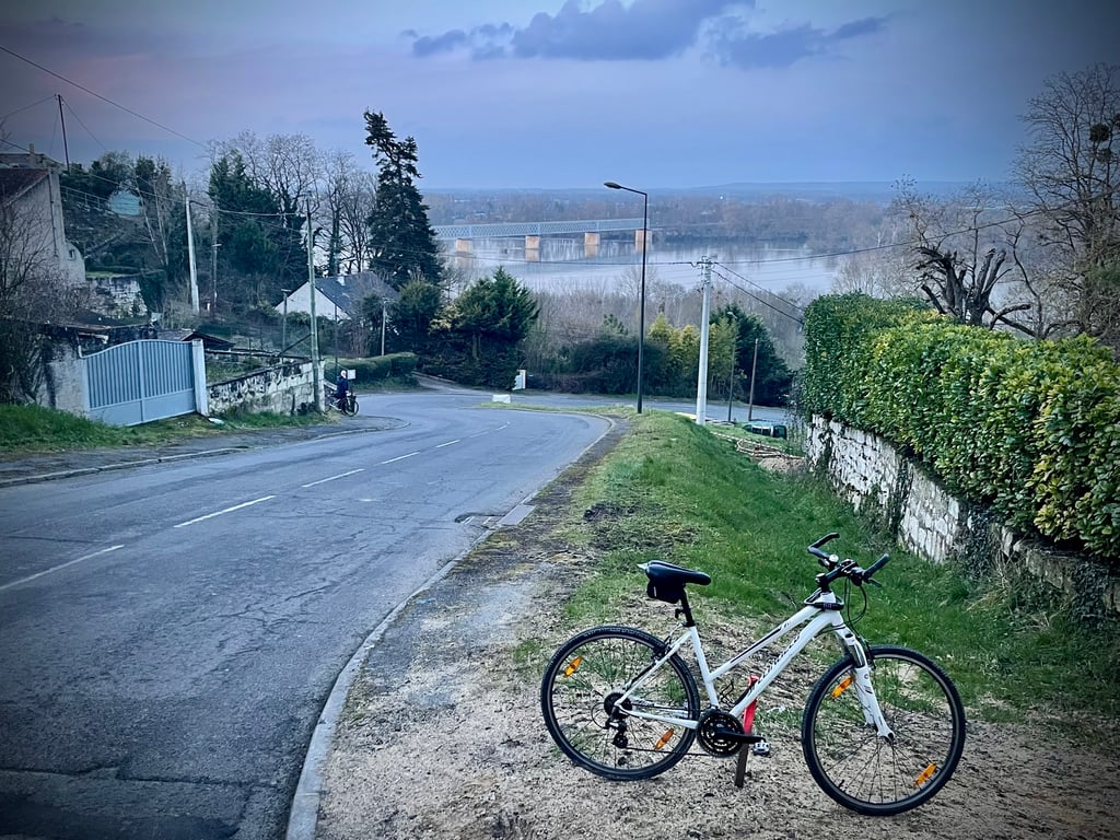
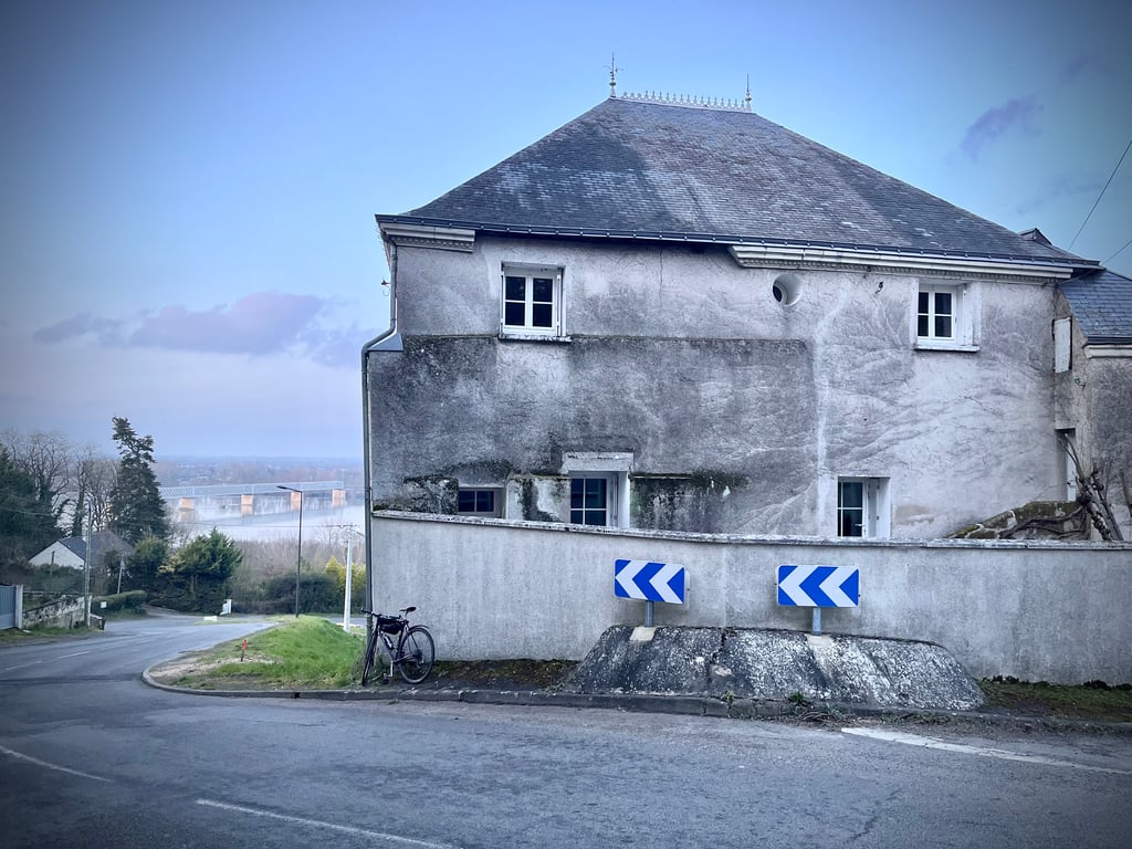
A view of the Loire and some fine buildings.
These little hillsides of Saumur are well worth the diversions.
Saumur propose quelques ascensions bien intéressantes. Elles sont courtes mais intenses.
Celle-ci serait la plus difficile. Mais, ce n’est pas celle qui offre le pourcentage le plus élevé.
Contrairement aux autres petites côtes qui strient ce coteau, la rue Chèvre est une vraie route empruntée par les automobilistes.
En haut, deux imposants châteaux d’eau.
Une vue sur la Loire et sur de belle bâtisses.
Oui, ces petites côtes de Saumur valent le détour.
Share your knowledge. What was the road condition during your ascent?
Traffic
71% 29% 0%
Based on 7 votes
Your experience counts. How much traffic did you encounter during the climb?
Frequently Asked Questions
You don't need special gearing for Rue chèvre. The slope isn't long or steep enough to require much shifting down. You can conquer this climb on power alone. However, a compact gearing system with a smallest front chainring of 34 and largest rear sprocket of 28 or 30 is always nice if you enjoy cycling uphill. This helps maintain a smooth cadence.
Rue chèvre is a 4th-category climb. A sprint to the top is usually not an option, and untrained riders will definitely feel it in their legs. For trained cyclists, it is a great training climb.
Rue chèvre is 0.4 km long.
The average gradient of Rue chèvre is 13.8%.
Rue chèvre has a steepest segment with an average gradient of 16%.
The summit of Rue chèvre is at 89 m.
At a slow pace of 7 km/h, it takes about 00:03:34 to climb Rue chèvre. At 11 km/h the time is 00:02:16, and at 15 km/h 00:01:40. For the fastest cyclists, 00:01:19 is an achievable time.