View on map
© MapLibre | OpenStreetMap contributors
1%
2%
4%
6%
8%
10%
12%
15%
20%

Route des Grangettes

3.0
1 review/story | Elevation profile | 1 photo
Tips nearby
Route des Grangettes
transparant thumb
transparant thumb
transparant thumb
transparant thumb
transparant thumb
transparant thumb
transparant thumb
Your achievable time
Calculating based on your best performances...
Relaxed
Maximum
W/kg
W/kg
W/kg
Analyse your climbing performance
Detailed insight into your climbing performance & automatically check off climbs
Based on your best performances.
Your best attempt:
Number of attempts:
Elevation profile Route des Grangettes

Statistics

Difficulty points 73
Length 0.9 km
Average gradient 8.6%
Steepest 100 metres 13.5%
Total ascent 74 m
Feedback about this climb?
Show climbs nearby Export to GPS device

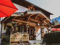
Route des Grangettes is a climb in the region Haute Savoie. It is 0.9 km long and bridges 74 m of vertical ascent with an average gradient of 8.6%, resulting in a difficulty score of 73. The top of the ascent is located at 1032 m above sea level. Climbfinder users shared 1 review/story of this climb and uploaded 1 photo.

Road name: Route des Grangettes
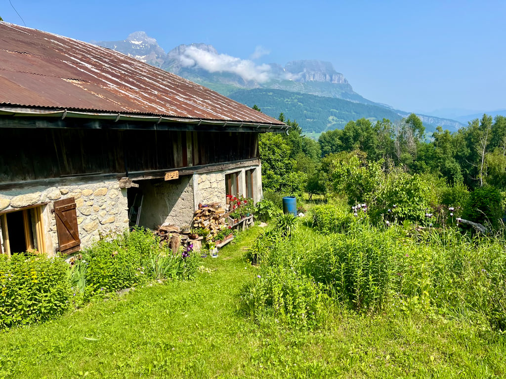
3.0 by Djay100
This is an automatic translation, the original language is: French.
Short climb between Combloux and Cordon in a superb setting amidst old chalets. There is a very steep section (13-14%) of around a hundred metres before an easier finish.... read more

Photos (1)

Route des Grangettes
transparant thumb
transparant thumb
transparant thumb
transparant thumb
transparant thumb

Your uploads (max 4)

Welcome! Please activate your account if you would like to share something. Look for the verification email in your inbox.

If you want to upload your photos, you need to create an account. It only takes 1 minute and it's completely free.

  • Receive free climbfinder goodies for your reviews & photos.
  • Create a bucket list and check off conquered climbs.
  • Add missing climbs.
Continue with GoogleContinue with Google Continue with FacebookContinue with Facebook Continue with AppleContinue with Apple Sign up with email
By signing up you agree to our terms of service and confirm that you have read our privacy & content policy.

Reviews (1)

5.0
4.0
3.0
2.0
1.0
Djay100
11 Mo 3.0
This is an automatic translation, the original language is: French. Show original

Short climb between Combloux and Cordon in a superb setting amidst old chalets. There is a very steep section (13-14%) of around a hundred metres before an easier finish.

Montée courte entre Combloux et Cordon dans un superbe décor au milieu de vieux chalets. Il y a un passage très raide (13-14%) d’une centaine de mètres avant un final plus facile.

Route des Grangettes
Dashboard

Climbing times

7 km/h 00:07:20
11 km/h 00:04:40
15 km/h 00:03:25
19 km/h 00:02:42

Road surface condition

0% 0% 0%
Based on 0 votes
Share your knowledge. What was the road condition during your ascent?

Traffic

0% 0% 0%
Based on 0 votes
Your experience counts. How much traffic did you encounter during the climb?

Frequently Asked Questions

You don't need special gearing for Route des Grangettes. The slope isn't long or steep enough to require much shifting down. You can conquer this climb on power alone. However, a compact gearing system with a smallest front chainring of 34 and largest rear sprocket of 28 or 30 is always nice if you enjoy cycling uphill. This helps maintain a smooth cadence.

Route des Grangettes falls into the 5th category. With good fitness, you can ride it up with speed and power. If you have less training, shift down and climb smoothly.

Route des Grangettes is 0.9 km long.

The average gradient of Route des Grangettes is 8.6%.

Route des Grangettes has a steepest segment with an average gradient of 13.5%.

The summit of Route des Grangettes is at 1032 m.

At a slow pace of 7 km/h, it takes about 00:07:20 to climb Route des Grangettes. At 11 km/h the time is 00:04:40, and at 15 km/h 00:03:25. For the fastest cyclists, 00:02:42 is an achievable time.

Route des Grangettes is located in the region Haute Savoie in France.

This page is better in the app

Climbfinder app
Climbfinder
(Free)
Open