View on map
© MapLibre | OpenStreetMap contributors
1%
2%
4%
6%
8%
10%
12%
15%
20%

Route des Granges

2.0
1 review/story | Elevation profile | 1 photo
Tips nearby
Route des Granges
transparant thumb
transparant thumb
transparant thumb
transparant thumb
transparant thumb
transparant thumb
transparant thumb
Your achievable time
Calculating based on your best performances...
Relaxed
Maximum
W/kg
W/kg
W/kg
Analyse your climbing performance
Detailed insight into your climbing performance & automatically check off climbs
Based on your best performances.
Your best attempt:
Number of attempts:
Elevation profile Route des Granges

Statistics

Difficulty points 58
Length 0.9 km
Average gradient 7.7%
Steepest 100 metres 10.9%
Total ascent 71 m
Feedback about this climb?
Show climbs nearby Export to GPS device

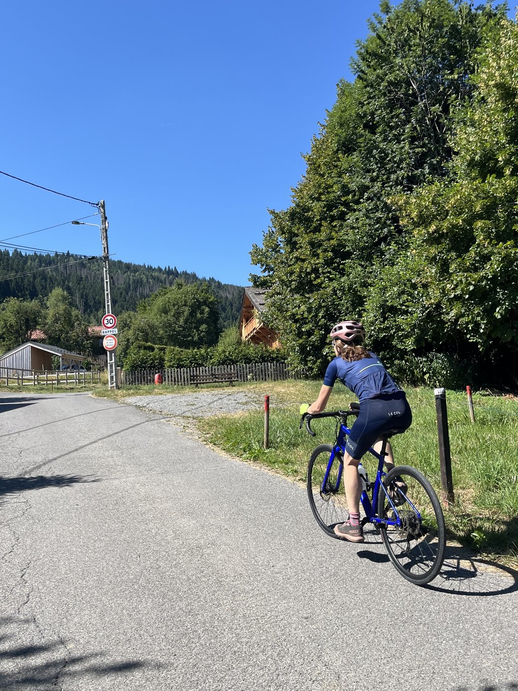
Route des Granges is a climb in the region Haute Savoie. It is 0.9 km long and bridges 71 m of vertical ascent with an average gradient of 7.7%, resulting in a difficulty score of 58. The top of the ascent is located at 1001 m above sea level. Climbfinder users shared 1 review/story of this climb and uploaded 1 photo.

Road name: Route des Granges

2.0 by Djay100
This is an automatic translation, the original language is: French.
A short climb above Nant Cruy in a rural setting. A good ramp at the end leads to a small car park. Option to extend with a very steep section of around 250m if you want to push your thighs and cardio (up to 18%!). The road then gives way to gravel.... read more

Photos (1)

Route des Granges
transparant thumb
transparant thumb
transparant thumb
transparant thumb
transparant thumb

Your uploads (max 4)

Welcome! Please activate your account if you would like to share something. Look for the verification email in your inbox.

If you want to upload your photos, you need to create an account. It only takes 1 minute and it's completely free.

  • Receive free climbfinder goodies for your reviews & photos.
  • Create a bucket list and check off conquered climbs.
  • Add missing climbs.
Continue with GoogleContinue with Google Continue with FacebookContinue with Facebook Continue with AppleContinue with Apple Sign up with email
By signing up you agree to our terms of service and confirm that you have read our privacy & content policy.

Reviews (1)

5.0
4.0
3.0
2.0
1.0
Djay100
10 Mo 2.0
This is an automatic translation, the original language is: French. Show original

A short climb above Nant Cruy in a rural setting. A good ramp at the end leads to a small car park. Option to extend with a very steep section of around 250m if you want to push your thighs and cardio (up to 18%!). The road then gives way to gravel.

Courte montée au dessus de Nant Cruy dans un cadre champêtre. Une bonne rampe pour terminer qui mène à un petit parking. Possibilité de prolonger par une portion très raide d’environ 250m si on veut forcer sur les cuisses et le cardio (jusqu’à 18%!). La route laisse ensuite place à du gravier.

Dashboard

Climbing times

7 km/h 00:07:50
11 km/h 00:04:59
15 km/h 00:03:39
19 km/h 00:02:53

Road surface condition

0% 0% 0%
Based on 0 votes
Share your knowledge. What was the road condition during your ascent?

Traffic

0% 0% 0%
Based on 0 votes
Your experience counts. How much traffic did you encounter during the climb?

Frequently Asked Questions

You don't need special gearing for Route des Granges. The slope isn't long or steep enough to require much shifting down. You can conquer this climb on power alone. However, a compact gearing system with a smallest front chainring of 34 and largest rear sprocket of 28 or 30 is always nice if you enjoy cycling uphill. This helps maintain a smooth cadence.

Route des Granges falls into the 5th category. With good fitness, you can ride it up with speed and power. If you have less training, shift down and climb smoothly.

Route des Granges is 0.9 km long.

The average gradient of Route des Granges is 7.7%.

Route des Granges has a steepest segment with an average gradient of 10.9%.

The summit of Route des Granges is at 1001 m.

At a slow pace of 7 km/h, it takes about 00:07:50 to climb Route des Granges. At 11 km/h the time is 00:04:59, and at 15 km/h 00:03:39. For the fastest cyclists, 00:02:53 is an achievable time.

Route des Granges is located in the region Haute Savoie in France.

This page is better in the app

Climbfinder app
Climbfinder
(Free)
Open