View on map
© MapLibre | OpenStreetMap contributors
1%
2%
4%
6%
8%
10%
12%
15%
20%

Rioupéroux via Route des 6 Vallées

1.0
1 review/story | Elevation profile | 0 photos
Tips nearby
Your achievable time
Calculating based on your best performances...
Relaxed
Maximum
W/kg
W/kg
W/kg
Analyse your climbing performance
Detailed insight into your climbing performance & automatically check off climbs
Based on your best performances.
Your best attempt:
Number of attempts:
Elevation profile Rioupéroux via Route des 6 Vallées

Statistics

Difficulty points 46
Length 5.5 km
Average gradient 2.8%
Steepest 100 metres 4%
Total ascent 154 m
Feedback about this climb?
Show climbs nearby Export to GPS device

Rioupéroux via Route des 6 Vallées is a climb in the region Grenoble. It is 5.5 km long and bridges 154 m of vertical ascent with an average gradient of 2.8%, resulting in a difficulty score of 46. The top of the ascent is located at 535 m above sea level. Climbfinder users shared 1 review/story of this climb and uploaded 0 photos.

Road name: Route des 6 Vallées

This is an automatic translation, the original language is: French.
If you want to cycle up the classic Oisans climbs (Croix de Fer, Alpe d'Huez, Lautaret, Galibier, etc.) from near Grenoble or Vizille, this is by far the easiest and most direct route. But in itself, this heavily-travelled Alpine corridor is anything but pleasant to do...... read more

Photos (0)

transparant thumb
transparant thumb
transparant thumb
transparant thumb
transparant thumb
transparant thumb

Your uploads (max 4)

Welcome! Please activate your account if you would like to share something. Look for the verification email in your inbox.

If you want to upload your photos, you need to create an account. It only takes 1 minute and it's completely free.
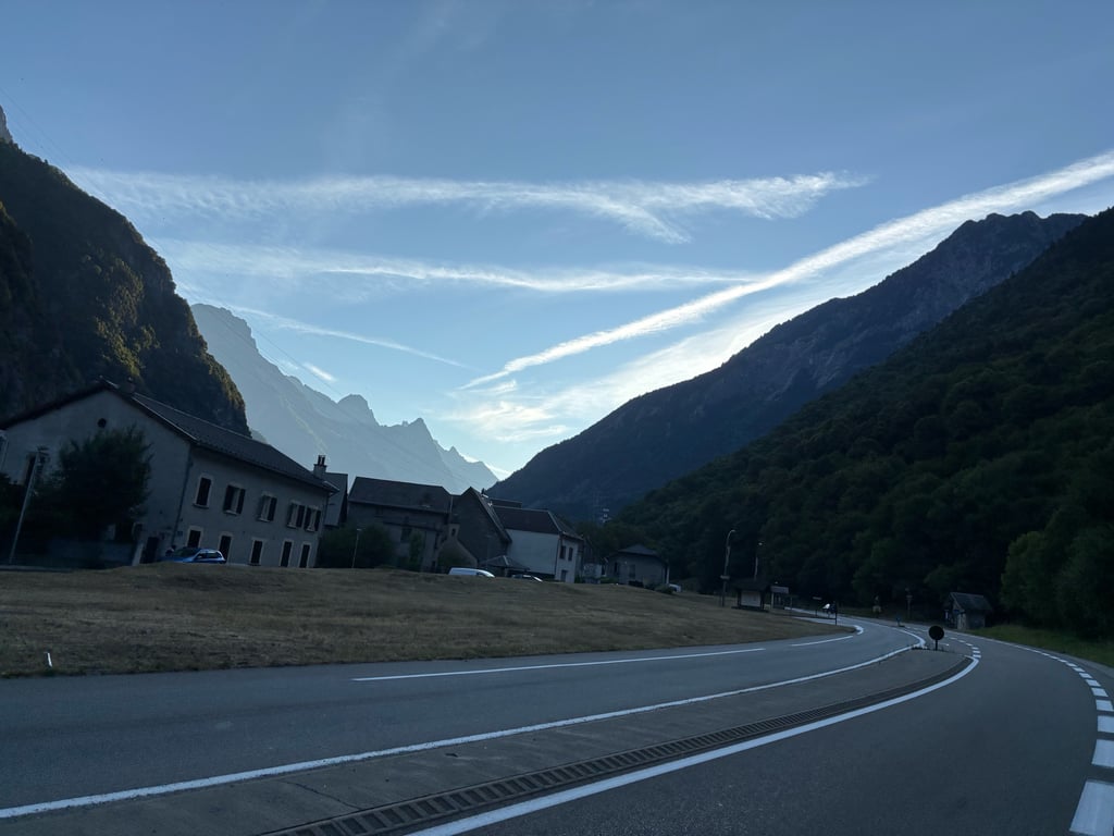
  • Receive free climbfinder goodies for your reviews & photos.
  • Create a bucket list and check off conquered climbs.
  • Add missing climbs.
Continue with GoogleContinue with Google Continue with FacebookContinue with Facebook Continue with AppleContinue with Apple Sign up with email
By signing up you agree to our terms of service and confirm that you have read our privacy & content policy.

Reviews (1)

5.0
4.0
3.0
2.0
1.0
Franck_Pastor
1 Mo 1.0
This is an automatic translation, the original language is: French. Show original

If you want to cycle up the classic Oisans climbs (Croix de Fer, Alpe d'Huez, Lautaret, Galibier, etc.) from near Grenoble or Vizille, this is by far the easiest and most direct route. But in itself, this heavily-travelled Alpine corridor is anything but pleasant to do...

Si on veut accéder à vélo aux montées classiques de l'Oisans (Croix de Fer, Alpe d'Huez, Lautaret, Galibier, etc.) en partant des environs de Grenoble ou de Vizille, c'est de loin l'itinéraire le plus facile et le plus direct. Mais en lui-même ce corridor alpin à fort trafic est tout sauf agréable à faire…

Dashboard

Climbing times

7 km/h 00:46:58
11 km/h 00:29:53
15 km/h 00:21:55
19 km/h 00:17:18

Road surface condition

100% 0% 0%
Based on 1 vote
Share your knowledge. What was the road condition during your ascent?

Traffic

0% 0% 100%
Based on 1 vote
Your experience counts. How much traffic did you encounter during the climb?

Frequently Asked Questions

You don't need special gearing for Rioupéroux via Route des 6 Vallées. The slope isn't long or steep enough to require much shifting down. You can conquer this climb on power alone. However, a compact gearing system with a smallest front chainring of 34 and largest rear sprocket of 28 or 30 is always nice if you enjoy cycling uphill. This helps maintain a smooth cadence.

Rioupéroux via Route des 6 Vallées falls into the 5th category. With good fitness, you can ride it up with speed and power. If you have less training, shift down and climb smoothly.

Rioupéroux via Route des 6 Vallées is 5.5 km long.

The average gradient of Rioupéroux via Route des 6 Vallées is 2.8%.

Rioupéroux via Route des 6 Vallées has a steepest segment with an average gradient of 4%.

The summit of Rioupéroux via Route des 6 Vallées is at 535 m.

At a slow pace of 7 km/h, it takes about 00:46:58 to climb Rioupéroux via Route des 6 Vallées. At 11 km/h the time is 00:29:53, and at 15 km/h 00:21:55. For the fastest cyclists, 00:17:18 is an achievable time.

Rioupéroux via Route des 6 Vallées is located in the region Isère in France.

This page is better in the app

Climbfinder app
Climbfinder
(Free)
Open