| Hidden gem |
| #35 average steepest climb of Isère |
Pont du Vorz from Saint-Agnès via Chemin des Cascades is a climb in the region Grenoble. It is 1.5 km long and bridges 146 m of vertical ascent with an average gradient of 9.7%, resulting in a difficulty score of 150. The top of the ascent is located at 904 m above sea level. Climbfinder users shared 1 review/story of this climb and uploaded 2 photos.
Road name: Chemin des Cascades
3.0 by Franck_PastorThis is an automatic translation, the original language is: French.Fairly narrow road in good condition (except towards the end for a very short section of dirt and stones overhanging a landslide that cut the road). As is often the case with these routes from the Belledonne balcony, it is very irregular, with sections that are veritable "walls". The bridge that gives the slope its name marks the end (the tarmac ends a few dozen metres further on, at a place called "Le Chenevrey") and overlooks the Vorz torrent, which is very active whe... read more
Welcome! Please activate your account if you would like to share something. Look for the verification email in your inbox.
If you want to upload your photos, you need to create an account. It only takes 1 minute and it's completely free.
Fairly narrow road in good condition (except towards the end for a very short section of dirt and stones overhanging a landslide that cut the road).
As is often the case with these routes from the Belledonne balcony, it is very irregular, with sections that are veritable "walls".
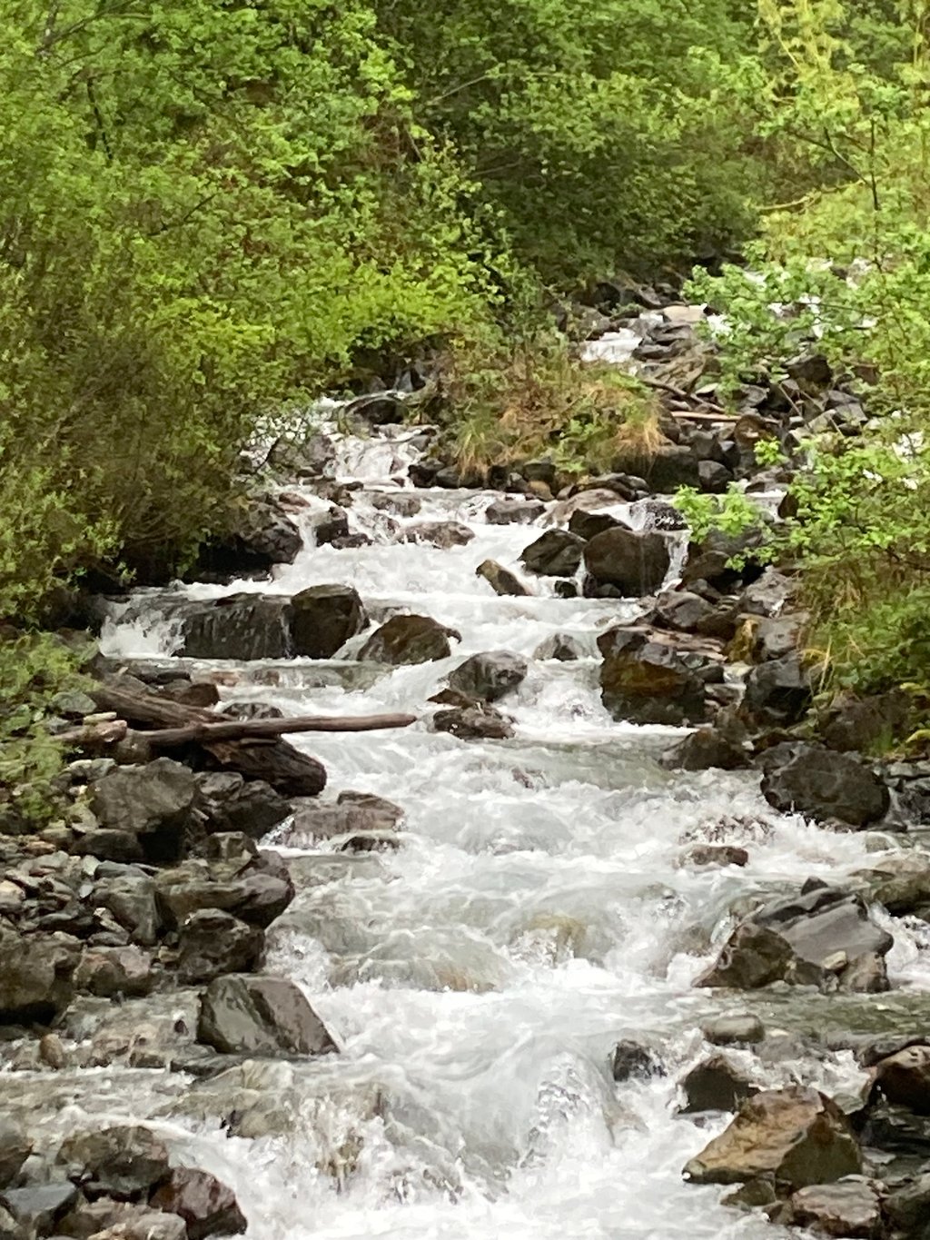
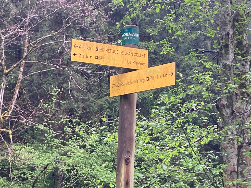
The bridge that gives the slope its name marks the end (the tarmac ends a few dozen metres further on, at a place called "Le Chenevrey") and overlooks the Vorz torrent, which is very active when the snow melts, and which the slope climbs all the way up.
Route assez étroite en bon état (sauf vers la fin une très courte portion en terre et cailloux qui surplombe un glissement de terrain ayant coupé la route).
Comme souvent dans ces routes qui partent du balcon. de Belledonne, elle est très irrégulière avec des portions qui sont de véritables « murs ».
Le pont qui donne son nom à la côte en marque la fin (le goudron s'arrête quelques dizaines de mètres plus loin, au lieu-dit « Le Chenevrey ») et surplombe le torrent du Vorz, très actif à la fonte des neiges, et que la côte remonte pendant tout son trajet.
| 7 km/h | 00:12:53 |
| 11 km/h | 00:08:12 |
| 15 km/h | 00:06:00 |
| 19 km/h | 00:04:44 |
This page is better in the app