View on map
© MapLibre | OpenStreetMap contributors
1%
2%
4%
6%
8%
10%
12%
15%
20%

Plan de Gralba from Castel Trostburg

0 reviews | Elevation profile | 0 photos
Tips nearby
Your achievable time
Calculating based on your best performances...
Relaxed
Maximum
W/kg
W/kg
W/kg
Analyse your climbing performance
Detailed insight into your climbing performance & automatically check off climbs
Based on your best performances.
Your best attempt:
Number of attempts:
Elevation profile Plan de Gralba from Castel Trostburg

Statistics

Difficulty points 980
Length 25.2 km
Average gradient 5.5%
Steepest 100 metres 12.6%
Total ascent 1396 m

Short recap

4 hairpin turns
#51 toughest climb of Bolzano
#100 most elevation gain of Italian Alps
#52 longest climb of Italian Alps
Feedback about this climb?
Show climbs nearby Export to GPS device

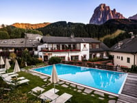
Plan de Gralba from Castel Trostburg is a climb in the region Dolomites. It is 25.2 km long and bridges 1396 m of vertical ascent with an average gradient of 5.5%, resulting in a difficulty score of 980. The top of the ascent is located at 1870 m above sea level. Climbfinder users shared 0 reviews of this climb and uploaded 0 photos.

Road name: Staatsstraße 242 Grödental und Sellajoch - Strada Statale 242 di Val Gardena e Passo Sella, Streda de Gherdëina - Staatsstraße 242 Grödental und Sellajoch - Strada Statale 242 di Val Gardena e Passo S

Photos (0)

transparant thumb
transparant thumb
transparant thumb
transparant thumb
transparant thumb
transparant thumb

Your uploads (max 4)

Welcome! Please activate your account if you would like to share something. Look for the verification email in your inbox.

If you want to upload your photos, you need to create an account. It only takes 1 minute and it's completely free.

  • Receive free climbfinder goodies for your reviews & photos.
  • Create a bucket list and check off conquered climbs.
  • Add missing climbs.
Continue with GoogleContinue with Google Continue with FacebookContinue with Facebook Continue with AppleContinue with Apple Sign up with email
By signing up you agree to our terms of service and confirm that you have read our privacy & content policy.

Reviews (0)

5.0
4.0
3.0
2.0
1.0

Climbing times

7 km/h 03:36:15
11 km/h 02:17:37
15 km/h 01:40:55
19 km/h 01:19:40

Road surface condition

0% 0% 0%
Based on 0 votes
Share your knowledge. What was the road condition during your ascent?

Traffic

0% 0% 0%
Based on 0 votes
Your experience counts. How much traffic did you encounter during the climb?

Frequently Asked Questions

Plan de Gralba can be cycled from 2 sides. Plan de Gralba from Ponte Gardena is the most popular side, but the summit can also be reached via Plan de Gralba from Castel Trostburg.

You don't need special gearing for Plan de Gralba from Castel Trostburg. The slope isn't long or steep enough to require much shifting down. You can conquer this climb on power alone. However, a compact gearing system with a smallest front chainring of 34 and largest rear sprocket of 28 or 30 is always nice if you enjoy cycling uphill. This helps maintain a smooth cadence.

Plan de Gralba from Castel Trostburg belongs to the Hors Catégorie, the top category. These are legendary and very tough climbs. A solid cycling condition, experience, and a good climbing gear ratio are essential to maintain a smooth cadence and complete the climb comfortably.

Plan de Gralba from Castel Trostburg is 25.2 km long.

The average gradient of Plan de Gralba from Castel Trostburg is 5.5%.

Plan de Gralba from Castel Trostburg has a steepest segment with an average gradient of 12.6%.

The summit of Plan de Gralba from Castel Trostburg is at 1870 m.

At a slow pace of 7 km/h, it takes about 03:36:15 to climb Plan de Gralba from Castel Trostburg. At 11 km/h the time is 02:17:37, and at 15 km/h 01:40:55. For the fastest cyclists, 01:19:40 is an achievable time.

Plan de Gralba from Castel Trostburg is located in the region Bolzano in Italy.

This page is better in the app

Climbfinder app
Climbfinder
(Free)
Open