Tips nearby


| 12 hairpin turns |
| #41 toughest climb of Hautes-Pyrénées |
| #40 most elevation gain of Hautes-Pyrénées |
| #42 longest climb of Hautes-Pyrénées |
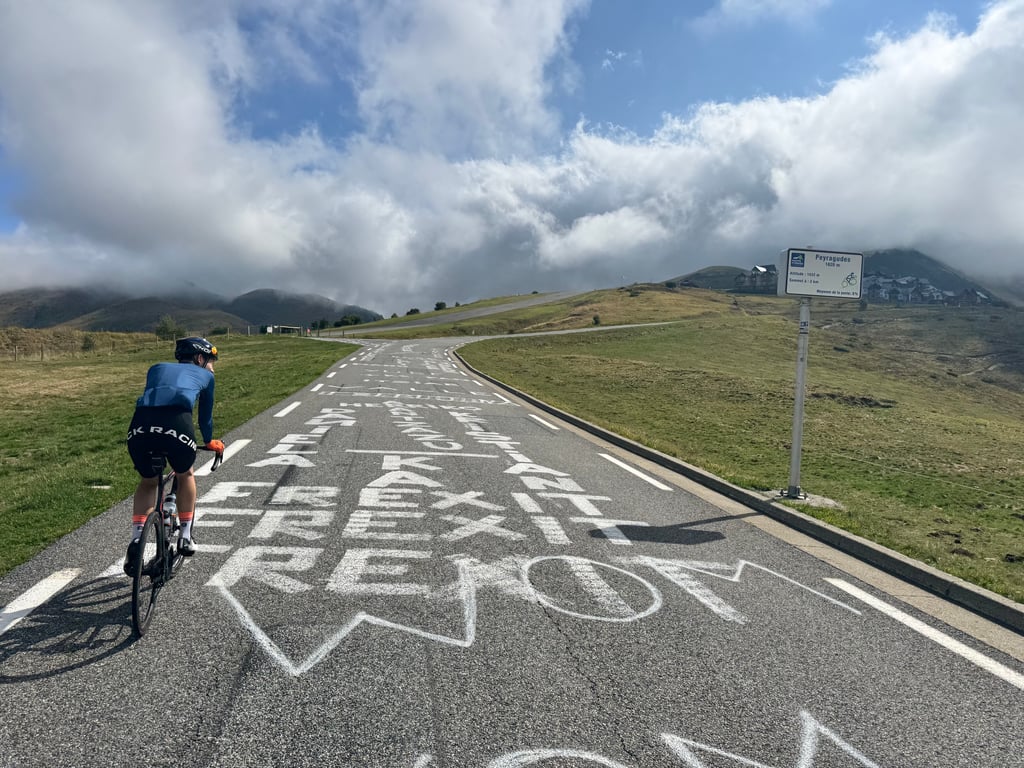
Peyresourde Balestas / Peyragudes is a climb in the region Hautes-Pyrénées. It is 9.3 km long and bridges 656 m of vertical ascent with an average gradient of 7%, resulting in a difficulty score of 570. The top of the ascent is located at 1589 m above sea level. Climbfinder users shared 2 reviews of this climb and uploaded 4 photos.
Road names: D 25, D 618 & D 619
4.0 by JoostfietstThis is an automatic translation, the original language is: Dutch.First part of the climb is the same as to the top of the Peyresourde. Last 3km you turn off and it is cycling up along a beautiful landscape to the ski village. On the way, you pass the airport where the 2025 climbing time trial finished. The final destination is not very inspiring, but the way there is worthwhile. If you descend along the other side, you will also see beautiful scenery and be at the top of the Peyresourde in no time, so you get that for free.... read more
Welcome! Please activate your account if you would like to share something. Look for the verification email in your inbox.
If you want to upload your photos, you need to create an account. It only takes 1 minute and it's completely free.
First part of the climb is the same as to the top of the Peyresourde. Last 3km you turn off and it is cycling up along a beautiful landscape to the ski village. On the way, you pass the airport where the 2025 climbing time trial finished. The final destination is not very inspiring, but the way there is worthwhile. If you descend along the other side, you will also see beautiful scenery and be at the top of the Peyresourde in no time, so you get that for free.
Eerste deel van de klim is hetzelfde als naar de top van de Peyresourde. Laatste 3km draai je af en is het langs een mooi landschap omhoog fietsen naar het skidorp. Onderweg kom je langs het vliegveld waar in 2025 de klimtijdrit finishte. De eindbestemming is niet heel inspirerend, maar de weg ernaartoe is de moeite waard. Als je langs de andere kant afdaalt zie je ook nog een mooi landschap en ben je zo op de top van de Peyresourde die je er dus gratis bijkrijgt.
A nice alternative - Tour finishes have been in Peyragude - and slightly less traffic, depending on the time of year. In the last kilometer, there's a TDF finish sign and panorama. If you want to complete the climb, at the roundabout turn right to the village, keep going right - slightly down and up again - until you reach the last parking. There's a "summit" sign there. Otherwise - or afterwards - continue at the roundabout towards "Le Col", first up, then a short downhill, after which you arrive 100 m from the summit of the Peyresourde to the right.
| 7 km/h | 01:19:49 |
| 11 km/h | 00:50:47 |
| 15 km/h | 00:37:14 |
| 19 km/h | 00:29:24 |
This page is better in the app