| 7 hairpin turns |
| #86 toughest climb of Trento |
| #74 average steepest climb of Trentino-South Tyrol |
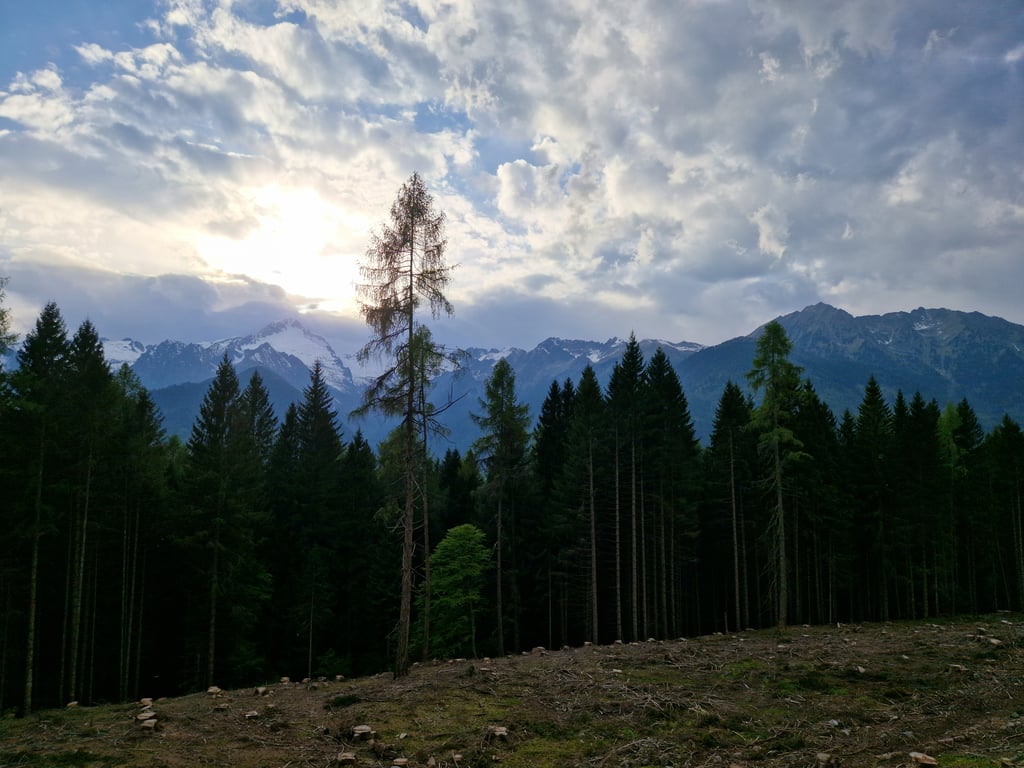
Passo Daone from Ches is a climb in the region Trento. It is 6.1 km long and bridges 638 m of vertical ascent with an average gradient of 10.4%, resulting in a difficulty score of 753. The top of the ascent is located at 1297 m above sea level. Climbfinder users shared 4 reviews of this climb and uploaded 5 photos.
Road name: SP53
4.0 by EmaThis is an automatic translation, the original language is: Italian.An ascent that immediately begins to make itself known after a few hundred metres... All in all short, but rough. The gradient almost never drops below 10%. Almost all in the shade inside the forest. Narrow road with decent asphalt. Good training if you are looking for a climb with a constant gradient.... read more
Welcome! Please activate your account if you would like to share something. Look for the verification email in your inbox.
If you want to upload your photos, you need to create an account. It only takes 1 minute and it's completely free.
An ascent that immediately begins to make itself known after a few hundred metres... All in all short, but rough. The gradient almost never drops below 10%. Almost all in the shade inside the forest. Narrow road with decent asphalt. Good training if you are looking for a climb with a constant gradient.
Salita che inizia subito a farsi conoscere dopo poche centinaia di metri… Tutto sommato corta, ma ruspante. La pendenza non scende quasi mai sotto il 10%. Quasi tutta all’ombra all’interno del bosco. Strada stretta, con asfalto discreto. Ottimo allenamento se si cerca una salita con pendenza costante.
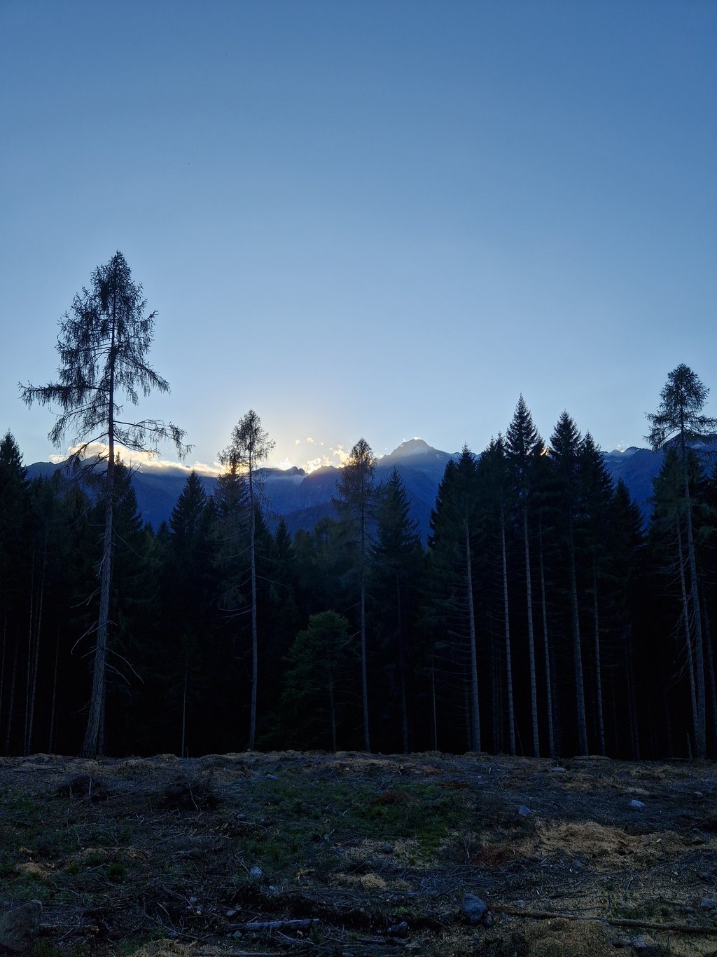
Steep and cool ascent, always in the forest. The panorama can only be appreciated in the last 500 metres with a beautiful view of the Carè Alto peak and its glacier. The slope up from Preore is more scenic and more varied, with better asphalt.
Salita ripida e fresca, sempre nel bosco. Il panorama si può apprezzare solo negli ultimi 500 metri con bella vista sulla cima Carè Alto e sul suo ghiacciaio. Il versante che sale da Preore è più panoramico e più vario, con asfalto migliore.
Nice, quiet, shady climb with little traffic. You can hardly see anything as a panorama, but you are immersed in a wooded area that provides relief, especially in the summer heatwave. It gives no respite even though the toughest point is at the beginning, which only lets up in the last 4 to 500 metres. You get close to 1,300 metres and up dirt tracks to the Durmont summit (1,395 metres). There is a bar/restaurant at the summit but it is abandoned (Jul 2023). The descent to Preore is very beautiful (better asphalt than the ascent), more uncovered and scenic and passes through the villages of Montagne (beautiful little church with adjoining cemetery) and Cort.
Bella salita tosta, silenziosa, ombrosa e poco trafficata. Non si scorge praticamente nulla come panorama ma si è immersi in zona boscosa che dà sollievo soprattutto d'estate con la canicola. Non dà tregua anche se il punto più duro è all'inizio molla solo negli ultimi 4-500 metri. Si arriva a ridosso dei 1.300 mt e su partono sentieri sterrati per andare in cima Durmont (1395 mt). C'è un bar / ristorante in cima ma è abbandonato (lug 2023). La discesa verso Preore è molto bella (asfalto migliore della salita), più scoperta e panoramica e passa per gli abitati di Montagne (bella chiesetta con cimitero annesso) e Cort.
Beautiful climb in a very beautiful area. You ride on a very quiet road of about 3m wide. The asphalt is okay but a bit rough and sometimes some holes. No loose stones or gravel. In the morning, the climb is in the shade, in the afternoon the sun is on it but trees give enough shade almost everywhere.
Furthermore, it was very quiet. On Sunday afternoon around 2 p.m. I was only overtaken by a moped, nothing else. The fact that it was so quiet is probably due to the fact that only a few people live there. There is no big village, only a few scattered houses. There is a bar/restaurant at the top but it seems to have been closed for a while. No other facilities but because the climb is not exceptionally long I could manage with 2 bidons.
Prachtige klim in een heel mooi gebied. Je rijd over een heel rustig weggetje van ong 3m breed Het asfalt is oké maar beetje ruw en soms wat gaten. Geen losse stenen of split. In de ochtend ligt de klim in de schaduw, ‘s middags staat de zon er op maar geven bomen bijna overal genoeg schaduw.
Verder was het heel erg rustig. Op zondagmiddag rond 14u werd ik maar door een brommertje ingehaald, verder niets. Dat het zo rustig was zal vooral komen doordat er maar weinig mensen wonen. Er is geen groot dorp, alleen een paar verspreid liggende huizen. Op de top is een bar/restaurant maar die lijkt al tijdje gesloten. Verder geen voorzieningen maar omdat de klim niet uitzonderlijk lang is kwam ik met 2 bidons prima uit.
| 7 km/h | 00:52:22 |
| 11 km/h | 00:33:19 |
| 15 km/h | 00:24:26 |
| 19 km/h | 00:19:17 |
This page is better in the app