Nayemont-les-Fosses from Saint-Dié-des-Vosges is a climb in the region Vosges. It is 7.4 km long and bridges 363 m of vertical ascent with an average gradient of 4.9%, resulting in a difficulty score of 311. The top of the ascent is located at 711 m above sea level. Climbfinder users shared 2 reviews of this climb and uploaded 5 photos.
2.0 by DudneyRebelThis is an automatic translation, the original language is: Dutch.Not straight from Saint-Dié, but via Robache (Rte des Molières) which makes you join this climb (at about'2 kilometres from the start) after a short but punchy bit of climbing around 10 per cent and a short descent just on the village border of Dijon, sharp left. It goes somewhat up an down through the village of Nayemont-Les-Fosses. Where more or less the forest begins, the percentages also start to rise. Where the forest track joins from the right, the percentages go into the double dig... read more
Welcome! Please activate your account if you would like to share something. Look for the verification email in your inbox.
If you want to upload your photos, you need to create an account. It only takes 1 minute and it's completely free.
An experienced polder cyclist is not much use as a novice climber when it gets as steep as here. Tried from the Nayemont side but not doable. From the other side managed it with 2 x short breaks. Made it to the top but even descending towards Nayemont is exciting with this %. For now, just give me routes from 5-9%. Who knows, maybe revenge on this one later.
Een ervaren polderfietser is als beginnend klimmer niet zoveel waard als het zo steil wordt als hier. Vanaf de zijde van Nayemont geprobeerd maar niet te doen. Vanaf de andere zijde lukte het met 2 x kort pauze. Top gehaald maar ook afdalen richting Nayemont is spannend met deze %. Doe mij voorlopig maar routes van 5-9%. Wie weet later nog eens revanche op deze.
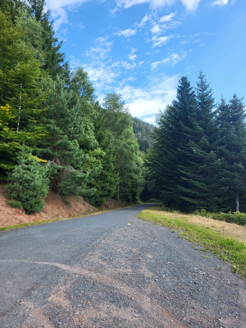
Not straight from Saint-Dié, but via Robache (Rte des Molières) which makes you join this climb (at about'2 kilometres from the start) after a short but punchy bit of climbing around 10 per cent and a short descent just on the village border of Dijon, sharp left. It goes somewhat up an down through the village of Nayemont-Les-Fosses. Where more or less the forest begins, the percentages also start to rise. Where the forest track joins from the right, the percentages go into the double digits and a hairpin can be seen at about 150 metres. After the hairpin to the right, on the way to the next left turn, this climb asserts itself over a length of some 700 to 800 metres. The percentages no longer drop below 12 per cent and peak several times to 15/16 per cent. The road surface is quite passable, but the wear layer is coarse and washed out here and there, so it does not bulge at all. Even after the turn to the left, it does not level out much and continues to push firmly for another kilometre to the summit with percentages between 9 and 12 per cent. On the way up, therefore, I saw little of the beautiful forested surroundings, but it is suffering in silence, as you don't meet anyone.
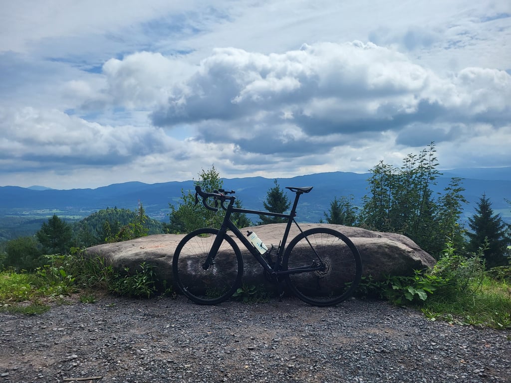
The reward at the top is a broken picnic table and a large flat stone, but also a beautiful view!
Beware of the descent towards La Petite-Fosse, as the first 2 kilometres or so after the summit are as steep as the climb and go on a very rough paved path with lots of loose gravel. I was glad that at some point the surface changed to a "normal" paved road. Once on the D45, the descent is delightful.
Niet rechtreeks vanuit Saint-Dié, maar via Robache (Rte des Molières) waardoor je na een kort, maar pittig stukje klimmen rond de 10 procent en een korte afdaling net op de dorpgrens van Dijon, scherp linksom, aansluit op deze klim (op zo'n beetje 2 kilometer van het begin). Het gaat wat op een af door het dorpje Nayemont-Les-Fosses. Waar min of meer het bos begint, beginnen ook de percentages op te lopen. Waar het houtvesterspad van rechts aansluit gaan de percentages in de dubbele cijfers en is een haarspeld te zien op circa 150 meter. Na de haarspeld naar rechts, op weg naar de volgende bocht naar links, laat deze klim zich over een lengte van een meter of 700 tot 800 gelden. De percentages komen niet meer onder de 12 procent en pieken meerdere keren tot 15/16 procent. Het wegdek is goed begaanbaar, maar de slijtlaag is grof en hier en daar uitgespoeld en het bolt dus voor geen meter. Ook na de bocht naar links vlakt het maar weinig af en blijft het met percentages tussen de 9 en 12 procent nog een kilometer stevig doorduwen tot de top. Op de weg omhoog heb ik dan ook weinig van de prachtige bosrijke omgeving gezien, maar het is lijden in stilte, want je komt er niemand tegen.
De beloning boven is een kapotte picknicktafel en een grote platte steen, maar ook een prachtig uitzicht!
Pas op voor de afdaling richting La Petite-Fosse, want de eerste circa 2 kilometer na de top zijn zo stijl als de klim en gaan over een zeer grof verhard pad met veel losliggend grit. Ik was blij dat de ondergrond op enig moment over ging in een "normaal" geasfalteerde weg. Eenmaal op de D45 is het heerlijk dalen.
| 7 km/h | 01:03:14 |
| 11 km/h | 00:40:14 |
| 15 km/h | 00:29:30 |
| 19 km/h | 00:23:17 |
This page is better in the app