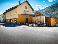
Montalbout from Valgelon-La-Rochette is a climb in the region Savoie. It is 4.3 km long and bridges 361 m of vertical ascent with an average gradient of 8.5%, resulting in a difficulty score of 319. The top of the ascent is located at 699 m above sea level. Climbfinder users shared 1 review/story of this climb and uploaded 0 photos.
Road names: Route des Monts, Route de Montalbout & Chemin de Montalbout
2.0 by ChasseurDeColDuRHoneThis is an automatic translation, the original language is: French.Short but intense. The only problem is that once you get to montalbout, apart from going back down, there's not much you can do (on a road bike). BY MOUNTAIN BIKE, there are trails all the way up the Montraillant hill. Take the whole of Montmayeur, for example, and you've got a great circuit.... read more

Welcome! Please activate your account if you would like to share something. Look for the verification email in your inbox.
If you want to upload your photos, you need to create an account. It only takes 1 minute and it's completely free.
 Continue with Google
 Continue with Facebook
 Continue with Apple
Sign up with email
Continue with Apple
Sign up with email
Short but intense.
The only problem is that once you get to montalbout, apart from going back down, there's not much you can do (on a road bike).
BY MOUNTAIN BIKE, there are trails all the way up the Montraillant hill. Take the whole of Montmayeur, for example, and you've got a great circuit.
Court mais intense.
Le seul porbleme c'est qu'une fois a montalbout a part redescendre vous ne pouvez pas faire grand chose (en vélo de route)
EN VTT des pîstes s'oourvent a vous sur l'ensemble de la colline du Montraillant. Enchainement jusqu'au tout montmayeur par exemple et vous obtenez la un beaucircuit.
| 7 km/h | 00:36:36 |
| 11 km/h | 00:23:17 |
| 15 km/h | 00:17:05 |
| 19 km/h | 00:13:29 |
This page is better in the app