Mines d'Anglade from Pont de la Taule is a climb in the region Ariège. It is 13.8 km long and bridges 659 m of vertical ascent with an average gradient of 4.8%, resulting in a difficulty score of 469. The top of the ascent is located at 1224 m above sea level. Climbfinder users shared 1 review/story of this climb and uploaded 0 photos.
Road name: D3
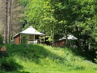
3.0 by AntoinebntThis is an automatic translation, the original language is: French.The first section leads to the village of Salau, with a gentle gradient that gradually increases, accompanied by the cool breeze from the Salat. Then 4 km at an average gradient of 9 per cent ... read more

Welcome! Please activate your account if you would like to share something. Look for the verification email in your inbox.
If you want to upload your photos, you need to create an account. It only takes 1 minute and it's completely free.
The first section leads to the village of Salau, with a gentle gradient that gradually increases, accompanied by the cool breeze from the Salat.
Then 4 km at an average gradient of 9 per cent
Première partie jusqu'au village de Salau avec une pente douce qui augmente progressivement et avec la fraicheur du Salat.
Puis 4km à 9% de moyenne
| 7 km/h | 01:58:04 |
| 11 km/h | 01:15:08 |
| 15 km/h | 00:55:06 |
| 19 km/h | 00:43:30 |
This page is better in the app