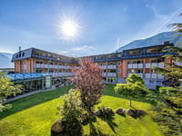
| Beautiful scenery |
| 26 hairpin turns |
| #63 toughest climb of Trentino-South Tyrol |
| #96 most elevation gain of Italy |
| #86 longest climb of Italian Alps |
Martelltal from Goldrain / Coldrano is a climb in the region Bolzano. It is 22.8 km long and bridges 1436 m of vertical ascent with an average gradient of 6.3%, resulting in a difficulty score of 1134. The top of the ascent is located at 2076 m above sea level. Climbfinder users shared 5 reviews of this climb and uploaded 24 photos.
Road names: Via Schanzen, Via Pilma, Via Masetti Di Fuori, Frazione Ganda, Santa Maria in der Schmelz & Alta Valle
5.0 by GreenAvocadoThis was one big surprise for me pretty challenging climb with two very steep parts with hairpins, gradient is there around 15%. Mostly covered by forest and with 3 short tunnels also nicely steep. Nature and landscape is amazing here with cherry on the top reservoir where is nice flat part and then few more kilometers to the summit. Unfortunetly deadend but still really nice. No traffic, just nature, animals and you. Worth it.... read more
Welcome! Please activate your account if you would like to share something. Look for the verification email in your inbox.
If you want to upload your photos, you need to create an account. It only takes 1 minute and it's completely free.
Nice climb, not a lot of traffic. Overall a smooth climb with two sections of switchbacks of 16%
This was one big surprise for me pretty challenging climb with two very steep parts with hairpins, gradient is there around 15%. Mostly covered by forest and with 3 short tunnels also nicely steep. Nature and landscape is amazing here with cherry on the top reservoir where is nice flat part and then few more kilometers to the summit. Unfortunetly deadend but still really nice. No traffic, just nature, animals and you. Worth it.
A long climb with a wide variety of views, gradients and landscapes with one common denominator: it is quiet. Wonderfully quiet. In Coldrano at the start you are immediately treated to a castle ruin, one of the many in the Val Venosta. Through the forest, you come to a beautiful series of hairpin bends in a field. Enjoy, those bends are still mild. After passing the last village, you climb steadily through the forest and come through an avalanche gallery. The road is steeper here, although it is still manageable. You arrive at a biathlon training centre in a valley with lovely wooden sheds. The hairpin bends after that centre are not so lovely; well into the double digits and undoubtedly a hell of a workout for biathletes (I once saw a few of them go uphill on those summer roller skis). Fortunately, as a reward, a beautiful reservoir awaits at the top and an almost flat road along the lake. To get to the end, you have to get out of the saddle one more time: the last series of hairpin bends is also murderously steep. We ended up at the second-to-last car park, just 200 metres and 50 altimetres below the summit. The last stretch of road was undergoing major maintenance (June 2022). All in all, a nice and quiet training climb if you are staying in the Val Venosta for the Stelvio pass.
Een lange beklimming met een grote variatie in uitzicht, stijgingspercentages en landschap met een gemene deler: het is rustig. Heerlijk rustig. In Coldrano bij de start word je al meteen getrakteerd op een kasteelruïne, een van de velen in het Val Venosta. Door het bos kom je uit op een prachtige serie haarspeldbochten in een veld. Geniet er van, die bochten zijn nu nog mild. Na het passeren van het laatste dorp, klim je gestaag door het bos en kom je door een lawinegalerij. De weg is hier meteen steiler al is het nog prima te doen. Je komt uit bij een biathlontrainingscentrum in een dal met lieflijke houten schuurtjes. De haarspeldbochten na dat centrum zijn niet zo lieflijk; goed steil in de dubbele cijfers en ongetwijfeld een dijk van een training voor biathleten (ik heb er ooit in de zomer een paar naar boven zien gaan op van die zomerrollerskies). Gelukkig wacht er als beloning een mooi stuwmeer bovenaan en een bijna vlakke weg langs het meer. Om naar het eindpunt te komen mag je nog een keer uit het zadel: de laatste serie haarspeldbochten is ook moordend steil. Wij eindigden op de een na laatste parkeerplaats, net 200 meter en 50 hoogtemeter onder de top. Aan het laatste stuk weg werd groot onderhoud gepleegd (juni 2022). Al met al een leuke en rustige trainingsklim als je in het Val Venosta verblijft voor de Stelviopas.
Really beautiful climb. Only disadvantage is that it is a branch of the vinschaudal, so you have to return the same way. For those who like laps could be a reason to ignore this climb. But a beautiful climb. At the end a beautiful lake, after which you think you're there, but then comes the hardest part with a series of beautiful hairpins. The road ends abruptly at a parking lot and you can only continue on foot.
Werkelijk schitterende klim. Enig nadeel is dat het een zijtak is van het vinschaudal, dus je moet dezelfde weg terug. Voor degene die van rondjes houden zou dan een reden kunnen zijn deze klim links te laten liggen. Maar een prachtige klim. Aan het einde een prachtig stuwmeer, waarna ja denkt dat je er bent, maar dan komt het lastigste stuk nog met een serie prachtige haarspelden. De weg eindigt abrupt op een parkeerplaats waarna je enkel te voet verder kan.
Nice and very irregular climb from the valley to ~2060m. Most of it is shady and nice and cool in summer. Just before the reservoir there is an unparalleled series of ~15% hairpin bends, just before the end another series. The final summit is disappointing with a parking lot for hikers.
Mooie en erg onregelmatige klim vanuit het dal naar ~2060m. Het merendeel is schaduwrijk en in de zomer lekker koel. Vlak voor het stuwmeer zit een weergaloze serie haarspeldbochten van ~15%, vlak voor het einde nog een serie. De uiteindelijke top valt tegen met een parkeerplaats voor wandelaars.
| 7 km/h | 03:15:11 |
| 11 km/h | 02:04:12 |
| 15 km/h | 01:31:05 |
| 19 km/h | 01:11:54 |
This page is better in the app