| Hidden gem |
| 13 hairpin turns |
| Gravel |
| #84 toughest climb of Trento |
| #65 most elevation gain of Trento |
| #83 longest climb of Trentino-South Tyrol |
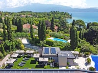
Malga Grassi from Riva del Garda is a climb in the region Trento. It is 15.2 km long and bridges 954 m of vertical ascent with an average gradient of 6.3%, resulting in a difficulty score of 760. The top of the ascent is located at 1042 m above sea level. Climbfinder users shared 1 review/story of this climb and uploaded 0 photos.
Road names: Via Ardaro, SP37 & SP37dir
3.0 by Fegi65This is an automatic translation, the original language is: German.In my opinion, the steepest section is not only KM 11-12 but KM 11-14. I rode the ascent at the beginning of July 23 to the end of the asphalt road and the gradient percentage on the last 3km was never less than 10%, mostly around 11%-12%. The descent on the same route is not entirely safe on the upper 3km because it is narrow, confusing and above all because there is gravel on the asphalt.... read more

Welcome! Please activate your account if you would like to share something. Look for the verification email in your inbox.
If you want to upload your photos, you need to create an account. It only takes 1 minute and it's completely free.
In my opinion, the steepest section is not only KM 11-12 but KM 11-14. I rode the ascent at the beginning of July 23 to the end of the asphalt road and the gradient percentage on the last 3km was never less than 10%, mostly around 11%-12%.
The descent on the same route is not entirely safe on the upper 3km because it is narrow, confusing and above all because there is gravel on the asphalt.
Der steilste Teilabschnitt ist meiner Menung nach nicht nur KM 11-12 sondern KM 11-14. Bin den Anstieg Anfang Juli 23 bis zum Ende der Asphaltstraße gefahren und dabei vielen die Steigungsprozente auf den letzten 3km niemals unter 10%, meistens um die 11%-12%.
Die Abfahrt auf der gleichen Strecke ist auf den oberen 3km nicht ganz ungefährlich da schmal, unübersichtlich und vor allem da hier teilweise Schotter auf dem Asphalt liegt.
| 7 km/h | 02:10:00 |
| 11 km/h | 01:22:44 |
| 15 km/h | 01:00:40 |
| 19 km/h | 00:47:53 |
This page is better in the app